Hurricane Harbor

A writer and a tropical muse. A funky Lubavitcher who enjoys watching the weather, hurricanes, listening to music while enjoying life with a sense of humor and trying to make sense of it all!

Tuesday, May 30, 2017

Start of Hurricane Season. Predicting a Busy Season With Possible Landfalls to US so PREPARE NOW!


State of the tropics above.
Quiet and nothing happening.
Now is the time to prepare.
Get a plan. Buy stuff.
Everyone has different needs.
Medication vs extra diapers?
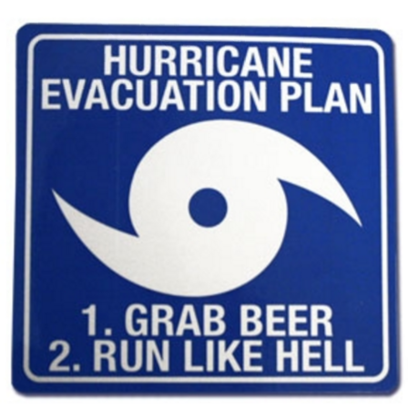
Beer vs Soda
Pet food?
How much water do we really need...

Unlike the baseball season there is no first pitch thrown out by the President, although the NHC regularly makes a pitch to the President for more money for the NHC. Money is key to research and better forecasting so we don't have to be reliant on the EURO model that currently is the Top Gun in forecasting leaving the American GFS model in the dust often. Sad, but true. I think they should give the NHC more money and help make the GFS GREAT AGAIN!

There is some chatter about a system in the Epac crossing over into the GOM and having some tropical possibilities down the road. I'm not a big believer in the crossover predictions as much as the possibility of moisture hanging out at the tail end of a cold front lingering too long over warm water near Florida. Happens and is more likely than crazy crossover scenarios though to be honest sometimes they do happen. So stay tuned.

http://www.publix.com/pages/publix-storm-basics

The link above is about as good as it gets to learn how to prepare for a Hurricane should you be new to South Florida and really who isn't? It's a state where locals often leave in search of cooler pastures and others move South for the warmth, jobs and a tropical lifestyle. Obviously part of a tropical lifestyle is the danger of tropical storms and hurricanes coming to visit when you weren't expecting them. So, read and take action by making a plan. Making a list of things necessary to you such as having an extra asthma inhaler or extra diapers in case Publix loses power... or it's roof and there is no new truck coming in with your favorite diapers. Happens.

I'm in Miami currently for a Jewish Holiday named Shavous and I'll be at my best friend's house (let's call her Magda to protect the innocent and make the guilty laugh) and we will be sipping red wine and nibbling on chocolate cheesecake for the duration of the holiday. Her birthday is June 1st and she is definitely a Category 3 or 4 Hurricane. There may be other food and activity involved but I'll be celebrating the start of the season and her birthday down here in Miami. See the picture below.. isn't she adorable? She's the blonde...obviously!


She makes me smile...or giggle or a little of both!
Thank God for best friends.........


Older picture above but you get the idea.
A close friend used to just call us both "trouble" 
And yeah...she's born on June 1st...
Duh...

Bobbistorm's Bottom Line on this Hurricane Season is expect a Hurricane to make landfall in the US and if we get lucky and it misses us thank your lucky stars! 

The water is hot, the air temperature is record breaking and that only heats up the waters near the coastline. Shear will lessen and Saharan Dust may not be able to save us as time goes by. Oh and El Nino is not currently predicted to pose a danger to tropical waves forming into Hurricanes this year!! The high temperature in Miami the other day beat the record for 1996 by five degrees. 1996 was a busy year for hurricanes. Every year is different. It's like picking a card out of a deck to see what you get when it comes to any one hurricane season. But I think it's safe to predict we have lots of trouble on the tropical horizon this year!!!

Get a plan, buy "stuff" and be prepared because by the time you get to Publix the water, soda and beer will all be gone.......... because the old timers here know when to go shopping.

Besos BobbiStorm
Follow me on Twitter @bobbistorm


Superman can't save you from a Hurricane! Only YOU can prepare and make a plan before the Hurricanes comes to call. It's your call.....


Don't say I didn't warn ya!!

Read previous posts for my forecasts and predictions.
And the list from A - Z on how you know a Hurricane is coming.

http://hurricaneharbor.blogspot.com/2017/05/hurricane-warnings-how-do-you-know.html

Ps ...IF anything forms before Thursday Night...

www.spaghettimodels.com
www.hurricanecity.com

They will have all the details you need!

Welcome to the Atlantic Hurricane Season!


Labels: , , , , , , , , , , ,

Sunday, May 28, 2017

Hurricane Warnings.. How Do You Know A Hurricane is Headed Your Way? Memorial Day and the Tropical Waters Are Warning Up. Mother Nature Had a Busy Night Last Night


Short post and a request you read the previous posts on the start of the Atlantic Hurricane Season that sometimes gets lost in the Memorial Day Holiday Weekend. There is no first pitch tossed out by the President to mark the beginning of the Hurricane Season. The checkered flag is not waved and few even know what a real Hurricane Flag looks like but the Hurricane Season happens June 1st whether you are ready for tropical weather or not. Luckily for business at the beaches there is no early Hurricane sneaking in under the wire. Stay tuned.........they will come.

If you try Googling be specific or you may get results such as the ones below. Wrong colors but you get the idea. Everything in life is about specific and the devil is in the details. So learn the details.


Years ago people heard the news...
...when they saw the flag flying.


Now days you find out how?

a) Your mother texts you and asks what kind of stuff do you want for the Hurricane..
b) A Whatsapp group forms as you are suddenly in the 3 Day Cone..
c) Someone told you Jim Cantore was at the beach.
d) You get an email your flight to Miami is cancelled.
e) Hurricane Cindy started trending on Twitter.
f) Your phone whistles, beeps and sends you a weather warning?
g) You still have a weather radio and followed it since it was a vigorous wave?
h) You get to Publix and there is no water and long lines?
i) You get the newspaper still and there's pictures of people shopping at Publix.
j) Snapchat started showing beach scenes and something about Cindy
k) You read my blog!!
l) You are addicted to www.spaghettimodels.com . . . 
m) Your weather app warned you.
n) Facebook Feed showed pictures of no water or beer at Publix.
o) ABC, CBS and NBC are all talking about Hurricane Cindy so you watch Netflix.
p) You slept through it and have no electricity and the palm tree blew away...
q) www.canetalk.com on www.hurricanecity.com woke up.
r) www.flhurricane.com says hype level is 7 
s) You have been tracking it since 10.2N and 42.3W
t) You asked someone what "vigorous" means.
u) They broke into General Hospital to tell you that you are now in the Cone?
v) Your little sister named Cindy just got a Hurricane Cindy Tattoo on her shoulder
w) You're a softcore fanatic and check the http://www.nhc.noaa.gov site every hour.
x) You're really a hardcore fanatic and tell time by the NHC clock on the bottom left.
y) What's a hurricane?
z) You have no power and are clueless what happened to your roof and electric :(


Heads up time bottom left...

How do you find out about Hurricanes these days? I'm pretty sure it's not because a flag is waving and if you are here you are not part of the problem, but part of the solution. So help spread the news. I'm pretty sure I missed a few possible ways. But, years ago people saw the flag flying on the highest building around. Years ago there were only a few channels on the TV and they all were following the storm. Years ago kids watched TV not Netflix on their smart phone. Years ago more people were #HurricaneStrong picking up maps, tracking and following each and every wave. Once burned by a storm you didn't let that happen again and watched each vigorous wave. Many years ago you didn't get any warnings at all; the town washed away, people died and those who survived moved further inland. Now days we have many ways of communicating the dangers but in reality for many until they are in the 3 Day Cone they rarely take it seriously. Big mistake if Hurricane Cindy hits your town. 

So leaving you with that question. How do you find out about a Hurricane today in 2017. 

The water in the tropics is heating up especially in all those June favored places where storms develop.


athhp.gif (873×397)

Fronts are dipping less.
Troughs are moving West to East.
Tropical Waves are moving East to West.
June 1st is also Meteorological Summer.
Models play with ten day scenarios.


http://www.intellicast.com/Storm/Hurricane/AtlanticSatellite.aspx?animate=true

But last night it was all about the Summer Lights.
Mother Nature lit up the sky in a wide array of ways.
Lightning and thunder.
Tornadoes on the ground....
Northern Lights in the sky.
Lightning bugs danced at dusk.


TWC stayed on all night covering severe storms.

If you have some extra time today...
...read up on the ways to prepare for a Hurricane

http://flash.org/hurricanestrong/

Enjoy the weekend.
Have fun.

Besos BobbiStorm
Follow me @bobbistorm on Twitter

Ps... Read the previous blogs with good info. And if Hurricane Cindy heads for Miami... I am so sorry but well it is the C storm and sometimes they do that and this year may be that sort of year according to many experts.


http://hurricaneharbor.blogspot.com/2017/05/hello-floridahurricane-predictions-2017.html

http://hurricaneharbor.blogspot.com/2017/05/hurricane-forecasts-2017-will-they-pan.html


Labels: , , , , , , , , , , , , ,

Friday, May 26, 2017

Hello Florida...Hurricane Predictions 2017. Sure Bet It Will Be A Busy Season.


I'm going to make a prediction you can take to the bank. A forecast that is totally 100% reliable. Hurricane Season begins officially June 1st and there will be named tropical systems. Actually we already had one so that's bet I couldn't lose. Tropical Storm Arlene came and went way before the season officially started. Those rules do not work with NASCAR or at the Dog Track however we do allow named storms before the flag has been waved.


Tropical Storm Arlene began the season before the flag was waved; before TV stations showed "how to prepare" videos and before the Internet went crazy with headlines on the start of the season.  You know the kind that Accuweather put up this morning of possible tracks for this coming Hurricane Season at the top of this blog.


Jim Williams from www.hurricanecity.com put up a map of possible tracks for this year on May 15th that is very similar to the one that Accuweather put up today although I doubt they did as much work mathematically on calculations. The general feeling on social media outlets, weather websites and in meteorological discussion is that storms could affect the SE and Eastern Gulf of Mexico more than other places. Again it's a prediction and they can happen anywhere at anytime as TS Arlene already showed us...

Split the uprights in the Accuweather chart and Jim's 2017 City Predictions and Florida is more likely to be in the cross hairs this year than most years.

Do not get distracted by mitigating factors such as El Nino forming late or SAL being a problem or SHEAR saving the day. This is not Superman or Batman and people love to have a hero and a villain it seems. It is what it is... it IS Hurricane Season. And one of these names below may come calling on your city despite shear, SAL and the ever popular El Nino.


NOAA predicts we get to Lee.

We could easily see Maria this year trust me.

CSU says Katia.
TWC says Nate.

The only sure thing is ... we have already seen Arlene!
So we start June 1st on the #2 storm Bret

So while out shopping on Memorial Day Weekend if you see something you might want to have for the Hurricane Season pretend June 1st is a birthday and buy the present for yourself. Seems Memorial Day Weekend is one of the busiest shopping weekend of the year. Be like a Scout and be prepared. Splurge and buy yourself something and hide it in the closet somewhere so no one uses up the supplies. Label it in a box TAX INFO or BILLS no one will look ;)

Be sneaky because Mother Nature is often sneaky as Tropical Storm Arlene has already shown. Let's see what other tricks Mother Nature has up her sleeve this Hurricane Season.

Please read:

http://hurricaneharbor.blogspot.com/2017/05/hurricane-forecasts-2017-will-they-pan.html


Kind of worries me that these incredible high heels usually get more attention than the start of the Hurricane Season and many know the names of tracks at NASCAR or obsess on the first day of the Baseball Season than they do Hurricane Season. Arlene won the game before the first pitch was tossed. If you have a Millenial in your family send them a snap with pictures of Hurricane Supplies... they like pictures of food ;) Do whatever you got to do because Hurricane Season is happening whether you are ready or not....


And have an incredible Memorial Day Weekend!!
Besos BobbiStorm
Follow me on Twitter @bobbistorm


Labels: , , , , , , , , , , , , , , , , , , ,

Tuesday, May 23, 2017

Hurricane Forecasts 2017 - Will They Pan Out or Be a Bust? Average to Above Average Year? What Happened to the forecast El Nino?


Enjoy the quiet times....
...they won't last forever.

The only thing constant is change.
Weather changes day by day ....
9 Days Until June 1st and Hurricane Season.
Are you prepared? Mother Nature is always prepared!

rb-animated.gif (720×480)


Let's talk Hurricane Forecasts for the 2017 Atlantic Hurricane Season. First off remember it's a forecast of future possibilities based on scientific study so understand forecasts are only verified in the rear view mirror. There are so many factors to consider and most of those factors have not shown up but are forecast in the long term by other forecasts. One piece of bad data can throw off the whole equation. You know the old saying "garbage in, garbage out" that we use for computer programs? Hurricane Forecasts are made by computer programs vs a Ouija Board or picking cards from a Tarot Deck. 


Before Stephen Colbert & Jimmy Kimmel ...
...there was Johnny Carson.

Times were not so politically correct...

But people laughed... and we knew it was a comedy routine. No one laughs if the forecasts officials put out do not pan out. So, many forecasts are drawn wide on purpose so the range is easier to hit. If you have ever played archery with me in Middle School you will understand that reference. I was better at the balance beam, baton and pinball then archery...

So that said here are some of the forecasts put out. Note they are vastly different from earlier forecasts that were put out when based on an El Nino forming and slowing down this coming season. That in itself shows how poorly previous models operated in predicting an El Nino that would ramp up fast. And, to be honest that is because there were many indications that an El Nino was forming and then.... something happened. With that knowledge it's worth remembering things can change again just as fast. Weather is fluid and follows it's own rules from year to year! El Nino is named El Nino for a reason as it historically appeared around the time of Christmas.


Mike from Spaghetti Models posted TWC forecast earlier.
There's a lot of great discussion on his Facebook page.
You might want to check it out...

https://www.facebook.com/mikesweatherpage/

Below is the "official forecast" from CSU


They update it throughout the season in real time.

http://tropical.colostate.edu/

Link to actual forecast is below:

http://webcms.colostate.edu/tropical/media/sites/111/2017/04/2017-04.pdf

Way back years ago when the Internet was young and we were all talking on the only real forum around we would discuss these reports in great detail. AOL Hurricane History Board became for me an educational experience in tropical meteorology. And in order to keep up I'd have to read the report very slowly and it forced me to understand things I knew intuitively but not in the proper meteorological terminology. If you have the time go through the report slowly and learn the many factors experts use to come to their forecast conclusion. You will learn much and view the whole process with more respect. For me personally I love the analog years that are used to view this coming season in the proper perspective. As a Hurricane Historian I love the details and it goes without saying, but I'll say it again... KNOWLEDGE IS POWER and HISTORY REPEATS.


1957
1965
1972
1976
2002

You can use the site below to study those years.

http://weather.unisys.com/hurricane/atlantic/

Again the CSU forecast that is now dedicated to the memory of Dr. William Gray a pioneer, iconic figure in the world of tropical meteorology. He was awesome, amazing and a totally original person who knew tropical meteorology better than anyone else. His views were often controversial but he was a compelling genius with a deep soul and sparkle to him. 

And, again the CSU forecast is updated throughout the season as factors either form or disappear and new factors previously not  predicted appear. It's easy to get a rain storm on a summer day but it takes many different variables to get a hurricane spinning. 

Jim Williams who runs www.hurricanecity.com also puts in a tremendous amount of time researching different cities in his data base to predict where those spinning hurricanes may make landfall. He is less about how many then he is about where... though his research is different for a busy season vs a slow season. Again, so many variables. He is right way more often than he is wrong. Putting the link to his blog that shows how much work goes into his forecast process.

http://hurricanecity.com/blogs/2017/05/city-predictions-for-the-2017-atlantic-hurricane-season/

Places below that need to stay vigilant!


Although they use vastly different methods many of the places Jim picked were affected by storms in the analog years that Phil put in the CSU report. Something to think on...  

For example in 1965 Hurricane Betsy crossed the Florida Keys affecting both Marathon and Key Largo. If you had a sailboat docked near Key Largo back then... you would know what I mean.


Different angle of track but landfall location exactly.

The link to the youtube video is below:


Feel free to discuss it or ask questions on http://www.canetalk.com/ a tropical weather forum online if you aren't on Twitter or some other social media. Note that his map for 2017 is shown below. Also note that his map for 2016, also shown below, came close to showing Matthew's track and the areas nearby were impacted by Matthew.

2017 


2016


Jim being extremely detail oriented posted this:


Compares and contrasts previous forecasts.

I'll make a forecast myself. Someone... somewhere... in Hurricane Country NEEDS to be knowledgeable about how to survive a hurricane as it's very likely we will have similar hurricanes this year to Matthew that forms and tracks close in along the coastline. In a world where you can't be safe from a terrorist attack at a concert or at the Boston Marathon you can be safe from a hurricane either by properly preparing or following evacuation routes. Knowledge is power and history does repeat. Stay #Hurricane Strong.

http://flash.org/hurricanestrong/

Life would be easy if you could just ask Alexa if you were going to have a hurricane hit your city this year, but trust me that's way above Alexa's pay grade... 


You are in denial if you think it's as easy as calling Miss Cleo and sadly Miss Cleo is no more so don't you bother calling that number.. unless you know how to reach her in the world beyond. Listen to the experts and as always be #HurricaneStrong. http://www.nhc.noaa.gov/

Besos BobbiStorm
Follow me on Twitter at @bobbistorm and check back again soon!

Ps Take a look at Hurricane Betsy doing her thing in the Florida Keys...


http://www.wikiwand.com/en/Hurricane_Betsy


Labels: , , , , , , , ,

Monday, May 22, 2017

Hurricane Season 10 Days Away. Learn How to Evacuate ... Prepare and Be #HurricaneStrong

rb-animated.gif (720×480)

10 Days Til Hurricane Season.

latest72hrs.gif (947×405)

You can watch as moisture moves West from Africa.
Across the Atlantic Ocean.
Moistening up the ITCZ
Moisture oozes N into the GOM
Clashes with cold fronts far inland.
But it begins to pool and fill in the E GOM.
Dry air pushes down, stretching everything out.
Everything is in flow, related, connected.

And we move closer to June 1st.

Water temps are warming up...


...well around the Florida coastline.
Epac is hot for sure...

East Africa has tropical waves.
But it's too soon to obsess.


Note the cold clouds above the ITCZ

It's just a matter of time.

Your local television channels are showing specials warning you about the Hurricane Season. How to prepare, how to be #Hurricanestrong and how to survive the aftermath of a hurricane. There are videos showing people boarding up businesses at the beach, stocking up on supplies for the days after landfall and how to get to your Emergency Shelter. And yet the season is really quite a ways off with the exception of that early Tropical Storm that forms down South of Cuba and threatens South Florida. Once in a while an early subtropical storm forms .... oh snap that happened already. It could happen again so watch those stagnant, stationary Upper Level Lows in the Atlantic. Stay on top of your game is the point I am making. Don't believe early discussion on forecasts for the season as they are forecasts... mere predictions based on scientific data that can be viewed differently by two different people. I'm purposely being redundant today if you haven't noticed.


Spoiler Alert if you see these near you....
... find out what they mean!

In truth we have miles to go of tornado chasing before we get into the heart of the Hurricane Season. Weather never takes a vacation it merely changes faces faster than kids did on AOL in 1997. We go with the flow, run with the tides and wait our turn and before you know it there is a 2 AM advisory because somewhere, someone has a watch or a warning. Not every storm is a Perfect Storm but you know them when you see them.... And, our perception of a perfect storm varies from "Oh Lord Please let it stay far away and go out to sea..." to a friend I had who always wished the storm would come and wash her world away so she could start over. A scientist wants to study, a forecaster wants to warn us and some of us want to be in the eye of the storm. Either way we are all in the same boat... waiting for Hurricane Season to begin on June 1st "officially" and that's 10 days away.

Besos BobbiStorm
@bobbistorm on Twitter... follow me on Twitter.

https://en.wikipedia.org/wiki/Hurricane_evacuation_route

Ps . . . 


Labels: , , , , , , , , , , , ,

Thursday, May 18, 2017

Severe Weather, Tropical Moisture in Caribbean. Life Threatening Flooding, Mudslides and Twisters. It's May... Anniversary Mt. St. Helens. BOOM!

Lead Weather Story Today


Warnings up for tornado weather.
Today into tomorrow big threat.
Tonight, night wrapped tornadoes.
Severe Weather for sure...
Sneaky, missiles of death and destruction?

Excellent article below on Elk City Tornado.

http://kfor.com/2017/05/17/held-on-as-tight-as-he-could-oklahoma-family-recalls-moment-elk-city-tornado-hit-their-home/

sat_ir_enh_east_loop-12.gif (640×512)

Fronts.
Trofs.
Frontal Boundaries.

So many words, names we use to describe the same basic weather feature. It's in this year to say DRY LINE (those who watch the movie Twister weekly know what that is) as we used Fire Hose a few years back incessantly. Much like the blast of water in the form of heavy rain that came with that set up the word was tossed about like some family's trailer in the wind on the plains. Nice places to live in unless a Finger of God Twister comes down and picks yours up and tosses it somewhere else. 


Yeah, that happened 37 years ago today.

Life is like that whether you live on the plains or at the beach. Today is the anniversary of Mt. St. Helens that rearranged the landscape and the air people breathed in a place that was usually filled with pristine air and panoramic views of a natural paradise. Mind you paradise for you and paradise for me may be two different things. I like the ocean, the moving water, the wind and rivers that end at the ocean. Some people love the view from the mountains, the air, the panorama ...the feeling of standing on top of the world closer to God. Yet I find God at a sunrise at the beach. Then there are places that have both such as Santa Barbara or La Jolla in California. 


A picture I took Monday Morning.
Waiting for that moment when the sun crosses the horizon.

Mother Nature finds you where ever you are... one way or the other. She's kind of like a Blondie, out there somewhere waiting to come and rearrange your world. And, then... life goes on. That's the reality of life. The coast of Carolina dealt with flooding rains and storm surge from Hurricane Matthew last year and except for a few signs not repaired it's beautiful there. Inland flooding creates a longer drama that is harder to recover from ironically though we think of landfall as being the worst a hurricane can do to us... Not true. Most of the people who died from Hurricane Mitch died from mudslides after it was downgraded to a Tropical Storm far inland, not at landfall.


I really didn't mean this to be so dower but the forecasts for today's tornado out break have been pretty dower and depressing. Again it's a matter of perspective as for young chasers and meteorology students who long to see their first tornado ...they may get lucky today.

That same system dumped snow out west late in May or I guess this is still the middle of May. Moving East, dipping down as warm tropical moisture from the GOM sucks up into the system, the clash of different air. You know it's sort of like sexual energy. Going to try not to wander too far from the topic this morning but they do say opposites attract. Sometimes someone you have much in common with and like and is a nice sort of guy or gal gets away from you and you wish them well and hope they find the right person. I've had some boyfriends like that over time, good guys .. good men... nice, it didn't work out. And then there's one that gets under your skin as you have so much in common and so much you don't and there is this yin yang, push me pull me energy that makes it hard for you to forget them. 

Love/Hate relationships are like that and yet usually the love outweighs the "oh my God he makes me so crazy" or maybe some people like being crazy? Weather people are like that. We love weather and we love wild weather and yet we hate the pain they bring, the drama they dump down onto good people in their path. And, yet "oh my God look at that sky" as line of storms is moving fast at you with the air beginning to change, the wind blow and you try to go with the flow and watch it evolve while trying to think as a scientist. Right brain, left brain all clashing about inside you at that wild moment. And whether you are out on the plains or out in Florida Bay in the Everglades it looks the same, feels the same.


Pick your poison or your pleasure.

And down in the tropics being ignored...


Our Caribbean Blob of Convection.
Note the energy oozing about.
Not organized.
Life threatening flooding still.

NHC kind of blinked in that they spoke on it today.
Well in their way. 


Water Vapor Loop


The irony is that though this will most likely fade away.
Models play with another system down the tropical road.
Models are like girls looking for fun.
They like to play.
They tease. It's true.
They are not always consistent in the long term.

My father always said..
"easier to bet on horses than Jai Alai players"
But he so loved watching Jai Alai.

So stay tuned.

If you live in the path of severe weather.
Over the next two days.
http://www.weather.gov/
Check your weather often.

Whether a tornado forms today or not.
A hurricane will form later this year.

Be prepared.
#hurricanestrong Google that Hashtag.

Nuff Said.

Have a good day... 
Smile...
It's 2017 "it's all good!!

Besos BobbiStorm
Follow on me at @bobbistorm on Twitter

Ps... It's not the 80s in LA where I was losing my mind ;)
No tropical meteorology only geology... 


And Dr George...
...and Boy George!


Labels: , , , , , , , , , , , , , , , , , , ,

Wednesday, May 17, 2017

Jamaican Flooding. Rain for Haiti and Maybe Miami & FL. Carib Blob a Hot Mess of Convection. Stay Tuned...


rb-animated.gif (720×480)

This is a big story today in the Caribbean.
Not because it is going to get a name.
But because it has caused destruction in Jamaica.

You can Google it ...


Or I will for you...


And as the rains end in Jamaica...
...the rains begin in Hispaniola 


Phil Ferro on WSVN in Miami highlights the concerns.
He also highlights the hope for rain in South Florida.

Parts of South Florida need rain, most of Central Florida needs rain and North Florida is in a dangerous drought with forest fires plaguing parts of the area. Usually late May brings monsoonal rains in South Florida. The truth is the chances of rain are higher because it is disorganized. Large disorganized areas of convection meandering around in the Caribbean masked by a trof that isn't moving anywhere fast usher in the rain faster than anything else this time of year. Happens, a frontal boundary stalled out, moisture coming up from South America, caught in the flow being pulled north as yet another frontal boundary dips South. The system that caused dramatic footage of Twisters on the planes shown by storm chasers across the Internet yesterday will also dip down and take a look around the Caribbean to see what more damage it can do later in the week.

sat_wv_east_loop-12.gif (640×512)

For now there is a trench of High Pressure.
A finger or foot down in the Caribbean.
As always it's an atmospheric drama.
Stay tuned.
Stay informed.


I'll update if anything changes.

In other parts of the world we are having a tropical heatwave. The heat bubble that has been situated over Florida is moving North. A taste of summer in May along with cherries and tomatoes in the market on sale everywhere.


It won't last forever but it is a sign of the times.

Besos BobbiStorm
Follow me on Twitter at @Bobbistorm


Labels: , , , , , , , , , ,

Tuesday, May 16, 2017

Caribbean Blob of Convection. Jim Williams 2017 Predictions for the Hurricane Season.


Being late May people are watching the loops.
And this ball of convection is entertaining.
There is shear present.
Storms are pushing off to the East.
You can see that above and below.

wv-animated.gif (720×480)

High Pressure is to the North.
High pressure is pressing down into the Caribbean.
Does have a look doesn't it?
Note the graphic below.


People have asked me so here's my thoughts.
It's early, but convection is in the Caribbean.
There is a "purple splotch" on the maps.
A blob of Caribbean Convection.
Sounds like a Jimmy Buffett song doesn't it?


As I said on Twitter I'm tired of ignoring it.


Embedded in a trof.. 
(old frontal boundary)
...is a hot mess of convection.


It looks better than it is...
Actually whatever center there is ..is to the West.
Not really a "center" as much as in impulse.


Shear could decrease a bit for a day or so.
Allowing some dramatic May water vapor loops.
But the odds are not in it's favor.


The models:

The Euro sees it and then loses it.


It's a temporary feature.
If anything changes I'll update.
But, it's real hard to ignore.
So I thought I'd clear that up for everyone.

Sadly there is flooding going on in Jamaica.
Stationary convection that's intense.


You don't need a tropical storm to cause misery.
A situation that needs to be monitored.
Flooding is flooding with or without a name.
That time of year...

The 2017 Atlantic Hurricane Season begins SOON...
..we are in fact on the B storm.
So unofficially it already began.

Time to think seriously... 
Jim Williams has a video up.
He gives his top city picks for possible landfall.
His predictions for the season.
More seasons than not he is dead on.
And often more "on" than "official predictions"
So those who know...
...know to pay attention to him!

He lists the cities he is most concerned with for 2017.
Watch the video.


www.hurricanecity.com 


Note the picture of Jim on a panel with Max Mayfield.
That's a panel of experts answering questions.
When it comes to hurricanes he is an expert.
So check out his site and his predictions.

I know I do.

Keep watching those loops.
And in places like Tampa where it's 95 degrees..
.. I'd worry on the hurricane season.

Besos BobbiStorm
Follow me on Twitter @bobbistorm


Labels: , , , , , , , , , , ,