A writer and a tropical muse. A funky Lubavitcher who enjoys watching the weather, hurricanes, listening to music while enjoying life with a sense of humor and trying to make sense of it all!
Thursday, July 29, 2021
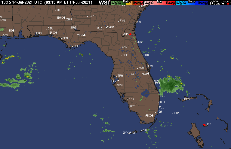
A Look at the Tropics When They are "Quiet" ... There is Always Something to Watch. SAL vs Strong Waves. GOM Convection with a High aloft. Where Could Surprise Development Pop UP?
Nothing officially happening for the next 5 days as per the 2 PM from the NHC. That said, often things pop up that we watch and wait to see if there is any model support. Or we go on vacation or a long cruise for a week and figure we won't miss much. I'm back from vacation for a week so I'm definitely taking a look at the tropics while reading up on the 8.2 Earthquake in Alaska in the early hours of this morning. I love geology, but it's a second love after meteorology.
Looking closer there is a huge wave off of Africa that interestingly came off around where they are supposed to come off when the MDR becomes more favorable. With Saharan Dust there still it's not totally favorable and the water isn't up to par just yet but that's a huge wave and it will definitely moisten up the atmosphere and attack the SAL. Again every day of July is a process that takes us one day and one step closer to the real storms of 2021 to show up and when I say "storms" I mean hurricanes. Above we see some blue thrown into the purple splotch indicating it's an area where something could develop, yet has not developed. Purple often shows up prior to yellow showing up on the NHC main page.
Next we watch Earthnull for signs of something...
....not there tho there is a bit of innuendo.
There's a complex of showers in the GOM.
There's also a High aloft ... interestingly.
This has been part of that stationary front.
Our pesky Low still is anchored off Georgia.
The High sits on top of the convection.
Models show nothing there developing.
But I'm bored so I'll watch.
Close in spin ups are often a surprise.
Late July favors a surprises so it's interesting.
That's a nice chunk of consistent convection.
Amps up the rains in Tampa and up the coast here.
Short wave imagery above shows a few things.
The wave.
A wave in the Caribbean.
Convection off of West Florida.
I'm not saying anything will pop up I'm just going over the general Atlantic now that I'm back and I don't like the misconception that when the NHC shows their "nothing" graphic it does not mean there isn't weather to watch and some possibilities of close in development. So far what's really kept July quiet is the lack of seriously warm water for tropical waves to work with so far. Yes, I said "so far" twice and now three times because so far only goes so far as we move into August.
Where it's red ... it's GO for development.
Note that's basically across the GOM close in.
And in the Bahamas off the Florida coast.
It's all a process, much like a family vacation. You spend a day with one child and their family, then you spend the next with another child and their family. You work your way over to the Brickell City Centre without the kids and shop at SAKS for some make up, you get some incredible coffee and a cheese croquette you take the Metromover back to their apartment and end up on Miami Beach getting Hamburgers and Israeli Salads even though it wasn't planned but it happened. CLIMO favored systems are what's on the schedule, sudden decisions to drive across the Venetian Causeway, look at a few new homes under construction and notice a lot of people and limos with security at the home of a HEAT player obviously having a party while Kanye is strutting his stuff in a soccer stadium while the lights of Miami glitter in the dark water under the bridges lit up in neon lights. It was supposed to be an evening alone at the apartment but suddenly we were out and about.
Surprises are not planned, but often we can see them possibly coming.
That's where we are at on July 29th days away from August and each wave comes off of Africa a bit higher and takes another bite out of the Saharan Dust. The water warms up and before we know it there's a hurricane possibly intensifying headed towards landfall just when you thought 2021 was going to stay quiet because it's July but it's not going to stay July nor August and you need to September Remember that in busy seasons or quiet seasons hurricanes will happen. Hopefully they will stay out at sea and not make landfall in your city but hoping doesn't help you prepare properly. It's a wonderful illusion when July is quiet but that gets pulled away really fast come August and September.
Prepare.
Get a plan.
Get a back up plan.
Refill your medications.
Buy lots of diapers as they go even faster than toilet paper.
Keep watching... because at some point the NHC takes out it's yellow crayon again.
Good to be home. It won't be for long as I'm on the move this summer.
Nothing Officially Happening BUT... 2 Huge Waves Off of Africa & the Pesky Low off the Carolinas Still ... Time to PREPARE for a Busy Hurricane Season
Nothing is officially happening in the tropics nor is anything expected to develop according to the National Hurricane Center for the next 5 days. The image above is from Zoom Earth, a fantastic site, and shows the Low off of the Carolinas that's still dumping rain on Myrtle Beach and a huge wave complex coming off of the Carolinas. Zoom Earth also shows the dry air to the North of it combined with the gauzy view of Saharan Dust that inhibits the large waves coming off of Africa.
I don't like to totally dismiss these are they can often flare up after they make it past the dust and as they are large there could be something left over in a week or so but officially the models say "No No No!"
Tropical Meteorology these days is very driven by the models and that is where the "nothing for the next 5 days comes from" but time has taught us not to ignore the tropics but to check back daily and see if anything has officially changed. Basically the NHC is saying "nothing to see here so move along" but what they should be saying under those white basic graphics is "but prepare for the Hurricane Season that will come alive sooner rather than later" because that is the message they should be pushing in the quiet time. Yes, there is a link on Hurricane Prep on their site but I'd prefer a link to that part of their page be more noticeable.
The trip goes on as there are places to go and people to see today .... working my way back to Raleigh. But for how long will I be in Raleigh? In truth I'd love to just stop and breathe and touch base at home for days. But time will tell.
Have a good day and remember to continue preparing for Hurricane Season. There's no reasoning with people who argue the season is dead with people who scream "La Nina!!" (as if they just saw a shark) and the truth is La Nina or no Nina the season will ramp up fast and furious and I'm not just quoting a movie. The signs are there and the question is not how busy it will be but how many could make landfall and hopefully not as a Major.
Invest 90L NOT Naked Anymore But Zero Chances of Being Fred... For Now It's the Prince of Tides. Ominous Thunder. Stationary Front STILL Stationary. A Look at 2021 So Far & How the Pattern Sets UP
The season so far and nothing has changed.
Pattern seems set for now.
Nice thunderstorm rolled through Atlanta last night.
And it's still rumbling here ominously.
But when I woke up it was awesome.
Traveling up the coast with that "boom" blow up.
Nothing much going on in the tropics except for Invest 90L that the models are still trying to forecast tracks for vs just going with CLIMO and current synoptic flow. Models haven't been good offering way too many suggestions but in truth it is what it is and it's just an Invest. That said... it's been fun "chasing it" or rather riding with it as we travel to Myrtle Beach. I'll admit I was hoping it would at least be Fred so that I can say I "met Fred in Myrtle Beach" which sounds like fun.
SAL is in charge yet not as intense as it was but widespread and as always it goes where hurricanes will go later as it's not just dust but dust in the wind flow. And that is as best as I can explain it but I've been doing this for a long time and every year I watch the storms follow the travel pattern SAL traveled a month earlier. And so far all data shows that tracks that make their way into the Caribbean and then aim for Florida and criss cross over or slide up the East Coast as long distance tropical travelers tracing the High Pressure that is currently still immense. That is not to say Louisiana and Texas do not see tropical trouble but they will be the ones that veered off from the highway.
I'll update tomorrow. I'll be on the road today and extremely busy this evening.
Do not let the quiet time fool you and rather than laugh off Invest 90L wonder if a named storm will soon trace this track with some variation and be a Hurricane. And, got to tell you having traveled with it ... it has it's moments and I imagine there will be lots of thunderstorms everywhere today along the coast. The clouds are more immense vs thunderheads that move fast and fly away. It's an organized mess of convection that lacks wind and you can thank the ULL that ran with it for a long time for that! Well it also wasn't a true tropical system but the NHC keeps putting Invests like stars over Alabama so it is what it is but once in the Atlantic it had to deal with a strong ULL creating shear and some dry enough air that it hindered growth. Had it moved more to the South as some models showed and sucked up more humid air and warmer water we might have had Fred.
Updated 10 PM Met 90L in JAX & Enjoyed the ride.... 9 AM Headed for Jax and So am I tho I'm headed North on 95 ...What will 90L do I10 West or Just Rain Itself Out or Travel UP the Coast? Otherwise Tropics are Super Quiet. (Is this the quiet before the storms of 2021??)
10 PM
I'm under the X tonight.
Snug in my bed after the trip.
Took awesome photos of 90L
such as it was and it was fun.
Headed into Jax and below...
Heading into Georgia
That's a color picture.
Dark but not dreary.
Low country cloaked in dark clouds.
Earlier today in North Florida.
The truth is I never believed the tracks back to the South of SW or even across Florida to the Gulf of Mexico. It wasn't logical or congruent with reality. It was obvious the most logical track was West (as it was/is weak and weak systems go West) or to crash back into the Florida Georgia line after hanging out in the Georgia Bight just offshore. Could it pull North a bit into the system moving down? Maybe. But the NHC basically upped it on each advisory by 10% and then brought it down 10% like that song "to the right to the right, to the left to the left" as their game plan based on models did not pan out.
Will see what happens tomorrow though they are close to pulling the plug so it's going to have to put some fancy clothes on as for now it's a naked swirl. But, to be fair at the Southern edge and the Northern edge it's got a mean bite and later tonight strong thunderstorms are supposed to move in. No real rain but a real sense of circulation oddly and some healthy bands of rain and thunder. A nice treat at the end of July on a slow road trip back to Raleigh. I was hoping the landfall of a tropical storm in SC would verify but mostly because I'll be there for a wedding tomorrow night.
I don't think we will get to Mid August without a named system though models are conflicted currently on when the season will start rocking and rolling. I've learned to just sit back and enjoy the ride and while talking with friends online I pass the time. August follows July that's too early usually and August you must look out... as the old saying goes.
Sweet tropical dreams from Savannah
Besos BobbiStorm
* * * *
Nice tweet online that is worth showing. It really tells the story. Invest 90L has less convection and severe weather than an afternoon thunderstorm in Miami but it has a weak circulation and low 30% chances of developing. Jacksonville Beach has some waves, there's been a lot of rain to the South of there but nothing really to write home about. Note it's still offshore and land interaction seems to be doing it well so keep watching. I know I am as I drive up into the Jacksonville area. More a swirl with convection but it has an official name Invest 90L but it has low chances of only 30% of actually doing anything. Something to watch, not much else to watch in the tropics. Rather see it from close up than far away as we were going to be in that area today anyway as we are on the road today.
Models say it sees the coastal cities.
Currently it's moving West ish...
Maybe it will do Savannah??
Slow moving system.
Tropical disturbance = Invest.
Not a real story currently..
The real question is where does 90L go? Does it slide up along the coast with part of it over water or does it keep going West across North Florida? It has a defined center but no real weather and models have been horrible trying to figure this one out so I'm watching in real time and hopefully up close and personal as today is a road trip day planned out to be able to look at Invest 90L up coast as we had North. I know where I'm spending the night tonight but does Invest 90L? I'd prefer it to hang a right and head up the coast but no one seems to know but Invest 90L.
Again it is still far off the coast over water.
Well the center of 90L but will see what we see.
I've been on real vacation all weekend trying to catch up with relatives I have not seen in almost 2 years so I haven't been online much. I am expecting to be in the vicinity of Invest 90L in a little while as today is a road trip day and planned the timing to hopefully see some weather from 90L, however yesterday we were in a strong severe storm with nearby funnel clouds sited and gusts in tropical storm force wind in South Florida so a weak westbound Invest without any real wind doesn't seem like much but you never know. I say that as often these systems that can't get it going over the ocean suddenly spin up some decent wild weather over land. I've seen that happen often, especially in parts of North Florida so it's definitely worth keeping an eye on the weather in North Florida today. That's why I'm going to be there and have places to go before we sleep.
Nothing of note in the tropics otherwise other than westbound waves and SAL doing it's thing. It is possible, depending on what happens with 90L that weather could spin up in the Gulf of Mexico but traveling West on I10 later tonight isn't going to help it go tropical. And the truth is that usually if an Invest doesn't ramp up fast on landfall it's one for the history books but seeing as how this began over land in Georgia who knows.
If I see anything on the road worthy of talking about regarding 90L I'll post and I'll be tweeting. This was an awesome Miami trip, including a trip down the Keys with my brother for the day, and I'll miss the kids, my friends, the palm trees and the water but it is what it is and at some point you gotta head North on I95 again and that's where we are currently in life.
Stay safe, stay well and stay happy!
Besos BobbiStorm
@bobbistorm on Twitter and Instagram
Usually happy to be on the road but it's a long complicated trip back with several stops and yet some weather to watch will make it more enjoyable as palm trees are in the real view mirror and oak trees with hanging moss welcome me back home.
Updated 5 PM Friday ...Orange 40% Invest 90L Off SE FL Coast. Will It Be FRED? Currently the Only Game in Town so Maybe. Florida Crosser or Carolina Coastal Cruiser? Stay Tuned.
Late Friday's models.
Everyone gets a chance it seems.
Also a chance it sits and spins or tries...
Shear is there.
The atmosphere is not so dry now ....
... Saharan Dust is due to move in soon.
Everything depends on where the center of Invest 90L forms and the exact location makes a big deal. It could slide up the coast not making landfall, it could criss cross North Florida or continue to loop in circles off the coast. The GFS currently takes it into the Gulf of Mexico and makes it south of 25North at some point whereas other models take it up the coast. Saharan Dust is moving into the vicinity of Florida and Invest 90L in the next few days so SAL could get a vote in it's development. The Gulfstream is a huge factor IF it stays over the Gulfstream as the water there is warm and the curve of the coast helps something form and usually move up the coast.
This is your typical July tropical disturbance. Sometimes they do not get a name but remain a tropical depression and head towards South Carolina after terrorizing Florida beaches. But this year the NHC seems more fast to upgrade something to a TS rather than keep it at TD strength. Most models keep this on the weak side but they do show development of sorts.
It has a short window before shear gets stronger and/or SAL moves in for a stay so will see what it does tomorrow. Expect surprises that would be my thought always with messy coastal lows.
Please read the rest of the blog as it explains this set up well.
Thanks... Bobbi
9 AM
Invest 90L off the SE Coast. 30% Friday AM
Invest 90L has been tagged off the coast of Florida just to the SE of Georgia. The problem with the models is there is currently a vast array of solutions. There is also a possibility one center could develop out of this and another area be left behind. Old dead fronts are common instigators of tropical trouble, however the trouble is they can often produce multiple centers within a developing area of low pressure so it will take a while to see which area wins out. The location of that center, if it develops, will dictate if this is a coastal cruiser or does it suddenly veer off towards Florida and the Gulf of Mexico.
So what do you do? If you live in Florida you already know the chances of rain are up and the colors on the radar are exploding everywhere. This is typical for a rainy season pattern in Florida as any visiting troublemaker amps up the moisture. But there's a difference between rain and an organized low pressure system with a center. Can 90L develop into Fred? Well if anything develops it should be Fred as it's the only game in town currently as the tropical Atlantic is dead, dry and taking it's time to ramp up into Prime Time later in August and September.
The water over the Gulfstream is warm and water temperatures are hot. It's in an area of frequent tropical development in July. the negatives are shear that is there currently and will dog the Invest as the pluses and minuses become a mathematical equation. Right now the odds are 30%. That should rise over the next day or so as it's now an Invest but does it get the name FRED? Time will tell.
I'll update later today. Once something is tagged as an Invest it investigates as that is the purpose of an Invest to investigate it's chances for development. There are more complex ways of studying it and models start running every few hours offering new solutions or honing in on the real track and intensity.
Again time will tell. The good news is you have plenty of time to prepare for it and the other storms of 2021 so you know what your "to do list" is and means anything you need to do for Fred or any real strong hurricanes in 2021 is to get it done. Meanwhile have fun. Oh and as for the Carolinas this is not a for sure Florida system it could loop around with a messy center (if it develops) and loop back up the coast as a coastal cruiser as currently the majority of the models support. Again models flip flop until a real center forms. Can one form out over the Gulfstream? Very possibly.
Decaying Fronts Produce Close In Home Grown Development ... Atlantic a Long Shot but Not Impossible ... Watch for a Small System Models Might Not Pick UP ... but for now.. It's Quiet in the MDR
I was at a wedding last night in Aventura for a family that is like my family as I've know the Mother of the Bride since she was about 9 years old. There was a beautiful ceremony outside "feels like 103 degrees" then a good amount of Scotch and Coke and dancing nonstop and finally I checked the NHC site that had an X over Georgia and wondered if I was seeing things. I'm still obviously not used to their yellow circles way inland but getting used to it. As I said the other day when the Atlantic is slow and unfriendly and fronts are sticking around you look for close in development that pop up suddenly as tropical possibilities.
There are possibilities close in....
It's not that there is a lack of tropical waves coming off of Africa, but they are suppressed still to the South by a very strong Saharan Dust outbreak that has taken up residence in the MDR and shows no signs of letting go. A wave could develop but the models are not picking up on it and none look as healthy as Elsa that came off of Africa spinning. Sometimes a small vortex develops and the models have problems latching onto it in it's early phases so while I'm not expecting development in the next week to ten days there I would not rule it out simply because models do not see it. Models sometimes notice after something begins to spin. That said..............the real deal is the old frontal boundary draped across the Southeast and strung out into the Atlantic showing up dark orange and red from Georgia to near Bermuda trailing off energy all the way towards England.
Models do show some development off the coast in several days but some models actually show two areas of possibilities as shown by the two purple splotches above. The Northernmost purple area wiggles up along the coast from Myrtle Beach towards OBX and some models hold onto it as an entity as it traces the coast. Oddly, other models show a piece of energy gets caught more to the South drifts across Florida and languishes in the Gulf of Mexico as convection and lower pressures but doesn't scream Tropical Storm.
The fact that this possibility is there is interesting as nothing says "homegrown tropical development" more than a front draped across the Southeast. It's our prime producer of tropical named systems of weak intensity that bump us up the alphabet as we move towards IDA and it's possibly FRED will be a flash in the pan as a storm that does nothing more than what other storms have done in 2021 and that is with an East Coast bias they drift up along the coast then race away.
The other possibility is nothing develops and we keep watching and I keep enjoying my Miami vacation. I really need to get to Miami Beach at some point but as I lay here in my daughter's bed staring out at the window at the skyline of Miami and it's hot outside and I think "maybe tomorrow" which is why Miami runs often on Manana time. After a wild wedding last night with mucho dancing and drinking and many selfies doing it manana works just fine for me.
The tropics are on Manana time nothing compelling or interesting. As a Miami girl I am weary of time when the Atlantic goes red hot later in August vs late in July as September makes you remember Major Hurricanes that trace a strong high and slam into Cuba, the Bahamas and Florida before they are able to put the brakes on.
Tropics Quiet. Weak Wave with a Purple Splotch of Possibility. Only Storm in the Caribbean is Cubans Trying to Gain Freedom or Just Go Online ... In Miami the Weather is Beautiful. Jose Marti Memories
This is the state of the tropics.
Eastern Pacific Prime Time.
Atlantic Quiet.
Purple splotch shows possibilities.
Low chances now but it's something.
Wave train stays alive even tho...
...the Epac is having a party now.
There's a blanket of dry air there and water that has not warned up just yet. The water is warming but in spotty patches across the Atlantic of warm, warmer and not yet warm enough. Soon the water everywhere will be warm enough to support tropical development. So until then we are in the in between days...that time when the early close in systems and random long shot waves win out over the overall unfriendly environment that might support an Invest yet not really a hurricane.
2021 so far has been East Coast Loaded.
Maybe Texas gets something but...
For now they be tracing the Huge High.
Sunny skies in Miami today...go figure.
That probably won't last long.
But connect the tracks .... a pattern there.
Picture from last night driving back from Hollywood.
I have several kids who live in Hollywood.
Buildings lit up with the Cuban Flag.
We show our solidarity.
It might not be much but it's something.
Beautiful day and night yesterday in Miami.
I'm in Miami on vacation in a sort of bubble 9 floors up over the Miami River and Biscayne Bay. My kids keep this place way cleaner than any hotel I've stayed in and I've stayed in a lot of nice hotels. During the day I venture out with one of the kids and their kids and we usually end up in one of their backyard pools or the pool here on the 11th floor in this 44 story Tower. Saturday I watched the protest at Freedom Tower from my perch on the pool deck looking up Biscayne Blvd at the crowds and the news helicopters as marine patrols raced up and down the bay. Everything was quiet, no one wants drama they just want freedom for their friends and family left behind in Cuba to be able to enjoy the simplest things we enjoy such as the freedom to go online and talk to their family in Miami or Key West a mere 90 miles away from Cuba. To be able to do a simple protest walking down streets holding signs without being shot or beaten up with bats. The average person in Cuba is not allowed to protest in public, they are not allowed to have guns and worrying on Free Bail is not an issue they are just shot on the spot. When you see Cubans marching for Communism they really are government sponsored protests where they go into a factory, put everyone on a bus and give them a sign. I had a friend who used to turn the sign upside down and an officer would stick a gun in his ribs and he's say "Lo Siento, Sorry... oops my bad" and turn the sign away and smirk. Eventually he floated to the florida with a cousin on a tire and started over. My Uber driver the other day has been here 3 months, he went from Cuba to Chile then to Mexico then to Miami and he's driving Uber worrying on those he left behind.
I may see the world differently because I was raised in Miami partially in an area known as Little Havana so I suppose I identify Cuban as Malta with milk was one of my first beverages and all of my friends at Southside Elementary were refugees from Cuba. It was always a disconnect for me that America worried on Vietnam on the other side of the globe or spent decades in one of the Stans yet totally ignores the injustice in a Fascist sort of dictatorship pretending they are a legitimate government voted on by the people. No not really. People vote by leaving and jumping in a large truck tire and trying to float to the Florida Keys and pray they are not eaten by sharks or lost in storms. Otherwise they are stuck there ignored while we worry on the Ukraine and Crimean and one of the Stan countries. It's kind of a disconnect because it would seem we should worry on our neighbors and our part of the world.
That said...there is no power change expected in Cuba any time soon and there is no sign of development in the Atlantic other than a long shot wave with a purple splotch getting some mild attention.
Wolf is up there on the balcony...
...behind Jose Marti in the early 1890s.
Key West.
To understand me when I talk on my perspective on Cuban politics understand my Great Great Grandfather met Jose Marti on a rooftop in Cuba in what is now know as La Te Da House in Key West on Duval Street. He and friends helped raise money for the Cuban Revolution against Spain. Wolf, ran his offices out of Ybor City where he moved after being violently ill with Yellow Fever in Key West (no running water only cisterns) and his son's grew tobacco they bought in Cuba that Cubans rolled into cigars. My Grandma who grew up in Tampa spoke both Yiddish and Spanish as well as English with a heavy Southern Drawl lived with Cubans, cooked Cuban style Chicken and Yellow Rice all the time when I was little. In Miami I grew up in Little Havana near Downtown and half of my friends were Cuban all the way through school. A Cuban doctor whose family fled World War 2 from Poland and was allowed to live in Cuba brought several of my kids into the world at Mercy Hospital. Note America would not let people come here by boat to escape Hitler yet Cuba did for a long time until they too stopped under American pressure.
A lot the average person doesn't know in America but assumes or thinks they know. Knowledge is power, research history not agenda driven news sites. Yet we fought two wars in Asia and spent 20 years trying to secure "freedom" for the average person near Iran yet our government under most Presidents of both parties tried to ignore Cuba only 100 miles away from where I often sip a Cortadito before breakfast. Something just is totally wrong there. You'd think there would be a way if we focused on it to achieve it without violence but everyone ignores it but people in Miami which is basically now a Spanish city truly a Gateway to the Caribbean tries to show solidarity with Cuba and their dream of freedom and liberty.
So the storm brewing currently may be in Cuba not a tropical depression threatening Miami. Maybe in August or September a hurricane will take aim at Havana or another part of Cuba the way Sandy did and then take aim at our East Coast. It's been an East Coast loaded hurricane season so far.
But things will change in the tropics... if not in Cuba.
But eventually I hope and pray for liberty and freedom for Cuba!
Besos BobbiStorm
@bobbistorm on Twitter and Instagram.
Ps Definitely on vacation for the rest of the week. I'll update if anything pops up or goes yellow!
Enjoy the song.... click on the link. Yes, I remember Jimmy when he looked like that singing in Miami years ago...
Nothing to talk about Friday morning. Well I could mention the strong breeze from Biscayne Bay in Miami and a chop out on the the water courtesy of the High Pressure. Why mention it? Because what is delivering fresh ocean air and a beautiful breeze could deliver hurricanes in August if this keeps up.
A pretty sunrise a busy day
NHC made an Invest and dropped it completely in less than 24 hours 🤷🏻♀️ So enjoy the quiet it won’t last long
Have a nice weekend I’m visiting kids, eating too much but enjoying the daily feasts I’ll update Sunday perhaps by then there will be something to talk about
Updated INVEST 99L - Tropics Dry and Quiet. SAL in Charge. 1 Wave Trying to Fight off SAL That Found Its Way to Miami Too!! Perspective on Hurricane History. Hurricane Sandy.
Worth mentioning the NHC has Invest 99L
at 10% yellow.
Usually they don't make an Invest at 10% yellow.
Most models keep this week.
There's always that one that breaks from the pack.
Track would be due East pretty much.
So mentioning it because it's there.
I spent time at the Museum today.
A bit of research. Wrote some poetry.
Soaked in some local color.
Always loved this photo that's part of "the morning after" collection from the 1926 Miami Hurricane. The details matter, cars trying to navigate in the flood waters that were on 12th Avenue not by the Bay as flooding after that storm was epic in some areas. Roofs torn off, buildings collapsed and some teetered on the brink of falling while people walked around in bathing suits or their favorite dress staring at the aftermath of the Great Miami Category 4 Hurricane that hit with little official warning with a population that for the most part had never gone through a hurricane.
Look at that detail. The guy in knickers (very popular then, the girl in her flapper dress with cutesy shoes staring down at the flooded road. the guy in his bathing suit (many put on bathing suits in the hot days after the storm) and the guy with arms folded and his robe tucked around him... the cute guy in the background staring. Did they know the hurricane would be the final knock on the boom that has busted earlier that winter or that the clean up would be epic? Did they wonder how to get out of town or did the thought never occur to them to leave? A moment in time as old Model T Fords tried to navigate the still flooded streets to check on their businesses and to see if they family was okay and had survived the devastating storm.
Seriously a Category 4 Hurricane that made landfall at Miami's door after slamming into Miami Beach with a storm surge that went up the river and then back again when the wide slow moving eye passed over Miami. More people were killed who went out in the eye to check on businesses and family than who actually died in the hurricane. I know people who I interviewed who rode out the hurricane on Miami Beach in a 3 story apartment building two blocks from the Bay and the Atlantic that watched the storm tide wash through the first floor of their building. To me it's always a miracle so many survived the storm surge on Miami Beach in 2 and 3 story apartment buildings. Yet, those who got in their Model Ts and tried to drive into Miami during the eye were washed off the causeway when the back side of the hurricane returned with another storm surge, Category 4 winds and they were simply washed away and never made it back to safety yet had they stayed on Miami Beach they most likely would have survived.
No one really understood hurricanes then, a few locals and some meteorologists but the coverage was far from how we have coverage today. So next time you think your local news channel is hyping the storm too much don't complain be happy because someone's life may be saved. Hype can be annoying for sure but knowledge is power.
As I sit here in my kid's condo looking down at the Miami River where yachts used to dock at the Royal Palm Hotel watching the boats going up the river or going out... people enjoying the tropical breeze always steady here I know that though I don't want Miami to get a hurricane that one day another hurricane will knock on it's door and I hope people have the knowledge what to do before a hurricane and after a hurricane not to mention during the hurricane; unless you're a news person or a storm chaser do not venture far from the front porch in the eye of a Major Hurricane. Enjoy those few minutes of amazement of calm, quiet skies but do not venture far from the building so you can be safely back inside with the doors locked and bolted. Knowledge is power.
Besos BobbiStorm ...keep reading if you have not it was just written this morning and nothing much has changed. Saharan Dust is coloring our skies with tropical sunsets and showing us the track that future hurricanes this season will most likely take.
The tropics are quiet this morning.
The tropics are also dry.
SAL has found it's way into Florida.
Sneaky odd route but it is what it is.
Looks like some hurricane track.
Cleo meets Sandy.
A wave has carved out some of the SAL.
Watch that wave way down the road ....
....they can wake up closer in to the coastline.
But for today nothing is pending.
10% yellow circle still in the Atlantic.
I'm in Miami and I had an interesting talk with an UBER driver who has been in 3 months and is from Cuba though he took a long route into the country via Chile and Mexico before Miami. He was not aware Hurricane Sandy hit New York City. You know why? Because he went through Sandy in Cuba where it trashed his home and the homes of many others and so he was a little surprised about New York City. Why I think this is important to mention is that many in America forget the Sandy was Cuba's storm and the one that missed Miami but slammed into Coney Island.
It's all about perspective.
After Andrew I had no power forever on Miami Beach and we listened to the local news that was dedicated to getting Miami back to recovery and reminding the Federal Government that we were sorry we didn't FAX the proper forms but the FAX machines were down and had no electric in Miami Dade offices who were supposed to FAX for help the forms. Miami radio was all about Miami so I barely heard details on where Andrew went after Miami and living with many kids on Miami Beach without power my ex-husband and I were not following Andrew when it retraced Hurricane Betsy's track towards Louisiana. When I was in a Historical Museum in New Orleans years back it is worth noting that they think of Betsy a THEIR hurricane vs a Florida Keys-Miami hurricane.
SAL has found it's way here because my brother's morning sunrise pictures are neon orange and red and to be honest even though it rained briefly yesterday it was sunny and dry and blue skies where I sat with my son in Coral Gables on Miracle Mile the road of my childhood sipping Caramel Iced Coffee.
Miami got very lucky with Sandy as it would have hit Miami as a much stronger hurricane than up in the New York latitudes.
May you escape any damage this Hurricane Season but remember the world is way wider than your own perspective on hurricane history.
From Miami with Love...
Besos BobbiStorm
@bobbistorm on Twitter and Instagram
Ps Personally my daughter is trying to get to rehab for her broken hip in Erie but it's been a difficult route working with NY and well she gotta go and hopefully that gets taken care of this week. Meanwhile I've got things to do in Miami research wise... writing wise.
Quiet Today. Thoughts on Long Term Forecasting in the Tropics. 1992 Quiet Season. Dr. Gray Did a Good Job with Pre Season Forecast but Could NOT Tell Miami the 1 Major Hurricane was the BIG ONE - ANDREW A Look Back!
All is quiet today on the Tropical Front.
Cluster or messy weather off the coast of Florida.
An active but low wave train.
Yellow 10% NHC monitoring.
Today I'm talking on seasonal forecasting.
The 1992 Hurricane Season being an example
It's quiet in the Tropical Atlantic with only a small yellow X with low 10% chances of development that mostly marks the spot of some weather that is being monitored. Waves are leaving Africa riding low in the water as they usually do in July as they try and avoid the Saharan Dust that tries to kill them off. Obviously, as we have seen one already make it across the basin I would not rule out any incredibly large, well formed waves that look to have low pressure attached. Currently they are mediocre run of the mill tropical waves so as always we will ignore them now and watch to see if one sneaks into an area of lower shear and develops closer in to the US as often happens in late July. Give them a week or so and July is more the Eastern Pacific active time of year.
So today I'm taking the quiet times as a chance to discuss something that needs discussing. In June and July every bored tropical meteorologist takes to posting reports, studies and home made graphs showing various reasons that the season might be slower than expected or pointing to when activity may ramp up. Meteorologists love maps and graphs. The media hungry for any lead story rushes to highlight this study or that and everyone likes them on Twitter because ... hey we are bored and there is nothing else going on. It's our virtual way of shooting the tropical breeze. And, those studies are good and the graphs are interesting and everyone knows I love a good map so I'm not kicking them completely but they are limited in their nature. Long range predictions can show that the Atlantic will juice up on August such and such a date and they can show us that strong shear from a developing El Nino may shut down the Caribbean and Gulf of Mexico or that a developing La Nina may favor development, blah blah blah blah but they can't tell you when a random hurricane will develop and be stronger than expected and do Rapid Intensification as it takes aim suddenly on a major metropolitan area. Every year we get better at our forecasts but we thought we were pretty good 20 years ago and 30 years ago with the help of computers meteorologists thought they finally had a handle on forecasting long term predictions.
Let's take 1992 as an example. Above shows us a very quiet hurricane season with only a few long tracking storms. The storm wearing the red running shorts is Hurricane Andrew. The others were not much to write home about. It is possible the team at the NHC would have squeezed out a marginal Tropical Storm that Bob Sheets or May Mayfield would have referred to as a Tropical Disturbance but still it would have been a slow year. Now with satellite imagery that is better than what it was in 1992 we might have sniffed out a few short term closed lows worthy of being Tropical Storm but there is no way it would be considered an above average season.
So if you had been reading the various reasons that 1992 would be a quiet hurricane season and you lived in the Miami area or Louisiana you must likely would have felt that you didn't have much to worry on and most likely would impact your tropical world. The headlines for a slow season due to numerous reasons listed with a few pretty graphs would have lulled you into a sense of security and the illusion that 1992 was not going to be "THE YEAR FOR THE BIG ONE" and I put it in caps because people in Miami or New Orleans or Houston tend to look at the list of names wondering which one will be "THE BIG ONE" as that's how we think to be honest.
There was an early season forecast by Dr. William Gray that I believe was one of the first pre-season attempts at long range forecasting and was not updated monthly as it is now with new current data.
This is from 1992....
"Forecasts of hurricane activity are issued before each hurricane season by Dr. William M. Gray and his associates at Colorado State University (CSU) and the Weather Research Center (WRC). A normal season as defined by the National Oceanic and Atmospheric Administration (NOAA) has 12.1 named storms, of which 6.4 reach hurricane strength, and 2.7 become major hurricanes.[1] In December 1991, CSU issued its first forecast for the year and predicted that 1992 would see eight named storms, four hurricanes, and one major hurricane.[2] CSU also issued a forecast in April, June and August; however, no revisions were made to the numbers of named storms, hurricanes, and major hurricane predicted in 1992.[4][5] Prior to the season starting, the WRC predicted that the season would see six named storms, with three of those becoming a hurricane while no forecast was made on the numbers of major hurricanes.[3]"
Dr. William Gray did an excellent job all in all as the finals statistics were very close to his pre season analysis forecast!
And yes there was one Major Hurricane.
The problem in 1992 as in 2021 is we can forecast how wet the Atlantic will be for the next month and how much shear may be there and we can talk on the MJO and Kelvin Waves and compare and contrast the EURO with the Korean model and the GFS and other tools we use but we can not pick the date that one rather good but wanting wave will make it across the Atlantic and become "THE BIG ONE" and slam into Miami, New Orleans or Houston any more than the NWS can warn parts of Miami that on July 12th parts of downtown Miami will briefly have a storm that looks like a hurricane. The NWS can warm people that the atmosphere is primed and ready to drop a huge thunderstorm with strong winds and possible hail but they cannot pinpoint where and when the locals need to take cover and not be on Biscayne Blvd as it will probably flood if the severe storm has a lot of moisture in it.
So that is the problem with a forecast long term. They can predict a busy period near the East Coast but they cannot pin point where the hurricanes will recurve out to sea or that one will get away and slam into the NJ NY area the way Sandy did in 2012.
Andrew was not expected to get across the Atlantic as it had much going against it.
Andrew was considered by most people in Miami as a stupid name for a hurricane.
Andrew was not expected to become a Category 5 Hurricane and go due West.
Florence was not expected to live long and prosper.
Florence was expected to develop fast and turn North fast and die out in the Eastern Atlantic.
Florence was not expected to slide through Saharan Dust and negative conditions and thrive.
Elsa was not expected to go the distance all the way to New England and Canada.
Once a hurricane forms and has a solid core and we get data from recon and the Gulfstream Jet we can get a good feel for the atmosphere own the road out ahead of the storm and get a nice narrow cone telling us what part of the Florida Panhandle or Louisiana will get landfall. And, then there is still the Holy Grail of Hurricane Forecasting being Intensity Forecasting as time and time again even today these amazing storms surprise us even with better models and more knowledge there is still more to learn.
So yes the 1992 Forecast was a good forecast and it did predict 1 MAJOR Hurricane but they were not able to and we are still not able to tell you that the one Major Hurricane will be THE BIG ONE that smashes into your home town be it Savannah or Charleston or West Palm Beach though you can always bet if it's aiming at North Carolina somewhere from Wilmington to OBX will feel the blow of a hurricane wind even if just as it cruises by offshore.
One last note for those still reading. It is interesting watching the little ball of moisture move in one mass up the Florida Coast, the remnant of the system that brought near hurricane force winds to my son's condo in Downtown Miami yesterday just 20 hours before my scheduled flight to Miami. Yes, I missed that by less than 24 hours I'm so annoyed but the sky here is blue today and there's music playing down by the pool deck below me and I'm taking it one day at a time. This is a test for any of my children as I didn't tell anyone I was coming in except for the two kids who live here. The last few weeks have been a nightmare of epic proportions as the News covered the search for bodies with my close friend and neighbor being one of them and waiting for my daughter who is still in an Erie Hospital be sent back to New York for recovery from a minor trip on a camping trip that turned into a long messy drama. She said I should enjoy being home with my youngest daughter as we rarely get time together and she'll see me when she gets out of rehab when they teacher her how "not to walk" on her injury. So I'll be in Upstate New York for the later part of the hurricane season it seems as I will go stay with her when she gets home and adjusted to life recovering from shattering her hip and other parts of her party before she is well enough to go camping again because unlike me she loves being out in the woods. Camping out to me is Days Inn or Best Western, I'm just not the camping out in the forest type.
A bit of test to see if any of my kids read the blog because then they will know I snuck into FLL in a thunderstorm with the clouds dark and gray the way they always are at 3 PM. Amazingly I found a $46 one day, nonstop ticket to South Florida and grabbed it on Southwest like I used to do before Covid when I used to "bank with Southwest" because if I didn't take the trip I could cancel and use the credit. So now I flew for the first time during Covid, the flight is just under 2 hours and it's the start to more traveling again I hope. Life lately has seemed a little uncertain, a huge tower can collapse, you can trip over a wire and break your hip and pandemics can pop up suddenly so going to live in the moment, enjoy the day and wander around the edges of Biscayne Bay and the Miami River doing a bit of Hurricane History research at the Library here and the Historical Museum before I venture out and see the rest of the family. I just wanna breathe............... inhale................exhale... and relax. And this morning it feels really good!
But like Gilligan the day after the hurricane the pool deck downstairs below the balcony is being cleaned up and the sky is blue and you'd never know there a crazy squall hit that area 2 days ago and because palm trees bend usually everything looks fine fine fine! Let's hope this place looks fine when the 2021 Hurricane Season ends and everything here was untouched as I do love Miami so even though I'm a Miami girl living in Carolina these days and loving the Carolinas also!
Something to think on... never let your guard down, always be prepared and know that no seasonal forecast or one month forecast can tell you whether some random wave makes it against the odds to your town and suddenly is THE BIG ONE!
Location: Miami, Raleigh, Crown Heights, Florida, United States
Weather Historian. Studied meteorology and geography at FIU. Been quoted in Wall Street Journal, Washington Post & everywhere else... Lecturer, stormchaser, writer, dancer. If it's tropical it's topical ... covering the weather & musing on life. Follow me on Twitter @ https://twitter.com/#!/BobbiStorm