Hurricane Harbor

A writer and a tropical muse. A funky Lubavitcher who enjoys watching the weather, hurricanes, listening to music while enjoying life with a sense of humor and trying to make sense of it all!

Thursday, May 31, 2012

Tropical Update on TWC - - Hurricane Season 2012 Game On


Well it's not a game... it's more a reality show that goes for the next six months officially.

Unofficially . . . the next few months may be the stronger part of the season IF (and that's a big IF) ... El Nino forms and the season comes to a grinding halt due to cool water and strong upper level winds across the basin.  Mind you that is only IF El Nino forms...  we are now in a "NEUTRAL" phase which is hard to figure out.. much like buying a new foundation. Is it "warm" or "cool" or a "neutral shade" ???

I spent the day at the Mall. Can you tell?  And, if it is "neutral" why does it have a "pink" tone to it?

Hurricanes like Make Up are about as hard to figure out and as hard to get just right. So many factors, so many shades ....

The last El Nino brought us a new definition of "El Nino" as they explained (they being the meteorological pundits) that this was a "different type of El Nino" which makes me wonder IF we get an El Nino... which type will we get?

It's definitely warmer in the Pacific than the Atlantic right now...and yet... we have had more development over here and it's not even the official season.

Take a look at this wonderful pic of "Tropical Depression Beryl" looking pretty darn healthy:


In Raleigh the Mimosa trees are in full bloom, a few Crepe Myrtle trees have started to bloom and the butterflies are fluttering around my Butterfly Tree. Every shade of hydrangeas are in bloom and the Hawaiian Gardenias are as heady and heavy as it gets.  It was close to 90 degrees today, and the yard was more perfumed than my trip to Victoria's Secret.  At 4pm in Raleigh it was hot, summery and it felt a lot like the middle of July. As beautiful as it sounds.... no proper Crepe Myrtle Tree would be in bloom just yet as this is Magnolia season still....    they usually don't bloom until July at the earliest. Sometimes June, not May.

Crazy. Really, really crazy.

There is a late night thunderstorm just now ..not far away and rumbling it's summer song yet we have yet to greet the Summer Solstice.

And, Jim Cantore was doing the Tropical Update today.. as were others... and shows showing Hurricane Andrew and I received an alert for Miami as Miami will be receiving more rain up from the tropics, from the same area that brought us Beryl.


Hydrologic Outlook

Effective: 2012-05-31 14:32:00
Expires: 2012-06-01 10:00:00

...HEAVY RAINFALL POTENTIAL THROUGH EARLY THIS WEEKEND... A TROUGH OF LOW PRESSURE WILL CONTINUE TO SET UP OVER THE CENTRAL UNITED STATES ALLOWING FOR DEEP TROPICAL MOISTURE TO SPREAD NORTH ACROSS THE KEYS AND INTO SOUTH FLORIDA TONIGHT THROUGH SATURDAY. TOTAL RAINFALL ACCUMULATIONS THROUGH THIS PERIOD ARE FORECAST TO RANGE FROM 2 TO 4 INCHES OVER SOUTH FLORIDA. AS TYPICALLY OBSERVED DURING THESE EVENTS...LOCALLY HIGHER AMOUNTS WILL CERTAINLY BECOME A POSSIBILITY WHERE THE HEAVIER ACTIVITY BECOMES CONCENTRATED. INTERESTS ARE ENCOURAGED TO MONITOR LATER FORECASTS FOR UPDATES THROUGH THIS TIME. AS CONFIDENCE CONTINUES TO INCREASE...A FLOOD WATCH MAY BECOME NECESSARY PORTIONS OF SOUTH FLORIDA
Crazy. Really, really crazy. 
As for me... I'm going to bed. Got a new foundation from Estee Lauder with a "gift with purchase" from Belk. Got a new Hurricane Map and notebook to take notes in and organize my thoughts into a Scrapbook of sorts. I'm going to bed.
The season starts at midnight.... the question is will we hit the peak of the season before we are midway into Summer?
Keep watching.........Mother Nature's best reality TV show... live, always changing and always breaking the rules, each year different from the last year, each year brings some new surprise.

Sweet Tropical Dreams

Bobbi
Ps... that's one of the healthiest looking Tropical Depressions I've ever seen... 

Wednesday, May 30, 2012

Driving through Tropical Depression Beryl


Last night we drove through Tropical Depression Beryl as she dumped 5.8 inches of rain over South Carolina, the part of South Carolina we were driving through and let me tell you... I've seen less wind and less rain in many Tropical Storms.  If anything, I truly believe Tropical Depression Beryl has been underestimated. She has already been responsible for one storm related death in Ormond Beach, Florida.

Tropical Depressions and Tropical Storms are funny things... one has more wind and less rain, one has much more rain and less wind... one has a barometric pressure that would define a strong Tropical Storm yet is named a Depression. There are parameters for these decisions and often in post season analysis they are upgraded or downgraded and there is a small article on the back of the newspaper. This storm deserves a reanalysis of it's strength.

Amazingly, I drove through the same outer bands of Tropical Storm Alberto at almost the exact same place and there was a lot less wind and a lot less rain than there was from Beryl. How many people can say they drove through BOTH of this season's pre-season storms? So, I believe I can make that comparison.  Alberto was barely noticeable at the beach, clouds offshore, banding high up in the sky and not much to talk about. Yes, a "small center" offshore supposedly.  Tropical Storm Beryl was a large, lumbering storm filled with rain wrapped in strong bands that affected a large part of the coast both north and south. What's five mph at any given moment of evaluation? Maybe an hour earlier or later when the recon was not in the storm they might have found winds of 5 mph more that would have properly deemed her a Tropical Storm.


Far to the south of the center the surf in Ormond Beach was strong enough to drag a young man swimming not far from shore six miles away to his death. Trees were down along I95, power was out in Jacksonville in many places and as she boomeranged back towards the ocean again she drew huge amounts of tropical moisture from the warm water just off shore which energized her and gave her the appearance of a much stronger storm than the Discussion out of the NHC would lead one to believe.

Telling you those flags were standing at attention for Beryl as she blew through ...


Also, she took the path that the GFS chose which was not the favored model in this case and she was definitely going NE last night chugging along I-95 much faster than the advisory indicated. The NHC favored the more southern solution and showed her moving ENE towards the ocean slower. No... she was burning rubber on I-95.


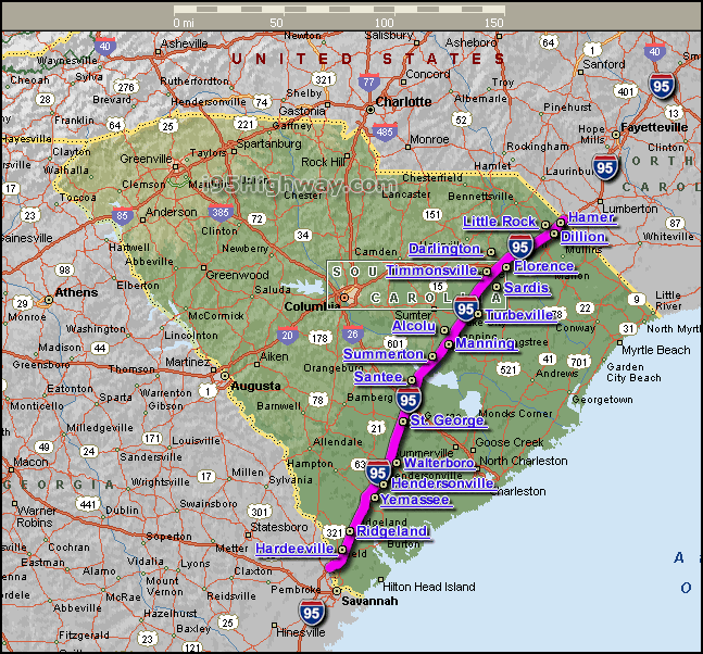
During the time she was pouring rain down on our car and we were driving past tall trees that had been downed she was dumping 5.8 inches of rain on the area we were slowly driving through. And, I mean slammed.... few cars were on the road, a few trucks slowly moving north as most motorists stopped or pulled over or refused to venture out.  We thought about staying in Waltersboro, however when you are hauling a lot of Kosher Meat back to Raleigh being kept cold with dry ice the thought of stopping becomes a practical decision. And, I knew that we were just about to get north of the where the strongest rain was....  "thought" being the operable word because it became apparent fast that Berly, despite her forecast, was chugging off rapidly to the NE not the ENE and taking the northern track towards the approaching frontal boundary. To me, that was the logical solution but I wasn't writing the discussion. I was however Tweeting.

Here's a "diary" of sorts of my relationship with Beryl where for once I felt as if Beryl was doing the storm chasing not me... enjoy and please follow me on Twitter "BobbiStorm"

"finally n of heavy rain. Ill take the gfs on this one. Stronger than she looks. Low barometric readings."


  • Rarely do I argue anymore with the NHC, but when you are driving through a storm and watching the radar... I'll go with what I know vs what they forecast.  Telling you SERIOUSLY TORRENTIAL RAIN and wind strong enough to down trees and make huge trucks pull over to the side. For a while, it was a total black out, you could barely see anything in front of you but the steady rain slamming down on the windshield faster than the wipers could wipe it away.  Note..that was when we were around Hardeeville.... five plus inches of rain in a short time.

    I've stood at the ocean taking pics with storm chaser friends on many occasions, this was one to remember. A different take on a storm. I've been in an old two story house, hunkered down on the 2nd floor on Miami Beach three blocks from the ocean as Hurricane Andrew raged outside in all her glory. I've driven through "weak Hurricane Floyd" in 1987 when we had to drive my young toddler to the doctor for stitches sustained by jumping up and down on my mother's sofa.... a bit more wind, a lot less weather.   Beryl is and was tougher than indicated, more a storm and less a statistic. Everyone is excited about the statistic of Beryl being the "strongest storm" to hit before the season or in that area .... but she was one tough Momma... let me tell you.

    http://en.wikipedia.org/wiki/Hurricane_Floyd_(1987)

    Home now... just north of Alcolu the rain stopped, slowed, misted and then.. blissfully the rain stopped and we drove on northwards towards Raleigh, meat intact and 20 Publix Yogurts (tropical flavors :) and Kosher Fake Crab...northbound towards a Pit Stop at South of the Border where their was no rain falling, yet the rain was just behind us spreading north and east...more north than east.  We pulled into the driveway and unloaded the car as rain began to fall from the outer rain bands of Beryl, it's raining still.

    I-95 South Carolina Map

    A Twister has been noted closer to the beaches attributed to Beryl. Her circulation quite tight still as she merges with the cold front ....looking stronger on radar now than I would have thought when I read the 11AM Discussion out of the NHC.

    "TROPICAL DEPRESSION BERYL DISCUSSION NUMBER 19
    NWS NATIONAL HURRICANE CENTER MIAMI FL AL022012
    1100 AM EDT WED MAY 30 2012

    SATELLITE IMAGES AND SURFACE OBSERVATIONS INDICATE THAT BERYL IS
    LOSING SOME TROPICAL CHARACTERISTICS AS IT BEGINS TO INTERACT WITH
    AN APPROACHING FRONTAL SYSTEM. THERE IS A CONVECTIVE BAND WELL
    REMOVED AND EAST OF THE CENTER...BUT THE RAIN IS SHIFTING NORTHWARD
    AS NORMALLY OCCURS DURING THE TRANSITION TO AN EXTRATROPICAL
    CYCLONE...AND THE CIRCULATION IS BECOMING ELONGATED. INITIAL
    INTENSITY IS HELD AT 30 KT AND THESE WINDS ARE PRIMARILY OVER WATER
    WITHIN THE AFOREMENTIONED CONVECTIVE BAND. WITH INCREASING SHEAR
    AND THE INTERACTION WITH THE FRONT...THERE IS A STRONG LIKELIHOOD
    THAT BERYL WILL BECOME A POST-TROPICAL CYCLONE LATER TODAY AS IT
    MOVES OVER THE NORTH CAROLINA COAST. WINDS COULD INCREASE A LITTLE
    BUT THESE WINDS WILL BE CONFINED TO THE SOUTHEASTERN QUADRANT OVER
    WATER.

    BERYL HAS ACCELERATED AND IT APPEARS TO BE MOVING TOWARD THE
    NORTHEAST ABOUT 17 KNOTS. THE CYCLONE IS ALREADY EMBEDDED WITHIN
    THE MID-LATITUDE WESTERLIES...AND THIS PATTERN WILL CONTINUE TO
    STEER BERYL NORTHEASTWARD AND THEN EASTWARD WITH INCREASING FORWARD
    SPEED. SINCE AVAILABLE TRACK GUIDANCE IS TIGHTLY PACKED...THERE IS
    CONFIDENCE THAT THE CYCLONE WILL MOVE AWAY FROM THE U.S. DURING THE
    NEXT 12 TO 24 HOURS AND ACCELERATE OVER THE OPEN ATLANTIC AS A
    POST-TROPICAL CYCLONE."

    Again note my tweet from ELEVEN hours ago..  "I'd say ne faster than expected"

    Will post more damage reports later (after I unpack the clothes) and some great pics I took as we entered the first bands outside of Jacksonville. I cannot over stress how WINDY it was at that point, my hair was flying about, the flags were flying straight out... I can easily imagine how a swimmer far to the south of the storm in Ormond Beach would underestimate this storm, as has the NHC I think but that is for them to say in the post season analysis.

    For me... Beryl was one wild ride I will always remember, sat writing bits and pieces of poetry as my husband handled the car excellently and definitely earned the right to wear a lot of my storm chasing tee shirts... though we were more riding with the storm, singing along to rock and roll and silently praying no trees fell down on the highway ahead of us....

    Loved it... love tropical weather, love all weather but well... I have a special place in my part for anything tropical... including Publix Mango Yogurt and their Guava Pastry Yogurt ;)

    Besos Bobbi


  • Btw tree down on median n bound on i95 south of lake marion. Some debris on and near left lanes. Be careful
    Hate twittering on fones. Finally n of heavy rain. Ill take the gfs on this one. Stronger than she looks. Low barometeric readings.
    Believe the gfs is handling beryl better. Traveling n on i95 as beryl spreads n faster than Ben. Id say ne and faster than expected.
    Torrential rain in hardeeville sc from beryl
    Humid and misting in Savannah. Alberto and Beryl...same place, same mist. Go figure. What are the odds? Minor flooding
    Darien, ga. Beryl out my real view window. Dark growling clouds over Georgia..headed back to the sea 

    Tuesday, May 29, 2012

    Jax/Savannah 2-0 ... Alberto & Beryl?

    What are the odds?


    I keep hearing the song "How Do You Like Me Now?" playing in my head here while watching the radar loops.  Beryl's rain is moving through the exact same places as Alberto's tropical moisture did. Can't imagine what will happen next at this point. And, there will be a lot of "nexts" this Hurricane Season.

    http://www.ssd.noaa.gov/goes/east/tatl/flash-rb.html

    The moisture down under Cuba that brought us Beryl is still bubbling away and can possibly bring us a third early season system if it develops. Not sure it will, but it's down there and looking even better than Beryl did a few days back.


    As for me, I'm looking south and north and all about wondering on how the tropical pundits could be so off on this Hurricane Season.

    This is one of the problems with early season predictions, a lot like those Sports Illustrated Covers which show a player who didn't quite live up to his potential or went down in the 2nd game of the season and though he got a lot of publicity in the pre-season the expectations were way off.

    We forecast, which means we are trying to take a stab at what we think will happen. Problem is tropical storms and bunches of them come in all sizes and shapes like babies in the same family. One year we get long coastal cruisers, one year we get Cape Verde Waves, one year we get storms that form close in...   like this year .... and we will get a few long cruisers and loop de doop storms this year.  We'll see... time will telleth but come on.... it's a warm, hot, steamy, muggy May and don't think this will change going into June.   In years like this we often get strong July Hurricanes, because July feels like September in years such as this when we are climatologically weeks if not a month ahead of where we should be this time of year.

    In New York the trees were budding weeks ahead of schedule, roses cover lawns in April almost two months ahead of when they usually blush forth in late May or early June.  In the Carolinas the pollen burst early, the Dogwood festival was without dogwoods and it was July in May. In Miami,, during the holiday of Shavous which usually ushers in the rainy season, we baked in extremely hot weather as winds circulating around a tropical system to the north brought us southwesterly hot winds and very little rain. It was one of the hottest, steamiest holidays I can remember... barely a breeze on the canal, hot airless days that my Grandma Mary taught me were a prelude to tropical trouble. Got to trust my Grandma Mary, there was something about her... she knew from years of living in the deep tropics (Tampa & Miami) when were were about to go into the hurricane season and she was right.

    This is it.  This is the start of things to come... tropically speaking...

    What kind of tropical storms and hurricanes we will get... can't say but they will come and it seems they will be coming in odd places. Will this be Tampa's year? Maybe... possibly.

    As for me, sitting in the backyard barefoot and watching the birds and the butterflies and the heavy crop of mangoes swinging on their thick rope like stems and enjoying the breeze from the ceiling fan we have out here. Love it... love it so much.


    Bright orange butterflies twisting around each other in some natural dance that has a meaning only they understand. Yesterday, striped yellow and black ones were dancing all around me as I walked to to Temple. I just stood there, remembering the month or two before Wilma when we had a similar set up and the yard was flooded with bright yellow butterflies. Something similar.

    As for the Jax/Sav area... not much damage and a lot of wave watchers at the beach. Imagine they will load up on hurricane supplies this year... and the song keeps playing in my head "How do you like me now?"

    http://www.youtube.com/watch?v=3umaLe37-LE

    Remember, this storm was 5 mph less than a Hurricane..that's got to be a wake up call for any city that thinks they are untouchable tropically and are "safe" as this year will be a year to remember I believe with regard to odd storms...

    http://staugustine.com/news/local-news/2012-05-28/minor-damage-beryl

    http://www2.wsav.com/?page=Refresh

    http://www2.wsav.com/special_section/local/savannahcams2/

    Keep watching, stock up on supplies, never think that the worst can't happen and hope that the storms go somewhere else...  always be prepared, now is the time. Alberto and Beryl were wake up calls, don't keep hitting the snooze button guys....

    Besos Bobbi
    Ps...got to love a holiday that includes eating ice cream sandwiches!


    Friday, May 25, 2012

    Sunshine in Miami --- Troubles in the Tropics

    There's trouble in the tropics for forecasters who have the difficult job of tracking a storm that models show will do loop de loops in the Atlantic before veering sharply left and slamming into some coastal town.  Of course, the more time that goes by... there is always a chance it lingers long enough and goes out to sea like most storms this time of year that form close in.


    Now if you were a forecaster....what would you do? How would you write a forecast and discussion?

    As for me, I will most likely be driving through Beryl on my way up north just as I drove through Alberto on my way down south, hard to believe but ironically funny.  It won't be so funny if NC gets hit while I am in Florida... who knows.... definitely  not Beryl who has not been named just yet even though everyone is toiling away trying to figure out which way she goes when she gets a name.

    Hurricane Beth in 1971 formed in a similar location in a slow season in August, one of the worst Augusts of my life I may add... and did the normal sort of two step off to Nova Scotia and the wide open Atlantic.

    http://en.wikipedia.org/wiki/Hurricane_Beth

    That was then, this is now. That was August, this is late May. A big difference between May of 1971 and August of 1971 and a big difference in predicting what any system will do when it forms early and steering currents are unset and unpredictable.

    Luckily, I'm just BobbiStorm enjoying a beautiful morning on the patio watching the orange butterflies and sipping Nespresso and waiting for my best friend to come by and go wander around a Whole Foods somewhere before starting the Jewish Holiday of Shavous.

    I will be away from the computer from tonight at sundown until Monday evening, so by the time I am back online we will know just what Beryl did ...if she forms.

    Great sites to use are:

    www.flhurricane.com which is one of the best sites around.. great home page and great posters on the boards.

    www.hurricanecity.com with it's www.canetalk.com forum.

    Skeetobite and the NHC have your back.

    I'll try and post later today but it's still too early to tell just what will be.

    I love Miami. I love Hollywood Florida too.... many places in Florida ...especially the Keys. There is nowhere like Florida. I have lived in California, trust me.... it's got nothing on Florida. And, seriously if you want a natural disaster... pick one you can plan for.  That said, life in California was wonderful it's just the Florida is that much wonderful.  Next in line is Savannah and Myrtle Beach and I don't even play golf. I just love MB the same way I love where I was raised in MB, FL.

    Ever want to read a great book, pick of River of Grass and learn more about this paradise we call home and what is was like before it was overrun with strip centers and parking lots.

    File:Everglades River of Grass.jpg

    http://en.wikipedia.org/wiki/Marjory_Stoneman_Douglas

    She could write about a hurricane like no one could even touch... and still, in the backyard while watching a palm frond fritter and the sun bouncing off the leaves of the mango trees while big, purple plum like fruit hang sweetening on the tree and the breeze from not so far away Biscayne Bay blows this way... you can close your eyes and picture what it was like to live here then... or live here now.  Nothing has really changed.

    I love it.

    I love a lot of places and I have kids all over the place these days so I travel a lot, but there is nowhere like home and this is my home, my Kansas, my spot on the beautiful globe that looks like a blue marble spinning silently in space.

    Besos Bobbi

    "All we need, really, is a change from a near frigid to a tropical attitude of mind."
    Marjory Stoneman Douglas
    Read more at http://www.brainyquote.com/quotes/authors/m/marjory_stoneman_douglas.html#eIGIjTtRfTWCft2T.99

    Thursday, May 24, 2012

    A Complicated Mess -- 60% Chances of Development

    TC Activity

    Possibly higher as they have upped the ante to a big RED circle off the coast of Florida.

    The models show a very complicated mess that must be making forecasters slurp Mylanta like it's mother's milk.

    Now that's perfectly normal:


    Let's see what tomorrow's model runs show.

    The rain suddenly wrapped up and departed the area around 2pm... around the time this system began to congeal off the coast of Florida.

    May I point out that there is STILL a lot of  energy left behind over Cuba, but for now let's worry on what will most likely at some point be Tropical Storm Beryl.

    The energy left behind around 21n and 81w is still down there and still bothers me.

    http://www.intellicast.com/Storm/Hurricane/CaribbeanSatellite.aspx?animate=true

    For now... going to enjoy the clear skies and figure the guys will go golfing tomorrow morning.

    As for me... going to wait and see what the next model runs show...

    Sweet Tropical Dreams,

    Bobbi

    Rain in Miami.... More on the Way


    On a gray, misty morning I'm sitting on the patio listening to Kenny Rogers singing "The Gambler" a song stuck in my head this morning, gray, misty morning...

    It's raining and the rain is streaming up from the system in the Caribbean. This is NOT an Afternoon Thunderstorm, though we may get some strong ones this afternoon with a chance of seeing waterspouts if you are lucky enough to be by the beach sipping a Margarita this afternoon.

    There is a steady train of moisture (RAIN) streaming NE out of the Caribbean from the system that has no real center and no real name... and yet is causing to much misery to it's north. Though the main direction that moisture is going is NE or NNE there are little storms forming and buckling back to the NW over South Florida. This should continue...  unless the area that was last night centered around 20n and 80w finds it's center. Note areas that blow off look bigger, but a piece of the energy hangs back always and seems rooted at the spot. The European model may  have seen that and may be going with it but hard to say for sure. Systems like this are murky at best.


    Also, with the development of Hurricane Bud in the Pacific the winds across the Caribbean will most likely be too strong for Beryl to form on our side of the basin.

    Keep watching.

    If you are in Miami today...or the Florida Keys..........................run fast through the raindrops or take an umbrella..something we Miamians rarely ever do.

    Besos Bobbi

    Ps... keep watching, today should be the day that tells the story. It forms or it blows off... either way, we have a Flood Watch, we have a Hazardous Weather Statement which is about as tropical as it gets in a month normally known for "dry Mays" and usually when we have a year like this the pattern gets set for wet Caribbean Cruisers that come up at us vs the long tracking Cape Verde storms that hit us from the East... usually.... but you never know for sure until you do a post season wrap up ;)

    http://www.youtube.com/watch?v=esAr0qGu2S4

    Wednesday, May 23, 2012

    Area of Interest in the Caribbean... and a Bounty of Mangoes


    It's an interesting area.... if it develops it would track north enough to make Florida and other areas worry.... it could go NE out to sea, many similar systems do... many don't. Many develop down there and go north to or through Florida for points of interest that are looking forward to a Memorial Day Weekend to kick off the "Beach Season" not to kick off the "Hurricane Season."

    Down here in Miami .... beach season is all the time... we are in Mango Season, an early mango season. Old timers often tell the weather by the mango crop. This year it was early and came on fast and furious and the trees are LOADED with mangoes, big, heavy, delightfully colored mangoes just hanging there in the humid morning.


    These mangoes cover the tree, hundreds of them... wondering on if there are thousands of them, no joke it's a BIG tree. Some so low they almost touch the ground.


    They almost touch the high grass, weedy filled with colorful flowers and what seems like billions of butterflies spinning about the scattered flowers. A whole wile world out there this morning. Orange butterflies, white butterflies...sucking nectar and enjoying a break in the weather. There was a rainbow this morning, it lied... it's gonna rain and rain on and off all day...

    Women appeared at the door just now... asking to "pick a few mangoes" and they are filling bags with them. To eat, to sell, who knows, who cares.... can't pick em as fast as they are falling, smelling up the yard with a mushy, mango scent that some of my kids love and some of my kids hate. I like it, to me it smells like "home" but well... to each his own.

    We have a bounty of mangoes this year, everyone is enjoying them. After they left, you couldn't tell they took any. They took at least 4 bags and yet, the tree is still loaded with mangoes.

    A lot like this year's hurricane crop I think.. a lot of tropical troubles down the road this hurricane season.

    I know. The mango tree told me so ....

    Besos Bobbi
    Ps... watching and waiting for that Caribbean rain as I run errands between the showers that are filling the yard with weeds and grass growing higher and higher and the mango pickers get money, the gardeners get rich and the tropical systems just keep coming and it's not even June 1st yet.
    Welcome to my world ;)


    Tuesday, May 22, 2012

    Florida & The Caribbean Connection... New System?


    I'm sitting outside typing this from the screen enclosed patio in Hollywood, listening to the sounds of the palm fronds rustling in the night and there's a train rolling by over near Dixie Highway... some one's wind chimes are dancing about making little cute cymbal like sounds.. my brother is in the house staring at the weather watching for any news on the invest in the Caribbean.

    So much action and it isn't even June 1st. Official Navy Site Invest:


    Until this system forms...it is hard to tell which path it will take. There is talk of planes being sent out should it continue to look threatening. Either way Miami and South Florida is in for more rain..

    It was a beautiful night in Miami tonight.... I was on Miami Beach, a block from the ocean at my son's school watching him graduate from High School... my youngest child to graduate from the Hebrew Academy which has made it through many a hurricane and will hopefully make it through this year's Hurricane Season.  Funny how we live and function on the edge of possible destruction every summer and instead of worrying over it...we watch the score from the Miami Heat game...

    Time will tell... tomorrow will tell... it was a good night tonight. Had a sushi party out on the porch, he floods hit another suburb today, the rains broke the humidity a bit and the ever constant Miami breeze made life a little more beautiful.


    Watch the Carib boil and simmer and let's see what we will see at sunrise. Sushi and Nespresso.... wondering if I will sleep tonight wondering if Beryl will form and come this way this weekend. Whatever happens, we are in monsoon season so we are in the flow... up out of the Caribbean.

    Sweet Tropical Dreams...

    Bobbi
    http://www.intellicast.com/Storm/Hurricane/CaribbeanSatellite.aspx?animate=true

    Monday, May 21, 2012

    An Interesting Storm

    Alberto hangs in there, intensifying over the warm waters of the Gulf Stream and most likely going out to sea.

    Time will tell on that one...  for now easy money would be on him following the NHC game plan.

    [Image of 5-day forecast and coastal areas under a warning or a watch]

    Yesterday, I was in Savannah and Jacksonville enjoying gentle rain from Alberto's distant bands.
    Gray skies to the east over the ocean, yet blue skies to the west. A lot of wind, breezy, warm and
    dry despite the rain showers that came onshore. There was definitely something out there.

    Will post tonight when we see what we shall see. For now I'm on Miami Beach taking care of
    personal matters (son graduating from high school) and breathing in the beautiful, lush landscape
    of South Beach... home base... the real "me" and oh so beautiful.

    I've lived many places... LA, NY... but nowhere like Miami Beach :)

    Miami...and it's many suburbs..is truly the Magic City!

    Let's hope Alberto's siblings down the road spare this beautiful, colorful, playful town!

    Besos Bobbi

    Sunday, May 20, 2012

    nhc sends in recon...would love to downgrade him b4 crossing the finish line...

    Tropical Storm Alberto Update... reality check ;)

    Well, it's still there this morning.... though a lot of other things out there that need discussing... but for now Alberto is on the clock...

    A good link with info in the vicinity of the storm is shown below.

    http://www.ndbc.noaa.gov/radial_search.php?storm=at1

    Alberto is a small, compact, little storm and I wonder if it will be downgraded in post season analysis or kept for the historical record. Most likely, it will miss land and go out to sea. I'm not sure it won't fall apart and move closer to or on shore...however if so it will mostly be a rainy day at the beach if that were to happen. Keep watching... interesting little blow up, sort of a pre-release publicity for the hurricane season.

    Any storm, no matter how small is always worth paying attention to especially when it is this close to the coast. The Tropical Storm watch remains for parts of the Carolinas. If you are at the beach today, enjoy the breeze. I"m tempted to go ...just not sure which beach to go to ... for the best breeze and taste of the tropics. Of course, I'll be on South Beach in 24 hours or less so... that's my favorite taste of the tropics..that and Key West. If I wasn't south bound I'd be headed to Myrtle Beach today.. lots to do, a really nice kosher restaurant and a great place to kick back and relax and shop til you drop at Victorias Secrets at Broadway on the Beach..... or whatever it's called.

    http://www.visitmyrtlebeach.com/play/amusements_and_attractions.html

    http://www.margaritavillemyrtlebeach.com/  <---  (i know, good link)

    Good link that shows the actual storm info... it is a Tropical Storm. It just has a very weak satellite presentation.

    Elsewhere in the tropics...............


    I'll take that area off the coast of Central America... and the old frontal boundary and ...
    WOW look at that low wave coming off of Africa.

    Gonna be an early and busy season in both the Atlantic and Pacific.

    That sweet little sky blue circle off of South Carolina is Alberto...

    Keep watching... will try to update from the road if there is something to say...

    Besos Bobbi

    Ps...   Game on...


    Saturday, May 19, 2012

    NHC Hedges It's Forecast... Alberto "drifting" towards the coast


    As noted in the 11 pm...there were a lot of holes left to plug or for later adjustment... hmmmnnn

    000
    WTNT31 KNHC 200537
    TCPAT1

    BULLETIN
    TROPICAL STORM ALBERTO INTERMEDIATE ADVISORY NUMBER 2A
    NWS NATIONAL HURRICANE CENTER MIAMI FL AL012012
    200 AM EDT SUN MAY 20 2012

    ...ALBERTO DRIFTING TOWARD THE SOUTHEAST U.S. COAST..

    Tropical Storm Alberto... Close to the Coast...

    The NHC seems not 100% sure of what this minimal storm will do... the discussion has more holes than a sieve and imagine the 5am discussion will be much more decisive.

    http://radar.weather.gov/radar.php?rid=ltx&product=NCR&overlay=01100000&loop=yes

    It's very close to the coast and moving west... tho now they are saying it's the "weather mass" part and not the actual center. That does happen. Point is someone on a beach in South Carolina is getting rain tonight from Tropical Storm Alberto.

    I'll highlight the holes in the discussion....


    TROPICAL STORM ALBERTO DISCUSSION NUMBER   2
    NWS NATIONAL HURRICANE CENTER MIAMI FL       AL012012
    1100 PM EDT SAT MAY 19 2012
    
    THE INTENSITY OF ALBERTO HAS BEEN DIFFICULT TO DECIPHER THIS
    EVENING. WHILE AN EARLIER SHIP REPORT SUGGESTED THE STORM WAS
    STRONGER...THE SATELLITE AND RADAR PRESENTATION HAS BEEN ON THE
    DECLINE SINCE THEN...WITH A NOTABLE DECREASE IN WINDS FROM THE
    COASTAL DOPPLER RADARS. THE INITIAL INTENSITY OF 45 KT IS A
    COMPROMISE BETWEEN THE SHIP REPORT AND THE LOWER SATELLITE/RADAR
    ESTIMATES. ALTHOUGH THE CYCLONE IS EXPECTED TO MOVE NEAR THE WARM
    GULF STREAM WATERS FOR THE NEXT DAY OR TWO...MODERATE SHEAR ALONG
    WITH PROBABLE ENTRAINMENT OF A DRY AIRMASS TO THE NORTH OF THE
    SYSTEM COULD PREVENT SIGNIFICANT STRENGTHENING. THE INTENSITY
    GUIDANCE REMAINS SPLIT WITH THE DYNAMICAL GUIDANCE SUGGESTING SOME
    WEAKENING...AND THE STATISTICAL TOOLS SHOWING STRENGTHENING. THE
    OFFICIAL FORECAST IS UNCHANGED FROM THE PREVIOUS ONE AND LIES NEAR
    THE CONSENSUS.
    
    ALBERTO APPEARS TO BE MOVING SOUTHWESTWARD AT ABOUT 5 KT...AS IT IS
    BEING STEERED PRIMARILY BY A LOW- TO MID-LEVEL RIDGE OVER THE
    EASTERN UNITED STATES.  THIS RIDGE IS EXPECTED TO BREAK DOWN IN A
    DAY OR SO...WITH A COMPLEX STEERING FLOW PROBABLY CAUSING THE
    CYCLONE TO TURN TOWARD THE NORTHEAST IN A COUPLE OF DAYS.  THE
    GUIDANCE ENVELOPE HAS SHIFTED SOMEWHAT TO THE SOUTHWEST IN THIS
    MODEL CYCLE...THOUGH MOST OF THE RELIABLE MODELS STILL KEEP THE
    STORM OFFSHORE.  THE NHC FORECAST IS SHIFTED SOUTHWEST OF THE
    PREVIOUS ONE THROUGH THE FIRST 36 HOURS...AND IS NEAR THE TVCA
    MULTI-MODEL CONSENSUS.
    
    ALTHOUGH THE OFFICIAL FORECAST CALLS FOR THE TROPICAL-STORM-FORCE
    WINDS TO REMAIN JUST OFFSHORE...THERE IS TOO LITTLE MARGIN FOR
    ERROR TO NOT ISSUE A TROPICAL STORM WATCH AT THIS TIME.


    Sweet Tropical Dreams...Bobbi

    Surprise Tropical Storm Alberto Off the Coast of Carolina... 1st Storm of the Year..


    Don't you just love it? Close in development off the Carolinas, when everyone has been looking at storm formation in the Caribbean and out near the Azores.

    Truth is I saw it yesterday morning and discounted it...even though it seemed to be rotating.

    I thought it was a sort of what we call "wishcasting" which is basically like a mirage on a hot day on the highway in the desert. But no... I was right, I did see it rotating and close to the surface at that.

    In Raleigh this Shabbos and leaving for Miami any day so may get a chance to travel through rain from Alberto if he does indeed move onshore...which is a definitely possibility. Not a big one, but because of his very small size and signature on the satellite imagery a real one. Small storms like this are less likely to be picked up by strong steering currents which would logically take him in a fast circle and out to sea. In this case... he may nudge onto shore and then when turning north (if he does) clip the Wilmington Beach area... Ocean Isle (early thoughts here) before getting swept out to sea.

    That little blue dot just off shore South Carolina is Alberto.


    I was concerned that he intensified so fast to 60 mph because if they get the intensity forecast off, they get the forecasted track off too. But, for now they are saying that the original estimate was wrong and too low... a ship reported stronger winds.  See below:

    "TROPICAL STORM ALBERTO TROPICAL CYCLONE UPDATE
    NWS NATIONAL HURRICANE CENTER MIAMI FL       AL012012
    650 PM EDT SAT MAY 19 2012
    
    ...SHIP INDICATES ALBERTO IS STRONGER...
    
    REPORTS FROM A SHIP NEAR THE CENTER OF ALBERTO INDICATE THAT THE
    CYCLONE IS STRONGER THAN PREVIOUSLY ESTIMATED.  BASED PRIMARILY ON
    THE PRESSURE DATA...MAXIMUM SUSTAINED WINDS ARE NOW ESTIMATED TO BE
    60 MPH...95 KM/H.  LITTLE CHANGE IN STRENGTH IS EXPECTED OVER THE
    NEXT COUPLE OF DAYS AND NO CHANGES TO THE OFFICIAL FORECAST ARE
    REQUIRED AT THIS TIME."
    
    
    Either way this is a fast start to the season and it should be interesting what happens over the next 24 hours. Very interesting. The cone should be closer to shore at 11, will see... hard to say, storms like this are a bit of an enigma. 


    You got to be glad this was not next weekend as everyone in the Carolinas is talking going to the beach over Memorial Day.... a big plus for the economy for those cities along the coast it would be a shame to have had that ruined by a pre-season storm.
    
    
    Otherwise tonight it is breezy and beautiful in Raleigh due to the Alberto spinning offshore.
    
    
    New York was wonderful, Miami will be hot, humid and rainy and I'll love every minute... just as I am loving the news this evening that we have started the 2012 Atlantic Hurricane Season early... 
    
    
    Besos Bobbi
    
    
    Ps...when I figure out why the new blogger wraps my words funny.. I'll fix it. 
    For now.. I'm packing ;)

    Thursday, May 03, 2012

    TWC 30 Years and WXR Today, thoughts from a messy meteorological mind..


    The Weather Channel has turned 30, no longer a mess child or a wild teenager or a young 20 something... 30.  And, the Empire State Building was lit up in blue for the occasion. Great picture from Stephanie Abram's Facebook, she has to be the poster girl for moving meteorology forward into the world of social media.  She's online, she's on Twitter, she's on Facebook and I'd bet she has an account on Tumblr. And, as always TWC keeps constantly evolving as it moves into it's fourth decade on the air, online and on your cellphone.


    There's a saying "change, or be changed" and in the ever changing world in which we live.... TWC stays on top of change always.

    Voila...Tumbr...http://www.tumblr.com/tagged/the-weather-channel

    https://www.facebook.com/twcstephanieabrams

    Anyway, all day yesterday I thought on TWC and yet every time I went to write something I put on TWC for inspiration but alas I couldn't find the weather... I did however see more than one episode of taped segments about disaster, lifeguards and something that even I couldn't figure out what it was without watching the whole thing and well.. I wanted to see the weather so... I changed the channel.

    A sort of sad commentary on the current state of The Weather Channel, but hey if it works and it's keeping them there... whatever...  I turn it on during the 8s to see if they are doing weather or entertainment and I usually switch the channel if it's not showing me what I want to see.

    I want to see weather.

    I am probably in the minority as many of my weather friends love watching to see the same couple rescued in a re-enacted drama and they don't complain as much as I do on the nonstop, Deja Vu episodes that remind me of those fluffy, fiction books that come out almost monthly by the same author that read as if a computer program wrote the story.

    Heroine.  Choose color hair.
    Location. Choose town
    Hero. Choose color hair.
    Conflict: Choose a conflict.

    Does it matter if they are in Maine or Maryland? She's alone, she's had some sort of sadness in her life, she moved to a new town or traveled somewhere, she met a man, he may be good, he may not be good, can she trust again? Some thing forces her to trust again. Etc...........

    That's personally how I feel about watching the Storm Stories sort of episodes. I do however watch the Weather Chase stories :)

    That's TWC today...something for everyone...and for me it's usually Weather on the 8s and of course there is the music...

    I remember the first time I ever heard about a TV station that was going to based on just Weather. A Weather Station...Weather Channel..  weather... was all I heard, all day... just weather.

    I sat mesmerized as if it was the biggest breaking news, as if some breaking news of the highest order had just happened. John Coleman was on ABC Morning News (which I actually used to watch) and he was talking about a new channel coming on Cable TV and why he was going to leave ABC.

    I smiled. What a thought. The Weather on all day.

    Okay, you have to be a weather nut to really think that's the coolest thing, but hey I had a son who would have watched NASCAR 24/ if he could have at a certain time in his life and except for a random wreck all the cars do is drive around in a circle, over and over and over (Hi Zalmy if you are reading this) and I had a little girl who would watch ballet mesmerized once upon the time ...

    So, being able to put on THE WEATHER at any given minute or moment in my life sounded like a dream. Sadly, it still does...said with a smile. But, having TWC the way it is is better than not having it at all. And, things are forever changing on TWC.

    Oddly, it seems that it took them 25 years to figure out what everyone already knew... people like having a "Weather Girl" on TV in the morning.  You'll note the women do the morning and you see more men showing up as the day progresses.   They are in dresses these days, something I always wanted so not going to complain on that one... why they had to stand there in stiff suits or odd layers doing weather always seemed stunted not natural. I suppose jeans and tee shirts on Friday would work as well or maybe leggings and long sweaters, hey sex sells right?

    Seriously though, I don't think it's all about sex as much as about being natural, fun, informative and there being continuity. People love continuity. They love knowing that the local weather is on the 8s and they love knowing who they will see every morning.

    With all the Weather Apps out there the one thing that your tablet, computer or phone cannot do is do live talk and discussion.

    Nothing like sitting in bed, half asleep wondering on the big decisions in life "Coffee or Nespresso this morning" and trying to focus your eyes and turning on the TV and watching the Weather for the day. Yeah, my son probably does that with his Apps but hey I'm Old School and he's not. And, therein lies the reason that TWC has tried to do a more entertainment style weather show.


    I love Stephanie Abrams. I think she does a great job...when she is doing weather. She can think and talk and walk all at the same time. That seems to make some people nervous who miss some of the older OCMs who stared like a deer in the headlights and just read the weather. Not that some of them were not good, many were but many were not.  A few you could never figure out how they even made it on air...

    Many are gone... like Dave Schwartz who entertained the late night crew. Jim Cantore's hair is gone, but he is still around though seemingly playing the senior weatherman role these days.

    Love it or hate it.... and so many love to hate it... it's still on after all these years.

    Do I have my favorite TWC moments?

    Sure.... though most are somewhat personal.

    Having my best friend go on a rant that they said it was going to be "one degree" in Portland, Maine. "One, one??? Seriously one? Why bother even saying anything ... they had to say 1 degree vs Zero" ???   Never argue with my best friend when she is on a TWC rant...

    Doing a Hard Copy episode with her while the camera man in the house waited through endless commercials to get a shot of me watching TWC on my little TV in the kitchen... one commercial after another after another after another after another.... and he looks up with his hand on his hip annoyed and says "Wow, they really do have a lot of commercials don't they?"  Someone, somewhere has at least 4 hours of unedited footage of me and my best friend cracking up and joking with the camera crew which was probably better than anything that was actually aired or that you have ever seen on TWC.  Including some older pre-teen walking in the house and saying, "seriously Mommy, seriously??" and walking out annoyed... lol. Oh yes, laughing out loud at the thought. Funny video, hope whoever has it enjoys it... (yeah I know you do... )...

    Watching TWC talk on a cold front that might actually make it's way down to Miami in the mid 1980s, first cold front of the year....they had a new set up on TWC. (That is the one thing that never changes, they are always changing their set up).

    Watching TWC in October of 1992... possibly November of 1992...after we FINALLY GOT IT BACK AFTER HURRICANE ANDREW and they had changed the whole set up while we were away waiting for our cable wires to be restrung...

    Watching Hurricane Andrew in retrospect on the tape that SNONUT sent me...funny, love watching Mike Seidel doing his Spanish Update and watching Jim Cantore at his most intense and watching in real time what happened after the power went out in our house on Miami Beach during Hurricane Andrew.  Thank you... again... loved it.

    And, John Hope doing his Tropical Update...


    I can't imagine the new crew at TWC covering a hurricane like Andrew today the way they did then but then again they would bring in Bryan Norcross :) and others and but got to tell you no one was John Hope.

    There was this quiet, urgency about TWC in the old days.  For Baby Boomers it was like watching a space flight at NASA. All those TVs in the background, all the scrolls... the data, the serious and sincere weather men doing their job keeping us informed.  I miss it. Okay... admittedly I am a weather geek but.... it was fun.

    Weather is always fun... immediate, real... happening... isn't that what I said way back when?

    I stand by it now...

    And, trust me on June 1st, 2012 I'll be turning on TWC and watching the first Tropical Update of the year like I do every year... and then I will know the 2012 Hurricane Season has really started.


    This morning I watched Phil Ferro in Miami doing the weather online... far away for a few more days watching him do the weather back home. I guess I am not so old school as my favorite source for immediate weather news is Twitter...

    http://www.wsvn.com/video/player/?clipId=7138456&clipFormat=flv&topVideoCatNo=88645#?autoStart#?autoStart  <-- Phil doing a good job explaining Miami's weather.

    Of course, I just put on TWC and they are doing a "Travel Segment" discussing which airports are best and which are worst. This is why ....btw... I no longer watch morning news shows. Also, it's taped because... now Stephanie is in a nice grey suit and a few minutes ago she was wearing a great dress...or maybe that segment was taped, who knows...who can keep track. I'm obviously still watching.

    And, the first thing I do whenever I am in a new city, while traveling on the road... I put on TWC and look at the new map, with some sort of visual verification that I am truly there... in Key West, NYC or Savannah... I know I am really there when I watch the local weather on the 8s and see the city on the radar image ;)

    Love it or hate it... TWC is now 30 years old, still crazy after all these years...
    http://www.youtube.com/watch?v=Ksa4VjKE3RY

    Besos Bobbi
    Ps

    Small note here... there have been a lot of earthquakes off the coast of California, near Big Sur..they have been upping the ante and are now in the stronger range than "just 2.6" and we might want to watch California for more earthquake activity... I know I have been watching.  Also, note the play between Alaska... California...has been going on for a bit now... worth watching. Even Hawaii has had action. Seems that part of the Pacific Arena is active...


     MAGUTC DATE-TIME
    y/m/d h:m:s
    LAT
    deg
    LON
    deg
    DEPTH
    km
     Region


    MAP 4.2  2012/05/03 05:17:47   21.419  -108.541 9.9  OFF THE COAST OF BAJA CALIFORNIA SUR
    MAP 5.0  2012/05/03 04:59:57   21.430  -108.759 10.2  OFF THE COAST OF BAJA CALIFORNIA SUR
    MAP 4.2  2012/05/03 04:56:16   21.216  -108.883 10.0  OFF THE COAST OF BAJA CALIFORNIA SUR
    MAP 2.7  2012/05/03 02:50:45   19.693  -154.950 41.5  HAWAII REGION, HAWAII
    MAP 3.1  2012/05/03 02:45:41   61.651  -148.226 10.1  SOUTHERN ALASKA
    MAP 4.3  2012/05/03 01:57:50   38.610   26.697 12.5  NEAR THE COAST OF WESTERN TURKEY
    MAP 2.5  2012/05/03 01:46:39   63.959  -148.786 0.1  CENTRAL ALASKA


    Some good links to read:

    http://www.sptimes.com/News/083001/Floridian/The_man_in_weatherman.shtml
    (John Hope)

    http://en.wikipedia.org/wiki/John_Coleman_(news_weathercaster)
    (history and background on TWC)

    http://en.wikipedia.org/wiki/History_of_The_Weather_Channel

    http://www.wjla.com/blogs/weather/2012/05/weather-channel-30-years-later-15350.html

    http://www.weather.com/tv/personalities/Kristina-Abernathy.html
    Kristina...

    http://www.youtube.com/watch?v=TCH8X7ZGBjY

    Dave Schwartz Classics:
    http://www.youtube.com/watch?v=-MesYz6p_RA

    http://www.youtube.com/watch?v=1s_W7kCQpkg
    Paul Kocin knows his weather...

    Personally liked this team:
    http://www.youtube.com/watch?v=KfAy29UqsIk&feature=related
    (long clip, pretend it's the old TWC)

    Ummmmm, well enjoy ;) Lisa Moser and Bob Stokes... I think...
    http://www.youtube.com/watch?v=BzFa7HgIYho&feature=related

    Classic Jim Cantore Thundersnow moment ;)
    http://www.youtube.com/watch?v=XjuVhA6LEE8. (some people love dust devils, some love thundersnow...)