Hurricane Harbor

A writer and a tropical muse. A funky Lubavitcher who enjoys watching the weather, hurricanes, listening to music while enjoying life with a sense of humor and trying to make sense of it all!

Sunday, June 30, 2019

Updated! BARBARA in the EPAC... Forecast to Possibly Become Major. Tropical Update. July 4th Looks Like a Go For Now. August, September, October... When and Where? We All Wonder.


Sunday Evening Update

Tropical Storm Barbara.


Nice shape, form and forecast to become stronger.
Some models show her becoming a Major Hurricane.
That would become... well.... major!


We will see how the models verify over the short term.
And see what happens with the long term.
Barbara has aspirations it seems.

In other areas....

atl_ir4_sat_tropicalindex_anim.gif (640×480)

It is worth noting there is convection near the Yucatan.
Moving up into the Gulf of Mexico.
Watch how the area to the South rushes towards.......
....the stormy area to the North of it.
They dance a bit.
If falls apart as it's falling down.
Very impressive.
Change begins slowly in the tropics.
And then suddenly there's a suspicious area...
...or a hurricane named Barbara.


I'm in Baltimore tonight...
I've bitched a lot about Baltimore in the past.
I'm done bitching.
Had a delicious dinner.
Resting in a nice room.
Spent some quality time with my Mother-in-Law.
Going shopping tomorrow.
Drove the back roads through Maryland.
Northern Virginia near the Potomac.
Pretty farms, old homes and quaint restaurants.
You take each day of summer as it comes.
Same with the hurricane season.

Never let anyone tell you nothing will form.
Believe the odds are against it.
But tropics are always filled with surprises.


The convection dances where the shear is less.
What will happen down the road?
Probably not much.
But ain't got nothing else to watch so.... 
...watching that and watching Barbara shown below.


Barbara down to the left.
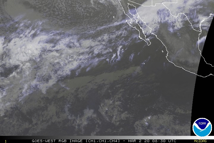
Small odd kinks in the wind barbs near the Yucatan.

My thoughts on Hurricane Season below.


One of the easiest ways to see what's happening is shown above.
NHC official nothing happening.
Satellite images of where there IS weather.


Mike is awesome at knowing what people want.
Obviously knows what I want.
It's a good time to show him your appreciation.
Buy a shirt, make a donation.
That goes for any site you love.
Money does make the world go round.
In these hot, dog days of summer.....
... everyone is in a mood.

Truth is so much we don't know.


Did you know that?
Okay I did but with my literature degree I know this stuff.
It's hot, it's summer. I'll call it stuff.

Some people love summer. 
Others hate summer.
(Really)
I grew up in an eternal state of summer.
So not sure what all the big deal is about it.


There is no hurricane today in the Atlantic.
Barbara IS forming in the EPAC.
I mentioned it in the last blog.

EPAC took it's time starting.
Now it's doing it's thing.
The same will happen in the Atlantic.

I could go long today on a rant but I am not going to do that. Taking a bit of a vacation for the next day or so and that means watching the weather on I95 wherever I am vs the Mid Atlantic Region or the Yucatan.  For all the newbies out there who scream "SHARK!!" every time someone mentions a statistic that is always in flux to try and predict hurricane develop know that water temperature and shear go up and down in heat and intensity every week or so as rarely do we build into a perfect stage set just right for hurricane season. If we did no one would be here and it would be all too predictable and boring. Boring as in ....there would be no discussion. Panic as in ......"oh my God it's gonna hit my town" and that is not how weather works. Weather is short term and climate is long term and it pays to know weather history on a personal level as much as it's important how to read a model or redo a model to make it have more pizzaz to get more viewers. Understanding the process and being able to compare it to other years is everything. Either you got it or you don't. I'll add in an out of the box ability to sniff out where development may occur and when it may happen that comes with years of studying satellite imagery, meteorology, oceanography and the history of hurricanes. Models are great and wonderful but they don't always catch rapid intensification and often miss small systems that now days get named faster than they used to so .... choose who you follow wisely.

That said...... this is the way it is in the tropics today.


Big flash of color down near the Yucatan.
The shear there is allowing it.
Understand things work in tandem....
...or they don't work.


Shear get's lighter closer in to Florida.
Eastern Gulf of Mexico.
Either that rain goes into the EPAC...
(moving on to the C storm)
Or it tries and get up into the GOM.
Shear in orange prevents waves from developing right now.
Let's look at the bigger picture.
That big orange blob is called SUMMER.
Summer up north brings derecheos.
And hot weather and pop up storms.
Summer storms.


Close up 


Shear to the left and SAL to the right.
High pressure anchored in place for now.
Watch the waves they are fun to watch.
They are not going to knock your house down.
They aren't even gonna toss your trampoline anywhere.
They are waves and we watch them.
Sometimes a bit of a wave gets past the shear zone.
And get mix it up with local weather.
That's why we watch.
But short of that sort of surprise storm.
Not much is happening.
And that is normal.

July 4th Weekend should verify to be a money maker.
When beach towns don't have to shut down...
...for a sudden hurricane that's good.

My concerns are the following time periods.
But understand anything can pop up somewhere also.
Why? Because there is a flow to weather....
Flow as in things change sometimes suddenly.
Prevent defense often winds football games.
Sometimes prevent defense loses football games.

August should have hurricanes.
August 11th time frame.
I believe we are a good 2 to 3 weeks early this year.
All the seasons have been early this year.
Magnolias were burnt up by a heat wave.
Azaleas are flush and it's not July yet.
Flush and falling apart way too early.
Since the snow in November....
...and the heat in May.
Seasons are a bit off.

I'm concerned with Labor Day Weekend.
The period from 8/29 on through that week.

September 14th through the 18th.
Yes peak of the season but I'd circle it for now.
Maybe in pencil if you still have a pencil.
I do because I bought it thinking it was a pen.
Oops.

October 3rd and 4th bother me.

Note full moons and equinox times are always interesting.
Location of where these storms would make landfall are...
... for now too far out to see.

Nothing has formed.
Just the regular arguing over water temperatures...
...and El Nino .. No Nino... What's with that?

MJO...
Most love it.
Jim Williams is not a believer.

Around July 10th things should look different.
Worried on close in around Florida and Carolinas.
Eastern GOM tho Texas at some point needs to watch.
The High will send us storms at some point.
Need to watch those early fronts.

Until then it's hot and it's summer.
Over a year away from the Presidential Elections.
Much hot air being wasted but hey it's summer.

atl_ir4_sat_tropicalindex_anim.gif (640×480)

Everything in life has a yin and a yang.
No I'm not into that stuff it's an example.

Somewhere it's very hot.
Somewhere it's very cool.
Somewhere someone wants the other.

SAL to the left.
Waves coming off from the right.


It's hot on the East Coast.
Cold on the West Coast.

Bless those people here who understand weather.
Cranky. 
Larry Cosgrove.
Bastardi.

Many others.

Mike who gets it intrinsically ....
Jim who is stubborn on what he believes.

So many others.

Sue who understands.

Anyways.......  have a good weekend.
When you see a sale on hurricane stuff..
Buy the stuff.

You don't need to complicate things.
Maybe something will form around those dates.
I'm pretty sure something will.
Either way... come they will.

Because in August the water is hot.
IN late July shear begins to shift.
When to fronts start moving again?

It's summer.
Get a tan but use sunscreen.
Buy a tan if you want.
Do whatever you want to do and enjoy it.
If you do what you want most likely you will enjoy it.

Don't worry, be happy but prepare.

Listen to Jimmy Buffet


Besos BobbiStorm
@bobbistorm on Instagram and Twitter

Ps........ there's a Mercury Retrograde coming July 7th.
If you're into that.
Sometimes computer stuff messes up.
Models might be off...
Who knows.
They often can be.
Do what you need to do and smile.


Friday, June 28, 2019

Enjoy Your Hot Summer Nights Because the Water is Warming UP and when the MJO Moves Our Way Things Will Explode Just As Fast As They Did in the EPAC... 3 Areas in EPac.. Wet Sahel Region + Strong High + Strong Waves = Trouble Down the Line. Enjoy those SAL Sunsets!


Alvin is slowly falling apart.
As expected.
Small systems blow up fast....
...fall apart just as fast.
Similar to Beryl from last year in the Atlantic.
Again worth noting the EURO missed the intensification.
Other models did call for that to happen.
Below we find a wide picture of the Atlantic.


That's a real Tropical Wave over South Florida.
Or as my kids call it the apocalypse is back!
The Tropical Wave moved up there from Puerto Rico.
That's the current pattern ... keep that in mind.

atl_ir4_sat_tropicalindex_anim.gif (640×480)

It's a wave not a tropical storm.
But still combined with the extreme heat daily....
...it's making Miami kids who know hurricanes worry a bit.
Don't worry.... Be prepared!

Below you can see the Waves in the Atlantic.


Shear blasts at the wave, disperses convection everywhere.
Wave behind this one is grinning.
Maybe he thinks it's like a carnival ride?
You can't make this stuff up.
Sort of like "oh crap that's not good...."


More departing Africa as I type.
Endless progression of waves westbound.
As the MJO moves to the East towards the waves.
Shear is forecast to weaken. We'll see...

Dabuh shows this so well.


Yup a real live Wave Train coming off Africa.
Rain has been higher than normal in the Sahel region.
And the water in the Atlantic is warming up day by day.


Note shear close in to Florida isn't so high.
That's why we look for surprises to POP UP sometimes.
Nothing is expected.
But just as the EPAC came alive suddenly.
There is now 1 storm, 1 red area and another yellow area.. 
That's how fast things happen in the tropics.


But I promise you within about 10 days....
Things will change. 
You'll go online and go "oh, wow... what's that?"
July 10th is my actual date.
Though anytime over the next ten days...
.... expect to see something interesting.
Til then... 
Shop for supplies and make lists of what you need.
Use your phone to record what you have for insurance purposes.
Hope and pray that nothing comes your way.
But better safe than sorry.

Have a most beautiful weekend.
Mike has some excellent wind shear sites.
Check them out on the far left of his page.
Below the models.

Hey I know it's hot.
But it's way hotter this week in Europe.
That's how Mother Nature works.
She spreads her love around....


Besos BobbiStorm on Twitter and Instagram.
Follow me there for real time discussion.

Ps.... Find some friends or a place to be alone.
And enjoy the wild summer nights.........


For Sue ... smiling........ besos and hugs


Labels: , , , , , , , , ,

Thursday, June 27, 2019

UPDATED! Alvin Strengthens in the Pacific to HURRICANE ALVIN.. Where's Barry in the Atlantic? June Not Too Soon For Debates and Candidates Surfing For Attention.


As I mentioned earlier today Alvin has strengthening........
...strengthening faster than NHC expected.

Alvin has been upgraded tonight to Hurricane status.


Compare and contrast with earlier today.


The earlier discussion is shown below.

Note it is said it's hard for models to handle small systems.
Alvin isn't that small... 

I know it's the HWRF ....
We have become so weighted to the EURO.. 
and the upgraded GFS (of course... sarcastically said)

But models did show this intensification was possible.


It was obvious this morning this could happen.
But the NHC drew the line at ain't gonna happen.

We know so much on track forecasting today.
But we still lag behind on intensity forecasting.
Something to remember as we move on in the season.
Use the models but adjust in real time ...
...to what is actually happening in real time.

Hope y'all enjoyed the 2nd Debate.
As for African waves....


These waves are getting higher and higher.
They also aren't fizzling when they hit the water.
What happens when the shear slows down as it's forecast to do?

It's a process.... 
Shear weakens.
Water warms up.
Something to take seriously.
2019 Hurricane Season.


Note.... Alvin wasn't taken so seriously.
Alvin exceeded it's early expectations.
The waves leaving Africa are also exceeding expectations.


PS..... Barbara seems to be forming behind Hurricane Alvin.


* * *

rb-animated.gif (1120×480)

There's Alvin a 60 MPH Storm currently.
That's hours ahead of forecast by the way.
Small but mighty.
Living out his moment in the Pacific sun.
Look at that Pacific ITCZ coming alive.

Earthnull shows us Alvin clearly


That intense little circle off of Mexico.
Up close you can see Alvin tightly wound up.


NHC describes him below as TINY


Someone at the NHC is getting way too political there.
They sound today like Trump at that debate.
Marco Rubio has TINY HANDS.
Pretty sure they aren't happy.
But in the end Alvin bites the dust.
Or more so drowns in the cold, windy Pacific.
Barbara is the next name up.
Maybe Barbara is like Tulsi and she surfs?
Of course her name would probably be Barbi if so.

Okay I Googled her.
How could I not?
There's no hurricane in the Atlantic.
And not much new I learned otherwise at the debate.


What amazes me here is this...
She could have been a Victoria's Secret model.
And she went into politics.
That's kind of a win for women.
This is NOT a political endorsement.
It's more a confession.
I Googled her.
Hey I've heard Booker and De Blasio bicker before.
Nothing new there.

I said last night I was watching the debate the way you'd watch interesting waves work their way across the Atlantic. You don't expect them to do much in late June and you don't expect people in debates over a year before the election to really shine out bright enough to remember next June but Tulsi definitely made an impression. Note the fact that there are waves fighting their way West without shriveling up the moment they hit the Atlantic Ocean IS interesting and makes me wonder which one of them will try and be a Dark Horse Wave and develop close in as we move deep into July. 

I also watch Alvin because I'm curious to see how the NHC has handled him other than being nasty and making fun or his small size. Note Alvin is noticeable from outer space so maybe his stronger than expected intensity matters. It matters in that they dismissed models that called for quick intensifying and went with the usual candidates for tropical gold and came up playing with gold dust. 


This morning's discussion forecast points above.
Yesterday's forecast points.
Intensity if usually harder to forecast than position.


Let's move on to Barbara.


See my point here?
It's time women know they can be beautiful and......
........go into science or politics.
Note we have never had a woman director at the NHC.
Oh but one did run one of their libraries.

I'm not much a Women's Lib person.
I'm a who is the best candidate person.
I'm a person who looks at everyone.
Everyone has a story.
Every wave leaving Africa has a story.
Only some make it to a named storm.

Catching the NHC attention is not easy.
Top heavy works better than bottom heavy.
Waves that work out and develop good structure..
...vs those that look great on the bottom.
But don't exist on the top are goners.

Good structure.
Good bones.
Even small good bones get a name.
Like Alvin or the much maligned Beryl.
Remember Beryl?
Small hands Beryl?
Okay being silly today.
But why not?
It's hot.
It's getting hotter.
I'm debating July 4th plans.
Let's have some fun because we can.
Nothing big out there.
That brings us back to Beryl.


I believe Cranky called Beryl a Thunderstorm last year.


Beryl was a July 4th kind of storm.


Written off as too small.
Barely there Beryl.
"Not a sign of a busy season" (oops wrong)


Florence was originally written off as a Fish Storm.
Wrong.
Well no not wrong in that Florence swam and swam.
Florence swam all the way to the Carolinas.

Never count out early strong waves.
Never count out early strong candidates.
Never count out a smart beautiful woman!

I believe a woman can be smart, sexy, beautiful and fun.
But SMART is smart.
Just an observation.
Not a political endorsement.
And not saying Barbara will be bigger than Alvin.
But could happen.

As for the Atlantic we are on the B name.
Where's Barry?
If history repeats it's a weak early storm.
And the name lives for another season.
Maybe.

Let's look back at 2007.
Tropical Storm Barry.


In 2013 Barry was an early BOC system.


Tropics today........


The water is warm near the Yucatan.
It's very warm near the Florida Keys.
High pressure to the North......
...often opens a door to low pressure to the South of the High.
Keep watching as we move into July.

As for me going to be listening to Senorita today.
Over and over because I like it.
And Camilla is a smart, talented, beautiful woman.
Those things can go together.
Time for a smart, beautiful woman to believe....
..she can be the Director of the NHC.

Something to think on...
He landed in Miami......
The air was hot from summer rain.
Truth in those lyrics.

Close in development could happen early.
And waves could develop early.
But it depends on so many variables.
Only big question now is?
What happens next?

atl_ir4_sat_tropicalindex_anim.gif (640×480)


Besos BobbiStorm @bobbistorm on Twitter and Instagram...follow me there for real time updates.

Ps.......  


Labels: , , , , , , , , , , , , ,

Wednesday, June 26, 2019

Tropical Storm Alvin Forms... Goes South of West a Bit... Hmnn. Keep Watching Those Waves in Hot Miami


Tropical Storm Alvin has formed in the East Pacific as expected. Though possibly because of it's new movement just South of West it may be in warmer water longer and gain more intensity than previous forecast by the NHC however they are not leaving the door open for development to hurricane strength. 
Note the discussion from the NHC below.
Compare and contrast with earlier discussion.
They've gone from 40 MPH to 45 MPH..
..now holding open the door for 60 MPH.


Even from far away you can see the tropical cyclone.


Up close shown below.


Other than his wayward movement S of West...
No real surprises here expected.
Well..surprises are never expected are they?

As with most EPAC storms they go quietly out to sea.


As for the Atlantic Basin it's like this.
There are waves moving West.
Despite the SAL and the shear...
That's what they do this time of year.
If they are there and they are there.
That worries us with regard to late July and August.
And when the MJO moves into the Atlantic.
We could see some interesting formation out there.


New wave over Africa.
Mid Atlantic moving towards South America.
Much moisture in the SW Caribbean.
A small barely there wave near PR.
More visible below in this beautiful image.


Is that a healthy wave or what?
Moving South of the dusty SAL.
Such a sneaky wave.
Shear is there near the Islands.
Interesting.........
If this keeps up we could have problems early.
Stay tuned.

atl_ir4_sat_tropicalindex_anim.gif (640×480)

Bottom right.... sneaky wave.
Shear shooting out through the Islands.. 
Weather is amazing.

In other news the candidates are converging on Miami.
Someone must hate them... 


How Florida views the Universe.....

Miami in late June with the temperature in the Mid 90s.
Expecting them to walk around Little Havana and shake hands.
I love Miami but it is hot and humid.
In the beautiful Banana Republic of Miami...
..the circus is always in town ;)
Like Carnival ...

In Miami people wouldn't stage a walk out.
That's because you don't leave the AC ... 
Maybe a sit down but you don't leave the AC.
Nope...

Keep those waves in mind.
And close in possible development.
Nothing is expected... 
But they weren't expecting that S of West movement for Alvin.
And they weren't expecting him to get past 45 mph.
So keep watching.
While you're watching the water is heating up.


Prepare for Hurricane Season.... 
Just do it!

Besos BobbiStorm
@bobbistorm on Twitter and Instagram.

Ps... this song is in my head all day all night ... 
Ooh La La

It's hot in Miami ....


Labels: , , , , , ,