A writer and a tropical muse. A funky Lubavitcher who enjoys watching the weather, hurricanes, listening to music while enjoying life with a sense of humor and trying to make sense of it all!
Wednesday, July 14, 2021
Quiet Today. Thoughts on Long Term Forecasting in the Tropics. 1992 Quiet Season. Dr. Gray Did a Good Job with Pre Season Forecast but Could NOT Tell Miami the 1 Major Hurricane was the BIG ONE - ANDREW A Look Back!
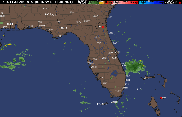
All is quiet today on the Tropical Front.
Cluster or messy weather off the coast of Florida.
An active but low wave train.
Yellow 10% NHC monitoring.
Today I'm talking on seasonal forecasting.
The 1992 Hurricane Season being an example
It's quiet in the Tropical Atlantic with only a small yellow X with low 10% chances of development that mostly marks the spot of some weather that is being monitored. Waves are leaving Africa riding low in the water as they usually do in July as they try and avoid the Saharan Dust that tries to kill them off. Obviously, as we have seen one already make it across the basin I would not rule out any incredibly large, well formed waves that look to have low pressure attached. Currently they are mediocre run of the mill tropical waves so as always we will ignore them now and watch to see if one sneaks into an area of lower shear and develops closer in to the US as often happens in late July. Give them a week or so and July is more the Eastern Pacific active time of year.
So today I'm taking the quiet times as a chance to discuss something that needs discussing. In June and July every bored tropical meteorologist takes to posting reports, studies and home made graphs showing various reasons that the season might be slower than expected or pointing to when activity may ramp up. Meteorologists love maps and graphs. The media hungry for any lead story rushes to highlight this study or that and everyone likes them on Twitter because ... hey we are bored and there is nothing else going on. It's our virtual way of shooting the tropical breeze. And, those studies are good and the graphs are interesting and everyone knows I love a good map so I'm not kicking them completely but they are limited in their nature. Long range predictions can show that the Atlantic will juice up on August such and such a date and they can show us that strong shear from a developing El Nino may shut down the Caribbean and Gulf of Mexico or that a developing La Nina may favor development, blah blah blah blah but they can't tell you when a random hurricane will develop and be stronger than expected and do Rapid Intensification as it takes aim suddenly on a major metropolitan area. Every year we get better at our forecasts but we thought we were pretty good 20 years ago and 30 years ago with the help of computers meteorologists thought they finally had a handle on forecasting long term predictions.
Let's take 1992 as an example. Above shows us a very quiet hurricane season with only a few long tracking storms. The storm wearing the red running shorts is Hurricane Andrew. The others were not much to write home about. It is possible the team at the NHC would have squeezed out a marginal Tropical Storm that Bob Sheets or May Mayfield would have referred to as a Tropical Disturbance but still it would have been a slow year. Now with satellite imagery that is better than what it was in 1992 we might have sniffed out a few short term closed lows worthy of being Tropical Storm but there is no way it would be considered an above average season.
So if you had been reading the various reasons that 1992 would be a quiet hurricane season and you lived in the Miami area or Louisiana you must likely would have felt that you didn't have much to worry on and most likely would impact your tropical world. The headlines for a slow season due to numerous reasons listed with a few pretty graphs would have lulled you into a sense of security and the illusion that 1992 was not going to be "THE YEAR FOR THE BIG ONE" and I put it in caps because people in Miami or New Orleans or Houston tend to look at the list of names wondering which one will be "THE BIG ONE" as that's how we think to be honest.
There was an early season forecast by Dr. William Gray that I believe was one of the first pre-season attempts at long range forecasting and was not updated monthly as it is now with new current data.
This is from 1992....
"Forecasts of hurricane activity are issued before each hurricane season by Dr. William M. Gray and his associates at Colorado State University (CSU) and the Weather Research Center (WRC). A normal season as defined by the National Oceanic and Atmospheric Administration (NOAA) has 12.1 named storms, of which 6.4 reach hurricane strength, and 2.7 become major hurricanes.[1] In December 1991, CSU issued its first forecast for the year and predicted that 1992 would see eight named storms, four hurricanes, and one major hurricane.[2] CSU also issued a forecast in April, June and August; however, no revisions were made to the numbers of named storms, hurricanes, and major hurricane predicted in 1992.[4][5] Prior to the season starting, the WRC predicted that the season would see six named storms, with three of those becoming a hurricane while no forecast was made on the numbers of major hurricanes.[3]"
Dr. William Gray did an excellent job all in all as the finals statistics were very close to his pre season analysis forecast!
And yes there was one Major Hurricane.
The problem in 1992 as in 2021 is we can forecast how wet the Atlantic will be for the next month and how much shear may be there and we can talk on the MJO and Kelvin Waves and compare and contrast the EURO with the Korean model and the GFS and other tools we use but we can not pick the date that one rather good but wanting wave will make it across the Atlantic and become "THE BIG ONE" and slam into Miami, New Orleans or Houston any more than the NWS can warn parts of Miami that on July 12th parts of downtown Miami will briefly have a storm that looks like a hurricane. The NWS can warm people that the atmosphere is primed and ready to drop a huge thunderstorm with strong winds and possible hail but they cannot pinpoint where and when the locals need to take cover and not be on Biscayne Blvd as it will probably flood if the severe storm has a lot of moisture in it.
So that is the problem with a forecast long term. They can predict a busy period near the East Coast but they cannot pin point where the hurricanes will recurve out to sea or that one will get away and slam into the NJ NY area the way Sandy did in 2012.
Andrew was not expected to get across the Atlantic as it had much going against it.
Andrew was considered by most people in Miami as a stupid name for a hurricane.
Andrew was not expected to become a Category 5 Hurricane and go due West.
Florence was not expected to live long and prosper.
Florence was expected to develop fast and turn North fast and die out in the Eastern Atlantic.
Florence was not expected to slide through Saharan Dust and negative conditions and thrive.
Elsa was not expected to go the distance all the way to New England and Canada.
Once a hurricane forms and has a solid core and we get data from recon and the Gulfstream Jet we can get a good feel for the atmosphere own the road out ahead of the storm and get a nice narrow cone telling us what part of the Florida Panhandle or Louisiana will get landfall. And, then there is still the Holy Grail of Hurricane Forecasting being Intensity Forecasting as time and time again even today these amazing storms surprise us even with better models and more knowledge there is still more to learn.
So yes the 1992 Forecast was a good forecast and it did predict 1 MAJOR Hurricane but they were not able to and we are still not able to tell you that the one Major Hurricane will be THE BIG ONE that smashes into your home town be it Savannah or Charleston or West Palm Beach though you can always bet if it's aiming at North Carolina somewhere from Wilmington to OBX will feel the blow of a hurricane wind even if just as it cruises by offshore.
One last note for those still reading. It is interesting watching the little ball of moisture move in one mass up the Florida Coast, the remnant of the system that brought near hurricane force winds to my son's condo in Downtown Miami yesterday just 20 hours before my scheduled flight to Miami. Yes, I missed that by less than 24 hours I'm so annoyed but the sky here is blue today and there's music playing down by the pool deck below me and I'm taking it one day at a time. This is a test for any of my children as I didn't tell anyone I was coming in except for the two kids who live here. The last few weeks have been a nightmare of epic proportions as the News covered the search for bodies with my close friend and neighbor being one of them and waiting for my daughter who is still in an Erie Hospital be sent back to New York for recovery from a minor trip on a camping trip that turned into a long messy drama. She said I should enjoy being home with my youngest daughter as we rarely get time together and she'll see me when she gets out of rehab when they teacher her how "not to walk" on her injury. So I'll be in Upstate New York for the later part of the hurricane season it seems as I will go stay with her when she gets home and adjusted to life recovering from shattering her hip and other parts of her party before she is well enough to go camping again because unlike me she loves being out in the woods. Camping out to me is Days Inn or Best Western, I'm just not the camping out in the forest type.
A bit of test to see if any of my kids read the blog because then they will know I snuck into FLL in a thunderstorm with the clouds dark and gray the way they always are at 3 PM. Amazingly I found a $46 one day, nonstop ticket to South Florida and grabbed it on Southwest like I used to do before Covid when I used to "bank with Southwest" because if I didn't take the trip I could cancel and use the credit. So now I flew for the first time during Covid, the flight is just under 2 hours and it's the start to more traveling again I hope. Life lately has seemed a little uncertain, a huge tower can collapse, you can trip over a wire and break your hip and pandemics can pop up suddenly so going to live in the moment, enjoy the day and wander around the edges of Biscayne Bay and the Miami River doing a bit of Hurricane History research at the Library here and the Historical Museum before I venture out and see the rest of the family. I just wanna breathe............... inhale................exhale... and relax. And this morning it feels really good!
But like Gilligan the day after the hurricane the pool deck downstairs below the balcony is being cleaned up and the sky is blue and you'd never know there a crazy squall hit that area 2 days ago and because palm trees bend usually everything looks fine fine fine! Let's hope this place looks fine when the 2021 Hurricane Season ends and everything here was untouched as I do love Miami so even though I'm a Miami girl living in Carolina these days and loving the Carolinas also!
Something to think on... never let your guard down, always be prepared and know that no seasonal forecast or one month forecast can tell you whether some random wave makes it against the odds to your town and suddenly is THE BIG ONE!
Location: Miami, Raleigh, Crown Heights, Florida, United States
Weather Historian. Studied meteorology and geography at FIU. Been quoted in Wall Street Journal, Washington Post & everywhere else... Lecturer, stormchaser, writer, dancer. If it's tropical it's topical ... covering the weather & musing on life. Follow me on Twitter @ https://twitter.com/#!/BobbiStorm


0 Comments:
Post a Comment
<< Home