A writer and a tropical muse. A funky Lubavitcher who enjoys watching the weather, hurricanes, listening to music while enjoying life with a sense of humor and trying to make sense of it all!
Monday, May 27, 2019
HEAT RECORDS BROKEN IN SOUTH... cool in the West... Tornadoes Still Happening. EF3 El Reno Killed 2 People. Memorial Day Weekend 2019
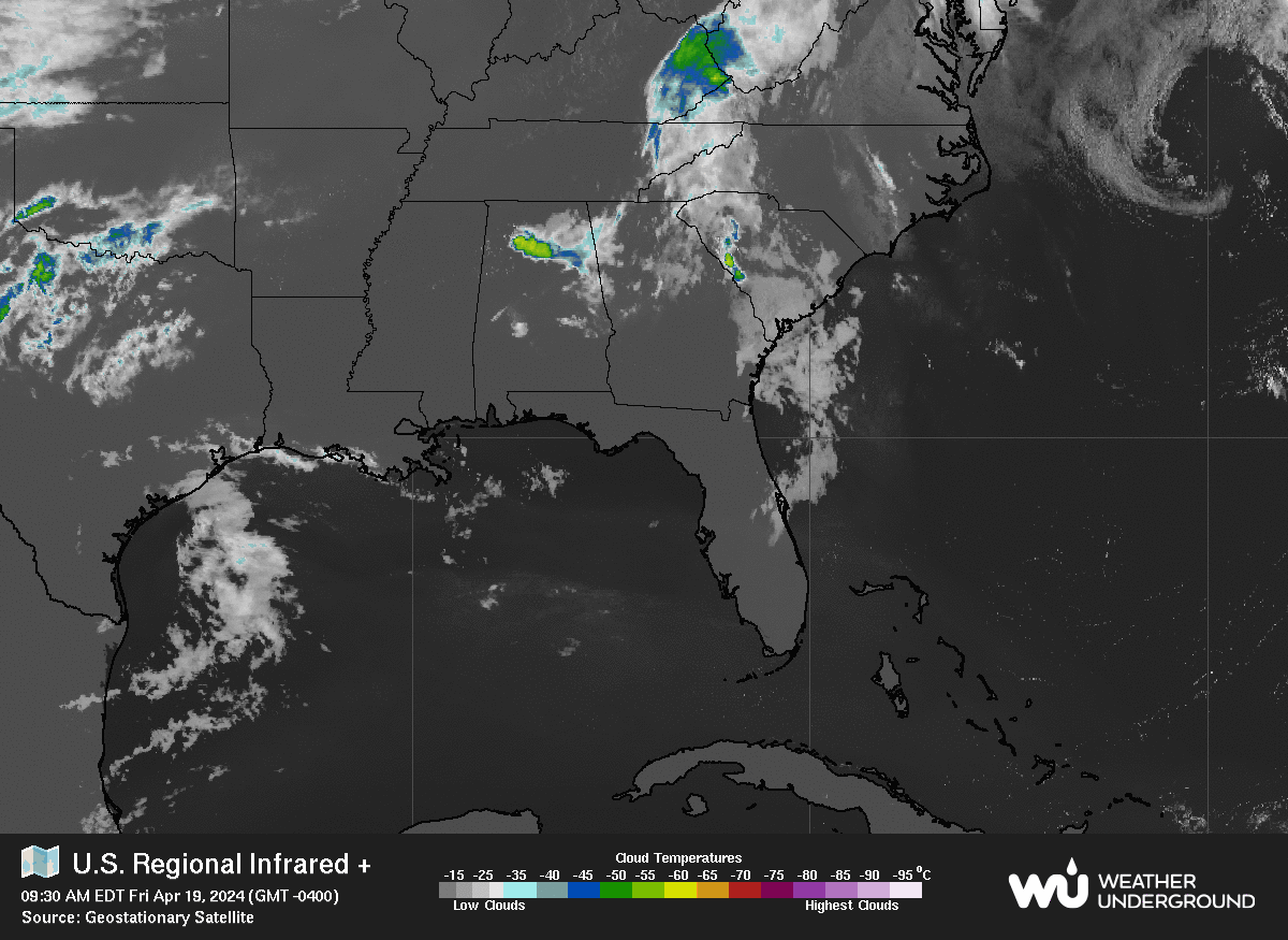
Tropics Memorial Day Weekend 2019
Days before the start of the Hurricane Season.
The NHC "nothing happening pale baby blue" is there
There's also a mess of convection in the SW Caribbean.
Central America Gyre aka CAG
Could something develop down there?
Possibly, not probably but a possibility.
I tweeted this last night.
Shear would have to relax.
Shear is forecast to relax.
MJO? Yeah maybe...who knows.
Keep watching.
And we have all been watching tornadoes lately.
First comes tornado season.
Then comes hurricane season.
Just to be clear before going on with some hot weather and tropical weather history the El Reno Tornado was a EF3. This rating was expected from the damage however until it's official we wait and see what the experts find. The experts found a small but devastating path of destruction for a short lived but strong tornado that killed two people and destroyed parts of El Reno; a town very familiar with destructive May tornadoes. In this case the fast developing, fast moving tornado hit an area with a motel that was adjacent to a trailer park and a car dealership which obviously made the situation worse wherever those cars landed. The article below is a good article to read on the tornado especially for anyone who has been obsessed with them since the first time they watched either The Wizard of Oz or Twister.
Another thing I want to point out is how pathetic it is sometimes to have expectations of a season or a day in history to judge that season or outbreak by be it Hurricanes or Tornadoes. Last weekend The Weather Channel was on air nonstop with headlines implying 60 million people were in the path of expected long track, destructive wedge tornadoes across a wide swath of the country. And, that was true for last weekend as much as it was forecast for most of the week after that. We are still "there" so to speak the violent weather on the Plains is not yet in the rear view mirror and more severe weather is still expected. This is the season they did not get last year when tornadoes took a Northern holiday and went elsewhere to places such as Wyoming and Cape Cod.
What we need to stop doing is thinking that a weak hurricane season because of an El Nino may keep us safer as history has not shown that to be the case and even worse the seasons when we begin to leave El Nino in the rear view mirror often tend to be the most memorable ones. Hurricane Andrew that was the first named storm to form in the middle of August is a prime example of why we should not judge a hurricane season by how busy it is and in the same way we should not judge possible tornado outbreaks by the size and duration of a large wedge tornado. Obviously the damage done to Moore Oklahoma by large, long duration wedge tornadoes over history makes us look towards them as the bar to judge a tornado outbreak.... however.... if you live in El Reno or any other town hit this week by tornadoes you don't think this outbreak was a "bust" because the previous Saturday was relatively quiet. The word relative is always important when reviewing weather history and various events. And this storm season out on the Plains is not over so everyone put those relative expectations where they belong and take it hour by hour, day by day.
Note the frequency here of 1926, 1953 and 2012.
1989 shows up too often as well.
But going to ignore that one for now.
I don't like to cry shark in a room full of Carolinians.
Let's move on to what I feel is the most important story possibly of this week and that is the record heat in the Southeast. Again, using that word relative it's worth remembering I live in the Carolinas and it relates to me. If I lived on the West Coast I'd be begging for some warm weather and wondering when this cool, wet weather trend is going to end. It's a regional phenomenon caused by atmospheric features far away that are in a stuck pattern that at some point down the road will become unstuck .... trust me on this.
A list of some of the records yesterday reads as follows.
Atlanta 100 degrees. Record broken was set in 1898, 1953, 1962
Augusta 100 degrees. Record broken was set in 1926.
Charleston, SC hit 100 degrees yesterday. 1953, 1989 were both in play record wise.
Fayettevillle NC hit 100 degrees. Record broken was 1926.
Florence SC hit 102 degrees. Record set was 1926.
Muscle Shoals of Jimmy Buffet fame hit 97 degrees. Record broken was 2012.
Charleston thought they peaked....
...but they were wrong.
What is unnerving to me and a few others is the constant references to certain year's records that were broken over the last several days and that is because those years were years when there was a huge High in the Atlantic and are infamous for hurricane landfalls along the East Coast and the Gulf of Mexico. Again for newbies hurricanes often trace the high in the Atlantic and they ride in under the high and then try and turn North wherever the High ends... add to that if or when there are any fronts on the map that may try and pull them North faster at the end of the High that is .... where landfall happens.
Again everything is relative so when I see the years 1926 and 1953 I think of Florida and East Coast hurricanes. I'm sure when I say 1989 my friend in Mt. Pleasant immediate thinks "oh crap... and remembers Hugo" so this is all relative and yes Sandy hit the New York area in 2012. Some records had previously been from 1979 and any South Floridian will scream DAVID while those along coast of the Gulf of Mexico will scream FREDERIC!
Monday records broken went back to 1916.
That year has shown up frequently this May.
Must have been a hot May.
And I'm guessing a very strong High pressure system.
1916 was a busy season with 5 major hurricanes.
The year 1916 sporadically comes up in broken heat records.
I felt it was a good year to review.
As it's not usually mentioned.
And that was BEFORE satellite imagery.
A close up look at the Gulf Coast Storm
That's a July Hurricane by the way.
Sadly too often heat waves are broken by tropical events.
Then in August there was the Texas Hurricane.
It formed as a wave traveling beneath a huge High.
Into the Caribbean ... Gulf of Mexico and hit Texas.
The year 1916 comes up frequently but most people do not remember it because well to be honest other than settlements in Tampa, a very young Miami and Key West not many in Southern Florida lived there or wrote much about that year and it landed in Texas relatively lucky for Floridians. But it was one of those years where a hurricane rode into the Gulf of Mexico around a huge High and made landfall far in Texas to be remembered as one of the Great Hurricanes of that region. Obviously in a time before satellite imagery it's hard to say where that wave first formed but it either developed out of some sort of Central America Gyre or a westbound tropical wave from Africa or a wave collided with the CAG. Camille formed in this region in 1969 but we know it was an Africa wave that didn't develop until it hit those friendly, welcoming waters. Often a high to the North and low shear there will get a storm going fast over very warm Caribbean waters. The 1916 Hurricane has it's own link....
Tropics Quiet Today. Danger on the Plains from Tornadoes & Flooding Remain. Thoughts on How We Convey Real Time Weather Threats Referencing Article by Marshall Shepherd
A quick perusal of Spaghetti Models shows there are no hurricanes today.
There is not even the ghost of Subtropical Storm Andrea.
Nothing is expected to form in the next 5 days.
Okay in truth some convection does remain....
But it is not expected to reform so let's move on.
There are things to think on down the road.
Areas in the Caribbean that sometimes flare up in early June.
They flare up there and move North into the Gulf of Mexico.
And sometimes they flare up there and move into the E Pacific.
Convection is congregating down there.
Again it moves into the Epac where a storm may form.
I could tell you models have been a little awkward lately.
A few keep predicting development down there.
Long range models are meant to be visited often.
They are for entertainment purposes only.
The system on the Plains is still dangerous ...
...and still on the move.
It's far from over.
With Memorial Day Weekend coming remember this...
It's a good time to start preparing for Hurricane Season.
Today's blog is about a look back at this week in weather.
The high expectations for long tracking tornadoes...
... and the reality that tornadoes did happen.
They were not long tracking EF5 Twisters.
But they destroyed people's lives.
And yet people yelled "busted forecast!!"
The forecast for dangerous weather verified.
The problem is how we convey what is dangerous.
The problem is our personal expectation of dangerous.,
The dangerous situation there continues.
And hurricane season is just around the corner.
The article below inspired me to write this today.
I'll talk models and satellite loops tomorrow.
I want to revisit some tropical weather history...
History repeats, it's good to learn from history.
The link to this article is below.
It's an article worth reading.
It's especially valuable as we head into the Hurricane Season.
https://www.forbes.com/sites/marshallshepherd/2019/05/21/three-problems-with-the-word-bust-during-real-time-weather-threats/#290dc83f5338 This is an excellent article that should open up our minds as to how we perceive real time threats or feel the need to communicate "what is dangerous" to the general public again often in real time. As the 2019 Hurricane Season is around the corner I find the need often to remind you to prepare for hurricane season. It is especially difficult at times after someone somewhere puts out predictions on how this may or may not be a busy or quiet hurricane season. These often circulated articles announce that the water is cold in the Middle of the Atlantic Ocean or Saharan Dust is blowing in the wind keeping the hurricane season weak or El Nino may or may not be leaving written often to capture the public's attention and get retweeted online. Public perception of danger is sometimes mitigated or heightened by these headlines and often there is a "boy who cried wolf" issue that arises later in the season when a hurricane veers away from a potential landfall and stays safely out in the Gulf Stream only kicking up big waves at the beach or when long tracking EF5 tornadoes do not form and people in the warned area let their guard down.
Long paragraph I know, but this is seriously a problem in today's world where people scroll through tweets or images on Instagram. Back in the the day people would complain that television news people wrote hyped up headlines or news promos that were merely "sound bites" to get you to check back at 11 PM for the late news. This is really a communication issue as old as time as I am sure somewhere cave people argued over dramatic cave drawings of lightning hitting a horse that was way over the top and not realistic. No disrespect to cave people I personally always loved the GEICO cave guy the best!
It's a problem as old as time in ways, and yet in today's very fast paced world it has it's own new unique issues. In today's world we have issues not problems. After a Presidential election years back it was discovered that by releasing early predictions when the East Coast polls closed on National News it had negatively impacted voter turn out on the West Coast. Many interviewed said "why bother voting as we were told who won already" and that's sad but it happened. News stations then agreed they would wait until the polls in the Pacific Time Zone were closed before making early predictions based on exit polls. If you are expecting large wedge tornadoes to be on the ground wiping out towns such as Moore and no big, huge EF5 wedge tornadoes wipe out Moore or Oklahoma City then suddenly we read on Facebook, Twitter and in our multiple Whats App groups that the forecast was a bust. This irresponsible message mistakenly gives many in the warned area the message to "stop worrying about it" when tornadoes were indeed on the rampage late into the night and early morning hours. Then those same people online and go negative about the media delivering the message saying that it was all hype and nothing more. The truth is the set up was there, there was potential and it was a forecast that thankfully didn't verify in the way that many thought it would.
The proper reaction should be to be thankful it was not worse.
And to be aware it's an ongoing dangerous situation.
As Reed tweeted yesterday.
Again it was only a "bust" in that long trackers didn't show up.
Other destructive tornadoes showed up.
And the dangers continue.
We are very happy the set up busted.
Again the "set up" that the forecast was based on.
Perception here is the devil in the details.
No it was not hype that the possibility was there for long tracking tornadoes, but there was also the potential for short flare ups of multiple tornadoes everywhere and the ongoing inherent risk of flooding. In the same way that if someone else has surgery you may think of it as minor surgery if it happens to you it is major surgery. If your town was severely devastated by a short lived, strong tornado you will remember it forever and consider the forecast to not have been a bust for a particularly dangerous situation.
Waveland's destruction often gets forgotten in the greater picture.
Take a look back at Hurricane Katrina that tore through South Florida as the first in several tropical systems that year to visit Florida, however most people obviously only remember New Orleans when they hear the name Hurricane Katrina. After Florida .... Hurricane Katrina made a second landfall near Waveland in Mississippi creating the slowly evolving horrible levee failure in the New Orleans area. Perception is in the eye of the beholder or whose home personally was damaged. Yes, Katrina was a National Tragedy that made us rethink many things but it was a personal disaster memory for many people far from New Orleans. Hurricanes history teaches us that hurricanes often do that especially the big ones such as Betsy in 1965 and Andrew in 1992 that made double landfalls in both Florida and Louisiana as they traced a path around a very strong high pressure area in the Atlantic that steers them into the Gulf of Mexico for additional landfalls.
Lastly after the fact discussion on a storm being a "bust" is really not necessary as many considered the Hurricane Irma forecast for Florida being wiped off the map a bust because it didn't destroy Miami or Tampa, however tell that to my friend in Big Pine Key who lost the family home and was forced to demolish it's remnants recently. There is always so much hype online and on air regarding large targets such as Oklahoma City in Tornado Season or Miami in the Hurricane Season. While Category 5 Hurricane Michael was in the slow process of coming together down near the Yucatan and Cuba many meteorologists doubted online complaining the forecast was poor and that "this thing is never coming together" in the same way that model forecasts for huge flooding in Houston from Harvey were played down as "garbage runs" and "probably won't happen" and yet the forecast actually played out even worse than forecast. Many tweeted on Twitter how the landfall of Harvey near Rockport seemed not to be that bad.... in the same way back when people watching New Orleans survive the winds of Katrina better than expected went suddenly quiet when the water began to rise.
There is much to think on as we work our way through the rest of the Tornado Season and move towards the Hurricane Season. When a 7.0 earthquake in a large city is first reported by some AP reporter it usually reads "no deaths reported" and we should know that means "no deaths reported yet" as we should not believe everything we read and wait until the rest of the story plays out.
Why the NWS went with the PDS warning? I'm sure it was to err on the side of caution and with concern that a PDS situation could happen. Why the NHC went with upgrading to Subtropical Storm Andrea I don't know, but I am sure they had their reason. It's not my job to second guess these things I prefer reminding you that now is the time to prepare for Hurricane Season before a hurricane is knocking at your door and the store is out of toilet paper, tuna fish and peanut butter!
Ask the people who were impacted by a compact, Category 4 Hurricane Charley that seemingly surprised them because the media seemed to imply that Tampa was under the gun and they were in the outer edge of the cone from the NHC. It was not a busted forecast as much as it was not properly communicated that the danger of any small town in that part of the cone in Florida was liable to get the brunt of the hurricane moving parallel to the coastline before turning in towards landfall.
Something to think on and to remember. No forecast can be 100% correct in the details even though the forecast for dangerous severe weather or a land falling hurricane will verify. Are you prepared is the bigger question?
Read the article linked to above and remember this applies to hurricane season and dramatic warnings on dire danger about to happen and how a busted forecast can have a boomerang danger such as flooding or even worse ignorance of similar warnings the next time a hurricane is headed your way.
Knowledge is power. Find out what you personally need to do to prepare for Hurricane Season.
Besos BobbiStorm
@bobbistorm on Twitter and Instagram.
Ps... Some video below from a friend who passed away but is always remembered from Hurricane Charley. Again... just because Tampa was not the landfall the forecast was not a bust and .... remember that sometime down the road Tampa will get a landfall again as they did in 1921 when a Category 4 hurricane made landfall in October. That is not hype it is merely learning from history. Turn the sound of it you prefer on CycloneJim's video on Category 4 Huricane Charley.
Updated 5 PM. Subtropical Depression Andrea & NHC Break Up - Severe Weather Continues with Flash Flooding on the Plains. Other Regions to Watch in the Tropics....
Not sure what we are calling it....
Post Tropical Cyclone?
Funny part is it doesn't look much different.
Note the new discussion mentions the Upper Level Low.
It mentions the ULL in the way that I did earlier this morning.
The real culprit here is shear and the ULL.
Yeah.... it's weaker.
Signature looks not as strong but closed.
The shear to the North is evident.
The ULL moving to the West is evident.
And even the NHC says the ULL is the dominant feature.
Note below the remnants of Andrea are marked....
Far to the North of the swirl that looks like Andrea.
Ex Andrea.
Seems the NHC broke up with Andrea.
It was a fast, short, bad relationship.
It served it's purpose I suppose ...
Next name on the list is Barry.
I knew a boy named Barry once....
...he was cute.
Good dancer.
6th or 7th grade.
I digress....
There really isn't much to say here.
Except that if there is no real convection left...
..and no real center left.
Then it would seem to me that the convection ...
...associated with the system once known as Andrea remains.
The Upper Level Low is moving slowly West.
Does the moisture still fly off with the "front" ??
Or .... ??? linger around longer.
So many questions so little time.
We will see soon enough.
Elsewhere there are tornadoes, flash floods and misery.
You don't need a hurricane for misery.
Keep watching to see what will be...
Not expecting anything immediately but who knows.
A week ago the NHC insisted nothing was forming.
Then they went from 70% to ANDREA
Stay tuned....
Barry is the next name.
He's out there somewhere.
Hopefully with a better presentation.
Til then give to the Red Cross.
Or give another reliable charity in the area.
The people being plagued with floods will need help.
And continue reading please there are many tropical thoughts.
Down past the 5 AM advisories.
Areas I'm watching for future development.
I'm going to keep this simple today and update later if necessary. Subtropical Storm Andrea is doing so far what was expected of her by forecasters at the NHC. A look at Earthnull from yesterday at this time compared to this morning shows how Andrea developed.
Before above.
This morning below.
That's a dramatic difference in 24 hours.
And while she doesn't show up well on the satellite image.
You can see down through her on this site and see the winds.
Going wider I want to point out a feature.
Between the coast of Florida and Andrea...
If you look closely you can see the mid to upper level low.
You can also see the shear to her NW.
This squeeze play has been going on for a while.
Yet she developed.
Partially ventilated by the ULL in the right location.
Marginal warm water temperatures.
Now let's look at the "cold front"
I wouldn't call it a "cold front" as much as a frontal boundary.
That wiggles around and then high pressure builds in again.
Also note the continuance of severe weather on the Plains.
There's an old chart that was one of the first wind charts.
My son when he was at Iowa State helped create this site.
It was actually an "art" site using meteorology as a base.
Location: Miami, Raleigh, Crown Heights, Florida, United States
Weather Historian. Studied meteorology and geography at FIU. Been quoted in Wall Street Journal, Washington Post & everywhere else... Lecturer, stormchaser, writer, dancer. If it's tropical it's topical ... covering the weather & musing on life. Follow me on Twitter @ https://twitter.com/#!/BobbiStorm