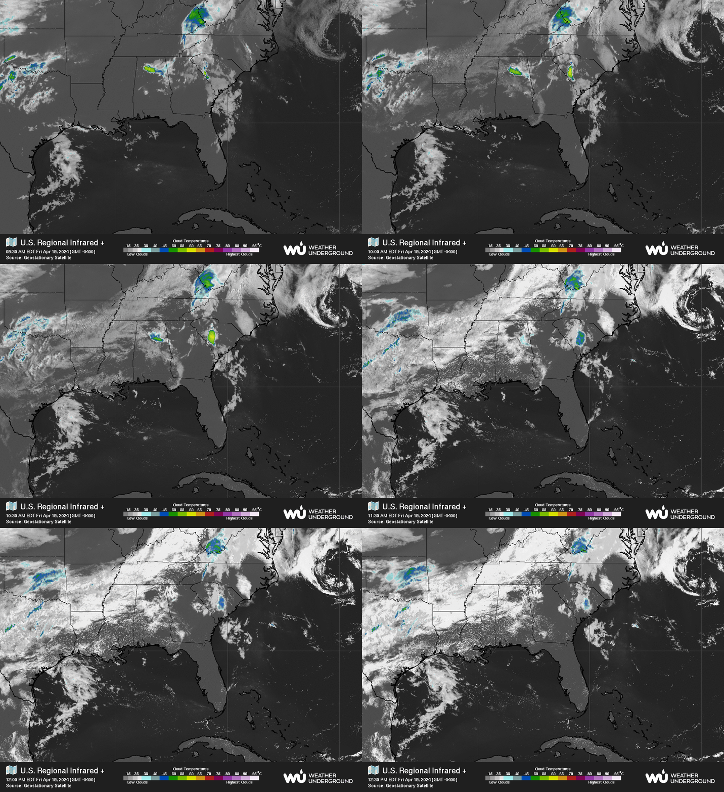
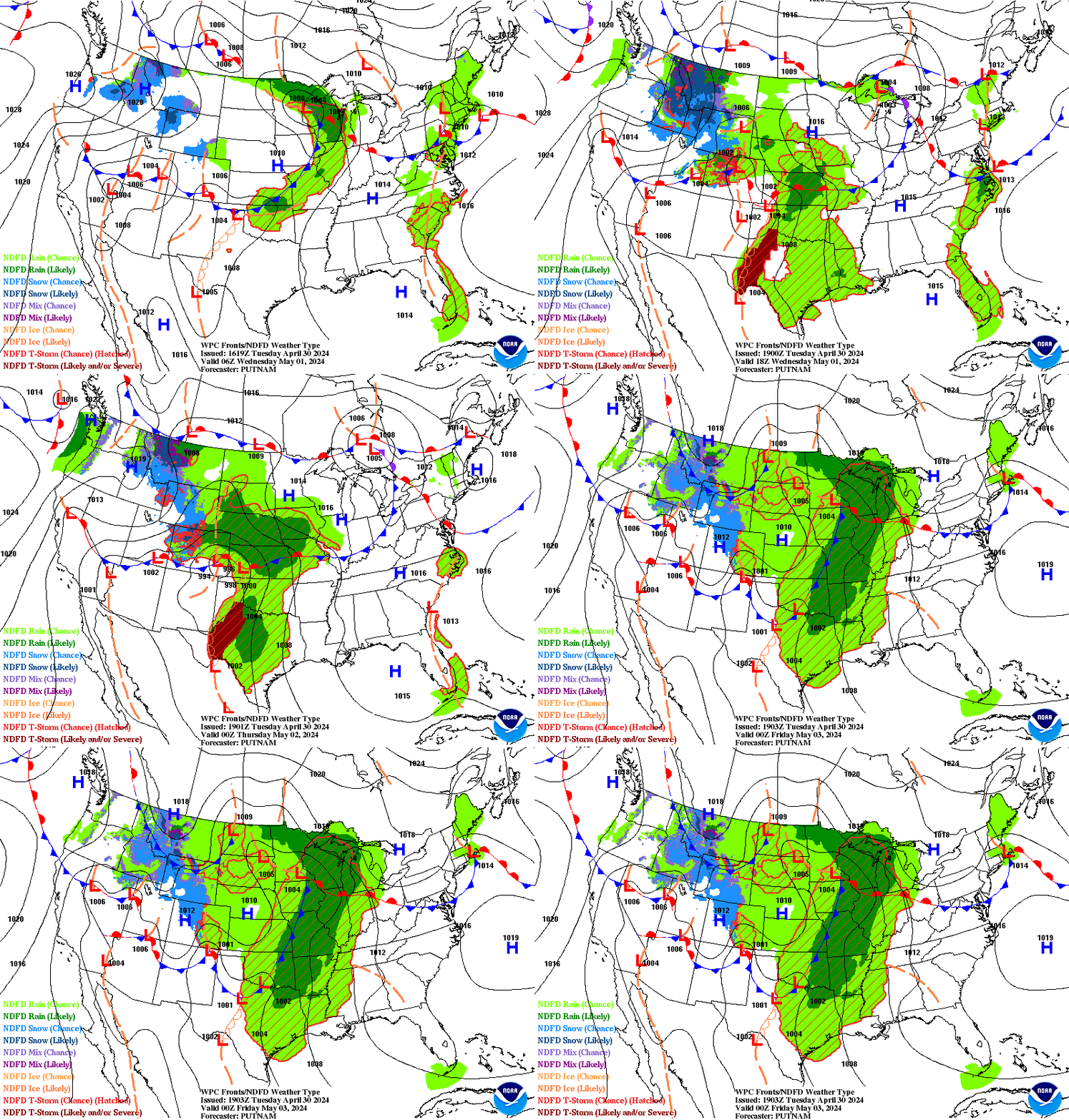
Updated 5 PM. Subtropical Depression Andrea & NHC Break Up - Severe Weather Continues with Flash Flooding on the Plains. Other Regions to Watch in the Tropics....
Not sure what we are calling it....
Post Tropical Cyclone?
Funny part is it doesn't look much different.
Note the new discussion mentions the Upper Level Low.
It mentions the ULL in the way that I did earlier this morning.
The real culprit here is shear and the ULL.
Yeah.... it's weaker.
Signature looks not as strong but closed.
The shear to the North is evident.
The ULL moving to the West is evident.
And even the NHC says the ULL is the dominant feature.
Note below the remnants of Andrea are marked....
Far to the North of the swirl that looks like Andrea.
Ex Andrea.
Seems the NHC broke up with Andrea.
It was a fast, short, bad relationship.
It served it's purpose I suppose ...
Next name on the list is Barry.
I knew a boy named Barry once....
...he was cute.
Good dancer.
6th or 7th grade.
I digress....
There really isn't much to say here.
Except that if there is no real convection left...
..and no real center left.
Then it would seem to me that the convection ...
...associated with the system once known as Andrea remains.
The Upper Level Low is moving slowly West.
Does the moisture still fly off with the "front" ??
Or .... ??? linger around longer.
So many questions so little time.
We will see soon enough.
Elsewhere there are tornadoes, flash floods and misery.
You don't need a hurricane for misery.
Keep watching to see what will be...

Not expecting anything immediately but who knows.
A week ago the NHC insisted nothing was forming.
Then they went from 70% to ANDREA
Stay tuned....
Barry is the next name.
He's out there somewhere.
Hopefully with a better presentation.
Til then give to the Red Cross.
Or give another reliable charity in the area.
The people being plagued with floods will need help.
And continue reading please there are many tropical thoughts.
Down past the 5 AM advisories.
Areas I'm watching for future development.
I'm going to keep this simple today and update later if necessary. Subtropical Storm Andrea is doing so far what was expected of her by forecasters at the NHC. A look at Earthnull from yesterday at this time compared to this morning shows how Andrea developed.
Before above.
This morning below.
That's a dramatic difference in 24 hours.
And while she doesn't show up well on the satellite image.
You can see down through her on this site and see the winds.
Going wider I want to point out a feature.
Between the coast of Florida and Andrea...
If you look closely you can see the mid to upper level low.
You can also see the shear to her NW.
This squeeze play has been going on for a while.
Yet she developed.
Partially ventilated by the ULL in the right location.
Marginal warm water temperatures.
Now let's look at the "cold front"

I wouldn't call it a "cold front" as much as a frontal boundary.
That wiggles around and then high pressure builds in again.
Also note the continuance of severe weather on the Plains.
There's an old chart that was one of the first wind charts.
My son when he was at Iowa State helped create this site.
It was actually an "art" site using meteorology as a base.
It's interactive.
Play with it... it's fun.
Once someone does something...
..... everyone copies and improves it.
But it shows the scope of the Low over the Plains.
Another view of the ongoing severe weather event.
Back to the tropics.
You can see both systems.
Remember it's a subtropical because of it's presentation.
And it's relationship to the secondary low I mentioned.
Note there will be serious flooding situations today ...
... flooding across the Mississippi River area.
And that's an area that doesn't need more rain.
It will also continue to rain in Texas and Oklahoma.
And when I say flooding I mean Flash Flooding.
And five days worth of flooding rains are possible.
Another area I want to point out is in the SW Carib.
There has been a constant increase in convection there.
Some models a while back showed development in that area.
The models went a little too Gonzo over development.
We discount models that show storms not in line with Climo.
But it's good to remember they were showing development.
Any area in that area that moves North will move into warm water.
And from the sites shown below the water is warming up.
As we move deeper into May and into June this concerns me.
This site is shown on www.spaghettimodels.com
If shear relaxes there we could have a problem.
As some of those crazy models implied.
And some of us are still watching that area.
Speaking of crazy models.
Check a few of those Andrea models.
Hmnnnn ....
The good news is most of them do go ENE.
What are the other lost models seeing?
Andrea is expected to go out to sea.
But there are other fish in the sea as well.
I'll be back later today as needed.
Remember weather is relative.
It's all a matter of perspective.
If your town got slammed by a tornado last night...
...the hyped outbreak materialized and messed you up badly.
If it's 90 degrees in the shade and it goes down to 88...
I guess it cooled off......
It's not such a strong cold front.
But the shear and the interaction with the Mid Level Low.
(Yeah it was Upper Level now it's more Mid Level)
Will steal the convection from Andrea...
..and Andrea will weaken as expected.
Keep watching.
Remember the big swirl you see here is not Andrea.
It's the Upper Mid Level Low...

When an ULL is SW of a developing tropical cyclone ....
...it helps ventilate it some.
Change the location a bit and it can help destroy it.
Let's look at a shear map.
And leaving you with a site you can play with if bored today.
Current image.
Last night it was crazy.
Turn the sound up.
Enjoy...
Have a great day.
Stay safe if you are under the gun weather wise....
... keep an eye on the tropics if you live in FL or along the GOM.
Besos Bobbistorm
@bobbistorm on Twitter and Instagram.
(yeah I'm that person)
:)
Labels: Andrea, bobbistorm, countrymusic, crazy, flashfloods, models, oklahoma, spaghettimodels, Storm, subtropical, tornadoes, tropics, weather


0 Comments:
Post a Comment
<< Home