Hurricane Harbor

A writer and a tropical muse. A funky Lubavitcher who enjoys watching the weather, hurricanes, listening to music while enjoying life with a sense of humor and trying to make sense of it all!

Friday, September 28, 2018

UPDATED! Tropics .... Kirk Exits Stage Left, Subtropical Leslie Got Her Name Back. Rosa Off Broadway Coming to a Desert in the SW USA Soon. Where Does Her Moisture Go? Tsunami in Indonesia, Hurricane in Mediterranean? Earthquake in Caribbean on Island Dealing With Kirk.


The long awaited for Subtropical Storm Leslie is back.
Officially.

Updating the blog for the upgraded status of  Subtropical Storm Leslie at 5 PM. You can see how it began to really fill in and convection wrap around the center in images I posted on Twitter while talking to friends about her and her potential drama. You can read the discussion on the logic of the NHC but the image below tells the tale.

https://www.nhc.noaa.gov/text/refresh/MIATCDAT3+shtml/282047.shtml


Convection totally wrapped around the center.

Currently Bermuda might watch Leslie carefully.


We will talk on Leslie more down the road.
I think it's very possible she becomes a hurricane...
...later after transitioning to a tropical system.

As for Kirk....
...he's on borrowed time.


Some interesting news from the Caribbean.
The same island dealing with Kirk...
...just had a fairly strong earthquake.


As Jim reminded me.
He has a link on webpage with news from affected islands.


Duly noted and sharing that information.
I was on the phone with one of my kids.
I do have a life besides weather you know....
Another interesting story comes from the Mediterranean.


Crazy surf.
Look how neatly that fits in the Mediterranean.


How impressive is that?

Further away but just as interesting.
There was a Tsunami in Indonesia...
.... after a strong Earthquake.
Mike posted this on his webpage.


Video found online. 


Been passed around on Twitter all day.

Seems there's a lot going on.
Tropics are active geologically and meteorologically. 

Stay tuned....
Should get more interesting over the next week.

Sweet Tropical Dreams.

* * *


Tropical Games.
Late September of 2018.

Cooler water temperatures initially.
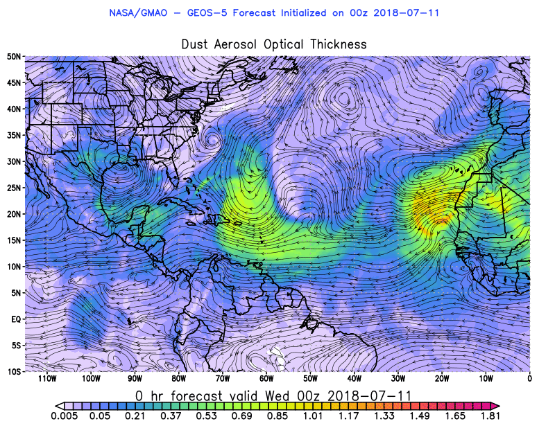
Strong, long lived Saharan Dust.
MDR shut down for huge Canes.


So what happens?
Mother Nature turns things around.
Shakes things up.
Plays by her rules.
Tropical energy goes elsewhere.
Tropical energy finds a way.


Watch that loop.
What was Leslie and will be again...
...is encapsulated by SAL.
Florence was as well.
And yet Florence found a way.
She took the far North path ....
...she went where few have ever gone.

If you loop that loop.
You will see the way shear...
..cleared out the Caribbean.
SAL not getting in there.
Neither have been hurricanes.

But they may form somewhere there soon.
The long term models show lowered pressures.
The pattern as we move into October hints at it.

Good Tweet from a good friend.


It's not locked in.
But most likely something will develop.
October and November...
Are about the Caribbean and GOM.

Often storms that fall apart....
...come back to life or more so..
Their moisture goes elsewhere.
Weather is about flow.

Look at the flow between Kirk & X Leslie.
You wonder where Leslie is getting that moisture?
In a sea of SAL?


Look at that long leash.
And Leslie is whipping the leash.
Slowly a center is filling in.


Long tentacles of moisture being sucked up...
Into the huge vortex that was Leslie.
That is being tracked by the ....
High Seas Forecasts.


Please refer to the NWS.
The new methodology of the NHC...
...is an extension of the NWS it seems.
That's my thought.
The culture there seems to have changed.
More people from the NWS move into place.
It's their way of doing things.
It's their call.

Jokingly I told a friend...
..they won't name Leslie...
..until they kill off Kirk :)

We joke a lot in meteorology.
We compare things to football....
...or movies or science fiction shows.

So where do we stand now regarding Kirk?


Still there moving WNW now.
Movement has been erratic for last day or so.
Generally West into the Caribbean.


Cone shown below.


Models show:


Truth is Kirk will battle shear as he tries to move Westward. He will fall apart, his movement will slow down and his convection will be displaced. The problem with Kirk really is that his convection is constantly being displaced and that convection will cause flooding over a longer period of time for some of the islands. A fast moving, small well wrapped storm would have whipped it's moisture with it deep into the Caribbean... but that is not happening. So there has been some minor flooding that could become worse in the Islands. That IS Kirk. That IS WEATHER and that is what this is all about. It's not all about finding the one wave that will become a Killer Category 5 Storm remembered for all time, though that does happen, it's about weather and in this case tropical weather. So all jokes aside and I do love the jokes... Kirk is causing trouble in the Caribbean Islands now. XLeslie is slowly building back to being Leslie and another cyclone in the EPAC named Rosa will move up towards Mexico and her moisture will move deep into the desert SE causing more flooding and then her moisture will mingle with westbound frontal systems and that is what weather is all about. You can Google it or look it up on Twitter but it's not being shown much on the news today. Remember the Islands have elevation so water runs downhill there often so you have flooding and more flooding and it's not as bad as North and South Carolina from Florence but much troubling weather from a minimal tropical storm.


We will possibly revisit Kirk down the road.
Or the moisture remaining from X Kirk.

Now let's talk about Rosa.
Nice name.. I know.

Rosa becomes part of USA weather.
Weather flows always.


He makes great maps.
Models shown below.
PLEASE... be aware of the FLOODING threat.
Please know campers in the desert southwest...
May deal with strong, flash floods.
Tropical rain in the desert is never a good thing.
But rain falling over farmland is...
It's all about timing and location.
Rain is a blessing...
...it can be a curse too.


Cranky has maps he makes.
I write. I write and describe.

I'll show this map and remind you.
It's not over til the end of October.
The ap below shows where systems may form.
Atlantic has candy stripes.
North Atlantic has dark red.
Then our eyes turn to SW Carib....
..and the Yucatan area.


I'll talk more on this another time.
By Sunday Kirk should be gone....
... Leslie should get her  name back.

This is the time between Florence.........
...and the next big storm.
It's about Pumpkin Spice Lattes.
Football.
Politics.
Changing leaves, falling leaves.
Stalled cold fronts in the Carolinas.
Then stronger ones that push through.
And the Earth is always moving.
Earthquakes... 
Meteorologists love geology.
Geologists love meteorology.

My advice in this turbulent time in which we live.
Find some music you love ....
..and enjoy it alone or with someone you love.
Whatever rocks your boat.

I love weather and I love my friends.
I love my family.
I love.


I love the water vapor loop :)
I love the way everything flows.... 

My taste in music evolves.
Always evolve.
Always find your flow...
..and go with it.

(love love love this song)

Besos BobbiStorm
@bobbistorm on Twitter..

Ps... special thanks ... 


Labels: , , , , , , , , , , , , , , , , , ,

Friday, July 20, 2018

Tropics Quiet. Coastal Low Moves Up Towards SNE. Carolina Getting Swamped With Rain. Twin Twisters Dance on the Plains (Iowa not Oklahoma) and SAL Lunges West Again as Waves Keep On Coming. Check with NWS Before You Make Your Weekend Plans on the East Coast


Just to stay grounded here...
NHC 8 AM


Nothing tropically to talk about.
Much discussion on a coastal low today.
Remember that GOM coastal system...
...never got a name but lots of rain?
Sort of a similar set up in NE.
SNE to be exact.
Long Island
Rhode Island.
Cape Cod.

But the real story today is Down South.
What starts down south doesn't stay there...


Note the long draped cold front that went flat and is now a rain front of sorts ( I made up that term) and it's raining, flooding, pouring across parts of South Carolina. Oddly they have had a rainy area off the coast for days in one way or another from Charleston up to Myrtle Beach to Wilmington. They have been a real rain magnet this past week. Now at some point the rain wraps up and moves it up the coastline; some models show it hovering over the coast vs off the coast. Had this system sat and lingered for a few days over tropical waters we might have gotten some sort of Chrissy storm system but it's on the move as if it's on a summer vacation bound for the great beautiful NE. My mother did that one year, she insisted we drive to New England for the only real vacation we ever took. All the places I really had no interest in seeing such as Williamsburg VA as she was into Colonial stuff and then onward to NE so she could see what Yale looked like (why Yale vs Harvard I don't know) and understand I had to sit in the back seat of a small car as a teenager between two little fighting brothers. This really totally made no sense. Looking back it never made sense and it was the one summer of my life I wanted to stay in South Florida. 

The hype I have read online makes no sense. People keep asking me if it will get a name. And, in truth the NHC that has been writing great discussion on waves and the tropics but they could do anything as the last few years they do things out of context with their general past pattern of doing things. Maybe next year they will make up a new storm name "Possible Tropical Weather System" known on the maps as PTWS for those storms that everyone wants to know why they are not naming and putting out forecasts for...

That's what the National Weather Service is for...

If this goes tropical or extratropical or subtropical they will be all over it immediately.
Feel free to save this link where the NHC talks about things not seen on their map page.


What is interesting is that we have fronts; one front after another progressing across the country and down into the Deep South in July. We also have a huge, strong High Pressure area that currently is propelling SAL into our cities providing colorful sunsets and health alerts for people with breathing problems.  You can see the SAL being propelled West below on the right side of the loop below. Again I'll remind you later in the season hurricanes can and often go where the SAL went especially in the earlier part of the season in August. 


hicbsat_None_anim.gif (768×496)

As for the weather mass ...
... you can see where it's going.
Prepare to spend the weekend at the Mall.
Maybe a movie?
Redecorate?

allfcsts_loop_ndfd.gif (799×559)


Basically the whole East Coast is gonna be messy.
Plain and simple.
Some places are going to be messier.
Rain is needed but...
Pain on the weekends.
No one wants rain on the weekend.
I actually don't mind it.
I don't like when it remains around for days.
I'm going to Florida this coming week.
Looks like rain.
Summertime.

And not going to ignore the incredible outbreak of tornadoes in Iowa yesterday. Some of the most incredible video I've seen in a long time and I've seen a lot of great storm chasing videos. You don't see that every day unless it's a badly made Hollywood movie that plays often late at night. Not talking Twister that if it was up to me could play every day and all night on some channel somewhere.


Even Hollywood wouldn't think to put that ...
...into the Wizard of Oz.


As for tropical waves.
They are there and healthy.
But then they hit SAL.
At some point this changes.

geos5_AOT.gif (800×618)

It's an atmospheric ballet....
Waves pulse up and cut into the SAL.
SAL wins out eventually.
Next wave comes off ...
...it begins again.


Think of them as dancing.
Waves dancing with Cousin SAL ;)

Excellent tweet.
Love someone who knows how to look at the long view.

Cliff Notes.
Week 1...


Please add him on Twitter.
Especially if you want to see Week 2 and 3..

Stay tuned and please watch the weather.
Weather happens very fast in the summer.
Over lakes, over plains and by the coast.


Check out your local weather this weekend..
...and every weekend.
Before going out on the lake..
..or to the beach.

Besos BobbiStorm
@bobbistorm on Twitter

Ps... Think of SAL as the BEAST.


Watch that loop.
They actually kind of dance with each other.
At some point SAL gets tired.
Winds shift...
Patterns flip.
Things change.


Labels: , , , , , , , , , ,

Wednesday, June 13, 2018

Tropics Wednesday. Invest 91L Not Doing Anything Yet. BOC Bound? Will Energy Transfer to the E Coast of Florida or Florida or Bahamas? Maybe. It's June.. .Watch & Wait. Euro Watching Florida Today? Hmnn Some Thoughts on Why We Shouldn't Live or Die By the Models Especially in June. Being Unique and Who We Are Online...


Tropics Today.


Watching the tropics in June to see if something will or won't develop isn't for the faint of heart. It's especially dangerous to live and die by the models as this time of year due to "feedback issues" the models often produce vigorous tropical storms just to lose them once people take the bait. Simply said the models in June are basically "click bait" and that's why I watch the satellite loops and other forecasting tools to see what I really think will happen rather than click on "you should see the so and so twins today" and spoiler alert clicking on those links never ends well.

That said I do look at the models, but only after carefully examining what exists and contemplating the shear maps, the water temperatures (that change daily sometimes) and low and high pressure patterns. I watch cold fronts that ooze Down South enough to wear jeans vs shorts on a cool June evening out in Raleigh. I watch hurricane history and use many grains of salt when dealing with anything down in the SW Carib that is forecast to develop in early June or late November.

MOST IMPORTANT TAKE AWAY HERE TO REMEMBER.
Never ever rely on or believe in ANY model until the area being investigated has a clear cut, verified center of circulation. And if there are multiple centers vying for control think twice on the model until that one center becomes the real thing. Only with good data from recon and a good starting point do you get a good end result. And, even then models change in real time as the storm itself senses new atmospheric steering currents and conditions that may alter the track or intensity of the storm that no model noticed. The next model run the model will adjust to the storm not the other way around!

To understand who I am and how I think it's worth understanding I studied dance at a young age and cannot stop myself from moving to the beat of a song I love. I studied meteorology in college as to how it relates to the larger political structure of the world as meteorology and it's boring uncle Climo has dictated time and again over and over why one country went to war with another country. Even in the ever changing world in which we live... weather affects everything. If you don't believe me follow Commodities for a while and you will see how weather can make or break fortunes.  So this blog post today is inspired by Ed Sheeran and Sting as we will keep on making the same mistakes as we follow the models refusing to be the leader vs the follower.


A case in point is the word "regardless" was used in official discussion and suddenly every weather person on air or online wove the word regardless into their forecast yesterday for the heavy rain fall Texas may receive regardless of a name or just a large mass of tropical rain moving into Texas. Yeah... how did that work for you all? Yes, with Harvey fresh in everyone's minds millions of people clicked on links wondering if Invest 91L would be the next Harvey like storm. Get a grip gang. And think for yourself a little bit and learn to wait and watch and see what will or won't develop especially this far out.


NHC above.
X marks the spot.
Below... close up map.
Ledge of Honduras.


I don't understand the rush by "pros" to be the first to post the first model run when the EURO follows the GFS and produces a possible storm and then just the way most divas the GFS suddenly leaves the scene of the crime leaving everyone upset and dismayed that the EURO made the same stupid mistake. Since the beginning of recorded history messy blobs of convection have sat down on the ledge of Honduras and shear blows off their convection to the central Caribbean and models dance about as if they are in dress rehearsal and meteorologists follow every frame that the models put out jumping to conclusions. Models do not TALK they infer, they imply and they often lie. If you are going to follow a meteorologist who talks on models make sure they really understand the nuances and are not just repeating the party line regardless of what may actually happen. Models are really not as simple as they look and not for the faint of heart. Always believe in models AFTER a true center has formed.


It's always good to be a leader rather than a follower. Find a few good mets who know how to lead vs follow and know what the heck they are doing vs following the pack. I've had more than a few people ask me how Mike became so big online and especially on Facebook where people wait to see him to do Facebook Live. The reason they do is that they have not been burned by him with bad information and he is the first one to say he could be wrong. He talks on the models, shows.... no teaches people how to use the models and then gives his own thoughts peppered with what the official line is while reminding people the NHC is the bottom line... even if he doesn't agree or see how it will play out. He is very honest and knowledgeable. Yet jealous long time on air types make fun of people like us who are popular online and seem dismayed that people actually enjoy reading a blog or going to a weather website run by someone who didn't get an online meteorology degree from MSU. We are who we are and we don't pretend to not be who we are and I believe people respect that honesty.

Great song...


I didn't write nonstop Tweets using the world "REGARDLESS" yesterday as I'm not going to wax poetic on a storm that hasn't even formed a center before warning people all across the coast of GOM that they need to worry on huge amounts of tropical rain just because everyone else is doing so. Yes, I will say that IF this forms we need to worry on the set up and explain why we watch weak tropical storms in June by using Tropical Storm Allison as a history lesson. We need to pay attention more to historical analogs and possibilities and less every new model run promising bigger and better cyclones then pretending it never showed a hurricane. And the NHC said 20% chances in the 5 day so why was everyone looking for development yesterday or today????

Another person who some mets like to make fun of is Dabuh who often sees what could be, may be and posts cryptic posts showing areas where something may develop way before the GFS or EURO show them. He doesn't pretend to be head of the NHC and he is very much who he is and not afraid to be himself. As a weather community online we are richer for his presence and participation.


Hmnn.....


Oh.....
Hmnn just one frame of the EURO.


Don't sell the farm ....
... just one frame.
But nothing in GOM..
And now it's watching Florida.
Okay...so we watch.
We watch, wait and go on with life
People ask how Dabuh does this?
Pulls tropical rabbits out of his hat?
Inquiring minds want to know...


Again it's important to be yourself. No one else can be you and everyone else can weave "regardless" into their own tropical discussions regardless of the fact that currently nothing is going on but everyone is talking about it so regardless of reality let's repeat what everyone else is saying. Ex Director of the NHC Bill Read was so right when he told me people must come from sheep not monkeys.  I do show models early on because people ask me about the models and because that's the name of the game in 2018. But I take those models with a lot of salt the way I take my margaritas.  If there is one thing Dabuh knows it is the East Coast of Florida as he lives there, surfs there and pays close attention to every sign of trouble or good waves.


So there's your model discussion for the day.

GFS shows nada.


I try to share info.
I try to educate on hurricane history.
I try to inform and amuse.
I do my thing.
You don't like my ending...
Make your own ending.
Great advice from an original.
Who makes a soap opera in a video?
The tropics are a soap opera.
The best show on earth.
Reality Show.
Mother Nature does the Tropics.
Stay tuned.

Again be an original!
Don't be a copycat.
Find your own stage.
Watch and learn.

GOES16-TAW-08-900x540.gif (900×540)

91L is not developing NOW..
 because of strong shear.
Diving ULL.
Shunting convection off... 
Watch it...
...but watch the Bahamas.
East Coast of Florida.
And any other area that bubbles up.
It's June this is how June works.


Besos BobbiStorm
@bobbistorm on Twitter
Join Twitter.
Follow me for faster updates.
Join in the discussion...
You want a long read?
Read Cranky I do... 
He's ALWAYS been an original!!

Ps......

Sting is who he is....
who he has always been.
Unique.
He's a leader not a follower.
Great lyrics.
Awesome stories.
I can relate.


Labels: , , , , , , , , , , , , ,

Wednesday, September 27, 2017

UPDATED ... Yellow Circle Caribbean 20% - Hurricane Maria & Cat 3 Lee.. Waiting to Go Out to Sea. Nate in the Caribbean or Off Florida? Maria's West Side Tries to Rebuild. Memories of Hurricane Sandy and 2012 .. Spinning Off the Outer Banks.


Yellow Circle
20% chances in 5 days.
Note the heavy moisture in that region.


From far away...
...very obviously bright convection.
It's been steady convection.


A look at the moisture feed.
Oozing up towards Florida.
It feeds Maria.
Distantly to the NW Lee.
Possible Nate forms here.

latest72hrs.gif (947×405)

I'll update with the newest model runs later today.
Worth saying this is just the first discussion.
There are many solutions.
Know it's there.
Stay informed.

I'll update with model runs.
After the EURO finishes uploading.

Note the ULL in theE GOM
As I said earlier...
where is the fly in the ointment.
ULL.. building ridge.
See circular spin..
East GOM

ir2-animated.gif (720×480)

Besos BobbiStorm


allfcsts_loop_ndfd.gif (799×559)

One of my favorite products above.
You can take this to the bank usually.
Hurricane Maria meets the front.
A hurricane again.
Then goes out to sea with Cat 3 Lee.

sat_wv_east_loop-12.gif (640×512)

WV Loop above.
Tropical crystal ball.

Close up below.

rgb_lalo-animated.gif (720×480)

Left side filling in a bit.
Intense weather on the right side.
Some weather moving closer to shore..
(short term)
Overall forecast to move NNE slowly.
Then pick up speed and Lee.
Think of Maria as a Cougar..
..going after the young, well formed Lee.

Sorry this post was later than I had planned but as always there is some sort of family drama going on in my life and I'm feeling a bit under the weather. Be it allergy or an infection I may go back on the Antibiotic and start sipping tea all day again. Blue skies present again, sunshine and a light wind out there so visually it's a pretty day. My brother is getting remarried (my sister in law died) and there are arrangements for a wedding in Florida. For those of you worried it's not that fancy nor a big wedding and I have dresses to wear so let's move on to Maria and Lee.  Obviously we have been waiting for days for hurricanes to dance with each other and for Maria to make a move out to sea. 

Hurricanes are not just about the eye, I have said that thousands of time and for those who like to High Five each other because you chose the model who better called the track and if it's not a Cat 3 hitting land you don't care then this post is not for you. My blog follows tropical weather, hurricane history and my life and thoughts as it is after all my blog and I don't work for some government agency where I have to carefully word my discussion and try to show how my forecast verified. People who have followed me over the years know that I wrote where Charley was going when it was paralleling the coastline way before it made that turn in towards Port Charlotte, Florida and that is why I have followers who read my blog. Overall I make a call, sometimes I'm off and if so I own it. I said I thought Irma would hit around Marathon in the Florida Keys after debating Miami or Key West or Tampa and it made landfall in Cudjoe Key and I was about 28 miles away as the crow flies days out. I don't blow my own horn very much, it's not my style but explaining again who I am and why I write and what I do ... and that's writing about weather and hurricanes, discussing and educating on hurricane history and sharing my thoughts with meteorologists I respect immensely. I'm always learning something new and I owe it to them to keep me on top of my game trying new things not being stuck in a box.


The Kmart in Marathon is closed temporarily.
They are reminding people to donate.
So am I.

So I want to take you back a bit today.
To another hurricane that spun off of OBX.


I took that picture in 2012.
The wind at my back.
A cold wind blowing... 
Whipping up the surf.
The ocean odder than I've seen it there.
As the hurricane passed off shore.
Not stalled like Maria.
On her way North.
Hurricane Sandy.
But in the same spot.


People stood around watching.
Surfers not in the water.
That should tell you something.


Now let's compare and contrast.

That image above is SANDY 2012.
Below Maria

sat_ir_enh_east_loop-12.gif (640×512)


A day ago Maria looked reminiscent of Sandy, however one picture does not tell the whole story. A different set up and Sandy had a ticket to New York vs out to sea with Hurricane Lee.  Same effect on the beaches at the Outer Banks and no one in the water surfing by either of them. The water pulling away from the beach, the wind slamming you around a bit, sand flying and the Sound filling up with water moving South caught up in the flow as the hurricane pulled North.

One thing I've learned over the years both studying and chasing storms is that you get a feel for them at the ocean ... even if they are merely passing by. When Floyd passed by Miami, despite a good forecast keeping it off shore hotels boarded up and the city shut down just in case it didn't follow the forecast. Some of the strongest waves I felt ever or saw were from Floyd as it was a real monster in size, scope and it had tracked a long ways. I've seen strong hurricanes that do not produce strong, intense pounding waves even though there is storm surge and high winds. Each hurricane is different and each has it's peak, it's drama and at some point most slowly they fall apart for various reasons. Each hurricane has their day in the sun, their memorable moment for the season we remember. Sandy, lurching towards Puerto Rico about to knock out it's radar and knock the island back into a time before electricity, phone service and before the Internet wiping away bridges and making clean water a thing of the past.

Note what I said about Sandy please shown below.... way before it moved North towards it's landfall and sucker punch to parts of New York that still five years later they are trying to raise up the old homes in Bayswater that got battered by Sandy to a higher elevation for the next hurricane. New York learned lessons with Sandy and they implemented them but at some point down the road NYC will be tested again. Long before the amusement park in NJ was destroyed and Sandy Point caught fire in the hurricane and the storm surge destroyed basements near the coast in parts of Brooklyn and Queens... Sandy raged by the Outer Banks. Look what I wrote before......Sandy moved on to New York.

Also Sandy trashed Cuba.
Most people forget that.

Yes Sandy meant business.
2012 Hurricane Season.
2017 Hurricane Season.
Both meant business.
2017 is NOT over.

So let's look at Spaghetti Models.
(the site not the models)


Maria is forecast to move out to sea.
Not going to NYC or Boston.
Discussion on Nate on the right.
Spectrum wants me....
I'll make that decision after the holidays.
Lee out there somewhere.
Intensifying.
This is reflected below:


Maria is a hurricane again.
Lee a Cat 3.
(Y not they all were this September?)
Maria once a beast is not one anymore.

Again the front, Maria, Lee


Only one moving much is Lee.
But.....look close up at Maria.
More rebuilding rather than moving.
Weather edging West temporarily.
Before going out to sea.
Luckily her West side is weak.
She's looping.
Forecast to move NNE soon.

rgb-animated.gif (720×480)

You can see out flow from Maria...
far left above.

Maria below.

rbtop_lalo-animated.gif (720×480)

A voice worth listening to..


Actually fog... a "marine layer"
Is what weakened Maria.
No one say THAT coming.
Part of Maria is pushing onshore.
Despite her move out to sea.
Her left side built up again today.

Some people get that.
It might be temporary.
Actually Cantore drew that this morning.
Before he took Maria out to sea...
..he showed the loop.
The edging towards the coast.
Then looping back out.
He's not a kiddie. 
He gets hurricanes.

OBX 2 days ago.


Check out this video ...
5 years ago.
Compare, contrast.


That's footage from Hurricane Sandy.
OBX 2012.
"Daylight video starts at 3:56"


It is a tale as old as time. A large hurricane moves north of 30 degrees and it begins to unravel in various ways, yet its still there spinning off the Carolina coastline. The Outer Banks were made by storms such as these who spend days battering the coast with winds and high surf. What is often most interesting is being there when the storm pulls the water out to sea as you stand on the beach watching the ocean recede. Been there and it's magical, but as Abrams said on TWC this morning it's "not sexy" but in ways she is wrong. There is something awfully compelling about standing at the beach, feeling the wind in your face, tug at your hair and buffet you and yet the water is receding, pulling away in odd ways hard to describe. Up the coast the North wind begins to pile water down the Sound and you get a sound sort of storm surge whereas at the beach the ocean is receding. Did I mention the sea foam blowing around... wild scene really.

I know you want to know what's next. Sandy hasn't even left the crime scene yet everyone wants to know who the next victim might be from the 2017 Atlantic Hurricane Season. Models continue to show a small disturbance in the force off the East Coast of Florida (maybe a tropical depression?) and it moves West under the big high that is forecast to build in and gets into the GOM. Very iffy but many models show that set up so not going to ignore it. And then models show another storm forming in about ten days time that could be a threat to South Florida. Yeah I know my family likes to make weddings during hurricane season.  Cantore put this up today on Twitter as the last of a series of 3 images showing how this plays out. The end game (all you really want I know) is on Thursday a week from tomorrow this might be where Nate is forming. October... hurricanes come out of the Caribbean going NE or NNE usually. Could a strong high left behind by a cold front be the fly in the ointment or a front be a ticket to Florida and out to sea?


Storms in the Caribbean take a while to form.
When they do they ramp up fast.
Loop below you can watch.


Convection in the Caribbean.
Maria's tail still there.
Lee far up to the top right.

I'll update later today most likely.
After I take some meds ..
..and another shower.
Maybe go for a walk.

Stay tuned...
October hasn't even begun.
Could we squeeze another named storm in?
September ends Saturday night.
Keep watching off the coast of FL.

Besos BobbiStorm
@bobbistorm on Twitter

Ps... Thanks to my friends for keeping me inspired and fresh!

If you like musicals... and I do.
Beautiful songs.
Good movie.
A tale as old as time.


Labels: , , , , , , , , , , ,