Hurricane Harbor

A writer and a tropical muse. A funky Lubavitcher who enjoys watching the weather, hurricanes, listening to music while enjoying life with a sense of humor and trying to make sense of it all!

Tuesday, May 14, 2019

Crazy Huge Hail in North Carolina. Yes Size Matters... Cool Weather This Morning. Nasty Weather on the Plains... Then Comes Hurricane Season


animate.png (1200×875)

To be clear...there is no hurricane today in our basin.
There isn't even a small tropical storm.
Not even a tropical depression.

Yet I'm a really good mood.
Why?

Is that awesome?
Okay it's a kind of denial but loving it.
Windows wide open.....
...fresh air.
Not hot, not humid.

And yesterday I got hail.
Big, huge, hard hitting, heavy hail.

This is a video from online.


Crazy fast hitting hail storm.
This shows why I don't have good video.
I was out in it in my husband's car...
...he really didn't want the hail in the car.
But he was fantastic about going out into it.
And he drove through a heavy white out while...
I was over the top crazy excited loving it.
I love hail.
I don't love hail to destroy your car or crops.
Just something about hail... it's crazy.

So the day began like this....

It was extremely dark outside for 9 am and despite warnings the last few days that we were in for marginal chance of severe weather nothing loomed big on the radar but the air had that feeling to it so I went outside. The sky was heavily cloaked in low, dark clouds. My phone announced a lightning strike hit about five miles from my location. I took a walk, tried to get a feel for the weather without staring at the radar or playing online with friends. I wondered on the man edging the lawn, gardeners out doing their thing with threatening weather didn't seem like a good idea. They were picking up lots of debris from the last late night storm and doing a nice job but using edgers with earphones on listening I suppose to loud music from the way the guy was enjoying himself seemed like flying blind into nasty weather. Suddenly there was this huge, jagged lightning bolt that cut it's way across the sky not far from me at a long, slow angle and then suddenly sliced down with an explosive sound that I'm guessing landed a few blocks away by Ravenscroft athletic field; nice private school with a huge athletic field filled with huge lights that often attract lightning or ravens... depending on the weather. 

My husband yelled downstairs and asked me if that was lightning. I yelled up "yeah" as my heart was suddenly beating fast and he yelled down "good" because honestly otherwise you would have thought a bomb went off somewhere. Raleigh doesn't get lightning storms the way Miami does and so this sort of came out of nowhere. Not a dark, threatening sky but low, heavy gray skies. And then the most incredible downdraft began as the temperature dropped and the breeze began and you could feel that feel in the air. So we left because I wanted to be outside somewhere if we were going to have weather and yet I didn't expect it to happen so fast and again no crazy warnings yet but you could see the radar had a few fast moving rogue cells* moving fast towards me. 


I took this picture and asked my husband if he wouldn't mind just going a few more blocks down to get a better view of the line and as usual he was agreeable :) so we drove another block or two and the whole sky just opened up and the wind began to blow and somewhere you could see a drop of rotation and huge, hard, heavy hailstones began pummeling the area. This system was moving faster than a bat out of hell as the saying goes and as I didn't want the hail all over the car I didn't open the window to get a good picture ... also figuring there were plenty of videos being taken I wanted to enjoy it. I did open the moon roof enough to watch the hail hitting before closing it as it was kind of making my husband concerned. Yes, the hail was that huge and more so voluminous amounts of hail not just one or two here or there as we usually see in Raleigh.


It says officially 1.75 inches in Raleigh.
I'd go with that but it really was the volume.
Trust me though size does matter with hail.

Wind was blowing wildly.
Total white out... could barely see the sidewalk.
Headlights in the white out that looked like thick mist.
And then it was gone.......

Within minutes a tornado warning was posted.
(Thanks....)

And I was nuts, excited and happy and loving it.
I do believe I said something like ...
"Can we do that again!"
And we did but without the hail.. just heavy rain.

Cranky calls them *rogue cells.
Good term.
Fast moving rogue cells.
Going under the radar til the NWS played catch up.
A catch me if you can sort of rogue storm cell.

Further away it was rated EF2 tornado.
Lots of damage.
By us we had immediate flooding ...
....but it ran off fast.

Yeah I love weather.

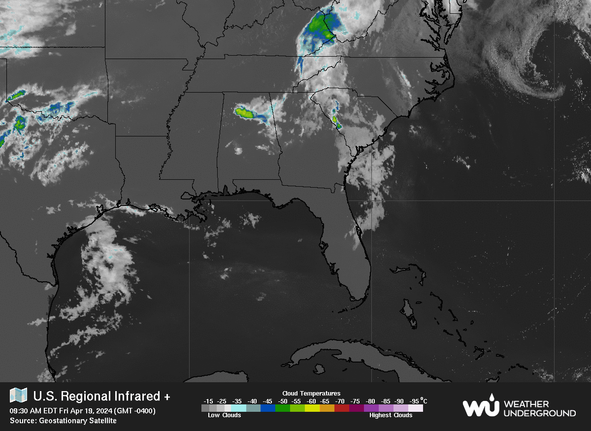
As for the tropics nothing there now.
But this triangle area needs to be watched.
Down the road.


As long as weather lingers there....
Anything can happen in a few weeks.

I'll be back soon with more real discussion.
I just wanted to record my thoughts.
And I want to get out and enjoy the 55 degree weather.
It's an illusion but I'll gladly take it.
Later in the week it's supposed to be in the high 80s again.
The real story is out on the Plains.
Severe weather for a whole week...
Storm chaser friends in place.
I'm waiting for the tropics to bubble myself...
Everything has it's season.

Sweet Tropical Dreams,
Bobbistorm
@bobbistorm on Twitter and Instagram
Follow me for faster updates in real time.


Labels: , , , , , , ,

Wednesday, March 27, 2019

System off SE Coast... Surfs Up FL ... Windy... Hurricane Season 2 Months Away. Are You Ready? Amber Sunsets and Some Thoughts on Moving Towards April.


GOES16-EUS-08-1000x1000.gif (1000×1000)

Going to talk on the system off the SE Coast.
And talking a bit on hurricane season.
Along with a few other things for various reasons.


Before I talk on this further note....
That huge storm off the NW coast.
That is not a hurricane...
It's cyclonic....
Winter weather is far from over.
Even though we are dipping our toes into Spring.
Today off the SE coast is a small system.
Up close you can see it below.


See the tight gradients along the NE FL coast?
This is a system that is coming together.
TWC is on the scene.
Surf's up.
Windy.
Stormyish.
Locals are barely talking on it.
But for weather people it's weather.
Guessing they are shooting videos for Daytona Beach...
..future episodes about NASCAR or ??
If they had been in Cocoa Beach they'd have seen hail!
Huge hail.

When I was a kid in Miami I never saw snow.
But one day the ground was covered with hail.
I mean as in huge hail stones....
No green school yard it was all white like snow.
Happens...
Mike knows it happens.


Mike's Facebook Page has the video.

In a month of so another similar system could get a name.
Subtropical Storms are always possible there in May.
It's April in 5 days. 
De Facto April today.

GOES16-EUS-07-1000x1000.gif (1000×1000)

This loop shows the story.
Freezing cold clouds to the North.
Warmer water to the South.
Tail end of fronts...
Swirls that get stuck..
Swirls that swim up along the coast.
Caught in a busy flow so out to sea.
But things begin to change day by day now.
Beach by beach the waters warm up.

atl_ir4_sat_tropicalindex_anim.gif (640×480)

My brother posted this picture he took from a S FL beach.


He obviously went to the beach early.
Wind not as strong in Miami-Hollywood area.
But that sense of weather out there somewhere.... 

Ironically Jo Malone sent me this advertisement seconds later.


So I'm naming that picture of his Amber Sunrise :)

I have a love hate relationship with Jo Malone.
Most of the scents I hate or they hate me.
Way too strong, expensive 
And sometimes just so wrong.
But sometimes they get it so right.
I have allergies so......
... have to try them on carefully.
Beautiful packaging.
If I had the money I'd buy it for the packaging.
Silly huh?
That's kind of how I feel about TWC being in Daytona.
It's not that strong a storm but hey if you have the money.
You fly off and stand on the beach looking serious :)
And do live updates.

Choose wisely which beach to travel this time of year.
If you want wind... OBX is always good.
If you want warm water... South Beach is always good.


For today Daytona is definitely breezy.
Multiple alerts for high surf and rip currents.


As for my local beach which basically is Wrightsville in NC
(when not in Miami...)


They have a link on their site to water temperatures.
Rising water temperatures coming.
That link takes you to this page below.
This is why OBX usually gets hurricanes in August and September.
Doesn't really get bath tub like until then.
But each year is unique in it's own way.


Link to Wrightsville Beach NC NWS


That's me staring at the water in March of 2017.
It was a rare warm March day.
Headed to the beach.
But didn't go in because not a tourist.
Miami girl in NC ya know...

Back in Miami Beach...........
... the water temperature is 77 degrees!


That's more like it.
Another image from their site is shown below.
Anomalies ...
Gulf Stream warming up.
Beaches near the coast cold still.
Pockets of warm water in the GOM
And just off the Southeast coast.
Prime regions for early development.


Areas to watch in May are same areas in June.
June comes too soon for people who hate hurricanes.
And never too soon for trackers and chasers.

It's kind of like Jo Malone perfume.
Some hate it as it's very strong and often lingers....
.... others love it because it's strong and lingers.

What do you love?
Today I'm in love with the word Amber.
I fell in love with this song below because....
... I loved the lyrics "caramel colored sunset sky"
Awesomeness.
Maybe "amber sunset" needs a country song ;)


Besos BobbiStorm
@bobbistorm on Twitter and Instagram.

Ps... kudos to Dabuh he's been on the money.
Before The Weather Channel began talking about it.


Labels: , , , , , , , , , , , , ,

Tuesday, December 18, 2018

Severe Weather in the South Again. What Starts in Texas Doesn't Stay in Texas. FL Winters Bring Wicked Weather. Torcon Drama. Snow or Rain? Find Your Happy Ending....


I wanted to talk on the system moving through the South later this week and in this case when I say the South I'm more worried on South Florida and actually the rest of Florida as Florida from the tip of Key West to the Panhandle to Jacksonville takes up a whole lot of Real Estate. Today it's as good as it gets in South Florida in December. This winter has arrived early and with a once a week chance to wear those boots and sherpa jackets as you race out the door only to peel them off in time to dash out to lunch and bask in the warm sunshine; cool nights and warm days is what winter in South Florida is all about. Another part of winter in Miami is the chance of severe, strong weather that races in ushering in the next cold front as the cold air clashes with the balmy weather. This winter dance is extremely popular in Tampa and Miami; the Florida Keys are a great destination for storm chasers to get incredible images of waterspouts over Florida Bay this time of year. Waterspouts and Tornadoes often happen in the Winter in Florida.

Being from the Tampa area Mike knows this.


Good map by www.crownweather.com


The 3 day loop shows the problem.
Below is the image most worrisome.


Put that in motion:

allfcsts_loop_ndfd.gif (799×559)


What starts in Texas doesn't stay in Texas...
Be warned.
Sucking up warm GOM moisture....

sat_wv_east_loop-12.gif (640×512)

And again the Southern Jet is the culprit. 
Say "Thank you to El Nino"
That strong signature is it's signature.


Cold weather is funneling down...
...but the Deep South is getting slammed with rain.
Where it dips, when it dips is the story.
If you add in a Polar Vortex dip you get more trouble.
But otherwise this is the story.
As the World Turns
(my mother watched that....)
I watch the water vapor loop
That's my Soap Opera.


Jim Cantore knows this as he waxed poetic on it earlier this morning seemingly annoyed the Torcon Index was not higher. What is the Torcon Index you ask? When it's higher than 3 my friend Sharon sends me a message that reads "looks like you're getting weather!"  They are from New England and weather is both a noun and a verb to them. Winter in Miami is when the sky turns purple black and a squall line sweeps through delivering hail embedded in severe weather and then the temperature drops 25 degrees in five minutes and you need your sherpa jacket.

Today as the weather slides along the Northern Gulf of Mexico remember that it will be storming in Florida soon enough. What it won't be doing in Florida or most of the South anytime soon is snowing. Well if you go up to the mountains the elevation will assure you a bit of snow and the snow making machines are doing their thing as well so if you are looking to ski in Boone North Carolina this Christmas Santa will be delivering. 


The 5 Day Snow Forecast shows that story.

The song should change the lyrics to ...
"Let it rain, let it rain, let it rain"


NC has had it's share of rain.
No drought this year!!

And the flow goes on and on..
So stay on top of your weather app.
You might not have a friend who texts you...
Weather be happening soon.
Not snow.
Not hurricanes.
But severe, dangerous weather.
And it travels up I-95 towards eventually.
Stay tuned.


Kind of sad.
Most happy movies end with snow on Christmas Eve.
Then I thought about it... 
Breakfast at Tiffany's ended with rain and love.

Besos BobbiStorm
@bobbistorm on Twitter


Ps.... See??? You may need to start singing in the rain again!!


Labels: , , , , , , , , , , , ,

Friday, September 01, 2017

Major Hurricane Irma and the Ridge.. Models, Historical Hurricanes and Extremely Severe Weather in Raleigh with Tornado Warnings..Thank You Harvey Remnants.


Irma. Category 3 Again.
Eye wall replacement cycle over.

The map I like for you to pay attention to..


 If you are in the shaded area of this grid you need to carefully pay attention to the storm even if you are far out from where the storm is as it's the best measure of who needs to worry vs watch. Wind probs are as far North as Ponce, PR and down by Barbados. Note they correlate to the map above from the NRL and that is why I tell you to pay attention to that map.

http://www.nhc.noaa.gov/text/refresh/MIAPWSAT1+shtml/012050.shtml?


ft_lalo-animated.gif (720×480)

Donut shape of Irma.
Cat 3.
The High has become to dig in...
The Westward Motion has begun.
Watch for that WSW dip.


Very good discussion at 5 Phttp://www.nhc.noaa.gov/text/refresh/MIATCDAT1+shtml/012050.shtml

Please click and read it for yourself. It's better to read this discussion and get familiar with it than what every person scared on Facebook says about Irma. It's kind of like rumor control. It's the truth vs hype. The Cone is shown below. Note at any point the High can push it more to the West than this cone shows currently. Easy to look at it and say it's going to curve up to the Carolinas but again it depends on the High.


Models.


I just don't want to focus on models today.
Sunday is my day for Model Discussion.
You get the idea..........
....it's coming this way.

You can see Irma below...
..as well as what I'm dealing with as I type.


Yeah.. Look at Inland Harvey.
Just as problematic as always.

rgb-animated.gif (720×480)


You can see Irma out there.
Far away.
Harvey is still causing problems here.


Close up radar of my area.


I'm writing this as Raleigh is under siege from extremely severe weather from the remnants of Havey mixing it up with a cold front that is trying to move South. The mixing the air has caused (and this is a so far list):

Flooding
Hail the size of baseball (not common in NC)
Tornado on the ground
Thunder, lightning.
Heavy Rain.
RDU closed Friday night at the start of Labor Day Weekend.
2 Active Tornado Warnings.
Structures with roof collapse.
Trees down.
Since I typed 2...there are now 3 Tornado Warnings (i type fast)
Huge Power Outages.

There was discussion we would get bad weather but the remnants would go to the North but seems as always Harvey makes his own decisions.

For those of you playing Hurricane Poker a Big Ridge beats an Upper Level Low. A Big Ridge is forecast to build to the North of Irma keeping her Westbound ... until the edge of the Big Ridge. That is the basic steering currents of every long tracking Atlantic Hurricane born in Cabo Verde. Add in the possibility of a trof or low (you'll hear both terms) over North America and the final scene is yet to be written in this weather drama. The players are there and it's a game of improvise in ways as the atmosphere is fluid and there are no dress rehearsals. It plays out in real time and the cities that do not get Irma get a rose and get to exhale and further upstream people worry and prepare.

The cost of gasoline has gone up as predicted by Harvey hitting an area rich in oil, gas and messing up the Colonial Pipeline. Oddly Hurricane Harvey took a bite out of the Labor Day Weekend as many have decided to stay closer to home. A long ride down to the beach is no longer in the cards for many. Several people interviewed on TV today said they feel they should stay close to home and maybe think on how to prepare in case another hurricane makes landfall. There are two types of people. If we are going to get washed away in a hurricane we may as well go party today and those who go shopping FINALLY for food, batteries, medicine and things they may need in case a hurricane really makes landfall near their town. Which kind are you?

People from Florida up to Maine are nervously eyeing Hurricane Irma, back to being a Major Hurricane again, and wondering where she will go if she does not go out to sea. I'm pretty sure survivors of Andrew, Hugo and Fran will to to church and temple this weekend and say a prayer it stays away from land. People who have been there, know what it means to be there...

I want you to look at the 3 hurricanes below. It is very possible that Irma does something like they did in it's own unique way. I have to post this before we lose power as our lights are flicking. No proofing, sorry but it's crazy here in the Raleigh general area. So yeah, tracks like those below could be analogs for Irma.


My TV station just lost connection with their reporters.
Stay tuned. 
I'll be back. 

Rather than worry... prepare.

Besos BobbiStorm
@bobbistorm on Twitter

sat_wv_east_loop-12.gif (640×512)


Labels: , , , , , , , , , , , , ,

Wednesday, March 01, 2017

Tornadoes, Hail, Straight Line Winds - Massive Midwest Outbreak Moving East Today. Stay Informed Check With Your Local NWS http://www.weather.gov/


March 1st. 
Severe Spring like weather outbreak.
Tornadoes, Straight Line Winds, Hail.
Even the signature above looks like a tornado...


Sadly that death toll now stands at 3 and could rise.
Last night Twitter looked like this:


According to MSNBC this morning more than 100 Million People were or are under the gun from severe weather last night and today. When you have a crazy, cell zoom by large cities in Illinois you get the media's attention. Even during the speech last night weather people broke away from complaining and cheering to cover the developing disaster. So far, and they are still searching through the rubble, 3 people are confirmed dead. Cars on freeways were tossed about and straight line winds competed with tornadic cells that popped up and moved en masse across the Midwest.


This great site below is on www.spaghettimodels.com
To the left of that "juice loop" I use so often during hurricane season.


Click on it and you can watch in real time.
Last night it was explosive.


Concerns for today as an even larger population area is again under the gun rises as do the warm temperatures pushing and blasting into the low pressure system out of the Southwest. It's a recipe for more damage and a loud, boisterous announcement that meteorological Spring is here today. Officially winter fights back a bit for a few days after the passage of the cold front. This weekend in Carolina threatens freezing temperatures and one last fling with boots and coats even though today we are in short sleeves and sandals.


Note the possible problems people will deal with today.


Let's see that;s from Boston down to Atlanta under the gun.
And all the cities along I95 along the way. I85 also...

Wow. 

In Raleigh the Bradford Pear Trees bloomed early.
If you like the white flowering trees.
Go out fast today.
The blooms will be gone with the wind this evening.
Maybe there will be a second bloom?
Who knows it's a crazy year.
My boots sit next to my sandals in the closet.

Some awesome pictures from last night below.


Great shots below.


Be aware as dangerous as a system is during the daytime...
...it's that much more dangerous cloaked in darkness.

Pay attention to weather any way you prefer.
Weather Radio. Weather App.

http://www.weather.gov/
Put in your city. Use it..
Knowledge is power.

The cars tossed about on I-55 last night were caught....
....in a fast moving line.

Be aware of your surroundings...
...especially what is going on with the weather!!

Besos BobbiStorm
@bobbistorm on Twitter


Above you have the professional view from the studio.
This was posted by chasers.
Lot's available on Youtube.
And everyone who chases is out today as well.


Labels: , , , , , , , ,