Hurricane Harbor

A writer and a tropical muse. A funky Lubavitcher who enjoys watching the weather, hurricanes, listening to music while enjoying life with a sense of humor and trying to make sense of it all!

Thursday, February 28, 2019

Friday Third Look at Snow Storms and Weather and a Cold, Cold Start to March.


Went out last night for drinks with friends.
Whiskey Kitchen in Downtown Raleigh.
The Capital of North Carolina.
Filled with big beautiful public squares.
And in the spring they burst forth with color.
Beneath the Oaks in the City of Oaks.
At dusk it was almost warm.
But the forecast as 22 on Wednesday.
Which season is it already?
Woke up this morning and it's March... 
...go figure.

March 5th is Fat Tuesday.
March 26th is Purim.
Busy month.
Make the calendar your own :)


Happy March!
Yes that means 3 months til the Hurricane Season.
For some it's considered Spring today.
Meteorological Spring begins March 1st :)
Why you ask?


So you can decide if you go with today...
...or wait til the Spring Equinox.

We're still waiting on the real winter storm to stand up.
This is an older tweet but I love it.
Because it's kind of how I feel as well.


Check back later this afternoon.
I'll talk on this weekend's storm.
And what will be will be with the next.

I'm still holding with Roxboro gets snow.
Doubtful on Raleigh.
A sliver of a chance it doesn't rain this Saturday here.
Sunday shows thunder.
Do I count ten days because it's winter?
Or go with March 1st being Spring?

Check back later.
Til then.... much here to think on.
And still relevant.


Posting this image from yesterday's blog.
It shows a messy mix of systems trying to come together.
Models have been doing the two step.
An old Virginia Reel .... 
Did you ever have to learn this in school?
I did.
If only Mother Nature would come together like this.
But they they kind of then they move back.


Mother Nature doesn't want to dance this year.
She's doing her own thing.
Bi Polar personality maybe?
Or 2 Faces of Mother Nature.
Northern Jet Stream.
Southern Jet Stream.
Will these two ever hook up again for a winter storm?
Not likely but possible.

DaBuh shows these possibilities here above.
Who do you believe?
Whether it's the hurricane season or winter....
... The EURO and the GFS can't agree on the weather.
It's like that dance above.
We take a few steps to come together and then...
... things fall apart and we slide away.
Move on down the line.

EURO says NO.
GFS promises YES.

When you love the weather there are always consequences and moodiness sets in if the snow storm gets yanked away by the Yankees and Southerners dream of one last chance to see snow flurries flying about. Boring weather is boring for weather people. We all have those memories we love to remember and wish we could get a set up like that again. A few thunderbolts that came down fast nearby frightening us out of the pool and running for cover. A day when tornadoes were predicted and hit nearby and the sky turned more colors than Jacob's coat of many colors but they were all turbulent and in motion as they raced across the sky to a touchdown nearby just beyond the horizon. Standing on the protected porch with my brother watching things flying down the street.... roof shingles, branches, small trees in what was not a strong breeze but a real hurricane. Santa Ana winds in California snapping electric wires, starting fires and killing the flowers in the garden as if a dragon just exhaled with his dangerous breath as LA was melting under it's relentless presence. Weather memories dance in our heads the way scenes from Twister make us laugh and we love songs that talk about the weather. Loving weather has consequences.


Loving weather has consequences.
For many of us it's the first thing we remember loving.
Staring out the windows at a hurricane blowing.
Palm trees bent over swaying in the wind.
Hanging out on the porch in a thunderstorm.
Playing in our first snow fall.
Seeing our first snow falling.
Seeing the trunk of a Twister forming in dark clouds...
... wondering where it will touch down.

We are stuck at the end of winter....
...with wicked cold about to descend.
And yet only promises of rain....
Even though we dream of snow falling.
Weather people don't play it safe.
I'll tell you that.

See when you film a video for a song named Perfect..
...you put snow into the video.
It makes everything more perfect.


In some places weather is happening.
The Tar River in NC is flirting with flood levels.
NC has had way too much rain this year.
Hurricanes and Winter Storms that brought cold, cold rain.
And rivers that flow downstream and well..
..Spring brings River Flooding doesn't it?


California also having problems with flooding.
Beautiful Sonoma County is washing away.


And in places like Canada......
......they have ice and snow.
Pulaski NY has snow and ice.


Up in those parts they are so over winter.
One of my daughters lives in upstate NY.


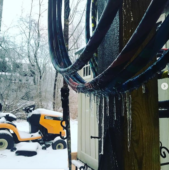
Some of her hoops have ice on them.
She has a lot of hoops. 
Can't keep them all in the house.
Snow everywhere.
And I know she's dreaming of summer.
Blue skies and bright clothes.
Fountains and rainbows.
And hooping in the sunshine.


In Florida and California where she grew up...
.... life was a different story.

In Miami winter is pretty much over.
Mango Season has taken over.


Mangos are so tasty.
The heavy scent of their blossoms baking in the sun is not.
The scent is musky and heavy and gives me headaches.
But oh the mangos are so delicious.

I had mangoes in a salad in Myrtle Beach.
A Key West salad.
Mangoes and Hearts of Palm.

Anyway.... maybe I'll get some snow flakes.
Not holding my breath.
They take the snowflakes out of the forecast.
They put in a wintry mix.
They take it out.
It's a dance weather people do...
...until a day or two before it comes through.
And then we will see what we will see.
I hope to see some snow.
If only wishes came true...

Besos BobbiStorm
@bobbistorm on Instagram and Twitter.

Ps... Weather memories are forever.
Somewhere an old woman stares out the window of a Rest Home at snow falling.
And on the front porch an old man sits in a rocker watching the sky and wondering....
... if it will snow or rain and we are as we were when we were little kids. Looking out 
the window and watching the weather. I've danced in rainstorms. I've stood on beaches 
getting slammed by tropical winds in nameless hurricanes that all blur together.
I don't want to watch a movie about the snow I want to walk in it and feel it 
and see it falling before we race ahead into the hurricane season which is coming soon.
Stay tuned.


Labels: , , , , , , , , , , , , , , , , , , ,

Thursday, December 13, 2018

Another Winter Storm in the Deep South in Hurricane Country.


Keeping this short today.
I just want to explain a few things.
Things to come so to speak.
For days mets have been waiting...
...for this system to show up.
Modeling showed dramatic images.
A deep slice of Arctic cold air...
slicing down into the middle of the country.


There has been much salivating going on...
..waiting to see if this would verify.
Note the watches and warnings up now.


Note the radar today and map.


Now look at the loop for the next 3 days.

allfcsts_loop_ndfd.gif (799×559)

That's intense.


Two things to think on here.

One.... 
If you remember back during the hurricane season Texas had flooding rains over and over from unnamed storms that developed from a low just off the coast? This is the same set up now this winter they had during the hurricane season. Now that fronts are on the move the lows that form are hooking up with the frontal boundaries moving across the map as the Southern Jet is enhanced due to El Nino. This should continue this winter and I'm wondering on what the 2019 Hurricane Season will bring or won't bring depending on how and where El Nino is strongest. Until then Texas is in it! 

Two...
People think a winter storm is not a winter storm unless someone is buried under a foot of snow. Nope, that's not how it works in the South. Winter storms bring flooding rains, torrential downpours and severe weather and even occasionally tornado outbreaks as the warm, warm air from the Gulf of Mexico meets up with the Polar Cold Air from "Up North" as we say "Down South. That collision zone can get nasty. Waves along the coast can and will be high. Wind will be strong and yet except on TWC it will not get a name. But it's wicked weather just the same. 

So if you live in the Old Deep South anywhere from Texas to the Mid Atlantic keep your eye on your best weather source for local advice. The weather will spread up along the whole coast of the US and someone, somewhere will get actual winter weather ala snow. However, weather is weather and when it gets nasty it can wreak havoc from travel problems to just regular every day problems. 

In North Carolina we have had record rainfall this year and other areas as well have had and between wet winter storms and snow further to the North at some point Spring Floods may be a real concern down the road... or rather down the river. Stay tuned...


Besos BobbiStorm
@bobbistorm on Twitter


Ps... This is called "Sea Foam" and it's fun to watch along the Outer Banks. But after the departure of the Great Carolina Snow Storm ;) it really kicked up the waters along OBX. Enjoy the video.... great place to visit and spend time in any weather but I prefer it when the wind is blowing.


Labels: , , , , , , , , , , ,

Thursday, September 27, 2018

Kirk. Leslie. Storms ... Take Them as WEATHER Not Just About the Center or the Wind Strength. Kirk is a Huge Mass of Convection and Wind Moving Towards the Islands. New Wave Off Africa. Chesapeake Bay Bridge Tunnel Beat's Out OBX on a Windless Day.


Ok, I am back home and watching the tropics along with all the breaking news of the day. So excuse me for not posting earlier. I slept very late and am watching the news like everyone while looping loops and trying to think just what to say here. I want to point out the reality vs the sublime, academic meteorological discussion that takes away from it the reality of life and what people are dealing with when facing any tropical entity. There are two huge systems below, both different and yet both similar in that they are easily recognized and compelling.

A storm by any name and in this case Kirk needs to be taken for what it is and not simply picked apart by academics living far away from the islands in it's path. The fact that it is a Tropical Storm vs a Category 1 Hurricane or God Forbid a Cat 5 is true, but this particular tropical storm carries with it strong winds far from it's center and huge amounts of tropical moisture. The center as always out runs the moisture but the problem with that this time is that where the center goes the moisture is going to follow. Out in the Atlantic it simply fell apart and then intensified again when it found warmer water and less wind shear. That's worth remembering as everyone is glad to stick a fork in Kirk and proclaim him dead as we had done that before and he's back again. I'm not saying he will come back if he falls apart as forecast but I am saying it's logical that him remnants can come back a second time until the last rainstorm dries up and his remnants can no longer be found. We are too ready to jump in and write off systems that have a history of pulsing up and down. I'm not hyping him, I'm being honest it just is what it is and that is how this works.


That is a HUGE area of moisture moving towards the islands.
We had flooding in the Carolinas from a similar set up.
A once powerful hurricane downgraded.
Falling apart....
...the huge pocket of moisture remained.
The rains came and followed.
So as always this is what I say.
A hurricane or Tropical Storm is more than it's center.
It's more than the cone that tracks the center.
It's more than how strong the winds in the center are...
...when stronger winds around found far to it's East.
The storm is one system moving intact across a region.
You have to view the whole system as a threat.
The Islands are threatened.
It's huge compared to the Islands.
So it will affect many areas with many problems.
Let's hope and pray it's just a strong few rainy days.
But knowing the problems of mudslides and flooding..
..we need to be concerned about those.
Not whether it's 40 mph or 50 mph.
Not whether it's running "naked"... 
... convection sheared to it's East of the center.
The whole mass is moving WEST.
Or specifically WNW at 14 MPH.


These are the facts.

Yes Kirk's between a rock and a hard place.


That does not diminish the threat to the Islands.
Luckily it's a tropical storm and not a Cat 5.
Still it holds a threat of severe weather.
So when you see Tweets such as this...
...remember the weather is the problem not the center.
We should have learned that from Florence.


Good graphic.
It doesn't diminish the weather the Islands will see.
That's a lot of weather.

Down the road?
Time will tell.

Kirk has often found ways to escape....
... death and destruction.
Keep watching.

As for Leslie..........

She has a name from the past.
The blast from the past is coming back.
90% Chances at 2 PM.


Another big, huge system compelling.
Hard not to stare.
People are staring.
People are talking.


Everyone is talking Leslie.
Except the NHC.
Imagine at 5 or 11 that will change.
It's not threatening the islands.
It's not trapped in the GOM.
It's not threatening NYC.
So they can bide their time.
Figure out how to handle Leslie again.


What your take away should be here is this.
There's a new wave coming off of Africa.
The hurricane season is far from over.
It's not 2017. 
MDR is a foreign, unfriendly place.
But as we move into October...
..we begin to look at the Caribbean and GOM.
Or the Florida Straits and dying cold fronts.
And cold fronts are on the move.


Models for Leslie show it out there.
The old cone showed it moving West.
I know scares people who just dealt with Florence.
Take it with Sea Salt.
This is a Sargasso Sea Storm for now.
And what is different now from Florence?
We have stronger cold fronts.
And it should eventually go away.
When I can't say.
For sure?
I can't say anything for sure now.
We need to watch it.
IT as in the system.
Not the models.
Models are fun.
I love models.
But I look first at satellite loops.
Then the models.
Then wait a day or so ....

Note the two images below.


Bottom Line.

1. A large (size wise) tropical storm with winds stronger than just in the center of 50 mph is moving en masse towards the islands and people will be dealing with it. Kirk is forecast to die from shear in the Caribbean, but we have seen many a storm do this and then come back to life. This is NOT Harvey, this is Kirk but Harvey was counted out about this time in it's track while many whispered on worries down the line. I heard many people laugh it off. Never laugh off a storm that has come back to life stronger than it was in warm tropical waters. This is not 2017 this is not Harvey but the Western Caribbean and Gulf of Mexico are littered with storms that made landfall that were downgraded or fell apart or reborn from remnants of a storm in the same exact place that gave it up to shear and then came back. 


Read the link.
Look at the track.
Not all that different.
Except the pattern today is not what it was in 2017.
But it's a lesson or should be.

2. Leslie is far out to sea fun to watch but nothing to worry about today. Yes it has been an odd year. Do we get a Subtropical Storm or a Gale Center or a Subtropical Hurricane or directed to some other division that handles storms at sea that the NHC doesn't want to deal with ??? Time will tell.

3. It's that time of year that we watch any convection that moves into areas where fronts die out and collide and that can become players down the tropical road.


Here are the fronts and the weather across the USA.


Nothing is threatening the US for the next 7 days.
People are threatened in the Islands from Kirk.
What was Leslie and probably will be again..
..is a beautiful system to watch on satellite imagery.

Should something develop.......
...it will all be about timing and the fronts.
Fronts and the placement of the High.
Now....


7 days from now.


Have a great day.
It was nice feeling a drop of fall in Maryland.
Wednesday it evaporated and I took the leggings off.
The cowboy boots I haven't worn in months were fun.
Just wait it out and it cools off.
Between now and then....
I think there will be an October Hurricane.
Somewhere... where?
Keep watching.

The Chesapeake Bay Bridge Tunnel is awesome.
So is that one by Kent Island.
You put the windows down.
Open the sunroof.
Feel the wind... the breeze.
Watch the pelicans flying about.
The ships gliding about.
If you haven't ever done it.
Do it.
Way better than the 7 Mile Bridge.
And I love the 7 mile bridge.
Watched the sun setting over it yesterday.
No reason to "chase" 98L
OBX had 1 mph winds out of the West.
Warm in the 80s.
No thanks.
I like wind, real wind.


And a great sunset.

Besos BobbiStorm
@bobbistorm on Twitter

Ps...the restaurant store was closed :(
Love that place.
Nice place to sit, get coffee and stare at the water and ships and birds.


A way better view during the storm.


Sandy.... now that's wild.
Driven it in quiet weather and real weather.
Windows down.... wild

Imagine if we had a bridge like that to Cuba..
...from Key West.

Just imagine.


Labels: , , , , , , ,

Saturday, September 15, 2018

UPDATED! 11PM. I95 Closed - Flooding From FLO Cause She's SLOW to Leave... Rain Training Over Same Areas Creating Much Widespread Flooding. A Problem Until She Starts Moving & Picks up Speed and Leaves. Acts of Kindness & Concerns on Orographic Lift & Flooding Rain in W NC

11 PM.
Suffice it to say no real change.
She's moving West at 3 MPH now.. 
Barely moving.
But the moisture from the tail is increasing.
And still spiraling in...

3 Things Important to know.

1. Roads are closed throughout NC including I95. Please check with authorities before traveling through NC or attempting to go home to your community if you evacuated. This is an evolving situation and I'll update tomorrow. 74, 73, 64, 95 all affected and that also means alternative routes will back up as well and as I said on Twitter you cannot see water on the back roads in the dark nor can you see a huge tree down until you slam into it. Please stay home until the situation improves and stay safe, do not become a statistic!


2. When Florence finally begins to move she will impact Western North Carolina and as rain works it's way up into the more mountainous areas we will have to worry on Orographic Lifting and the dangers of flash flooding in Appalachia in the small towns, back roads and communities not used to tropical downpours. In 1940 after a hurricane hit Beaufort, South Carolina it moved inland with a similar track obviously under similar steering currents or lack thereof and that's when the flood happened. Just as we have with Florence the moisture made it's way into Western North Carolina and created tragic, historic flooding. There was an article in March in Our State Magazine about this flood written in great, intense detail by the incomparable Philip Gerard. It's a hard article to read if you scare easily or hate hearing about families who lost loved ones but it's a MUST READ if you live in an area like Western NC and have not experienced such a flood. And, I say that as moving to North Carolina has become very popular of late and many newcomers who may be familiar with hurricanes at the ocean have never seen what that sort of moisture once it works it's way inland up into the mountains can do. Our State Magazine is one of the true treasures of North Carolina and they often do stories on our weather and our history.


3. Lastly I'll leave you with a heartwarming story of one woman who wanted to make a difference however she could and so she took $50 to a local Walmart in Garner and decided to buy what she could with it and take it to a nearby shelter where evacuees were sheltering from the storm. It turns out the manager at the Walmart added supplies to her $50 and excitedly she took the supplies to the people in the shelter who were very appreciative and felt quite blessed. Then she received a phone call from the store manager who asked her to come back again and he gave her more supplies in a beautiful story of people helping people, but the main point here is had she not gone to the store to try and help as much as she could... the ball would not have started rolling. It shows how one woman can make a huge difference just because she cared enough to try and do something. You can read the story yourself, but after a day of sad stories, news of deaths, people losing their homes, rivers rising and more misery to come it's uplifting to read a story about how one person changed so many lives just by her actions. Many of us think to ourselves we'd like to do something but then we talk ourselves out of it, luckily she is not that type of person she took action.


I'll update tomorrow. But what is important to remind you is that currently people are trying to help other people who are stuck on roads that are flooding out. People are rescuing others with their boats or their friend's boats or any boats they can get their hands on as lives are in danger tonight in North Carolina. And when the sunrises Sunday morning the stories of how people were saved will come out and sadly we may hear stories we do not want to hear of people missing or a climbing death toll. Charlotte NC has issued warnings on their NWS website about the problems of flooding in mountainous terrain as well as local areas that will be experiencing the continued misery that Florence has wrought across our state.


***


The sun has rose...
..the sun has set.
And Flo won't leave.
She just sits there yet.


Moving at 2 MPH-ish West.


Until the steering currents kick in ..
...kick Florence out.
She's an unwelcome guest.

I'll do a full update tomorrow on the flooding.
It's still going on so it's a moving target.
Like a flowing, flooded river.
Or creek about to leave it's banks.


Loop:


Great link by Levi Cowan at Tropical Tidbits.

That rain (moisture) is swirling in nonstop like a top that won't stop. Note the small bursts of convection closer to the NC/SC border that are popping especially bright. Cranky spoke on this earlier on Twitter so I'll let him explain the details. Bottom line is some areas in NC and SC are going to be in for a rocky night of bad weather and additional rain that will add to the flooding, rain totals and misery.


Bottom Line is it's not over yet.
And tomorrow brings more of the same.

Raleigh weather show's the story.
Again those cells are spiraling around.
So extrapolate the area inland..
..and then more comes from the same spot.
And we do this over and over and over.


Why?
How is a weakened Tropical Storm doing this?
She's being fed from down below.


latest72hrs.gif (947×405)

Note the bright oranges feeding Florence.


This is a tree that fell in Raleigh.
Lucky home owners.
Just missed the house... 


As for me I'm okay, it mostly rained this afternoon all day, off and on last night though one cell roared loudly and some small twigs and branches down around the property. In general doing very well here, though nearby some trees were down and the ground is saturated and soggy. The wind has been very off and on, more off in Raleigh. I've been told the trees here (large hardwoods and heavy pines) don't need much wind to bring them down. The leaves are soaked, the branches are heavy and they topple easily especially in soaked ground. 

Also any damaged trees (which we have a lot of round these parts) are more likely to splinter and topple over. I was once in front of the house (SEVERAL YEARS AGO ...NOT NOW) when I first moved here watering the hydrangeas in front of the house when I suddenly heard this loud odd noise coming from my left in the forested area next to the house in what was known as Salem Woods... and I saw this large pine tree fall down and hit the side of the house, splinter into pieces and then it was quiet. Not a breeze, not a rain storm... maybe a heavy rambunctious squirrel? I mean what the ??? My husband came running out to see if I was okay and I told him a big pine tree fell down nodding over to the now broken pine tree. He looked over and said "yeah they do that" and went back in the house. I stood there over watering the hydrangeas thinking "what the hell???" And yes I came to find out over time that does happen... for no apparent reason, it wasn't a dead pine though it did kind of splinter fast. My husband came back out and went about trying to clean it up. And THAT my friends is North Carolina...  We have dips in the road, creeks that over flow, dams owned privately that fail (not owned by the State) and are often poorly maintained. You get a hurricane that dumps a lot of rain and things flood, trees topple and streets get washed out. In general Raleigh tends to be a bit boring as we rarely get bad snow and rarely get the brunt of the hurricane, yet areas Down East are hurting bad and the hurting keeps on going. And whatever you see today on the news is not as bad as it will be tomorrow sadly.

Two things I'll add tonight are words of wisdom from two people that know. Do not cross a street that has running water over it and never underestimate a slow moving, large Tropical Storm to bring historic misery


For anyone living in VA, NC or SC..
and parts of GA apparently.
Hunker down tonight...
Don't go out if you don't have to..
..random roads that are dark have tree branches down.
This part of the world is dark at night.
Until you hit it you won't know it's there.
And if you live near a dip or a creek...
...and water is covering the road.
Just don't.


With prayers to those hit in bad areas.
And asking as always to give charity...

Any Red Cross will do...
...but especially here is good.


Or any organization you know and trust.

Besos BobbiStorm
Ps.. Full update tomorrow on the tropics and Flo.


Labels: , , , , , , ,