Hurricane Harbor

A writer and a tropical muse. A funky Lubavitcher who enjoys watching the weather, hurricanes, listening to music while enjoying life with a sense of humor and trying to make sense of it all!

Saturday, June 30, 2012

HEAT, Derecho Damage and the Tropics

It's what you never worry about that gets you.

People worry on hurricanes, earthquake and tornadoes and yet several hundred thousand people were out of power during one of the Nation's most historic hot spells due to damage from a fast moving derecho that raced east towards the West Virginia, Virginia, Maryland and the DC area.

I mean seriously, who woke up in Baltimore yesterday morning and heard that a severe storm that formed in Iowa was going to wreck their home by Friday evening? Doubt that hardly anyone paid attention to the reports of damage from the Midwest that began streaming in yesterday.

Part of the problem is that the NWS is the ugly sister of Weather coverage in the United States. They report it, they issue warnings, they do their job...however they don't get the constant coverage by the media that the NHC gets regarding tropical weather.  There was probably more coverage of a wannabe wave in the Atlantic and some rain in the Gulf that had yet to form and was days away from making landfall .... while this meteor sort of storm rocked east creating havoc and misery everywhere it went. Nameless Storm knocked out power, took down big trees, ruined people's roof tops and was responsible for over a dozen deaths and that death toll may climb.

http://www.chicagotribune.com/news/sns-rt-us-usa-weather-stormbre85t02u-20120629,0,1801684.story

Millions without power... MILLIONS...   that's more damage from most tropical landfalling systems yet no one saw it coming... except in real time in weather offices that scrambled to get out word as soon as possible, however in this case that wasn't fast enough.

http://www.examiner.com/article/derecho-takes-out-power-to-millions-at-least-13-dead-across-five-sta

Really amazing in retrospect.

http://www.washingtonpost.com/blogs/capital-weather-gang/post/derecho-behind-washington-dcs-destructive-thunderstorm-outbreak-june-29-2012/2012/06/30/gJQA22O7DW_blog.html

http://www.theyeshivaworld.com/news/General+News/131999/15-Die-Amid-Heat-%26-Storms.html

Something that most people barely knew existed caused them so much misery and pain.

A lot of work out there for tree trimmers and home repair people.

Sort of like finding out way too late that the really annoying boy you hated in middle school is the one that you really loved when you were off spending all your time staring at some guy you thought would be the love of your life. Hurricanes, Twisters... they get all the fame and glory and are sexy as hell for all of us weather lovers.  But, it's the ones that come out of the blue at you like derechoes that you can never forget.

I discussed this with Bill Read, the former director of the NHC who previously worked for the NWS and he agreed. The NWS does their job well, but they don't get the press coverage...   That needs to change. Weather is weather. While staring at that cute, drop dead gorgeous guy you may not realize you are being watched by a really, unforgettable annoying, funny, smart guy... watching you watch someone else.   While worrying on tropical weather yesterday, people in Maryland never realized that a derecho was coming at them from over their shoulder ...

Who knew?

Well, now we know...

Let's see how long we remember...

Sweet Tropical Dreams,

Bobbi

Ps....it was very hot in the Carolinas... 2nd day of 105 in Raleigh and as for the tropics... the wave went poof and the Gulf is still possible but for now.... the derecho is the big story...   some even wonder if what is left of it might form offshore... let's see tomorrow.

http://www.youtube.com/watch?v=oOCJAVlESEo&feature=fvst


Friday, June 29, 2012

Early Model Run on Invest.. Atlantic Wave

Seems to continue moving WNW into that area that makes people in Miami sit up and go "ummnn"

Invest on Atlantic Wave up to 20%, HOT DAY IN THE SOUTH, DERECHO IN OHIO

Very hot day, but I'll talk on that later. Remember this detail... Raleigh, NC tied an all time record that was set in 1954... the year that Hazel came to visit.

Busy weather day from Iowa to the Atlantic Ocean and look at that new wave coming off of Africa..


The Wave in the Atlantic has blown up nicely today and maintained convection despite the best attempts of Cousin Sal to destroy it. The wave might be getting away as it moves slowly west into a an area where it might have better chances to develop. There is a big Upper Level Low, that many like to call "King Tutt" that is helping more than hurting "The Wave" in ways that are hard to explain here.. Suffice it to say, what does not kill you makes you stronger and the wave is stronger.

Now that we have an Invest by the Navy Site we will have more data, more model discussion ..so far the models have been ignoring the wave. If it  continues like this...it will be hard to ignore much longer. NOTE: Any wave that makes it this far west this early against negative conditions battling it's progress should never be ignored. It's the fighters like this that we remember forever. 

An Invest makes it pretty official as it goes that the wave is something to think upon and trust me I'm thinking. Pay attention Miami, Florida... Virgin Islands, places beyond.


In Miami, OHIO they had a Derecho which is like one of those strange Aunts or Uncles who show up on rare occasions at the family reunion and they talk and talk and talk all day, all night and drive everyone crazy. They travel great distances at a single bound... on a hot summer day like today.

Currently there is damage at the Dayton Mall and over a 100,000 people are without power in Ohio from what is called a "Derecho" and the whole storm system is moving east FAST. The Miami Valley is a mess and the mess will grow in size as damage reports come in all night. This started in Des Moines Iowa earlier... reports of overturned trucks and winds in excess of 70 mph. How far will this system go??


In Raleigh it was so hot today that the freeway buckled. Just up and buckled, stopped traffic to a grinding halt.  I guess extreme heat CAN affect Mother Earth... even if only tying up the traffic.


And, am wondering if the heat this year being so similar to 1954 will bring us similar storms like Hazel that left a legacy of destruction in this region that all old timers talk about.  Yes, I know we are supposedly having an El Nino and that should put a grinding halt to the hurricane season in October. Then again, Cousin Sal was supposed to take out The Wave and well... weather is hard to predict.

"1954 - Drought: 1954 was a year of disastrous drought, especially during the very hot summer months. The statewide mean annual precipitation of 32.96 inches holds the record for the driest year. Small streams went dry and crops were devastated. The National Weather Service reported that the 1954 crop was only ten percent of the ten year average production.
1954 - Hurricane Hazel: As the state was trying to escape from the drought and heat of the spring and summer months, Hurricane Hazel dealt a staggering blow. Hazel smashed inland just north of the South Carolina/North Carolina border on October 15. Winds in excess of 100 mph were reported in the Myrtle Beach area. Towering seas, excessive tides and hurricane winds combined to inflict damage totaling $27 million on the state. The fury of the hurricane and the slow, creeping destruction of the drought combined to create losses in excess of $100 million."


Keep watching the wave... stay cool, stay safe... stay hydrated and keep watching to see how high the high temps will go... and where the wave goes later next week. Obviously, I have my thoughts and they include the Bahamas, Florida, over or under Cuba.. if it gets north it could pose a threat to the Carolinas. Keep watching............and note there is a BIG wave coming off of Africa that is far enough north to be viable as something to watch down the road, especially if the Invest doesn't fizzle out and keeps getting stronger and moving west.

Besos Bobbi

Ps... an article about Greg Fishel and why people up this way pay attention to him the way they do Bryan Norcross in Mami.. a reminder that meteorology is about math not just science.


Glossary:


(you thought i was making this up??? lol)

Tropical Update Friday ... TGIF :)

TC Activity


Okay, simplistically said here.. not much going on...

There is an area of moderate to strong convection in the Western Gulf of Mexico that pulses up and down and needs to be watched. It most likely is nothing more than rain that will move west towards the coast of Tex/Mex but you never know.

There is an old frontal boundary draped across the Florida Straits which to me needs watching as any passing impulse (like a wave) could make it a suspect area for future development. That said...no models support any sort of development and the high seems strongly in place.

Further out in the Atlantic there are two waves moving through an area known as Cousin Sal.. African Dust particles which make tropical development difficult. I guess we should  nominate Cousin Sal for a medal as when he works his magic mojo it's hard for waves to rock and roll vs slowly oozing west holding on for dear life   So far the wave that has a yellow circle and a 10% chance is a real fighter, hanging in there with another small wave behind it.  Cousin Sal is of course the arch enemy of real hurricane fanatics who wait all year for one or two good Cape Verde Storms to develop............ You know how relatives are... it's all a matter of perspective and relative so to speak.


Hot and dry in the Carolinas down through Atlanta. Not that hot this morning, but tomorrow morning should feel more tropical. Let's see how hot it gets, but the record to beat in Raleigh is from 1945.

I think 1945 is a doable analog year for this year so it's something to keep in mind.

Otherwise, have a nice weekend... enjoy it...stay cool and I'll update this if anything changes. But, imagine at this point the Yellow Circle known as Debby is gonna keep moving out to sea and the Yellow Circle known as The Wave is gonna keep getting closer to the Islands. Can't see it going orange just yet and amazed it's still there.

The NWS out of San Juan says the following on the wave: " A TROPICAL WAVE WILL MOVE ACROSS THE ERN CARIB SEA MON." 


http://www.intellicast.com/Storm/Hurricane/AtlanticSatellite.aspx?animate=true

Besos Bobbi

File:1945 Atlantic hurricane season map.png

Thursday, June 28, 2012

Areas to Watch...

Just a quick heads up tonight. An area of persistent convection in the Western Gulf of Mexico needs watching. No Yellow Circles as I write this but.... it's persisted all day, doesn't go away, we'll see.

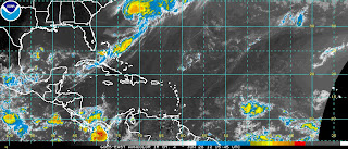
The Atlantic Wave moves further west and is gaining latitude. The islands need to watch this area as it can flare up and develop closer to land.

Debby seems to be maintaining her Noname status with warnings to Bermuda to watch for weather.

More tomorrow... just thought it deserved an update.

Note... a second wave begins to roll behind the first one... wave train has started.

Sweetest Tropical Dreams.. BobbiStorm

Does Debby Reform? Atlantic Wave? HEAT WAVE

http://www.ssd.noaa.gov/goes/east/tatl/flash-wv.html


The tropics today first:

My wave ... okay that's how I refer to it as I have been watching it since it rolled off of Africa while others were watching Debby obsessively. It's out there in the middle of the Atlantic moving west slowly dealing with dry air, SAL, negative conditions and climo and yet she is still there...

Second... Debby looking good.... more tropical up near the Carolinas than she did down in the Gulf, go figure.... models did predict she might reintensify. Vacation might be over for forecasters who may have to start issuing advisories again................

Three... Look at that front draped down into the Florida Straits and draped across Cuba. Did that GFS call that one or what?

What will happen down the road? Front dies out.. breaks up, parts of it linger. The wave moves WNW towards that area left over from the frontal boundary. How long will the hot, dry air remain over the South and will the wave affect Florida down the road? Hmnnn

Keep watching.

The Juice Loop shows Debby as being "iffy" as always and the wave working it's way, stair stepping to where it needs to be to have "close in" development' down the road. Note... staying weak gets it further west and gives it more of a chance to develop down the road. Florida, Carolina, Savannah, Cuba pay attention... and the Islands first of course...

Otherwise... this blog goes LONG with musings on the upcoming HEAT WAVE about to move into the SE with ALL TIME RECORD TEMPS and less publicity than a Category 1 hurricane would receive. In reality this is a BIGGER NEWS STORY as it relates directly towards tremendous economic losses, death toll of people affected by asthma, illnesses and old age diseases that occur with every bad heat wave and cause possible blackouts and massively high electric bills next month as people will have to run their fans and air conditions on over time and there is no relief, not even at the beach.


Weather for Raleigh, NC

76°F | °CThuFriSatSun
ClearClearClearMostly Sunny
Partly Cloudy
Wind: W at 5 mph
Humidity: 52%99°75°104°77°108°81°104°77°


I woke up this morning and Google Weather upped the temps.

 I find that not surprising as Greg Fishel thought the high temperatures earlier predicted might be a bit low and well 108 degrees. Last time I felt 108 degrees was driving through Phoenix pregnant with Mendy and it was 107 degrees at the corner of Sunset and Vine the day before Shuky was born in Hollywood, California. And, that was hot... nuts hot. Crazy hot.

Miami has HEAT, it does not have HOT as when the temperature flirts with 90 it pours beautiful tropical downpours and then it cools off. Gets a bit steamy yes, but it cools off... we are blessed with strong, ever constant breezes coming in from Biscayne Bay.

Up north, in places that are really "Down South" but which my Grandma Mary referred to as "up north" the air just hangs on a hot day. No breeze, no air movement... just hot. You can smell the red clay baking beneath your feet. To be honest, Grandma Mary called West Palm Beach "up the road" and anything north of Cape Canaveral was "Up North" ... there was something about Grandma Mary... something wonderful and that Florida gal... loved to talk about weather. A lot like me. I guess I got the weather gene in the family :)

Note nationwide, it has also been hot. In the past week, across the United States,1,011 records have been broken,including 251 new daily high temperature records on Tuesday."
www.wral.com


Years back when I was first online hanging out on AOL in the old "Weather Chat" I met a lot of strange people who were ahead of their times, prodigies of sorts who knew how to surf the web when others didn't even know that the Surf was up on the web or how to connect with other crazy people who had a predisposition to reading around natural disasters of all kind. Everyone finds their way into the weather section... if there is one common backdoor it's weather. Everyone talks about it, especially those who are hypochondriacs (sorry, I call em as I see em) or doomsayers who worry on the end of the world before it became fashionable in 2012, out of work writers, programmers and screenwriters stuck looking for good material to fill a script. Geologists with no earthquakes or volcanoes to watch will .... if bored to death ....watch the tropics.


We are all "map crazy" if you ask me.


Show me a map of earthquake fault lines or historic hurricane tracks and I act like a fifteen year old girl in love for the first time. I love maps. All maps. Maps of any kind. Once, during an extremely slow period in 1997 I actually did someone's astrological chart on a hurricane map for fun... I told them that their Venus was in Charleston but their Mars was in New York creating a problem in their energy flow. Hey, I was bored, being silly with an equally funny person and I obviously was not using the Hurricane Tracking maps for what turned out to be ....despite all predictions otherwise...............an extremely SLOW hurricane season.


This hurricane season was predicated to be slow to average based on El Nino, and as El Nino seems a bit shy and a hermit it is going to be a stronger than expected hurricane season. Oddly, back in 1997 no one saw El Nino coming before it became the Mother of All El Ninos according to Time Magazine. 


Weather is not easily predictable. That is why strange people who are restless and love excitement and figuring out mysteries love weather...and geology... 


Geology and Meteorology go together like peanut butter and jelly. Every card carrying geologist has a secret passion for weather and every card carrying meteorologist sneaks away often to check out Drudge's Earthquake Chart. Matt of course is a closet meteorologist, earthquake freak who would probably ignore reading info on any starlet who has suddenly run off with some low level politician if a strong earthquake was happening somewhere... 


It's a passion... a fetish of sorts. 


Whatever is going on in someone's life ... if they are the map crazy types they will stop whatever they are doing (sex included) to stare a glance at a breaking earth weather story. Trust me on this. I know. 


Lex Luthor had one obsession in the world, other than getting Superman and that was WEATHER. He'd have thrown Lois and any woman he loved to the wolves if he had a chance to control weather. And, yeah Lex always had a thing for Lois but I am digressing here............


There was a "room" on AOL for Hurricanes and people who liked to talk about them. There was also a room for Geologists called "Earthquake Weather" and they would constantly debate whether there was such a thing as Earthquake Weather. When bored, which was often............they would come over to the Hurricane boards and get thrown off the hurricane boards for going off topic... 


Is there a link? 


I don't know... no one does for sure but everyone discusses it quietly.


No earthquake in America history lends itself to more chatter on links to UFOs (not discussed here, google it yourself, Indian curses which led to the Mississippi River running backwards and Presidents dying every 20 years until Reagan to wicked winters and hot summers before the first of 3 massive quakes. It's always been an Enigma as it is generally a quiet area unlike California which is an anchor in the Ring of Fire.


Was it an Indian Chief who wanted revenge..and took it via Earth Weather like some Lex Luthor character who knew the way to misery is to play with the weather or make an earthquake? Hey, it was before we created nuclear energy........


http://newmadridearthquake.com/2009/10/30/prophecies-tecumseh-strange-worlds-most-amazing-prophet/


A map... my heart goes pitter patter:


http://globalrumblings.blogspot.com/2012/03/sulfur-smell-new-madrid-fault-region.html


http://www.washingtonpost.com/blogs/capital-weather-gang/post/bicentennial-of-the-
new-madrid-earthquake-sequence-can-it-happen-again/2012/02/07/gIQAbF0WwQ_blog.html

http://earthquake.usgs.gov/learn/topics/booms.php (note link to Charleston, SC)

http://www.tennessee.gov/tsla/exhibits/disasters/newmadrid.htm

http://www.new-madrid.mo.us/index.aspx?nid=132


A chilling, detailed report by an eye witness, survivor of the Great 1906 Earthquake.


http://www.sfmuseum.org/1906/ew20.html

An article about the Japanese Earthquake and hot weather preceding the quake:
http://www.technologyreview.com/view/424033/atmosphere-above-japan-heated-rapidly-before-m9/

Lex Luthor's secret obsession:
http://www.fanfiction.net/s/5028061/1/Lex_Luthor_Tall_Tales

Charleston, SC ...was there a link to the Hurricane or was it just bad karma or a Saturn aspect astrologically lol?? http://www.scmemory.org/education/After-the-Storm-8-5.5.pdf

Storms and Earthquakes have happened before, upping the ante on weather and earthquakes going hand in hand in some way we have yet to figure out..like the cure for the common cold.

http://www.scmemory.org/education/After-the-Storm-8-5.5.pdf

Jamaica: You can believe it was a punishment from God (sick) for the wicked ways of the people in Port Royal Jamaica or you could believe there was some connection:

http://en.wikipedia.org/wiki/1692_Jamaica_earthquake

http://www.mona.uwi.edu/uds/GEOHAZARDS_2001/EQprep-20010612b.html


Can flooding or extreme heat affect the earth and tip the balance that creates a quake?

Well..............they are having problems with sinkholes in North Florida..not the same but an after effect directly related to Debby tho in North Florida it doesn't take a lot for a sink hole to open up.

http://elainemeinelsupkis.typepad.com/earth_news/2007/08/hurricane-dean-.html  ??? ;)

Debby vs Florida:
http://www.firstcoastnews.com/news/local/article/261458/3/Debby-affecting-local-roadways


So, why am I waxing poetic about earthquakes?

Because..............when there is extreme heat forecasted for parts of Hurricane Country, after moving east from places near the New Madrid Fault Zone.... I can't help but wonder IF ...maybe there will be some connection.

Anything that historic in the area around the New Madrid Fault makes me think: Earthquake.

Anything historic weather wise in the Carolinas and Georgia makes me think: Hurricanes.

Often............in years where things flip fast, a strong heat spell will be broken by an usually early or late hurricane.

Raleigh is forecasted to have the hottest weather EVER in RECORDED HISTORY later this week. And, just think I am here


Weather for Raleigh, NC

76°F | °CThuFriSatSun
ClearClearClearMostly Sunny
Partly Cloudy
Wind: W at 5 mph
Humidity: 52%99°75°104°77°108°81°104°77°

Weather for Wilmington, NC

76°F | °CThuFriSatSun
ClearClearClearFog
Clear
Wind: W at 5 mph
Humidity: 56%90°72°97°75°99°81°104°79°

Weather for Charleston, SC

82°F | °CThuFriSatSun
ClearClearClearMostly Sunny
Clear
Wind: W at 6 mph
Humidity: 54%90°75°91°77°102°77°104°77°


Weather for Jacksonville, FL

76°F | °CThuFriSatSun
ClearClearClearMostly Sunny
Clear
Wind: W at 4 mph
Humidity: 67%88°72°93°75°97°75°93°75°


For those who love Dr. Strangelove and love Conspiracy Theories... you can forget Mother Nature and blame it on Big Brother... am sure someone somewhere is blaming the heat wave on HAARP or some other conspiracy. Take your pick.... Indian Chiefs, astrological aspects, Native American Indian curses or random, weird weather. Or... jaws music here.............Mayan Prophecies as it is 2012...  

http://thestrongwatchman.com/news-underground/47-news-underground/686-video-dead-birds-dead-fish-haarp-earthquakes-weather-modification-the-new-madrid-faultwhat-is-going-on.html


I will say this though about the whole "chemtrail" conspiracy ... I'm a little tired of seeing them in Raleigh, nonstop and down towards the coast around Wilmington. From no where you see them, planes flying low with their chemicals unraveling..not high flying jet planes... and they criss cross the sky and within 30 minutes the blue sky suddenly turns milky white... my headaches get worse and I wonder...does no one notice this? Do people just not look up as they are driving paying attention to their texts and the road or do they simply think it's normal.

Twitter abounds with nonstop Tweets on HAARP. If you enjoy conspiracies it's a great highway to play on:

Temps over #100excessive high winds &amptornados all summer&ampspringI'm sure it has nothing to do with  

It's not normal. Not sure what the story is there with them.. maybe they are making rain and it's no big conspiracy, Raleigh no longer has a drought...  but whatever it is... my breathing and my headaches get worse whenever I notice the low flying planes with chemtrails unraveling ribbon like into white milky trails.

Like most people... I have priorities. I have to find the right something to wear with a wedgewood blue/purple gown for a wedding in July in New York as my weather focused daughter gets married...  but am wondering what if any long term damage we are doing to the weather as we try to control "global warming" which will cause more problems than "global warming" has caused.

Bottom line... don't mess with Indian Chiefs, Lex Luthor or Superman and think Mint Juleps, small fans blowing on you while wearing as little clothes as possible if you live in the Carolinas when the "scary heat" arrives and you watch the mercury climb up into the triple digits.

Can hurricanes be far behind? I think not.............

1954 ... 3 sisters of Hazel, Edna and Carol
1955 ....3 sisters of Connie, Diane and Ione hit the Mid Atlantic after a very  hot summer.
1966
1999 

(maybe its a double digit thing like people with double consonaunts in their names spells trouble?)

Really the bottom line is 2012 has been a year with seesaw temps. A warm winter and then a sudden spate of cold spells and cool air, then hot weather again...historic temperatures... 

Only time will tell if we have earthquakes or hurricanes this summer... you can blame it on the Mayan Prophecies, HAARP or Global Warming.... it's all the same thing in the end.

We love to talk about the weather while watching the earthquake ticker on Drudge or on your handy, dandy phone APP... 

Nero fiddled while Rome burned and trust me weather watchers were discussing the strange weather and how the earth was rumbling while Nero fiddled.  

As for me... I'll be eating Frozen Yogurt, wearing tank tops and thin guazy skirts and not much else while wondering on if the wave in the Atlantic will develop and come and break our heat spell. And, listening to Jimmy Buffett songs and using my new Bella Rocket to make smoothies with what's left of my Publix Yogurt Guava and Mango yogurts I have that I keep stored away for days like this in Raleigh.

http://www.youtube.com/watch?v=Qe-45dj-aGo   Enjoy... Marilyn singing Heat Wave..

Pick your poison, pick your passion... and dreaming of being back home in South Florida when the wedding, family obligations subside and you know where you can find me... by the breeze, next to the gumbo limbo trees staring out at the blue beautiful water.

Besos Bobbi


Wednesday, June 27, 2012

10N 38W -- Cape Verde Wave - Yellow Circle


This is the real thing...if it develops and if it hangs in there. So far, it's shown itself to be a very tough  wave working it's way further west than anyone thought it could.

A model last week showed it developing, honestly cannot remember which one as it was a long shot and the priority was Debby.

Priorities shift.

This is a priority, a wave worth watching.

Debby has been downgraded. After days of being a Debby downer, the forecasters finally got rid of her... at least for now. She could spin up and if so they will upgrade her back to a Tropical Storm.

This is the one to watch... is 2012 so bizarre that a Cape Verde Wave can develop the last week in June in the middle of the Atlantic. Not sure. But, if any wave can...this one might.

IF SO...it would beat Bertha's formation in 1996 which was historic and one of my most memorable hysterical moments on TWC when John Hope turned around to see they changed the graphics and suddenly there was a storm where there had been no dot on his "areas of hurricane formation chart" :)

Things change. Some years are different.

This is one of them....

Miami, Charleston, the Virgin Islands... everything west of this wave will be watching it very carefully IF it develops.

Keep watching.

http://www.intellicast.com/Storm/Hurricane/AtlanticSatellite.aspx?animate=true

Besos Bobbi
Ps..on a personal note. Am back in the gym at ballet/stretch classes working the barre and debating whether "wedgewood" is close enough to purple to pull this off for the wedding. Either that or can I really pull off a bright purple ball gown? Maybe... time will tell... am window shopping and watching the Cape Verde Wave.  And, thinking if the heat in the South really happens... it will warm up the waters off shore and then...well yes everything connects in my mind to tropical weather ;)


Tuesday, June 26, 2012

Debby Makes Landfall ...Finally..... Yellow Circle in the Atlantic

Been a long few days waiting for Tropical Storm Debby to finally make landfall. And, finally...she did in a place very familiar with tropical storms... Steinhatchee, Florida.

There is massive flooding across a wide area and the misery goes on and on.

There isn't much more I can add tonight to what I have said. I will add more tomorrow.

As usual, her convection is far removed from her center and her center should follow the convection.


Looks more like a big frontal boundary.

It's cool across the region where the front dropped down. Saturday and Sunday in Raleigh it's forecast to be 103 degrees. All time record high at RDU is 105. According to Greg Fishel we have a serious chance of breaking that high this weekend.

http://www.wral.com/rs/bio/1010713/

56 degrees tonight... 103 a few days later?

Why am I talking on this when I usually discuss Miami? Because I spend a lot of time in Raleigh and because I find that when there are constant flip flops in temps and the pattern is not set in stone... things get funny in the tropics. Unpredictable weird years.

Beware the Atlantic Hurricane Season of 2012...

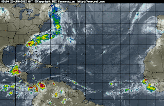
And.... there is a YELLOW circle where I pointed out a strong tropical wave this morning. Out in the distant Atlantic, halfway across this strong, tough wave keeps going west.


Far out there on the right... banding around a wave with a bright white circle in the middle.

Cape Verde Waves. The Holy Grail.

Harder than finding a purple, evening gown in Raleigh in the summer............  busy with wedding preparations for a wedding in New York in July.

Busy watching loops.

Busy watching Debby move "Southeast" across South Florida.

Hmmnnnn. Funky.

I keep thinking on the years 1944, 1945 and 1947. Strong Florida storms, many of them extremely wet and many of them affecting this same region of South Florida.

http://en.wikipedia.org/wiki/File:1947_Atlantic_hurricane_season_map.png

Be back later tomorrow... with dreams of purple and yellow in my head.

Besos Bobbi


Close up and Personal... I see Debby...

20120626.1132.goes13.x.vis1km_high.04LDEBBY.40kts-994mb-290N-847W.100pc.jpg image

Track and areas to worry on for impact from Debby:


There are three things worth mentioning here:

http://www.ssd.noaa.gov/goes/east/tatl/flash-avn.html

1. Debby starts to move East...with the frontal boundary that the GFS forecast as being strong days ago....the GFS was right.

2. Look at that moisture left down near the Yucatan for later development, maybe.

3. Look at that strong tropical wave fighting his way west across the Atlantic.

Other things worth noting that I cannot show visually vs waxing poetic as I sit here enjoying cool weather... while watching loops and TWC with a cup of Nespresso...

It's 65 degrees in the Raleigh, RDU area... cool air filtering in through the open windows. Air moving, leaves rustling outside .... something changed. It may be a temporary change, but it's a beautiful change and makes you want to go for long walks ....sing in the shower, open the windows all over the house and eat breakfast on the deck.

Tropical Storm Debby is now slowly moving, forecast to pick up speed and move Eastward (give or take) across Florida. She should come in just south of Cedar Key, but hard to say and if so she has running room as it would have been a faster path to landfall if she had gone north. The Cedar Key area is host to more novels than I can list. Read about it online or in any mystery novel as mystery novels seem to love that particular neck of the wood... mysteries with funky family members I may add.

http://www.amazon.com/Cedar-Key-Florida-A-History/dp/1596293101

The GFS has my choice for an award for being a Meteorological Forecasting God this morning. Okay, maybe that's a little sacrilegious, but it definitely needs a little gold statue, a Gatorade bath and possibly a parade down Main Street!!


Great coverage of the problem of damned up rivers and how they hurt beaches that have been eroded by storms which would normally be replenished by the natural action of the sand being replaced as the river flows towards the coast again. Bottom line: We try so hard to control everything and then have to control the problems we generated by trying to control nature to begin with... Originally, water flowed down to the coast from inland rivers... carrying sand, dirt, crystals, various minerals and sentiments down to the beach. We damned up the river in the name of progress and then the natural replenish system of resupplying beaches with sand over time after a tropical storm or hurricane passes doesn't work so we spend more money to replenish the beaches with fresh sand..not native sand mind you either.  Every beach in the South used to have it's own character as the sand on the beach was native to it's own ecosystem. Even in the Carolinas some of the beaches have a finer sand, others have a crystalline look to them that makes them shimmer at sunrise... others have broken shells, coral, more dirt, etc.....   Once, a long time ago, they thought it was a great idea to blow up the rapids in the Miami River, drain the Everglades so we could plant more orange trees and crops so the Everglades could fulfill their "promise" of being a great farming region able to provide pineapples to Indiana one day...  sounded like a great idea at the time............. The problem with doing things in the name of  "progress" is that progress is short sighted and never sees the long view down the road or the problems it will cause as they arrive in real time ... like the sand used to work it's way down to the mouth of the river and pile up on the beautiful beach.

Speaking about "progress" it's worth noting thousands, tens of thousands across the region are still without power and Progress Energy in Florida is trying to restore power as soon as possible.

http://www.abcactionnews.com/dpp/news/region_tampa/thousands-of-progress-energy-teco-customers-still-without-power-from-debby

Two people have died so far from deaths attributed to Tropical Storm Debby.

I-10 is closed as well as other major arteries across the NW part of Florida, so check carefully before you insist on going out somewhere if you need to traverse that area today! This changes in live time so check your local weather and online sites as well as Twitter. http://www.fl511.com/

(Oh wow, the leaves are all rustling, feels like Fall suddenly here. An illusion, for sure, but makes me wonder how similar this Debby is to some late summer Tropical Storm crossing Florida slowly waiting for a strong cold front)


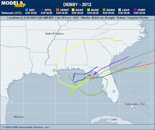
Check out the map below often for the exact area that the "center" of Debby's crossing Florida towards the much warmer waters of the Gulf Stream. She is forecast by many to move across the narrowest part of Florida and oddly will exit into an area that helped spawn Alberto and Beryl. Note, her strong rainfall is already raining on Georgia this morning, but the "center" will finally be important if it reforms into a stronger storm after the crossing. Another question yet to be answered. Also, depending on timing... will she zoom off out to sea or stall yet once again?

NOTE... her weather, now moving slowly across Florida in bands will impact areas further to the South. Dog Island will be happy to see her go. Areas around the Cape, Melbourne, Jupiter, etc should all see increased changes of severe weather as she moves east slowly.


More later ...after  I take a shower, take a walk, go to the gym and see what she has actually done ...

vs...

what she is forecast to do...

And, when this is all said and done... can we please retire this name now?

Besos Bobbi


Monday, June 25, 2012

Tropical Storm Debby Discussion


I often complain about the NHC and their discussion. Not this morning, great discussion... excellent detail and honest admittance that areas far from the center of "Debby" and how they are experiencing Tropical Storm Conditions.  


That's viewing it in an honest, holistic way and needed more often. Less defensive positioning as to why Debby didn't do this or that, etc. They are dealing with what "is" and what will most likely happen.


There are two main scenarios here. The NHC, as usual, is going with the more conservative one that keeps Debby in the Gulf edging slowly towards the coast, refusing to leave the water until later in the week. By Saturday she might do the beach resorts...  that's a hard forecast to buy but it's within the realm of possibility. The second scenario is that the GFS model ....which was ignored in earlier forecasts.........was right and the front is stronger than previously thought and she begins to move her sorry butt across the State of Florida taking her rain offshore in the formation zone of Alberto and Beryl and intensifies better over the warmer waters of the Gulf Stream.  Not a totally unbelievable possibility as that has happened before and can and will happen again. And, the area is ripe for development so far this year. That forecast would also take a stronger storm up along the East Coast staying just off shore and coming near Cape Hatteras down the road.  Note, newer projections show it staying further off shore but I have problems with that seeing the current synoptics over the South. Or I could see it lingering off the coast of Savannah and SC... my thought no one elses. I'm a realist when it comes to these storms, what is plausible and in sync with what is happening further up stream.  Another possibility is it  moves into South Georgia with flooding rain ... etc, etc.


So... watch the various loops to see any movement or indication that the GFS is and was right.


http://www.ssd.noaa.gov/goes/east/gmex/flash-avn.html


Another possibility is, as strange as it seems and not supported by official discussion but more in chatter online and off by trackers trying to forecast this storm... she may not be a true surface storm with a stacked, vertical alignment... her strongest convection has always been far away from her center and at times there have been competing swirls which tried to break off and yet didn't... this could happen as her "energy" (rain) finds itself in the Atlantic over the warm waters of the Gulf Stream, warmer than where she sits right  now and that may be what the GFS and other models were smoking when it looked like she was spitting out newer storms that raced away from Florida. That was about a week ago... but maybe they were on to something??? 


Either way, stay safe. Many people are without power across a large area ...in small swaths where the damage from Twisters and strong cells created havoc last night. Because of how widespread an event this is..it will take longer to restore power and fix the infrastructure than if a small, category 1 storm had moved inland over Panama Beach.


I'd take a real Cat 1 Hurricane any day over a pissant, annoying Tropical Storm like Debby. The damage done from these sorts of dysfunctional storms is frustrating and costly... and there are no exciting moments of "wow for ten minutes I could hear the roar of the wind through the pine trees" or I watched as "rain flew sideways through the streets, each drop like a missile stinging me in the face and making me run for cover" No, wild moments of watching a hurricane move across the land...  no storms like this go on and on and on, like a bad toothache as the water rises, flooding occurs, torrential rains plaque the area and things begin to go snap in the tropical night not so much from the strength of the wind as much as the length of time the wind blew, off and on and weakening from the torrents of rain.  


It's like watching a ficus tree go over. They topple over in Miami from the wind, as much as from water logged soil unable to support the weird horizontal root system of the tree... and suddenly there are three humongous ficus trees down on a golf course that is flooded and looks like a lake. It's the rain, not the wind that really caused the problem. Yes, one big gust took it down...but only because of the foot of standing water on what used to be 6th Hole of what was once a beautifully manicured course.


Debby is that kind of pissant storm.  Had Debby been moving she would have been a forgettable, footnote to this season. She is memorable because she is not moving. In the same way she stayed anchored South of Cuba and then in the Yucatan, she has anchored herself yet again.


Let's see if the "strong front" can budge her a bit and dislodge her...and then ...where will she drop anchor again I wonder.  Hope it's off the coast of the Carolinas and not over the Carolinas because she can do major damage as an inland flood threat later on... when she finally makes her move.


Besos Bobbi


Discussion worth reading below:


WIND...TROPICAL STORM CONDITIONS WILL CONTINUE OVER PORTIONS OF
THE FLORIDA GULF COAST TODAY.

STORM SURGE...THE COMBINATION OF A STORM SURGE AND THE TIDE WILL
CAUSE NORMALLY DRY AREAS NEAR THE COAST TO BE FLOODED BY RISING
WATERS. THE WATER COULD REACH THE FOLLOWING DEPTHS ABOVE GROUND AT
THE TIMES OF HIGH TIDE OVER THE NEXT FEW DAYS...

APALACHEE BAY TO WACCASASSA BAY...4 TO 6 FT
FLORIDA WEST COAST SOUTH OF WACCASASSA BAY...2 TO 4 FT
ALABAMA-FLORDA BORDER EASTWARD TO APALACHEE BAY...2 TO 4 FT
SOUTHEASTERN LOUISIANA TO ALABAMA-FLORIDA BORDER...1 TO 3 FT

THE DEEPEST WATER WILL OCCUR ALONG THE IMMEDIATE COAST IN AREAS OF
ONSHORE FLOW. SURGE-RELATED FLOODING DEPENDS ON THE RELATIVE
TIMING OF THE SURGE AND THE TIDAL CYCLE...AND CAN VARY GREATLY OVER
SHORT DISTANCES. FOR INFORMATION SPECIFIC TO YOUR AREA...PLEASE
SEE PRODUCTS ISSUED BY YOUR LOCAL NATIONAL WEATHER SERVICE OFFICE.

RAINFALL...DEBBY IS EXPECTED TO PRODUCE TOTAL RAIN ACCUMULATIONS OF
10 TO 15 INCHES OVER EASTERN PORTIONS OF THE FLORIDA PANHANDLE AND
NORTHERN FLORIDA...WITH ISOLATED MAXIMUM AMOUNTS OF 25 INCHES
POSSIBLE. SURROUNDING THIS AREA...TOTAL RAIN ACCUMULATIONS OF 5 TO
10 INCHES ARE EXPECTED OVER CENTRAL FLORIDA AND SOUTHEAST GEORGIA
INTO COASTAL SOUTH CAROLINA...WITH ISOLATED MAXIMUM AMOUNTS OF 15
INCHES POSSIBLE. GIVEN THE RECENT HEAVY RAINFALL AND WET SOIL
CONDITIONS...THESE ADDITIONAL AMOUNTS WILL EXACERBATE THE FLASH
FLOOD THREAT ACROSS PORTIONS OF NORTHERN FLORIDA AND SOUTHERN
ALABAMA.

TORNADOES...A FEW TORNADOES ARE POSSIBLE TODAY ACROSS THE EASTERN
FLORIDA PANHANDLE...AS WELL AS WESTERN AND CENTRAL PORTIONS OF THE
FLORIDA PENINSULA.


NEXT ADVISORY
-------------
NEXT COMPLETE ADVISORY...1000 AM CDT.

$$
FORECASTER KIMBERLAIN/FRANKLIN

Sunday, June 24, 2012

Donde Debby? 11 PM Discussion

11 PM:

60 mph
Stationary
29.8 85.9

Salient part of the Discussion written by Stacey Stewart who is one of the best:


All of the NHC model guidance...except
for the GFS and GFS-ensemble models...indicate this blocking pattern
across the central and eastern U.S. Should continue as fast-moving
shortwave troughs pass well to the north of Debby. The result
should be that the cyclone will move little during the next couple
of days...and then only drift slowly northward after that as the
ridge over the southeastern U.S. Gradually breaks down. Although the
GFS model has been very consistent with a fast northeastward motion
across North Florida the past few days...the large sprawling nature
of the cyclone and the blocking ridge to the north would suggest
that the GFS model may be lifting out Debby too quickly. The
official forecast track is similar to but slightly left of the
previous advisory track...mainly due to the more westward initial
position.


The big red circle that is now the cone, looks like more like a scoop of Dark Cherry Ice Cream on top of a missing cone.

Bryan is not happy.......he wants to know where they found those winds... so do I.

The trouble with Tropical Storms is...they are not Hurricanes. As bad as Hurricanes are they are easier to track, to predict and to prepare for... they are ORGANIZED.  Tropical Storms like this are a different bird, sort of like an Ostrich is a bird but not like the bluebird on your bird feeder. Yes, they both  have feathers, otherwise that's about.

To the untrained eye... someone would have problems finding Debby on this satellite loop.

http://www.ssd.noaa.gov/goes/east/gmex/flash-avn.html

Sometimes we rely on Dvorak, other times we don't.

Again, where is Debby?


According to this image... a good part of the Southeast can go outside and look up at the sky and see the far, distant out flow from Debby.


I've received emails asking me what that thing is forming down by the Yucatan.

Can we please retire the name Debby?

People have died. Several people. Homes have been destroyed. Bridges and roads are out.
Power is out.

And, unless the GFS is right.... Debby will continue to cause misery to everyone from trackers to tourists, forecasters to emergency management to the average Joe in Port St. Joe who has been taking the brunt of this lopsided, now you see me ...now you don't tropical storm.

Sweet Tropical Dreams..

Bobbi


A better cone from the NHC:


Good News: They believe they have a better handle on her track... mostly N to NE.

Bad News: She's not forecast to go anywhere any time soon... I'll write on this later, but trust me the West Coast and Big Bend area... Port St. Joe, Panama City, Tampa north...cannot handle 3 more days of flooding rain, twisters, beach erosion...etc.  Let me explain it simply. Say you a leak appears in your roof during a bad downpour or a day or two of strong rain.. you try to fix it when you get around to it or as soon as you can figure out who to use and how to pay for it. After 3 days of nonstop rain there are going to be a big problem. Roads are out. A woman died in Lake Placid during a Twister and the Twisters will keep coming if Debby stays there until Wednesday?? which is what they are forecasting.

Odd News: She looks better on visible now than she has in days, slowly moisture is wrapping around her inner, anchored center of circulation.


Beginning to think she is going to spawn a second storm in the BOC. Being silly but, that's one long tail and tropical energy flowing into Debby's center far away and partially exposed. Strange storm.

http://weather.unisys.com/satellite/sat_wv.php?inv=0&t=l12&region=ea

It's all a "low confidence forecast" according to the NHC.

Hopefully...that model that wants to drag it across Florida is right... low confidence in anything right now.  Norcross seems to think she is drifting NE...   hope so, I trust him.


It is a wicked pleasure of sorts to lie in bed and listen to Bryan Norcross do his thing so excellently while talking to friends online...when I know so many people are suffering in NW and West Florida from the ongoing, barrage of nonstop intense storms training over the area. I'm enjoying it, in a way that only someone who watched Bryan Norcross cover the weather in Miami for years, including hanging on his every word in the middle of the dark night when Andrew made landfall just to my south and her winds slammed into my two story house making the building vibrate and groan.

Bryan Norcross... no one like him when it comes to explaining the models, the forecast, the Water Vapor Loop or the history of the models and the whys and wherefores of how it all comes together.

He is the best. Forget the rest.

His voice is calm, measured and strong while he searches for the right word to explain the intricacies of  meteorology in a way that never dumbs down the weather. He respects the weather, he respects the storm and he respects his viewers. Doesn't get much better than Bryan Norcross doing the weather.

And, I sit today in North Carolina, far from home and twenty years later listening to him as he speaks in Atlanta at The Weather Channel doing his thing... while I do my thing here and online at a few sites where you can find me on any given storm day.

Bryan then...


Bryan now....

 Bryan Norcross

http://www.weather.com/tv/personalities/Bryan-Norcross.html

Appreciate him.... listen to him... he is wise.

I was on the second floor of my old 1926 Roaring Twenties house on Miami Beach, and I could hear him...and I could hear the ocean a few blocks away over the roar, screaming wind.

Trust me, a lot easier to enjoy him from my bed, with my netbook on my lap while talking to friends online.

Stay safe...stay tuned... keep watching..

Besos Bobbi