Hurricane Harbor

A writer and a tropical muse. A funky Lubavitcher who enjoys watching the weather, hurricanes, listening to music while enjoying life with a sense of humor and trying to make sense of it all!

Wednesday, September 30, 2015

Cat 3 Joaquin, The Face of Joaquin. Where is it Going? Models & NHC Debate it's Track.


This is a screen capture from tonight's discussion.
Jim Williams and his side kick Bill... were discussing...
www.hurricanecity.com was live with Joaquin talk.
I realized in the middle of their tropical chit chat...
Joaquin was staring longingly SW towards Cuba...
While the models pick him up and pull him North.
I'll be honest with ya.. sometimes storm people..
... like Jim and I see shapes in clouds.
It's a sort of game we do.. 
I'm sure you do it too!
Rarely do I see such a poetic ghostly looking face tho...
So decided to share it and my thoughts.

He was explaining how the ULL is supposed to form and ... 
pull it up... as the models imply.
Well the Euro model has a different solution..
...hold that thought I'll get back to it.

Jim knows hurricane just as Mike from Spaghetti Models knows WXR.
That's capitalized on purpose.
They do not have doctorate degrees in meteorology.
But they are the ones to watch as often they speak the truth.
Without political agendas or having their hands tied like the NHC at times.
They do not answer to studio heads or producers as on TWC.
They are worth their weight in gold.
Their friendship is priceless.
I listen to them as much as I do most with degrees.

Enough with my agenda here.

Greg Fishel in Raleigh tonight spoke on a political war of sorts.
He talked on how money was spent to improve our models after Sandy.
The EURO always beating out our models.....
... money was spent to upgrade our models.
He said... if the Euro is right...
Well I will paraphrase it.. people are going to wonder where all the $ went.. 

Money greases the wheels of life. 
The budget for the NHC should be MUCH BIGGER.
But it is not, money goes to global warming research.
To studying the habits of moths in far away locations.
Money goes into weather modification ...
Money should go into better modeling.

Joaquin with the hard to pronounce name may drive home this point.
Some models have Joaquin slamming up the Potomac into DC.
A true outsider trying to get into DC it seems.
Other models, like the EURO, take it out to sea.. LBAR did earlier.
Hmnn Euro in bed with the LBAR.. who knew?

Tonight Joaquin is a Category 3...
And he has dreams of being a Cat 4 down the road.

Discussion out of the NHC shows how easy this may be.

Note Joaquin is forecast to hit 140 MPH.
Category 4


I put this up before I show the cone.
As being a Cat 4 could be a game changer.
And, it stays strong for a while.

Here's the models first.
You can see how the NHC draws its cone...


A lot of the models have Carolina on their mind.


Purposely chose that video as it is slow... like Joaquin.

I'm in the cone ...
Inside the Navy cone and way inside.
Though part of the cone is out to sea... 
like the ships going safely out to sea...


The NHC weighs in with their cone.


Nice long loop.
Loop it.

http://www.eldoradocountyweather.com/current/satellite/goeseast-wv.php

Last frame tonight.
Shows why Joaquin went SW.
Went, traveled, moved... did not DRIFT.


An upper level low may form (as per models) ..
And scoop Joaquin up and move it North.
That is what Jim was talking on earlier.

I'll just throw out some early runs tonight.


I'll post Jason because... I have always had a soft spot for Jason ;)

And, its purple... I digress.


This truly bugs me. 
Just showing what the models are burping up tonight.
Bad sushi maybe? 

As the NHC has a good chunk of the East Coast in this..
It's time the models made up and came together.


It's as if someone lit a match and it explodes North.

I do think the timing is off... 

Every one is up tonight ...
scratching their head and making attempts at feeble humor.

On one hand you have a Cat 3 Storm.
Cat 4 Thursday possibly.
A weak front.
A strong major hurricane.
Models that won't agree.
The NHC....
...putting most of I-95 in their cone.


We keep hoping to get better modeling...
And we keep getting strange solutions.

The NHC is trying to blend, average out the models.


Stay tuned ... 

As Matt said earlier..........


Besos BobbiStorm
@bobbistorm on Twitter

Ps ... my gosh how many versions of that song have you sent me??


Joaquin Pushing Cat 2 Status... Moving SW at 8 MPH. So many questions on the models & US Landfall UP the Coast. Needs to make a U Turn..


At 5 PM Category 1 Hurricane Joaquin has sped up to 8 MPH SW and intensified all afternoon steadily. Over warm water and low shear the center of Joaquin is doing the Bahamas while a good part of the Mid-Atlantic awaits his much anticipated Northerly turn...  Look carefully on the loop below and you will see his eye popping out from far away.

wv-animated.gif (1120×480)

Showing Joaquin before I discuss the NHC cone.

Note he has been pushed SW by a strong flow all day.


See the dark blues to his NE pushing down on him.

A before and after view of this is below.

First image 12 hours ago, next image current as of 5 PM.


Loop....

sat_wv_east_loop-12.gif (640×512)

Note the dry air is shoved South of him to Panama.
Do you see that? 
That's a strong flow.

Joaquin is a strong hurricane pushing Category 2 strength.

The frontal boundary is weak looking compared to the push SW.

Listening to Norcross as I type this.
After years of listening to him can feel his thoughts almost.
Met him too.. heard him speak at Met Conferences.
He's concerned. You can hear it.
And, HE keeps mentioning South Carolina to NE.

Could the Euro be right?
Perhaps if Joaquin lingers down near South FL..
And the front fades away... 
But it's hard to see him going out to sea... 
...without something to drag him out to sea..
And the current push to the SW is strong.

So what is the Euro seeing or missing?
Can't interview it so we will have to wait and see.


Joaquin getting close to Cuba at this point. 
Out flow ...moving SW at 8 MPH.
That's movement NOT crawling.


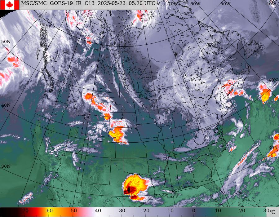
goes_nam_1070_100.jpg (900×700)

Look how solid Joaquin is...
Look how weak the front is....

Now we move on to the NHC 5 PM advisory.

I'll let you all read the discussion yourselves.

Noteworthy part explaining track is as follows:


For those of you who don't know geography well...
...this comes into the DC area...


The cone takes it anywhere from the SC NC line to NE & far inland to PA
New Jersey is definitely in the long range parts of the cone...
NYC metro and parts of Long Island.

This is a HUGE job for the NHC to nail this track down.
And to get intensity and timing right.

Personally I feel they are missing something.
Timing I think is off... 
Let's be realistic it has not followed the forecast well so far...

Let's be honest....
...Joaquin is slipping South... into warm water.
Low shear ... rare this year.


I am not saying it's not going to make the big turn North.
But you can see why Norcross keeps mentioning SC vs Delmarva.

Check that with yesterday or the day before.
No longer due E of Miami and Palm Beach is it?

Joaquin looks like a fighter who is bulking up for his fight.


These are my thoughts.
I'll add other people's thoughts later this evening.
I try not to read too many other blogs or videos as I want to be fresh.
I want to be unique and not just repeat what everyone else says.
But I will update this evening with other thoughts around the web.

Funktop is all about the green.
Joaquin must have some Irish ancestry ;)


And eye peaking out.
Tight pinwheel spinning.

Wind probabilities show a large spread of uncertainty


Honestly there is extreme uncertainty.

I have 2 things to say before taking a break.

Where is the ULL going to form?
Can't see it yet... can see where it could, but...
And........note how low Joaquin is now .... 
..he is disappearing off the Eastern US satellite site.


But you can see Joaquin on the Caribbean loop now...


Note that eye on the last few frames.
Cat 2 by 11 PM I'd say...if not now.
Barometric pressure is there...
967 pressure ??
...waiting on the winds to increase now.

Models keep calling for a sharp U turn.
Note cruise ships in Bahamas are being rerouted.
For now... Joaquin is IN the Bahamas and moving SW 


Message to Joaquin:

You are supposed to make a U Turn...


If you trust the NHC and the models ...
..we are 3 days away from big problems.

3 Day Cone


Stay tuned...

All I know for certain is tonight he is going SW at 8 MPH.
Anything beyond that is speculation and forecasting... 

If the Euro wins this shoot out... 
... they should drop the model game and go with it.

Note they were badly burned this year following models...
...and not watching the storm.

Hard to discount it but on one side you have the EURO...
...all the other models basically go the other way.
If this was a tug of war.... the Euro would fall down.

Where is he going?
When will he get there?

Stay tuned..

Besos BobbiStom

Ps.. not going to show models that so far have been wrong.
www.spaghettimodels.com has them all ;)


Check back later tonight for an update!


UPDATED !! Hurricane Joaquin Strengthening. Landfall possible in 5 Day Track. Intensity Question is Huge... Intensity Affects Everything and NHC not great on Intensity Forecasting ...hopefully getting better

At 2 PM Hurricane Joaquin is 85 MPH.
Stronger.
Barometric Pressure dropping.
Wind speed is up.

Still headed SW at 6 MPH.

A good illustration of this is below.


Wind history below from NHC


Future projected wind history.


Note too many storms have done that.

The closest I can currently find is Diana in 1984.
Well Chuck in Fayetteville NC came up with that one.


Not the best as it looped twice.
With weak steering currents that happens.
Most models sling shot it up into NC and VA FAST...
..once it starts moving N again...but it hasn't yet.

Chick posted this a little while ago.
Mets are beginning to take the models seriously.
The stronger Joaquin gets the more seriously they will take him.


Everyone wants to know do I buy the GFS or Euro.
I don't buy either. I only bet on sure things.
Sure things are watching the hurricane.
Knowing climo and hurricane history.
Watching the front (where is the front...)

Everyone is watching from the Florida Keys to Maine.


You got to admit that SW movement is odd.
Happens. Happens with odd storms.
Hurricane Alice in 1954 and 1955 went SW.

New Years Eve Storm.
Crazy.


Where's the cold front?

Where's the big bad front???
sat_ir_enh_east_loop-12.gif (640×512)

It feels like summer in October in Raleigh.
Roses in bloom. 83 degrees at 3 PM.
The front is there somewhere.
Is it strong enough?
Maybe we will wait for the next front?
Maybe upwelling.... 
I keep saying I won't say "maybe" but then...
..a long comes Joaquin

Look at that eye.... 


All those Cape Verde Waves and none could do what Joaquin did...
...found a spot close in, a sweet spot... Home Grown.


It's as if he doesn't want to move.... but he will.

And, where will he go?


Stay tuned.
Full update this evening.
New model discussion and a look at more thoughts.


Check out the discussion from the NHC.
Well written and long.
Brings up many important points.

http://www.nhc.noaa.gov/text/refresh/MIATCDAT1+shtml/301458.shtml

Truth is I adore Beven. 
Don't tell him cause ... its not good for his ego ;)
and i meant that!

;)

3 points to remember .... while reading the 5 PM and 11 PM


Please continue reading from earlier.
I showed 4 possible storms that affected similar areas...
...from the same position.

I'll update later, everything below is STILL VALID.

Besos BobbiStorm

11 AM


Up close look at an intensifying Hurricane.

ft-animated.gif (720×480)

Note speed has picked up just a drop ...
...still SW moving at 6 MPH forward speed.

Intensity up to 80 MPH.
Consistent with an eye like feature...
A track with the infamous hook possible to the left (West..)
Note we are talking possibly Cape May Monday.
That is not a long range forecast.
This is not a 10 day out wild card for a CV Wave.
This is a close in, home grown hurricane.
And currently still heading SW.
I put emphasis on that direction as it's important.
It may be a short term movement but...
..it has long term ramifications.

1. Water is hot and gives Joaquin a chance to strengthen.
2. Shear there is low and gives Joaquin a chance to strengthen.
3. Makes a turn out to sea down the road need to be sharper.


By the way if someone tells you...
Models show a Cat 4 Hurricane... 
...it's true some models went ballistic last night.
Few of us got much sleep last night.
When Cantore came on and started posting ...
...I knew I was up way too late.
Other models were conservative.
It's a danger filled road that Joaquin is traveling.
Has many possible targets and inherent pot holes.

So let's look down that road.
Worth noting the Invest behind it has a 70% chance of forming.


I don't want that fact to get lost in the Joaquin shuffle.

There is just so much to say today on the developing problem of Hurricane Joaquin. The many potential, possibilities that could wreak havoc on some city in it's path. The coastal effects of a landfall along the East Coast, including coastal impacts and inland flooding, are valid concerns yet need to be handled without hype or hyperbole. And, yet it IS a huge concern.

1. Joaquin is already close in and the route out to sea becomes sharper and less possible. But, it is possible it turns just before landfall and parallels the coast for most of this coming week.

2. This is HERE not OUT BY AFRICA and location is everything.  Look how close to Florida Joaquin is and how it is already affecting the Bahamas.

vis_lalo-animated.gif (720×480)

Those islands ARE the Bahamas.
The coast of Cuba is visible.
The East Coast of Florida is visible on the floater.

3. I don't want to hear about Sandy or how the Euro called Sandy as that was 3 years ago and in meteorological years that was a decade ago. Models are always being revised, reworked and the Euro has shown him going out to sea, making landfall and being out to sea again; not very consistent.

4. Let's look at the models. And, while looking remember this is a very slow moving storm. Slow storms are a problem as if a model gets the timing off just a day or so ... the door slams shut on an exit off stage or it changes landfall from say Norfolk, VA to Ocean City, Maryland. This holds especially true as the storm would be moving north up along the coast and even a matter of degrees makes a difference in this being an OBX storm or a Delmarva storm or New England storm. A matter of degrees makes a track like Bob or a track like Floyd. 


Bob went up along the coast and then inland.
Rainfall along the coast was huge even if the eye was offshore.
Well, until it wasn't off shore anymore.


Both took similar paths along the coast.
Hugely different storms.
Both were huge rainmakers.

Note you don't need to have a Cape Verde Hurricane...
...to make a huge disaster at landfall.


I'm going to post the Sandy track as everyone is screaming SANDY.
Beginning to feel like I'm watching Annie on TWC vs Joaquin.

Oddly had Sandy never hit ... 
Irene would have gone down in history as the big one.
Eclipsed by Sandy a year later. Go figure.


Note Sandy had the "hook" and the forecasted "hook" is in play again.

Now you see how difficult a job the NHC has with regard to Joaquin.


5. The players here are the front aka Trough as always. A developing ULL that could affect him. The role of Joaquin's own intensity, as the stronger he gets the more he can have a part in his own evolutionary track. The intensity forecast may be the fly in the ointment. If you are off on the intensity forecast.... you are off on a lot of other things. A small cut off low may develop or it may not develop or it may develop but not affect a strong hurricane. The front may stall after it moves through and a stalled out front with a strong hurricane to it's SSE is not a good set up. Some possibility of dry air entrapment or light shear developing or....  I will be discussing this in depth later today, in real time, so check back often.

Compare and contrast the way this storm is being handled.


Knabb is focusing now on surf impacts.
Bastardi is focusing on intensity forecasts.


Bastardi and Mauve are concerned with Intensity.
And, so they should be.
What a Cat 1 Hurricane might do ......
......is NOT what a Cat 3 Hurricane would do..

And, RaleighWX is concerned with getting better model data.
So am I.
The planes are out there, data is coming in.
Hopefully next set of model runs will be more reliable.
Because garbage in is as we know garbage out in the model business.

I'll be back with more thoughts soon.
Besos Bobbistorm
@bobbistorm on Twitter.

Ps Adding in here... good to take this all with a grain of salt.
Yet salt is in these days again and is so is hype.
Keep in touch with your local weather if you are in the track of Joaquin.


Your local emergency planners are watching out.
So should you be... just in case.
 Biggest concern right now is the rain.
If the NHC pulls the cone to the left....
...add in winds, storm surge and other tropical troubles.