Hurricane Harbor

A writer and a tropical muse. A funky Lubavitcher who enjoys watching the weather, hurricanes, listening to music while enjoying life with a sense of humor and trying to make sense of it all!

Friday, May 31, 2013

Are You Ready for the Hurricane Season?


To misquote Monday Night Football... Are you ready for some hurricanes?  I'm not a betting person and yet I would bet you are not.

Here is that same storm Hurricane Isabel in 2003 over land....same shape.... same storm.


Neat fact about hurricanes I learned from the best...once they get that shape going early on ...the bad ones keep it and you can see the similarities.

Below is a picture of inland flooding from another storm ... Hurricane Floyd.


No one is safe from a hurricane and safety is an illusion. This year's hurricane is not the same as last years and we always ... by human nature... prepare for last year's hurricane. Beach towns up and down the coast will worry on another Sandy. The year after Andrew everyone worried on another Category 5 and after Katrina every town with a levee worried on their levees holding. Mother Nature likes surprises and she likes to keep us on our toes. Last year it was beach towns, this year it could be inland flooding like the devastation that Isabel brought to areas far inland.

http://en.wikipedia.org/wiki/Hurricane_Isabel

Isabel is the hurricane image above when she was down in the Caribbean. When she moved out of the Caribbean and up across the Atlantic and moved inland to towns far from the sexy beach shots of the storm surge her wake of devastation surged on and on and on. Highlighting the salient points in bold and color below. This storm ...not as well known as "Katrina" or "Andrew" caused damage from South Carolina to Maine and from the coast of Carolina to Michigan and a province in Canada.  Are you SURE you are READY?? I bet not. You are ready for the hurricane you think and fear you might get, but you could be blindsided by the storm you thought you would never get. And, that my friends is the way of the world when it comes to Mother Nature and Hurricanes.  In ways... they are less predictable than twisters. Their point of landfall is pretty predictable, the damage far inland and along the way is not. Read on from Wikipedia on Isabel in 20003.

"In North Carolina, the storm surge from Isabel washed out a portion of Hatteras Island to form what was unofficially known as Isabel Inlet. Damage was greatest along the Outer Banks, where thousands of homes were damaged or even destroyed. The worst of the effects of Isabel occurred inVirginia, especially in the Hampton Roads area and along the shores of rivers as far west and north as Richmond and Washington, DC. Virginia reported the most deaths and damage from the hurricane. About 64% of the damage and 68% of the deaths occurred in North Carolina and Virginia. Electric service was disrupted in areas of Virginia for several days, some more rural areas were without electricity for weeks, and local flooding caused thousands of dollars in damage.
Moderate to severe damage extended up the Atlantic coastline and as far inland as West Virginia. Roughly six million people were left without electric service in the eastern United States from the strong winds of Isabel. Rainfall from the storm extended from South Carolina to Maine, and westward to Michigan. Throughout the path of Isabel, damage totalled about 5.7 billion (2003 USD, $7.11 billion 2013 USD).[1] 16 deaths in seven U.S. states were directly related to the hurricane, with 35 deaths in six states and one Canadian province indirectly related to the hurricane."

This morning, governors everywhere are making public service announcements and lying to their constituents that their state is ready for a hurricane. It's a lie they believe mind you or pray is not a lie and yet it is a lie, because no one is really ready for a hurricane.  With the recent destruction from the most recent Moore Tornadoes weather is in the news and the more severe the weather the more it is in the news.  CNN and FOX are out there LIVE covering every tornado and TWC has given up their own mediocre hunts for Tornadoes and signed up with Reed Timmer the REAL THING and has taken to the road with the storm chasers in search of LIVE WEATHER.

May I remind you that New Orleans flooding from a breech in the levee system after a strong hurricane was the number one feared national "weather" disaster. It happened, over twenty years after that first report went out that it would happens one day unless something was done...   New York City being hit by a large hurricane has always been played up on shows like TWC and yet when it happened everyone seemed shocked it could do that much damage. Or more so...that sort of damage. We thought it was all about the subways flooding and the Statue of Liberty being flooded up to her knees... no one said nothing about islands on the shore burning out of control and the stretch of beach to the south in New Jersey washing away under a wall of water leaving ferris wheels rocking in the waves.

Trust me as someone who knows.. you are not ready. You are ready for a small category one hurricane where you will get your supplies, put up your shutters and hunker down and far away in some random band a twister will form and wipe out a trailer park or rip the roof off of a shopping mall and the storm will stall and inland flooding will occur far from landfall.

Are you really ready? Rethink that.. no matter what your governor or mayor tells you .. listen to the folks at the National Hurricane Center or your most trusted weather people online and make a list of ALL possible problems that your area could have from a hurricane and make a Plan
A and then make a Plan B. That is what life is about in the Hurricane Zone.


LIVE WEATHER has become the new REALITY TV SHOWS of 2013.  Every chaser worth his name is out there in some sort of vehicle dubbed with a gritty, grindy sounding name such as the DOMINATOR taking videos of tornadoes grinding themselves out as they pass over their live cameras. And, oh what a show it has been . . .

Incredible video that was passed around the Internet and I am wondering if this new fascination on storm chasers and weather will continue into the Hurricane Season?


http://www.youtube.com/watch?v=v075d9Vfqcg

That is a "violent wedge tornado" in the video above that Brandon Ivey took on May 27th, 2013. While Brandon was out there on the road risking his life to get that video and the data that is collected ... KFOR helicopters were in the air intercepting the tornadoes in the air. What next?

This is from the earlier outbreak in May as there were several, the news team goes from the ground to the air to radar and back to the video from the chopper chasing the twister. That is not a twister.. it is a piece of the helicopter. . .


So what will we see this coming year in the news and what will we see from Hurricanes? Everyone expects towns like Miami, Key West, Wilmington NC to get hurricanes. How about Jacksonville who is long overdue or Tampa? How about Mobile and Maine? How about your town far inland where a dike might fail or a storm will stall out and dump days of rain on you after you already had a lot of rain from a stalled out frontal system? Hmmmnnn?  And, twisters form in hurricanes... Are you ready for twisters? Power Outages?

Not trying to be a Negative Nancy here... more a realistic, rational voice at the start of the hurricane season.  Two packages of twinkies that your kids broke into at their last slumber party and some old water bought on sale months back is NOT going to get you through the season. And, I am glad your phone has a flashlight App but....buy flashlights and good ones and buy extra batteries. Medicines that you use consistently, stock up on diapers for the baby and while at it buy an extra pack of two for grandma. Crayons work when the power goes out and you have to conserve that battery on the iPad.

Trust me... you think you are ready for the Hurricane Season, but you are not.

The lights, cameras and action of the TWC are ready and Jim Cantore may be ready, but he is going to hop on plane or a bus out of town and chase the next down impacted and you will be stuck for days, weeks with no power, no cable and not a clue that Andrew wiped out Louisiana until you read about it days later. Trust me, been there... never realized they got it so bad as we didn't get TWC back until well into October...nor CNN. Everything was down and we were miles away from Homestead on Miami Beach with trees tangled around wires and cable and telephone service taking showers when the rain fell in the backyard.

Towards the bottom of www.spaghettimodels.com there are many links on how to prepare as there are articles everywhere in your local news, the NHC page or your favorite weather website and if you are more the TV type of person TWC will be covering what to do nonstop, around the clock today and tomorrow between going live to storm chasers out on the plains and their "get ready for the hurricane season spots." Pay attention! It really could happen to you!

Hmmnnnn possibilities in our world and out by Africa the possibilities are growing.


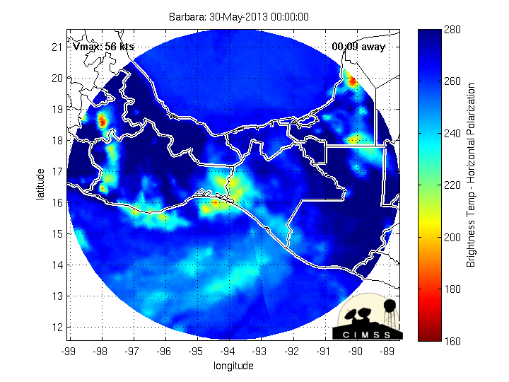
And, in the Atlantic there is already an Invest from the remnants of Barbara.

Keep watching... the 2013 Atlantic Hurricane is here...sooner than you think and sooner than you think you could be under the gun ,,,so prepare now and don't believe the myth that your town is ready. No town is really ready as you never know what kind of storm you may be getting until it's bearing down on you..

Something to think on...

Besos Bobbi


Thursday, May 30, 2013

Barbara's Center in the Gulf... what will the NHC do?

20130530.1815.goes14.x.vis1km_high.02EBARBARA.25kts-1004mb-184N-949W.100pc.jpg image

That's amazing.

The cone from the NHC has moved also further into the Gulf of Mexico... or BOC whichever you think of it as...

This is the last discussion from Pasch/Landsea.

http://www.nhc.noaa.gov/text/refresh/MIATCDEP2+shtml/301446.shtml?

 Both great forecasters though together it sounds like they are selling tropical styled sun glasses..or aqua blue contacts :)

The last several model runs have shown every city from Nola to Tampa to being "under the gun" of a possible system. I think we should wait until the models stop fantasizing and see what we will see.

Stay tuned...

Bobbi

Tropical Depression Barbara Still Alive... Fasten Your Seatbelts... 2013 Atlantic Hurricane Season is going to be Crazy!


.

Will the first tropical system of the 2013 Atlantic Hurricane Season be a Sequel to Hurricane Barbara? Hard to say but the way this year has gone weather wise.... anything goes and everything is possible! In a year where snow is in the forecast for Wyoming in the first week of June and the Twister season started late and with a vengeance after Winter came late... who can say what mischief Barbara will brew up in the Gulf of Mexico?

Currently, the forecast for the slow moving Tropical Depression Barbara is for her to linger and cling to the coastline and then move back in for a second landfall. Hard to say for sure... had she not slowed down the chance for her being Barbara in the Atlantic Basin would have been better.


This is the updated 11 AM Track for Tropical Depression BARBARA :) which you will note does emerge possibly over the Gulf depending on the track. The Gulf of Mexico is IN the Atlantic Basin and the "cone" is partially in the Atlantic so it's a matter of watch and wait... but either way she is being watched by the Atlantic Sats and the NHC as a possible Atlantic System..


Hey this is as close as it gets to me having a storm named my name. I rarely ever use Barbara as it's my given name but really.............been Bobbi forever.................but I'll take it!!

This image below seems to imply that her circulation center is in the Gulf and her convection is still to the south over land. Some people call that decoupled, however I think it's more a matter of a weak tropical depression trying to grab moisture anywhere she can...


Check out the visible...shows her circulation IS in the Gulf of Mexico...


That's pretty definitive by my book...for a visible. But.. I'm not making up the rules... 

Official word from NHC is ... close by no cigar yet but close........

Tropical Depression BARBARA RSS Feed iconSatellite | Buoys | NDFD | Storm Archive
...BARBARA NEAR THE GULF COAST OF MEXICO BUT VERY ILL DEFINED... ...THREAT OF HEAVY RAINS AND FLOODING CONTINUES...

So now what?

Models show something might be developing down the road in the general area that could be from Barbara..............or from another area to the south... and could be a problem for NW Florida maybe... a real big maybe.

Let's take a look..........................

Enh Infrared Satellite - GOES East 12 hr Loop

You can see the mess off the East Coast of Florida which is not tropical and an area in the SW Carib that has been lingering. And, you can see the convection from Barbara playing peek a boo on either side of Mexico. Sort of like a girl in a Mall and she can't decide whether to go to to Victoria Secrets or the Pink Victoria Secrets Store... the clothing or the beauty supplies... so many decisions...what's a girl to do???

Energy aka Orange Juice Loop as we used to call it online...


I don't want to get too into the model discussion as it's too far out and too unclear.. sort of sketchy, like a guy trying to come on to a girl in a Country Western Bar telling her he loves her boots and she's wearing red high heels.......   I'll deal with the models tomorrow.

For now... Barbara is swimming in both basins and only time will tell if she gets the name Barbara in the Atlantic before Andrea even gets a chance to try out for an audition.

Been a crazy year and it's getting crazier and am thinking 2014 may be just as crazy... back to back seasons of crazy do exist in the tropics.

For Twister Chasers...........going to be a hot day out on the Plains..


And for those Cape Verde fanatics (and who isn't???) why is there a purple circle there NOW?


Hmmmmmnnn ... buckle your seatbelts.... 2013 is going to be a busy, crazy year in the tropics!


Mind you nothing should be there in May..............


Be back later... keep watching.

It's like Santa Claus came early this year for hurricane trackers and chasers... welcome to the unofficial start of the 2013 Atlantic Hurricane Season.............

Sweet Tropical Dreams

BobbiStorm

Ps......if anyone has any Lemon Lime Kampai tea leftover from Teavana... it goes really well with a drop of Honey Bourbon... just saying........   ;)


Wednesday, May 29, 2013

Hurricane Barbara Makes Landfall... Incredible Radar Imagery

More later but really was worth posting...


Puerto Angel, love that name of the place.

Also note the eye is keeping intact well inland and she is moving fast...

11:00 AM PDT Wed May 29
Location: 15.8°N 94.3°W
Moving: NNE at 10 mph
Min pressure: 990 mb
Max sustained: 75 mph

....more later... Bobbi

...Barbara nearing hurricane strength... Still Forecast to Move into the Gulf of Mexico


There is so much to say today I don't know where to begin. So, I'll just jump in... try and keep up!

The above images is the track and the location on visible imagery of Tropical Storm Barbara in the Eastern Pacific that is currently forecast to make it into the Gulf of Mexico. It is worth noting that forecasts change often.

Watch her spin...

Visible Water Vapor - GOES East 12 hr Loop

Worth noting there is another area further west that may or may not develop. But, we are really only concerned for now on Barbara..one because I like the name..and seriously because it may become a force to reckon with in the Gulf of Mexico which is our own backyard.

Think of this as a Dress Rehearsal :) for our season which starts in a few days!

...Barbara nearing hurricane strength...
...Hurricane Warning issued for the coast of the Gulf of
Tehuantepec...


summary of 500 am PDT...1200 UTC...information
----------------------------------------------
location...15.2n 95.0w
about 70 mi...115 km S of Salina cruz Mexico
maximum sustained winds...65 mph...100 km/h
present movement...NE or 35 degrees at 8 mph...13 km/h
minimum central pressure...995 mb...29.38 inches


For Hurricane People it doesn't get any better than this..  We often wait and wait on a something to track, study and chase and nada...nothing happens til late June or even late July. This may be an illusion but it's a fun one for now. Note..it will cause a lot of trouble in the land areas that it will traverse on it's way towards a watery grave in the Gulf of Mexico where it may or may not regenerate. Often we discuss these crossover systems, but this year it seems more possible.

Note there is also a lot of moisture in the Caribbean currently for it to tap into as well as around Florida which is swamped with humidity and daily moonsoons. Also, there are vibrant diving cold fronts still which have blown the lid off of the tornado chasing season the last few weeks that could pull a storm northward that is in the Gulf of Mexico.

This image which will change in real time shows THREE areas of strong convection. One is Barbara.. one is in the Caribbean and the other is near Florida.


From the Farmers' Almanac:

June 2013
1st-3rd. Sultry weather.
4th-7th. Big thunderstorms from the Gulf Coast to Carolinas. An early tropical storm is possible in the Gulf of Mexico.
8th-11th. Mostly fair and dry.
12th-15th. Scattered thunderstorms, then fair.
16th-19th. Hot and steamy.
20th-23rd. Showery rains from Georgia through the Carolinas, followed by clearing. Squally along the Gulf Coast.
24th-27th. Scattered thunderstorms.
28th-30th. Fair, hot, and oppressively humid.

July 2013
1st-3rd. Oppressive heat and humidity.
4th-7th. Thunderstorms for Carolinas south to the Gulf Coast, then clearing.
8th-11th. Showery rain for Gulf Coast and much of Southeast, followed by clearing.
12th-15th. Hot and humid.
16th-19th. Scattered showers, thunderstorms.
20th-23rd. Hot for Mississippi Valley and points east; with more scattered thunderstorms.
24th-27th. Some scattered thunderstorms, followed by clearing skies.

http://www.farmersalmanac.com/long-range-weather-forecast/southeast-us/

It shows a typically early Gulf storm...then nothing until later in the Season, which is typical though questionable. There is a "rule" that when you have an early June storm... the season sits like dead weight until later in the season when things pick up. In active seasons this rule does not apply. This is slated to be an active season, but then again a lot of movies are slated to be the "blockbuster" of the summer and sink like a rotten tomato and hope to make their money back as people order them to watch at home half-dressed, tired and barely paying attention on the worn out sofa in the den.

By the way... I have a long list of movies I have been meaning to watch and yet haven't. At the moment I have a few in the theatre that I want to see..

Back to the tropics...

How does the Farmers' Almanac get it right so often? You don't want to know, because a lot of it involves astrology, astronomy, patterns and a messy mix of atmospheric science combined with astronomical data and a lot of hocus pocus that most scientific types write off as "nonsense" and yet... it predicted Hurricane Andrew almost to the day so a lot of Floridians or relatives of Floridians pay close attention still. It also I believe showed multiple hits back in one of the Frances/Jeanne years for Florida or Wilma/Katrina years. Yes... KATRINA HIT SOUTH FLORIDA. I know, you  missed that one as you think it just hit Nola ...but it trashed South Florida big time. Trash as in rotten trees, downed power lines and no power for a week or so for many people. Not storm surge, not high wind damage but a lot of damage never the less. New Orleans was not destroyed by Hurricane Katrina.. but by a levee failure that had been predicted and forewarned and yet... the levees weren't up to snuff to handle a hurricane that made landfall in Mississippi. Think on it. One of the WORST "weather" disasters of our time related to a hurricane, but more a failure of government to financially keep up with the needs of a city whose safety relies on a good, safe, strong levee system.

I go to classes sometimes at Dancing Moon Book Store. Yeah, anything that says "dancing" catches my eye. A lot of people who do astrology were waxing poetic on this year being a big year for storms on the plains and in the tropics and they never picked up a copy of the NOAA report or William Gray's report. Based on all the planets currently in Gemini which is ruled by Jupiter ... that lends itself to a lot of wind. The Gemini is squared by Neptune in Pisces ...Neptune rules the seas as any science fiction nut knows. Anytime the moon goes into Cancer we have a water trine which usually connects to very watery tropical storms and hurricanes and in late June and early July you will enter into Harmonic Water Trine land with the potential... according to those who watch the stars not the sats of mucho water trouble.. be in flooding, watery storms with big storm surge or a lot of rain...  only time will tell on that one...........like watching models I like to see what I get vs what could happen on any given day but as someone scientifically minded I will watch any data from Farmers' Almanac or daily reports from the Canadian Model ;)


Current Planets29-May-2013, 14:07 UT/GMT
Sun821'40"
Moon950'55"
Mercury279'56"
Venus2429'27"
Mars2840'21"
Jupiter2342'57"
Saturn62' 2"r
Uranus1134'40"
Neptune521'12"
Pluto114'34"r
TrueNode1641'30"r
Chiron1341'10"
Back to 2013........and meteorology which... comes from the word meteor.. but we can discuss that later another day.

Will Barbara or another area of moist, tropical weather already down in the tropics that links up with the remnants of Barbara be that Gulf storm or hurricane? Keep watching...

I'll be back as more data comes out and I wake up and recover from this mornings back to back ballet sessions at the gym. I'd say how does ballet connect to hurricanes? Oh, seriously? It's all about choreography don't you know? If you don't get the "core" right in ballet you look like an ugly duckling trying to learn to walk ... let alone dance. If a tropical wave or tropical storm does not get it's core set up... it never becomes what it could be and often becomes "unstacked" and collapses in a mess of strong, severe weather despite all the hoopla over it based on models of what it could do..but didn't do because it didn't get it's core right from day one.

Something to think on...

Besos Bobbi

Ps... anyone notice weather is THE rage right now? I came home earlier, turned on the TV... watched a whole segment about an amateur storm chaser getting an awesome picture of a wedge tornado dancing and spinning safely in an empty field yesterday... and then I thought I'd put on CNN or FOX and realized it WAS CNN..... not TWC.   Shame there isn't a really good hurricane chasing film the way Twister did it for tornadoes. Just saying...  and if you make one, I'm the cute girl in the inappropriate heels with platforms standing on the rocks near the water with messy hair and getting great pictures and feeling the wind............

And, thanks for posting comments and discussion... I posted the Farmers' Almanac for everyone to see what they are talking about and so that we can go back and compare and see how close they were in their forecast.

Tuesday, May 28, 2013

Tropical Storm Barbara Forms in the EPAC... Could Cross Over INTO the GOM..


I'm back from my long Memorial Weekend Trip and watching the tropics. And, what a time to come back.

So, the EPAC (which basically means Eastern Pacific) has a depression that formed that according to the NAVY site has become Tropical Storm Barbara and Barbara could move north towards land and cross over into the Gulf of Mexico.  Moving North is something early storms in the EPAC sometimes do, but rarely do they do it.


The GFDL Model has a storm in the Gulf of Mexico moving North..


If that happens and Tropical Storm Barbara does cross over into the Gulf ...oh what a start it would be for the 2013 Atlantic Hurricane Season.. a season predicted to be a very busy one.


In 1949 this happened and some authorities have said this year bears a resemblance to the 1949 Atlantic Hurricane Season.

File:1949 Atlantic hurricane 10 track.png

That is .... a harder track than "Barbara" would have, but worth noting.

From Wikipedia" On September 27, a tropical storm formed in the Eastern Pacific Ocean just off the coast of Guatemala. It drifted northwestward, and made landfall on Guatemala on September 28. It moved northward along the western border of Guatemala, and after crossing southeastern Mexico the storm entered the Gulf of Mexico near Ciudad del Carmen on October 1. As it traversed northwestward it strengthened, and became a hurricane on October 2. It turned more to the north and intensified to a major hurricane on October 3 as it neared the Texas coastline. It rapidly attained peak winds of 135 mph (205 km/h).[5] Subsequently, the made landfall near Freeport, Texas on October 4 as a Category 4 hurricane. The lowest recorded pressure was 978 mbar,[6] and estimates place the minimum central pressure near 972 mbar.[7] The hurricane rapidly weakened to a tropical storm as it turned northeastward over land, though it maintained tropical storm status until October 6 while over Missouri. As a tropical depression it accelerated northeastward, and later that day it dissipated near Chicago, Illinois.
The hurricane produced high tides along the Texas coast, peaking at 11 feet (3.4 m) in Velasco.[2] Moderate beach erosion from the storm damaged streets in Galveston and destroyed a wooden fishing pier.[6] The hurricane dropped heavy rainfall in Texas, including a maximum amount of 14.5 inches in Goodrich. Damage from the storm totaled to $6.7 million (1949 USD), primarily to crop damage. The hurricane also caused two deaths.[2]

It is worth noting so you see it can and does happen... if rarely.

More recently in 2010 the EPAC storm Agatha moved inland over Central America and it's remnants emerged into the Caribbean where it continued to wreak havoc across the area.

http://en.wikipedia.org/wiki/Tropical_Storm_Agatha_(2010)

June 1st, 2010... in the Caribbean....

File:Extratropical Agatha jun 1 2010.jpg

"After landfall, Agatha continued to cause floods and landslides, however it did not bring a lot of tropical storm force winds on shore.[15] The system weakened quickly after coming on shore, dropping its winds to 25 mph (20 knots, 40 km/h) and its pressure to 1007 mbar (hPa29.74 inHg) before dissipating.[16] A burst of convection re-emerged east of Belize, in the Atlantic basin, on May 31. On June 1, the National Hurricane Center stated that the remnants of Tropical Storm Agatha had only a low chance of regeneration in the western Caribbean Sea.[17] By the next day, the thunderstorm activity associated with Agatha in the western Caribbean had dissipated. However, the remnants of Tropical Storm Agatha persisted until June 6, causing death and destruction over Central America. On June 6, the remnants of Tropical Storm Agatha dissipated completely, after ravaging the Honduras and El Salvador."


Another storm Hermine formed from a disturbance in the Pacific as well..

 File:Hermine 2010 track.png


"Hermine formed out of the remnants of the 2010 Pacific hurricane season's Tropical Depression Eleven-E in the Bay of Campeche. Organization continued and by the very early morning hours on September 6, a tropical depression formed. Later, during the morning hours, the system achieved enough organization to be classified as the eighth tropical storm of the season, and was named Hermine. Significant strengthening took place later that morning, then slow strengthening continued in the afternoon and evening. Before landfall, Hermine had an eye-like feature. Hermine made landfall that evening in northeastern Mexico, south of Matamoros, Tamaulipas, as a strong tropical storm with 70 mph (110 km/h) winds. After landfall, Hermine maintained an eye-like feature until shortly after weakening into a depression.
Damage was reported in the Rio Grande Valley region, primarily due to downed trees and power lines and scattered to widespread power outages.[74] A woman drowned in a rip current related to Hermine in Jamaica Beach, Texas.[75] On the evening of September 7, 2010, multiple Tornado Warnings were issued in Austin, Texas, with two confirmed touchdowns east of the city and one in the city. By 10:00 pm (CDT) the NHC issued its final advisory on Hermine as it weakened to a tropical depression.[76] Hermine slowly weakened some more as it continued farther inland, and then it became extratropical over Oklahoma early on September 9. Hermine's remnants continued to produce heavy rain and tornadoes as it continued inland, with the circulation dissipating on September 10 over Kansas."


So...is it possible? Of course it's possible. Will it happen? Don't know... Keep watching, only time will tell!

There's an example for everything and we are often learning in real time.

A paper was released recently that shows us a May Hurricane named Amanda that was not previously recorded and helped alter battles in the Civil War in May of 1863.

An amazing piece of historical meteorological research, piece together a mystery.

http://journals.ametsoc.org/doi/abs/10.1175/BAMS-D-12-00171.1

(really worth clicking on that above link and reading it.....)

Watched tornadoes skip across Kansas today on TWC and heard that Vermont had 3 feet of snow over the weekend. As for me.. it was cold, very cold and I was wearing long sleeves and a thin poncho as I walked around the harbor watching low lying storm clouds.


Rained very heavy ...but was "stuck" in the Galleria so it really wasn't that much of a problem. Any place that has a Starbucks and a Victoria Secrets is a great place to get stuck inside when it pours.. nice breezy day.  Crazy storms later that day, almost like a hurricane.

So, get ready for the 2013 Atlantic Hurricane Season ...because it's definitely ready for you!

Besos Bobbi

Ps...incredible, "insane" and aweseome video from inside a tornado that is making the rounds..

http://www.theatlantic.com/technology/archive/2013/05/insane-video-from-inside-a-tornado/276299/