UPDATED!! Invest 90L Stands It's Ground 50% in 5 Days ...Orange Like the Lava. Beach Washout Likely Memorial Day Weekend For Many Beach Vacations. Is Alberto Going to Form Before June 1st?
Update as of 7 PM Tuesday.
Chances for development over the next FIVE days are now up to 50%. Currently because of interaction with land and strong upper level winds development is not expected to happen for a while. In about 2 to 3 days when Invest 90L has lifted up into the very warm Gulf of Mexico and if the forecast for reduced shear verifies than it has a chance to develop; actually a 50/50 chance of developing. Not it is currently a broad area of spin and you can see signs of that spin on both sides of the Yucatan. This is not very organized, however it has potential.
My advice is sit back and wait to see what happens when Invest 90L lifts away from the Yucatan and finds it's actual center, gets it's groove and the models will be more reliable after having a definitive center. The models are pretty good currently, however it's better to try and find things with the light on then stumbling around in the dark.

Again currently the concern is for the flooding rains vs whether it becomes a TD, TS or Subtropical Storm. Look at that moisture plume sucking up deep tropical moisture and depositing it over the SE and the Mid Atlantic. Then check out the feature to the NW of our Invest digging down and well keep watching as in a day or so you will begin to see the drama. It's like a Soap Opera in that in the beginning the writer's toy with the script (and history) and it doesn't make any sense, but like geometry if you keep watching, studying it at some point it begins to make sense.

Be glad this is a mushy, messy Invest.
Not a WNW bound Hurricane.
If you are impatient and want to see something happening now... feel free to watch the video of the Hawaiian Volcano with the colorful dancing lava fountain in real time. A bit concerned personally about the lava flow that has already flowed onto the property of the power plant. I'll take a hurricane any day, but it's mesmerizing still the same.
***
To be clear.
There is nothing there now.
A small kink in the force there.

Up close.
This is a watch and wait day.
I know I say that a lot.
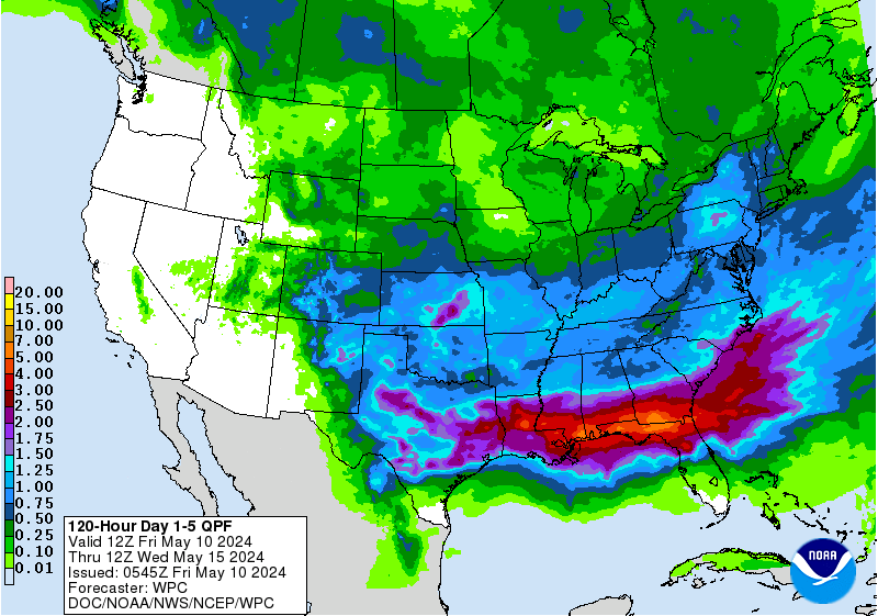
The models have been calling for development and it's not just about the models there's obviously something there that keeps spewing up moisture and bursts of convection. To be honest the models won't stand down . . . they are standing their ground. Time will tell if this develops where the center will make landfall and more likely where ever this makes landfall be aware heavy rains can be displaced far to the right of the actual track. This happens often with early season and late season systems when conditions are not 100% perfect but allow some development. Remember back to many a big, large subtropical sort of system in the Gulf of Mexico leaning right. And, often what starts out as a subtropical becomes tropical. Only time will tell and that's the truth. But, what is worth noting is we are where we thought we'd be this season that is forecast to be a busy season and possibly starting early. The graphic below shows the real story and the scope of the story across a large area.

That's a shield of moisture.
A water world.
From Nola to Miami.
Includes the Florida Keys.
Spoiler Alert.
And this moisture spreads North after 5 days.
What this basically means is Memorial Day Weekend may be a wipe out for most of the Lower South and the people who make their living from the tourists and local beach goers will be coming up short this summer. Hopefully they can make it up as we move towards July 4th but this will put a big dent in the local economy wherever it goes. I imagine Malls and bars will do a brisk business. Which beaches you ask? That's the big question that the EURO and GFS are currently debating. As always until something actually forms, wraps up around a defined center long range models are weak indications of what will really happen.
A good loop to watch is this one:

Note South Florida is dark green.
Not a great time for a Key West vacation.
But hey the bars are great there all the time.
I am not saying this will happen.
I'm saying this could happen.
The link is on www.spaghettimodels.com
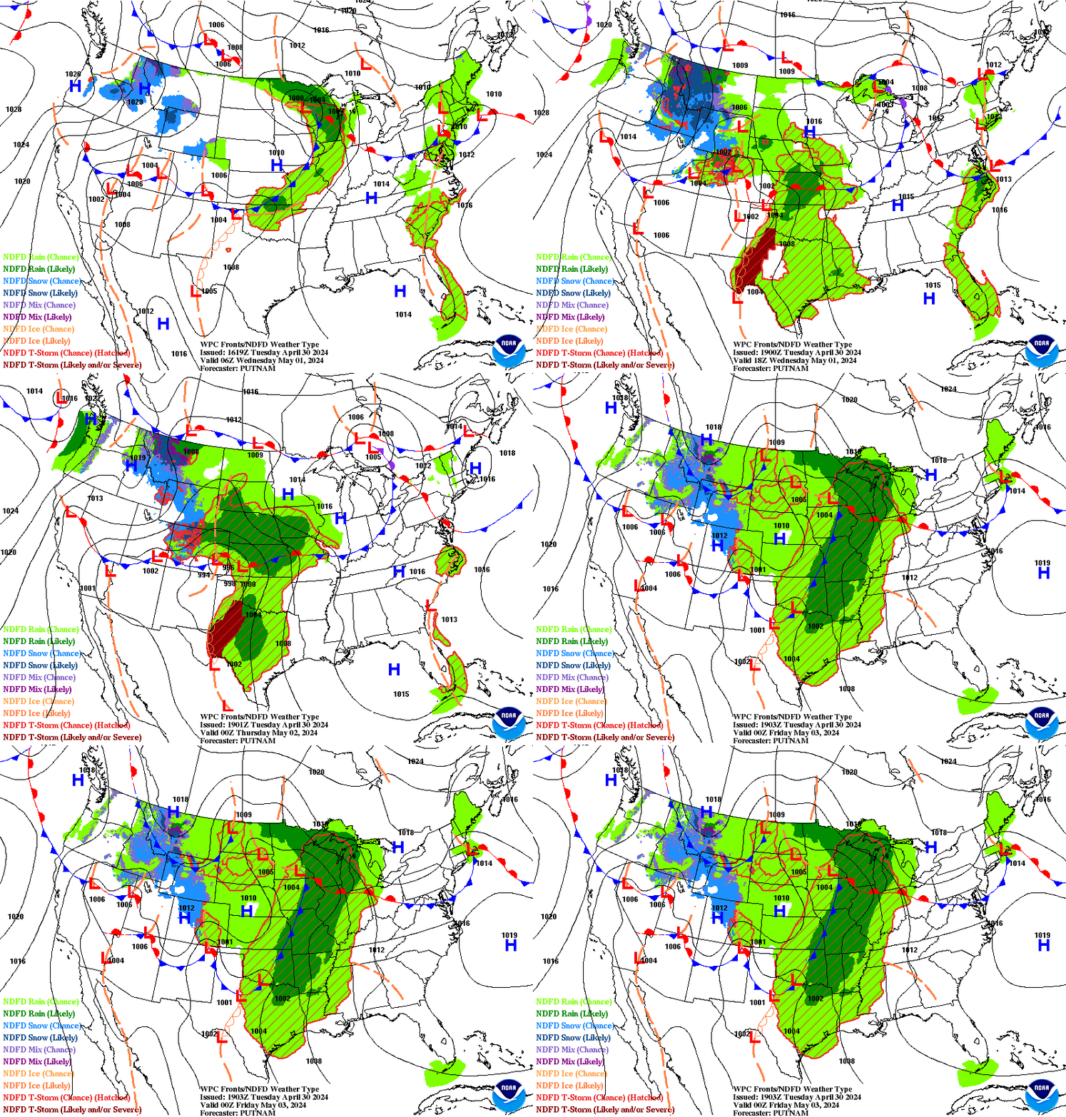
The point is that is a forecast map by NOAA that is used by forecasters and updated often as things evolve, change or develop. You can't ignore it, but you can take it with a good measure of salt and be very aware the WEATHER may be on the East side as dry air will be a problem on the West side. So we could get a Tropical Depression or Tropical Storm Alberto that is aiming at the Upper Gulf of Mexico beaches but causing flooding along the West Coast of Florida. What about timing? Does it move fast or slow and when it gets where it is going will it become an unwanted guest that doesn't want to leave? If it leaves will it move North towards the hills of Alabama and Georgia into Tennessee or will it hook right and slide on up towards the Carolinas bringing those beaches more stormy weather? This system may be an equal opportunity beach vacation trouble maker. This weekend might be a good time to go to the movies.

Note even now...
..the convection is strong.
But displaced from the "center"
Or the X the NHC put up.
Either way the models won't back down and it's obvious there is something down there that wants to grow, expand, develop and move North with the overall flow. Dry air on it's West side is a problem and shear is still an issue. This strong tropical flow coming out of the Caribbean won't back down and neither will the Volcano stop putting on a beautiful light show that's causing misery and gobbling up houses as lava fissures ooze up out from the core of the earth and roll down the hillsides. It's all about being caught up in the flow be it a tropical moisture feed or a lava flow that flows all the way to the ocean.
Besos BobbiStorm
Ps.. I'll update during the day if anything becomes clearer but again where it develops, where it goes (does it cross the Yucatan or Cuba or slide through the Yucatan Passage?) and what happens when it gets there is the big story in about five days time. Now is a good time to look through that Hurricane Supply Shopping List, dust off the generator and figure out how many batteries you need for all those things that make life normal when the lights go out. Check out that water temperature chart below, shows how much available heat/energy there is for storms to keep firing up and remember location is everything. http://www.baynews9.com/fl/tampa/weather/tropical.map.html/
Look carefully.
It's there.
But so is shear.
Things change in about 3 days.

Labels: 90L, alberto, Caribbean, flooding, Florida, GOM, hurricane, invest, Invest90L, lava, music, rain, tropics, weather, yucatan


0 Comments:
Post a Comment
<< Home