UPDATED 98L in E GOM - 2 Areas of Interest in the Tropics. E GOM 20% & 30% African Wave. OBX Shut Down This Week But Not From a Hurricane.. Seattle Fire Ball... a meteor? Weekend Round Up.

As of 8 PM Invest 98L has a 30% chance of forming.
Yes we now have Invest 98L in the Eastern GOM.

A bit closer view below.

And the sun is setting....
...have to see what it looks like in the morning.

Again models show at the most weak storm.
Many show tropical depression status.
As always depends on timing.
How fast does this spin up if it does?

It's small and it needs to detach from the front.
There's shear currently.
It's small.
The NHC SAID "SMALL NON TROPICAL LOW"
Kind of more than a swirl but not there yet.
Possibly tomorrow it can go subtropical or tropical.
It's visible on long range radar...see below.

Tail end of the front.
Also notice the NE side of the front as well.

As I said earlier today....
With or without a name it brings rain.
Mucho rain... drenching Florida.

Larger view below:

Look at that cold front mixing it up over Cuba.
Enhanced convection... so close.
July 30th.
Hmnn
So as the sun goes down...
...I'm gonna let y'all watch it loop a bit.
See what we shall see in the morning.
Oh in the East Atlantic the wave is trying hard.
Impressive bad ass front!
Yup. That's what she said.
Please make more of them... she added.

Sweet Tropical Dreams,
BobbiStorm
@bobbistorm on Twitter
Keep reading if you did do so earlier today.
Thanks..

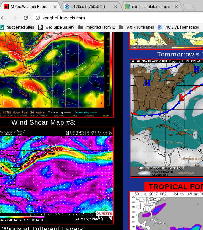
Let's take this apart one area at a time. Close in we have the area that has been introduced by the NHC in the Eastern GOM near Florida. Part of this area is basically over Florida if you have been following the watches and warnings for severe weather there today and yesterday. The front, the incredibly beautiful front, is draped across the Northern part of Florida. And there it sits and as always we watch the tail of fronts that stop dead in the warm water of late July or August.

This is one reason I've mentioned fronts and the GOM for days.
Models have consistently shown something forming.
Very close in.
And so far away we have the beautiful wave.


That was the wave exiting.
Just directly over the beach at Dakar.
This was one of John Hope's favorite adages.
The waves have to move further north to Dakar.
When they start to come off by Dakar you watch.
August is Tuesday so we are that close...

Still holding strong.
Can't say how long.
But for now :)

Another view above.
With regard to the SE and the possible coastal low it's worth remembering the water is very warm. Crazy warm and wouldn't take a lot for something small to try and spin up and ride it's way up the coast. It's worth noting water in the E GOM is warmer than just off the Jax coast. But along the East Coast there is ample warm water to get some spin going. Put this in motion and you see what the problem is in North Florida currently.

The other problem is the issue of timing. For a low to develop it really needs to sit there a while vs crossing over Florida rapidly and the shear is strong where it is currently. The water vapor loop shows the front still on the move. Not the most welcome environment to sit a spell and hang out. But it is producing a lot of convection that will remain in the area for the next few days. Mike has a great link up on the bottom left of his main page. It shows lightning in real time and it's on fire in several spots around the globe but especially North Florida. That's lightning, not some earthquake ticker ;)

Note regardless of development the SE will see tons of rain.
That's a lot of rain.
For areas flooding it's a huge sigh and grief.
For areas trying to avoid heat index in 100s it's relief.
It doesn't need a name to rain...

And that is why the NHC posted the yellow circle.
No floater and only 20%
As always that figure could change in real time at 2 PM.
And then again at 8 PM...
You'll notice two things here.
They show that more and more I'm a Carolina girl.
Honestly though I'm just being honest.
It's more likely something forms closer to Carolinas.
Coastal Low of some sort rides the coast.
Could it get a name?
Stay tuned.
Will a piece of the energy slide across Florida.
And leave a piece behind in the GOM?
Possibly.
The Euro shows a Low visits Mike in Tampa.
Crosses the state and moves on.
Stops in to say hello..
..take a dip in his pool.
Meet his girls..
Makes sense.

And weakly develops my wave in the Atlantic.
Then eventually it loses it but...we will see ...
The last frame is tantalizing.
More from the coastal low than the wave.

https://www.tropicaltidbits.com has the models up and they are linked at the top left on Spaghetti Models. Most sites have them but Levi Cowan does a great, enormous and wonderful job putting them out there with definition and clarity.
I'll update later on this set up as it is pregnant with possibilities but not with potential to develop into a Rhodes Scholar. If anything develops it's staying close to home and going to Community College in the short term. Who knows after that?
Another few stories I wanted to mention are below. A lot of weather related stories worth mentioning.

First off you don't need a tropical entity to shut down the Outer Banks. Usually in late July the biggest fear in OBX and the associated Carolina beaches is the threat of a hurricane shutting down the beaches at the height of summer. Carolina beach season really ends around first few weeks in August. School starts early, teachers go back to work and parents have to buy school supplies and uniforms. There is a flurry of beach going on Labor Day Weekend but the big beach rentals that come with people who spend money is now. This is prime time and a mistake in ongoing construction on the Bonner Bridge has shut down parts of North Carolina beaches. This is really heartbreaking for people who have spent months planning family vacations and even more so for the small businesses there that make a good percentage of their annual revenue during this crucial time. Huge loss of money. Plain and simple.
The EPAC is NOT done as models produce more tropical trouble in that area.
Taiwan has had problems this weekend with Typhoon Nesat creating flooding.
Areas in the South and the Mid Atlantic have had huge flooding problems without a named storm.
My son lived in Overland Park Kansas for a while years back while interning at Garmin. I have other friends there. I was pretty sure the Chabad House there would be affected in the flooding. They've been there 30 years, this is the first time they have had this type of flooding. He said it looked like they had been in a hurricane zone on an interview online.
http://fox4kc.com/2017/07/28/flooding-prompts-johnson-county-to-issue-disaster-declaration-for-first-time-in-15-years/

Another cold front may move down across the US, not as strong but still it would be interesting to see another cold front make it through the heat ridge. If so that would be three in a row moving across an area that doesn't expect to see frontal passages this time of year.
The NW is HOT. Heat ridge developing and holding tight.
Speaking of the NW the sky in Seattle lit up late last night with what appears to have been a meteor. Some people questioned if it could be space junk re-entering the atmosphere. Late July stray meteors can often be seen that break from the pack. Eventually this meteor mystery will have a conclusion. Wish I was there and had seen it...
http://earthsky.org/astronomy-essentials/everything-you-need-to-know-delta-aquarid-meteor-shower
http://westseattleblog.com/2017/07/sight-in-the-sky-over-west-seattle-meteor-or/
My Bottom Line for the tropics today is that consistency is good with regard to the larger than average wave that has more convection in it than the last few that have rolled off of Africa. A look at the loop below though shows the pretty unfriendly environment the wave has to transverse to get to the really warmer water. It also shows the complicated set up in the Eastern GOM. Even if the wave dies (as it could obviously) it will do much to juice up the atmosphere that SAL has dried out over the last few months. And that is often what happens with great early tropical waves. They are part of the process to get us closer to prime time.

Water temperature is friendlier further west.
Stay tuned.

Swim big wave ...swim...or you ain't gonna make it.
As for the GOM feature.
Going to quote Rob here from www.crownweather.com
"Analysis of radar loops and visible satellite imagery indicates that a low pressure system may be forming to the south of Fort Walton Beach, Florida near 28.8 North Latitude, 86.8 West Longitude. The formation of low pressure forming over the very warm waters of the northeastern Gulf of Mexico is something that will be watched closely over the next couple of days for signs of tropical development."
He's good at pin pointing low pressure and his thoughts match mine in many ways as he is watching for a low to develop closer up the coast near the Carolinas. He explains why in his posts he sends out. If you want to become a subscriber to his service check him out he's good. And, I say that as time tells in the world of weather forecasting. Over time you learn who you trust and who you feel is just hyping every passing feature to attain attention. And that has always been around with regard to discussion online on news, weather or sports.
As for the East Atlantic Wave he is also watching. Who couldn't watch that loves tropical weather as it's a heavier, healthier wave than most. If someone tells you they aren't watching don't believe them as if they have to comment on it they know it's there and they have been watching. Again quoting from Rob's site www.crownweather.com. Nice picture...

Another voice I listen to is shown below.
He's on Twitter check him out.

So so agree.
So going off and getting outside.
Cause it is so fine to be in Carolina this morning ;)
Besos BobbiStorm
@bobbistorm on Twitter.
Follow along and join in the discussion.
For my friend who knows who they are ....
#rollingeyes... had the most awesome gown on last night ;) in a dream.
Labels: 98L, beaches, bobbistorm, carolinas. strawberries, chabad, crownweather, flooding, Invest98L, love, music, NHC, obsession, rollingeyes, spaghettimodels, tropics, Waves, weather
posted by BobbiStorm @ 7:19 AM
![]()


0 Comments:
Post a Comment
<< Home