Hurricane Harbor

A writer and a tropical muse. A funky Lubavitcher who enjoys watching the weather, hurricanes, listening to music while enjoying life with a sense of humor and trying to make sense of it all!

Friday, August 16, 2019

Updated Tropics Friday Evening.. 8 PM Yellow Circle Over Florida. Watching Models and Loops... Waves That are Silent Runners and Close In Areas for Possible Development.

Late breaking as expected NHC put up a yellow X over N FL


Putting this up fast before going off for the night.
As I pointed out earlier the potential was there.
As I expected the NHC put up a Yellow X over FL
Low chances for now.
Let's see what it's got going for it.


Somewhere off the SE coast a storm could form.
Tropical Depression or Tropical Disturbance?
Either way it's Tropical Rain.
Could it get a name?
Stay tuned.

Please go to www.spaghettimodels.com for updates.
I'm off for the Jewish Sabbath til tomorrow evening.
Have a blessed, beautiful weekend!
Official bottom line from the NHC.

Please keep reading as I wrote this earlier.
In anticipation of the 8PM update.

GOES16-GM-GEOCOLOR-1000x1000.gif (1000×1000)

Note written earlier around 6 PM my thoughts...

NHC still has their nothing happening sign up.
Other signs point to possible development.
But as the song goes... time will tell.


Will the NHC respond soon with a small yellow circle?
Only the NHC knows..
(adding in here... yes they did...)


So I'm going to put this out here as sometimes things change rapidly close in, however nothing is expected to form or develop, it's a lot of moisture congregating around North Florida in the Gulf of Mexico. Some models play at concentrating the moisture into stronger areas of convection but they refrain from developing a named storm. Everyone is talking, complaining and bitching about the rain in parts of Florida and for good reason; it's been a whole lot of rain.


Most of social media has showed this one...
I feel their pain but it's no name rain for now.


Kind of looks like there's some spin.
Or it wants to spin.
But it's parked there.
Note there is another area off the Carolinas.


Down in the Caribbean there's more rain.


What's a bigger story than the rain?
The shear.....
If you thought SAL was bad....
...you haven't seen the shear maps.


Red means No.
Green means Go.
There's a sliver of where there isn't much shear.
And where there is less shear in the Atlantic....
...there's SAL.

Tho the set up with SAL may be slowly waning.
Things will be changing the next week or so a bit.

But unless something spins up fast close in...
...where there's warm water and green on the shear map.
It's rain.
Lots and lots of rain.

Mike has dubbed it a blob.
He's right on some levels.
The blob may shift around a bit.
But it's a blob of rain.


As for me I keep wondering if the NHC...
...is gonna put up a yellow circle over Arkansas.
Post traumatic Stress from the Yellow Circle over Tennessee
I guess ;)


Every day that blob forms...
...the new purple blob on Planet Earth.

Hang in there.... keep reading.
If models show some support.
The NHC could put up a yellow area.
But either way it's still rain.
Keep watching.
Trust me I will be.

Til we get something official from the NHC...
... just keep watching.

It's like when you used to wait for the phone to ring.
Remember that? 
Some of you do...
...some don't.
Now days we get nervous when the phone rings.

Change is the one constant in our world.
If the phone doesn't ring it's me....


(keep reading if you didn't read Friday morning)
Some great links to loops you might want to save.
Or just save my blog ;)

I'd like to be out in the eye of the storm.
Bet some one here would like to be...
...in the eye of the storm.
Or at least at the beach in a storm.
Sweet Tropical Dreams


Can show it to you in Color too!


Not the strongest Atlantic waves today.
But they keep hanging in there...
...or trying to anyway.
Indian Ocean lit up.

But our wave train should depart the station soon.
Sometimes trains are late...
...if you use Amtrak you'll know what I mean.

So that's the wide view of the tropics above.
A wave that left Africa in the MDR.
MDR = Main Development Region for newbies.
Cluster of Convection in the NE GOM
Later with the heat of the day it will fire up more.
A weak Caribbean wave moving Westbound.

Why do we watch weak Caribbean waves you ask?

@DaDaBuh has a rule.
Okay he has LOTS of rules....
But he explains this well.
They move along like silent runners.
Barely there and then hit the 50 yard line.


Often waves can flare up in the Caribbean ....
...down near the Yucatan.

Sometimes the North end of a wave flares up....
...near PR and suddenly close to Florida.

Until the Atlantic Waves begin doing their thing.
We watch close in areas for development.
When the Atlantic Waves begin to kick in.
You'll know as everyone goes crazy.

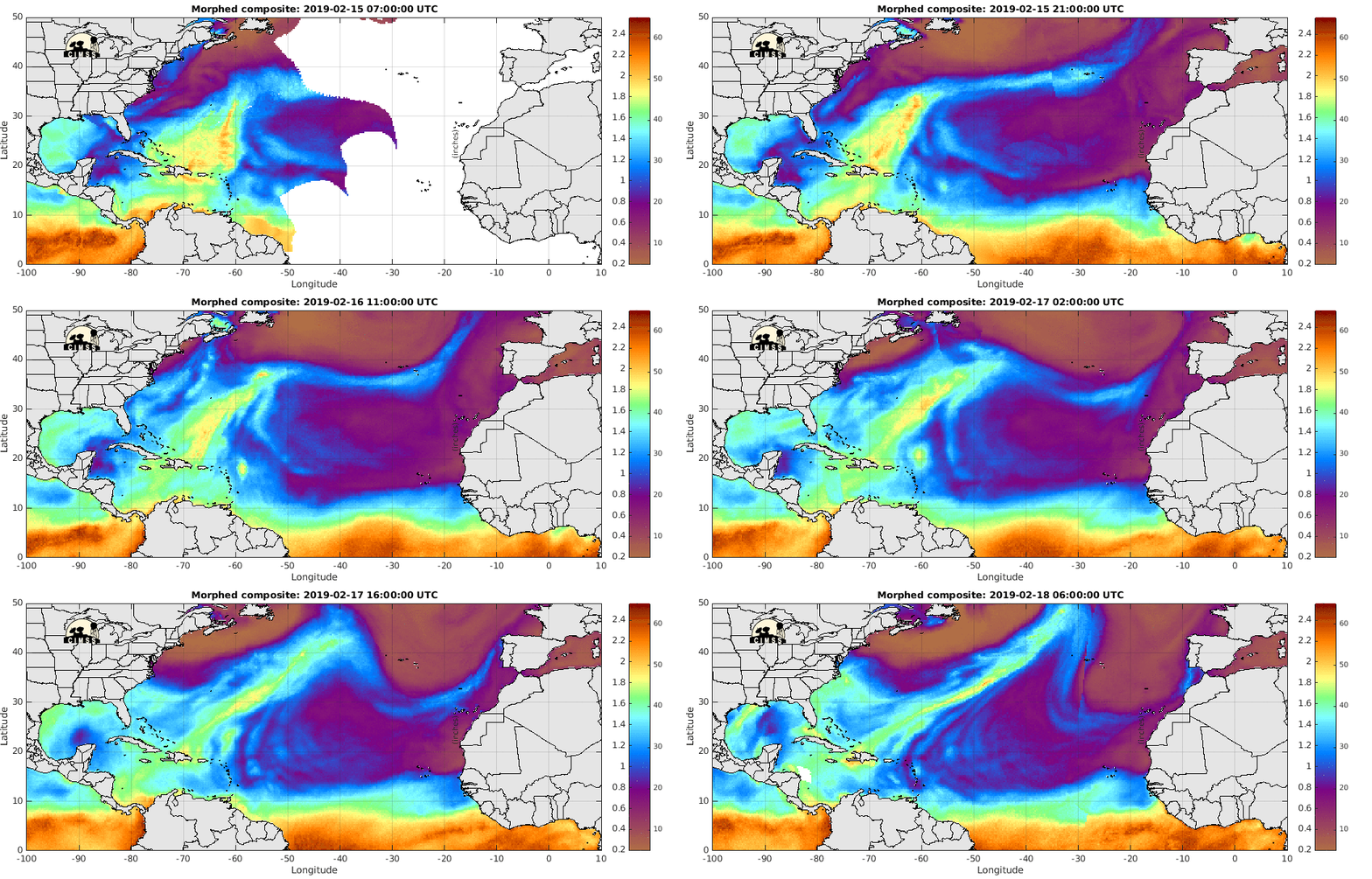
Those dotted lines in the Atlantic....
...show the Saharan Dust.


There is a wave there way South of the SAL.
But the SAL sucks moisture out like a vacuum cleaner.

Kind of like this.


And everyone watching the tropics falls asleep.....
Not easy for people who wake up and check the NHC.
What else can you check? 

https://www.nhc.noaa.gov/text/MIATWDAT.shtml

When things are slow in the tropics, as they usually are this time of year, it's good to read the NHC discussion on the Atlantic Basin. They have something to say about everything and often the amount of attention they give an area of the exact words they use show what they are watching for down the road development or by contrast areas they believe are shut down due to unfavorable conditions.


That's our area close in connected to constant convection and watching for any possibility of low pressure that could spin up. This front has become a semi permanent feature kicking up convection from the Carolinas to Florida and out into the Gulf of Mexico. The models have spit out small lows off the Carolinas and some believe models are indicating that low pressure could become an issue in the Central Gulf of Mexico. I'm a big believer if anything forms in the Gulf of Mexico that remains weak it will hook right to the NE or NNE with the flow. But eventually things can change so you can't judge next week by this week, but it's been a very persistent problem. And, until cooler air dives down and shoves these fronts out to sea each front replaces the previous front and where we had a large High Pressure System parked over the SE we now have a frontal boundary that doesn't want to leave. Often.... it's something big.... from up above or down below that kicks that pattern out. Could that kicker be a tropical storm or hurricane down the road? Probably faster than an Arctic front. Mother Nature generally finds a way to get it done.

Currently here's the picture.


Frontal Boundary.
Little orange dot is the current Caribbean Wave.
Moving along West bound.
Under a layer of shear that's there.

Will something develop?
Maybe. 
But the location of it developing tells the story.
There is the chance it can develop near Louisiana..
(for example)
And crawl along the coastal boundary....
Visiting all the beach cities along the way.
Weak development means everyone gets weather.

Loops to watch and ponder on as we wait for the tropics to heat up and conditions to become favorable to where something could form close in or far away.

hicbsat_None_anim.gif (768×496)

The wider view.
Big wave rolls off of Africa.
Goes poof in the water.
Does it flare up again?

hiatlsat_None_anim.gif (768×496)

That time of year that feels as if nothing will form ever.
And then it does.

Now look close in at Florida.

pie_None_anim.gif (768×496)

Always raining somewhere.

The sun goes up....
...the sun goes down.


August Climo.
Where do storms most likely form?


As for some Hurricane History?
1999 after a fast start was slow.
Then as usual it began to get busy.


Note how the switch was flipped.
A strong high and SAL owned the Atlantic.
And then it did not.


A look back at the beginning of Floyd.

I'll be back later this weekend...
...or if something pops up.
But for now...
Enjoy the summer.
What's left of the summer.

Go to the movies.
Go to the beach (but watch the weather)
Take the boat out if the weather is somewhere else.
Go shopping.
Lord knows there's a Mall somewhere that needs ya.

And as always.... enjoy life.
But buy hurricane supplies when you see them.

Besos BobbiStorm

@bobbistorm on Twitter and Instagram.

As for me.......... you know what I'll be doing.
Making Sangria to go with dinner tonight.


Labels: , , , , , , , , , , ,

Friday, August 24, 2018

Remembering Hurricane Andrew. Hurricane Lane. Invest 95C Very Close to Lane. And a Tropical Wave with Low Chances For Development NOW but Can Things to Change Down the Road Close to SE Coast?


Warning a long blog today.
When I have something to write about in the Atlantic...
.. I can't write long or muse.
Today I'm musing.
Scroll down and find something you like.


Today we remember Hurricane Andrew.
First named storm of the 1992 Hurricane Season.
Slow season.
Tropical Storm Andrew barely survived.
But it did.
Then we barely survived.


The image I have on my wall above my computer.
Good Tweet below.
The last image after the radar blew away at the NHC.
Strong gust...


Today is that day when everyone remembers Andrew.
Well if you lived in Miami you do that's for sure.
Hurricane Andrew.
1992
(Same year Hawaii got hit with Iniki)


I feel like so much began in 1992.
But that's another story I'm not telling here.
Everything changed.
Like some huge meteorological earthquake.
What a storm.
Landfall.
Almost direct hit on Miami... 
... it bobbled just a bit to the South.
Slammed into Homestead and the suburbs.
Spared downtown that direct hit.
But we all struggled through the night together.
And we listened to Bryan Norcross in the dark.
On the radio.........
.......the battery operated radio.
Before the electric went out
...it looked a lot like this:


You know we live in parts of Hurricane Country and we know a hurricane can come and visit in any given year and yet whether it's Florida, the Carolinas or Hawaii life goes on until we have something aiming directly at us and then we all go into Hurricane Prep mode and do what we've got to do. If we are newcomers to an area and not familiar with hurricanes we do what everyone else does. We grab the water, the beer and batteries. And, in places like Key West that rarely gets hit we wonder on the magic that we barely ever get a direct hit and light candles and pray at the Hurricane Grotto and give thanks when the hurricane makes landfall somewhere else. People keep thinking it's odd that Hawaii doesn't get impacted more than it does and rarely does it ever get a direct hit. It's a rock in a huge ocean and it's not hard to hit a rock as the people in Key West can tell you but even then the stubborn WNW bound Hurricane Georges found a way. Lane is finding a way to bring tropical weather to Hawaii today. In the Atlantic we are remembering Hurricane Andrew and relieved there is nothing out there like Harvey or Irma or Maria as everyone is still a bit shell shocked from last year. 


Zero Percent changes for the next 5 days.
Something to watch though down the road.
A possible Home Grown problem?
Still watching the Wave Train...
...and this wave as well.


Collage above shows today's story.
Lane in the Pacific.
Nothing much in the Atlantic.
Yellow X just off Africa with very low odds.
But we are watching it.
Cold front with another disturbance behind it.
If the wave only looked as strong as that disturbance...
...over land, inland over the US.


... it would keep it's yellow circle longer.

Been this way all summer and continuing...
...as we slide slowly from Summer to Fall.
If you don't believe me my windows are open.
My AC is resting for a few hours... 
There's a breeze coming in from the windows.


Loving it.

Back to Lane and the ongoing coverage.
Why is everyone worried about Hawaii?
"It's not a Cat 5 anymore" people say...
It's getting a rare bit of really tropical weather.
That means flooding, fires and landslides so far.
Also models show different solutions.
Most slide it on by Hawaii....
...as a weaker storm but with much rain.
Time will tell what happens.


There are many models.
Spaghetti Models show many scenarios.
We err on the side of caution always.
You don't need a Cat 3 to have serious damage..
...or loss of life.

Mike explains what's going on in a summary below.


Love his honesty :)
"(which means nothing lol)"


Note even tho NHC gives it low odds.
Something is there.
Will it form there?
Or closer to here?
As in close in to the SE coast?
Inquiring tropical minds are wondering.
Note the yellow closer to the islands below.


Inquiring minds are discussing it.


God I love his maps.
His intelligence is a thing of beauty.
Knowledge of weather history.
Student of the pattern.... 
... as the pattern is what gets you there in the end.

I'm musing here.
Did I mention the cicadas are crazy noisy today??


Above is our African Yellow Area.
It started to come off Red and Purple.
And then it went yellow.
Then it went poofish as seen below.


It kind of shot off at a high latitude.
North of the ITCZ
Maybe it heard this was the Year of the Subtropical?


It's all a process as a pattern sets up.
Wave train suppressed South by a Strong High.
Waves have been flaring up further West.
Keep watching.


Note the lead old wave.


Yeah not much to look at.
But give it a few days.
Time does tell.

I'll always remember when I was a little girl sitting on my father's lap watching the Ed Sullivan show and Peggy Lee came on singing "Is that all there is?" and he said....."I've always liked her." It was an odd moment. She was old, not very beautiful in a traditional way but a voice kind of like a husky angel. Didn't look anything like my mother who often had to take in size 2 gowns to wear to family events. A few years later he showed told me he always thought Anne Miller was wonderful and I began to see a trend here. Either way they were both older and not what I thought of as classically beautiful, yet they were classic great song stylists who obviously had quite a bit of sex appeal in their time.


When looking at the latest wave to roll off the coast of Africa and seem to fizzle fast as it hits the water I wonder to myself, "Is that all there is?"

As for Hurricane Lane that isn't wall there is .... there's always some surprise with Lane, currently Invest 95C in it's Eastern bands........


Cat 2 Lane to the left.
Strong area of convection with a tiny tail is Invest 95C.


Good thoughts on Invest 95C above.
A summary of Hurricane Lane below.


Mind you no one in Hawaii is singing that tune "Is that all there is?" They have been dealing for months with a volcano and it's deadly, destructive lava flow taking out who neighborhoods on it's way down hill to the water where it crackled and put on a whole bigger show than the last few African waves that fizzled when they hit the water. Now they have a hurricane with an odd tag along Invest behind it and a fire has broken out on Maui obviously stirred up fast with stronger than normal winds. No one wants to know what comes next. Landslides and on the Invest behind Lane that might change or rearrange the flow of moisture towards a part of the Islands not expected to get such a strong piece of Lane. Time will tell.


Remember when....
That was May.
A few months back.


Cantore posed the question earlier on TWC during their ongoing coverage as to how the two might interact. Could there be the tiniest subsidence issue holding back the moisture from the hurricane? Could the rain from the hurricane hitting the hot lava......(fill in the blank with your own question) make a difference or ???   Seriously for a real scientist the list could go on forever as rarely do you have two such Earth Science events happen in the same area. Skeptics would just laugh it off and say the hurricane is going to fizzle by the time it "hits Hawaii" and just be a bunch of rain and wind and the usual flooding that occurs from such rain will happen and nothing more. I'm pretty sure that person isn't in Hawaii.  Many geologists love to follow meteorology, but always deny the weather can affect geology in any way; most are what I call closest meteorologists for the obvious reason as they watch weather message boards and slurk around on Reddit. Some question whether heavy rain can help trigger small earthquakes, many say it isn't true but when I lived in California the government was studying an area out in the High Dessert that is always shaking and sometimes gets high rain fall amounts during the very short rainy season to see if there was an increase or decrease in the ongoing tremors. Then there is the whole fracking debate, but I'm not going there. Obviously I'm a closet geologists. Don't tell anyone. (Especially my favorite geologist...)

What is really interesting is that after Lane has fallen apart and the people of Hawaii try to clean up from whatever Lane dished out then Lane will be studied over time by meteorologists to see why this storm was so unique that it took a road many have not taken. It also has that friend known as Invest 95C that formed in it's wake and is being "investigated" to see "what the heck it's doing and how did it get there?" as usually a slow moving tropical system has some upwelling (it's moving slow) and the outflow makes it hard for anything nearby to spin (it has a huge outflow) and yet it's there. It's actually very reminiscent of the second center of convection of Matthew, but that was a part of the actual system not a system in it's tail with it's own designation on NRL. It would be like a small comet showing up in the tail of Hailey's Comet. Yeah, I like astronomy too. Things like this will be studied over time under the greater umbrellas of "Hurricane Lane" and as always we learn and we getting better as knowledge is power.

Lane with the little area of strong convection in it's tail.


Matthew with it's odd larger double center.


It wasn't really a "center"
It was a second area of deep convection.
Not the same but we remember Matthew well.

As for Lane.... 

Category 2, 110 MPH moving North very slowly at 5 MPH as of 11 AM on Friday morning. As for me I'm going to shut the window soon if the cicadas don't stop singing. I'm not a fan. But loving the last cooler days of Summertime before the heat returns later this weekend. I'm chilled, resting a bit, writing while the eggplant is cooking in the oven for Baba Ganoush and enjoying just musing a bit. The only cones in my part of the world have frozen yogurt in them. Nothing I need to convey but somethings I want to convey.


My mother loved Lena Horne. My parents obviously had different tastes in both music and pretty much everything else. They had a long marriage and a good sense of humor that probably kept them together. That and my mother made various eggplant dishes for my father every Shabbos as it was his favorite vegetable. My mother was a singer when she was younger doing appearing as a featured coloratura soprano and sometimes sneaking out to sing with a Band when she was way underage but dressed up with lots of make up. She loved music. 

As for me I'm waiting for the leaves to start to fall and turn colors and it's not too cold to go out and the heat has evaporated by the progression of time and seasons moving swiftly in this region from one season to another. Fall in the Carolinas is a long, beautiful season even if you are not a fan or orange, red or Peter Yellow. (Yeah in a mood today) but it's still so beautiful. 


Have a very wonderful weekend.
Not sure yet what I'm doing.
Going with the flow....
Seeing what feels right.
Some weather and some football... 
And listening to music. 
A song I love and can't stop dancing too.


Besos BobbiStorm
@bobbistorm on Twitter


Ps...    The Bottom Line here is that Hurricane Lane like Peggy Lee when I saw her singing on that show isn't as photogenic as she was a few days ago. The shape of a Category 5 hurricane is gone and yet the dangers that Hawaii faces from fire and rain are very present. The ever changing images of Hurricane Lane are still beautiful even if far away in a different ocean.  Yet this particular beautiful Pacific hurricane is endangering the lives of people in the State of Hawaii not missing the islands as most of them do. So just because it weakened as predicted and will take a track away from the islands most likely - it has inherent dangers still present that people in Hawaii that present a clear and present danger. Being repetitive here on purpose. No laughing matter. Meanwhile I'll be looping while I cook tonight's Friday night Sabbath dinner and dancing around in the kitchen to the music. Music from today and yesterday, but mostly today.


latest72hrs.gif (947×405)


Labels: , , , , , , , , , , , , , , , , , , ,