UPDATED for 2PM Advisory.....INVEST 94L aka Jose Possible Behind Major IRMA WSW ... FL and Cuba in It's Track? Models Shift ... Cone Shifts As IRMA Stubbornly goes WSW. Where Does It Make the Turn. Lesser and Greater Antilles in Play.
2 AM
Intermediate advisory.

Still WSW.
Looking at Irma below...

Worth noting that the top left side of Irma looks more rounded, bulging out a bit. I don't want to read too much into this but you can often tell what the hurricane will do by observing it carefully before it starts to do it. Subtle clues exist, this might show it will begin to stop moving WSW. It's a big storm and it takes a while to turn a storm this huge. The high is to it's North but it will soon get to an area where the High is weaker, the ULL to it's NW is still there despite discussion that it would fade away. You can see this better in the loop below.

Note the NW side of Irma looks different.
Evacuating energy well on the North side.
Better than earlier when it was squished by the High.
Winds probability map.

Irma is not alone.
September in the tropics.

Will update with new model info shortly.
Keep checking back
* * *

NRL


You can see what may be Jose...
...twisting, coming together.
Once Irma moves away.
Jose will have running room.
Again w regard to 11 CONE
WHERE Irma is in the 4th Day
Makes all the difference.
If NOT in the center of cone.
The cone will move N or S.
Stay tuned.

First things first..
Irma center stage in Atlantic.

Updated as of 11 AM NHC

WSW movement continues.
Arrival of WINDS (not rain)

Cone:

The cone is NOT over Florida YET because it's more than 5 days away and currently they have moved the cone over Cuba with one forecast point over the Cuban coast. IF the south part of this track verified it would take a bite out of the Major Hurricane intensity that sadly the Islands further East will be dealing with as Irma will hit as a Cat 4 ... even possibly a Category 5. The Islands really cannot take that sort of hit; it's been a long time. Note I showed the cone with watches and warnings. Now is the time in FL to prepare, plan not panic. There's time for panic later I promise you.

Note how circular Irma is now.
Soon (in theory) it should go West.
Not leaning WSW anymore.
Perfection.
Dangerous beauty.
Killer Hurricane.
The name should be retired.

Wide view.
If you live in FL focus on this view.
It's becoming increasing hard to focus on the now when models online go out ten days and show landfall everywhere from Cuba to Florida to the Carolinas (eventually) and it makes the hurricane seem closer than just the five day cone from the NHC. It's far away, it can do many things. There are two things it will or won't do. It will start to turn more WNW or it will keep going WSW to West. It either catches the trof or it ignores the trof. That happens in about 2 days, use those 2 days to prepare early and keep watching the Hurricane and living on NHC time 11 to 5 to 11 to 5 when they update the Cone. No matter what I say or infer they are the bottom line. NO ONE even your favorite local forecaster has the bottom line and the NHC does a good job generally... of staying on top of the hurricane.
Rob from Crown Weather wrote this today on his site.

We are ethnocentric and worry about our home, our place in the sun but the truth is the one given is this Hurricane will affect the Islands as a STRONG Major Hurricane. I feel the NHC is being conservative on Intensity going with Cat 4 and it could be Cat 5 IN THE ISLANDS. So first things first.
I'll update later today with more model discussion and based on the actual movements of Irma as well as recon information. There is a plethora (LOTS) of information on Spaghetti Models. Use it wisely and try new things; don't just go to the same sites as it is jam packed with info.

This is my bottom line.
You can stay informed on the storm.
Mike adds sites often.
Years ago people heard vague news of a West Indies Cyclone down in the Islands. If a ship wasn't in the eye you didn't get good details or if the ship went down... you just figured the storm got it. Fast forward to today when you can get the same info the people at the NHC get but you need THEM to translate it to you and take the confusion out of it. People like Mike do their best to keep you informed. On his Facebook Live this morning you could hear the concern in his mind as he spoke, not as easily as sometimes. I'm concerned. I have kids, family and I love Miami and I love Key West where my family lived in the 1800s... I know Florida Hurricane History like the back of my hand. So... I'm telling you take this as seriously as you can but DO NOT PANIC, prepare, plan... then adjust accordingly tomorrow to see if Irma is still going WSW or if the NHC has placed your world into their 5 day Cone. And worry more if you are in the 3 Day Cone. This is still far, far away but as it gets stronger it seems way closer as we worry more on a Cat 4 Hurricane than we do on a weak one. And, after Harvey and Matthew last year we are very aware of what a hurricane can do. This is NOT Harvey, it may bring catastrophic winds in it's path vs flooding or both. Stay tuned. Things can change over the next five days and the only given with a Hurricane is models will flip flop and the NHC will adjust their cone accordingly. More later.
Keep reading if you haven't and compare and contrast the 11 AM with the 5 AM.


Irma and the wide view.
The Cone.

Imagine at 11 AM it should be touching Miami Beach..
Wind Probs.

Orlando is in it.
Way Inland.
Why?
Answer is obviously.
Current models turn it over Florida.
Note KW thru WPB...
HIGH ODDS.
I use wind probs often and the reason is that they show where the cone may be going on the next model run. They are usually consistent with the NRL map grid I show often. Good meteorologists use the wind probs they don't just look at the cone. Observe the map that Morales made with the wind probs to make it more understandable. In the short term he is concerned and preoccupied with the Islands, that will change quickly as the threat to South Florida goes up if Irma continues to continue WSW. It can bounce sharply North as I will show at the bottom of this blog in hurricane history discussion. However, it will need a sharper turn to avoid bumping into South Florida making a wide turn with this large a system. Or it will turn over South Florida or go through the Keys and make the turn there. Note Venice Florida is in wind probs. See the cone and the wind probs put in for more clarity.

This concept is shown below as well.

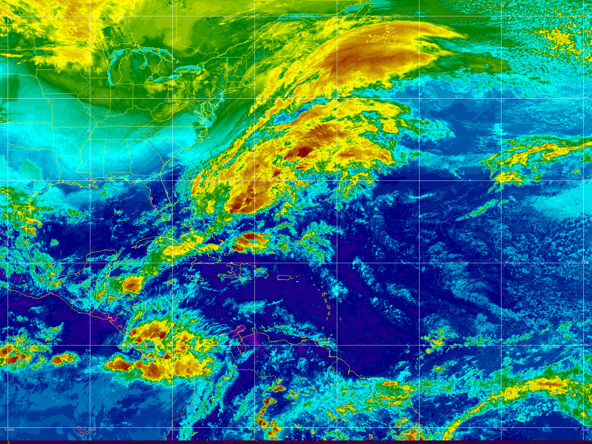
Look at this satellite image below.

Before the models got way better in the old days we used to weigh heavily on this satellite image above as we would watch to see if the specific hurricane missed or made it's forecast points. Note the points are placed close together in the short term. IF it came in higher or lower than it's forecast point we knew the next advisory might be adjusted. They change the forecast points every six hours, but it's a short term indication of a long term problem. We also could put in frontal boundaries and upper and lower level winds and by doing so it showed us more than the motion, direction of the storm. It's still there but it's shown less and less as most focus now on the models. The models follow the movement of the hurricane, not the other way around. The other day I heard someone say "the EURO is going to SAVE US" and I made a face, rolled my eyes and shook my head. The models indicate based on what they are currently reading, they do NOT set the path. If only it was so easy. No watching the models is like reading a fairy tale sometimes and often there is a surprise ending in store.

I'm honestly not sure where to begin this morning and I'm going to update info at 11 AM with the new forecast package. To be honest and direct the NHC hasn't changed much as in reality Irma hasn't changed it's track much and despite all recommendations otherwise it has continued (Georges like) to continue moving WSW around 14 MPH. Not too fast, not too slow and this is beginning to feel a lot like Goldilocks with the CMC, GFS and the EURO each weighing in while Irma continues on and on. CMC shows one scenario and everyone laughs it off, then the GFS weighs in and everyone rolls their eyes and then the Pappa Bear EURO weighs in and everyone sits up in their bed at 3 AM and pays attention. At 11 PM the NHC paid attention last night to Irma as much as they did the new model runs showing a more Westerly movement. That movement is based on it's continued WSW movement, despite projections it would pull out of that dip sooner rather than later.

Let's put it this way.
Irma is looking for a good Air B and B.
Reading reviews.
She is taking a long vacation.
Going to put up reviews on Yelp.
A book deal may be down the road.
Now let's look at the models.
Actually they are in better agreement.
That's not good for South Florida.
Not good for Cuba either.
Going straight to the source.

Below Momma Bear and Poppa Bear.

A lot of agreement there.
Devil as always in the details.
Short term tightly clustered.
Long term wider "cone"
And you can see what the NHC will do..
AGAIN... the models adjust to IRMA
NOT the other way around.
Can't believe I have to say that ...
...but seen crazy things said online.
First things first, as they start let's start at the beginning. It's very hard to see a way out where the Islands do not get impacted by a very strong Major Hurricane. First comes the Virgin Islands and some small, beautiful islands nearby. Then comes PR and then it is possible, but don't rely on it, that Irma could bounce around the N coast of the Dominican Republic. Or it will trace the islands to the North and take the Old Bahama Passage along the North coast of Cuba through the Florida Straits. These are some of the many questionable tracks below.
a) Keeps going WSW then slowly W then slowly WNW into the GOM.
b) Slides along bumping into the Greater Antilles, keeping strength in check.
c) Visits Cuba and begins to peel away from the Westerly track goes through the Florida Keys.
d) Pulls up through the Keys somewhere between Marathon and Key West.
e) High probability Cantore gets to see Key Biscayne and Key Largo .. maybe KW.
f) Approaches Cuba and begins to pull North up towards Bahamas and Florida.
g) Pulls North sharply and slides just off shore South Florida clipping WPB with eye wall.
h) Traces Hispaniola then traces Florida up to landfall in the the Carolinas.
i) Irma does what Irma is going to do and sees Florida and Carolinas ..travels I-95
You get the idea here? It's too soon to tell. But it's NOT TOO SOON TO PREPARE. In reality you should have a stock of water, supplies and some OTC medications and first aid supplies hidden in a closest under old clothes (hide them from the kids trust me) if you live in South Florida or any part of Florida. Florida sticks out into the Caribbean seeming to say every season "go ahead, hit me with your best shot, fire away!!" and yet often Florida gets lucky. Often the Islands get lucky and the hurricane aiming at them suddenly hears the call of the North and pulls right fast just before approaching them.
Oh and Irma is not alone.
Jose may be forming behind her.

This is where we are today.

Close up dark view of this story.

Living in NC now I have learned to trust Chick.
He's in NC and he's very good.
Possibility #1

Possibility #2

Spoiler Alert there are many possibilities.
For now let's stick with the 2 above.
Can a hurricane make that sharp turn?
Can it bounce off Cuba?
Jeanne bounced off Hispaniola.
Made a hard right turn.
Cuba got lucky.
It missed it's ticket out of town.
Stalled, looped.
Headed back sharp left turn to Florida.

Frances, same year, also made a sharp turn.
After making landfall and crossing FL.

Cleo bounced off Cuba and went North into Miami.
Y'all know I talk about Cleo a lot.
It was a dangerous Cat 4 in the Islands.
Sound familiar.
Cuba took a small bite out of her.
She regained energy over warm FL Straits.
Marched straight up Florida.
Kind of like the GFS last run huh?

Donna did a similar track but curved after the Keys.
Then went ALL THE WAY up to NY NE
Messed up OBX on the way.
Donna is kind of the Goldilocks track.

Online the other night I simply said "I could see a track through the Keys with Miami in the strong NE part of Irma" and someone said that wasn't happening. I didn't say it WAS happening. I was answering a question my youngest son posed as we were discussing it online. Obviously it seemed Irma would make the turn in the Bahamas and miss the Islands, but .... it was obvious if it did NOT make the forecast turn it COULD go through the Florida Keys and Miami would get the strong, weather often associated with the NE quadrant. Happens. Donna made that turn very slowly and Miami was blasted for days with strong tropical weather; not a fast mover like Andrew.
Then we have Georges 1998.
Every forecast advisory talked on a turn.
It was forecast to miss PR.
It was forecast to miss Hispaniola.
It was forecast to miss Cuba.
It never really made a turn North.
It did pull NW some...
Covered more real estate ...
...than I can remember any storm doing.
If there was land...
Georges found it.

Note the plots below.
It did NOT dip.
It just kept going WNW all the way almost.

Lastly in this trip down Hurricane History Lane.
The Great Miami Hurricane 1926.
Up and over the Islands.
The classic CV track.

No dip. Up and over.
Seems Irma is not taking that track.
But just showing it.
I want to say this again.
Hurricanes do what they do.
Weather is fluid.
Steering currents appear suddenly.
Steering currents vanish into thin air.
Hurricanes can make sharp turns.


If you live in Miami PREPARE.
IF you live in FL KEYS...PREPARE.
If you live in FL.. be ware...
Keep watching.
If you live in GA, SC and NC
Watch Irma closely.
The NHC adjusts their track every six hours.
You should be living on NHC time now.

My brother is at the Dollar Store as I type this.
It could turn...
..or it could go South thru the Keys.
Don't stare at the models.
Or the loops.
Prepare, then sit back and watch.
Better safe than sorry.
Please take IRMA very seriously if you live in FL.
And as for the Islands.
You should have prepared already.
I'll update at 11 at the top.
If anything BIG changes.
I'll post a new post.
Check back often.
Watch this loop.
The deep red is the REAL weather.
Hurricane force winds.
Not cloud cover as you see on other loops.

Besos BobbiStorm
@bobbistorn on Twitter
Ps...Again updating in real time during the day.
Labels: 94L, bobbistorm, Cuba, discussion, Florida, History, hurricane, Irma, Jose, keys, keywest, kw, landfall, miami, models, NC, NHC, SC, spaghettimodels, weather
posted by BobbiStorm @ 6:40 AM
![]()


4 Comments:
Good post and thanks for the information shared and this make me to visit your portal again,
certainly like what you’re stating and the way in which you say it.
SSC Latest Jobs 2017
Good information.Thanks for shairng.
Latest Results 2017
Thanks for sharing information.
sccl Badli Worker Recruitment
tgjobsnews is India's top most job website Central Govt Jobs
Post a Comment
<< Home