UPDATED - TS Harvey, Invest 93L CV Wave, PTC10 Off SE Coast Headed to SC, NC Possibly TS IRMA Later Today... TORNADO WARNINGS CURRENTLY ONGOING
Harvey
Just goes on and on and on.
Yet he will eventually move on.
Exhausting tragedy.

Still a Tropical Storm
Still a Flooding Problem.
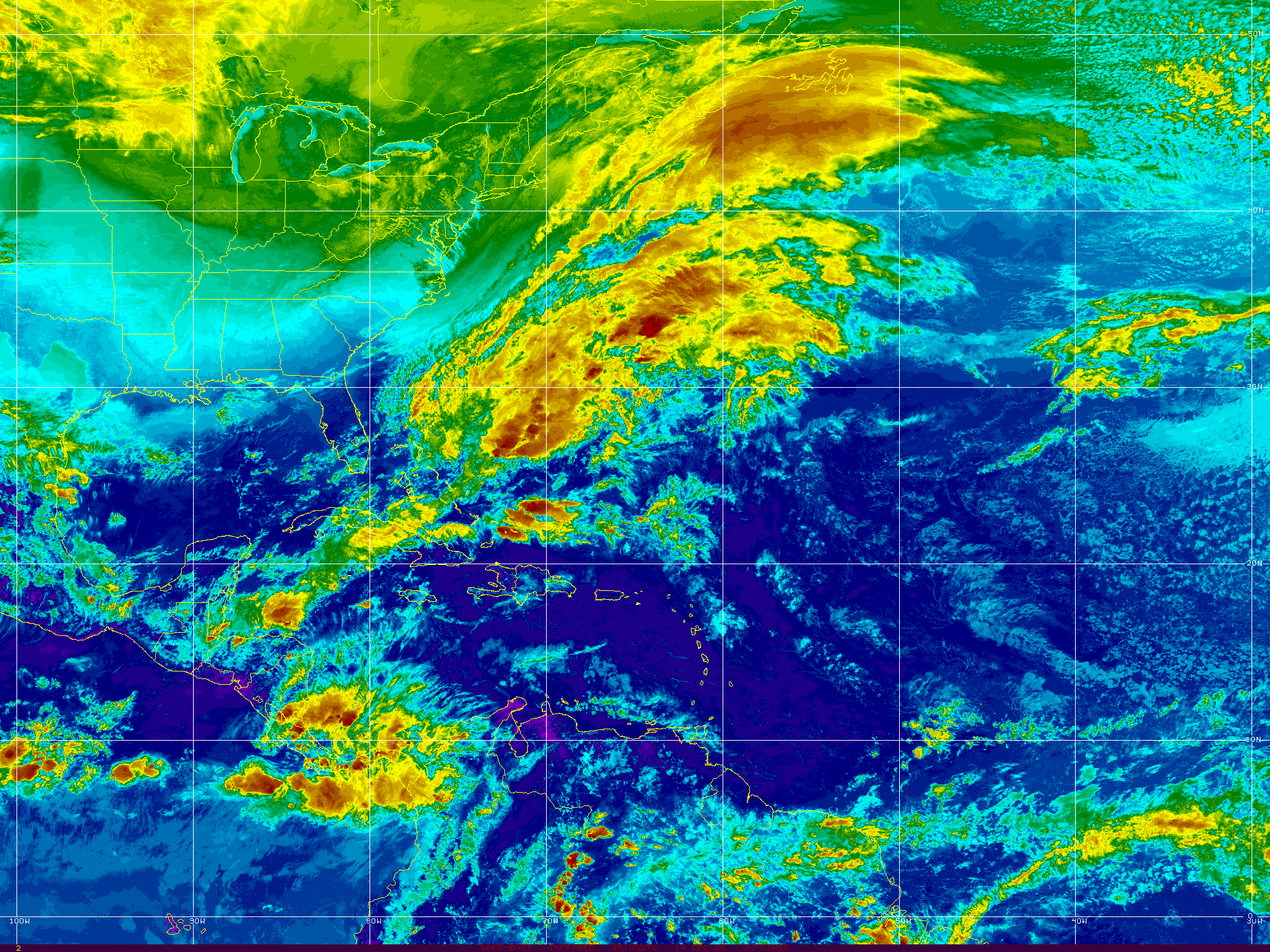
And off the East Coast of the US..
That bright red area is PTC10.
What was once Invest 92L
PTC10
There is intricate discussion going on as to whether or not this system will eventually become a Tropical Depression or Tropical Storm. Yet....it has 40 MPH winds, remember that. Suffice it to say a storm by any name is still a storm and there is stormy weather moving en masse along the East Coast of the United States. So let's focus on the weather and not the discussion of the name. The winds are there for Tropical Storm strength as it currently has 40 MPH winds, however it's circulation is not complete. There is heavy rain along this stormy patch of weather and some possibilities of flooding in areas in Eastern NC that are prone to flooding. The beaches have high surf and rip currents and it looks...well...very stormy. Here In Raleigh there is a constant, beautiful breeze with light rain. Feels tropical ... feels a bit like an early Autumn Cool Front and then it feels tropical again. As it moves up the coast beyond the warning areas the beaches along the Del Marva Peninsular should see storm whipped surf. Nothing like what it could been had the shear enhanced by Harvey had not been there to create problems for 92L (PTC10)
And, then Labor Day Weekend comes with no big storm threat along the East Coast. That may happen later from Invest 93L in the Atlantic but this week enjoy life and have a wonderful Labor Day Weekend.
From Discussion below.
93L Models - Discussion.
80% chances in 5 days.
40% in 2 days.

Has a nice spin.

Really too early to tell where it's going.
For now WNW... maybe NW..
Then maybe bend back to WNW or W.
We have lots of time to watch.
Below is a comparison.
Compare and contrast Harvey and PTC10
Both with low intensity forecasts.
Tropical Storm...
Then a ticket out of town..
PTC10 .. ? Irma sooner.
Harvey later.
But they will go..
Good solid discussion from the NHC. A dry slot visible on water vapor imagery shows things are beginning to happen regarding Harvey. Yet, he has not started to make his move. Winds will be felt in areas where people are trying to put their lives back together close to the coast where Harvey originally made landfall. This can be seen on the water vapor loop I am posting from LSU below.
Watch the blue air (dry)
moving down around Harvey.
At some point...
....he will move.
As the cone shows above.

Regarding PTC10
Cone and discussion the same.
Waiting for it to pull it together.
See information below.
Thank you.

Similarity between Harvey and PTC10 above.
Waves out in the Atlantic evident.
Stalled frontal boundary.
Headline from the NHC.
TS Harvey.
PTC10
That link shows a tornado warning currently.
Lake Charles as shown above.
New Iberia and St Marys Parish as well.
Currently a sort of one sided STORM system.
Cradled in the curve of the Carolina coastline.
This is the area that will be impacted by PTC10
The cone is wider.
That's a forecast coordinate.
Cone below from earlier.
Nothing new there.
Nothing new there.
I want to be really clear here. PTC10 is NOT Tropical Depression Ten. They are not the same the P stands for POTENTIAL and most likely it will become Irma, however I have seen posts online by many who should know better who simply say TD10. Yes, details matter. Words matter.
As for Harvey, it is currently a Tropical Storm and forecast to stay a Tropical Storm. That can change as always so stay on top of it if you or loved ones are in your path. As Houston is the 4th largest city and much commerce goes through that large area this is an economic mess for many as well as a personal tragedy for those in it's path. The NHC puts out a good product that is shown below. It's the basics, pictures, words; more words than Twitter and Snapchat but concise and well done.
See this image below:
When NHC links to the NWS.
Follow those links.
Links now show NWS Lake Charles.
Note the heavy moisture is moving East ..

My thoughts from last night remain the same, you may want to read them below. Anytime a system is back out over the water in enhances the moisture and the misery. The loop below shows how that moisture is being funneled up and over the area making TS Harvey look more like a Stationary Twister on satellite imagery than a true Tropical Storm. The winds are there and it has a viable center, despite the odd signature on satellite imagery.

Next we have Invest 93L
Introduced this morning to the mix.
Westbound.
Not going to discuss models.
From Spaghetti Models.
As soon as they are all out.
Mike will put them up.
He also has a specialty page for Harvey.
There's lots of time to discuss 93L
It's moving westound.
You can connect those dots.
Threatens land or goes out to sea.
Leaving you with one thought.
Other than please donate what you can.
Remember September.
September is 4 days away.
Hurricane Season.
Next name is Jose.
After Irma ...comes Jose.
This is a huge story.
According to Amazon news ...
Image from the Washington Post below.
As for the rest of you in Hurricane Country... Remember September. Hurricane Season is just ramping up. Get a plan you can execute and be realistic about the threat this Hurricane Season may pose to your particular place in the scheme of things. El Nino is no longer in charge and Hurricanes are back in style again.

Besos BobbiStorm
@bobbistorm on Twitter
I'll update at the top throughout the day.
Or start a new post if NEW possibly.
Check back often for updates.
Thank you..
http://hurricaneharbor.blogspot.com/2017/08/ts-harvey-reborn-tropical-storm-again.html
Labels: 93L, African, discussion, harvey, History, hurricane, Irma, Jose, music, PTC10, September, Storm, tropical, tropics, Wave, weather


0 Comments:
Post a Comment
<< Home