HURRICANE MARCO Updated 5 PM- Laura Looking Like Big Trouble Down the Road in the GOM AFTER It Finishes in the Islands.
5 PM.
Models got a big wonky.
Or just different.
Models pull Marco further West.
Sort of slides along the GOM Coast.
NHC staying conservative and good idea.
Wait for another model run..
..everywhere has watches and warnings.
As for Laura....
again playing follow the leader.
If Marco pulls more West...
...could pull Laura more West.
Could.....
Another point is that after landfall...
...the moisture will end up moving East.
Back across the US but that's days away.
For now stick with the NHC Cone.
Stay informed on the storm.
And will see what happens.
Will Laura take the Southern route under Cuba?
Possibly, possibly not.
This was my thought once the Miami scenario was out.
Storms head towards the Yucatan Channel often.
Time will tell.
Keep your guard up as always.
And check with NHC and your local NWS.
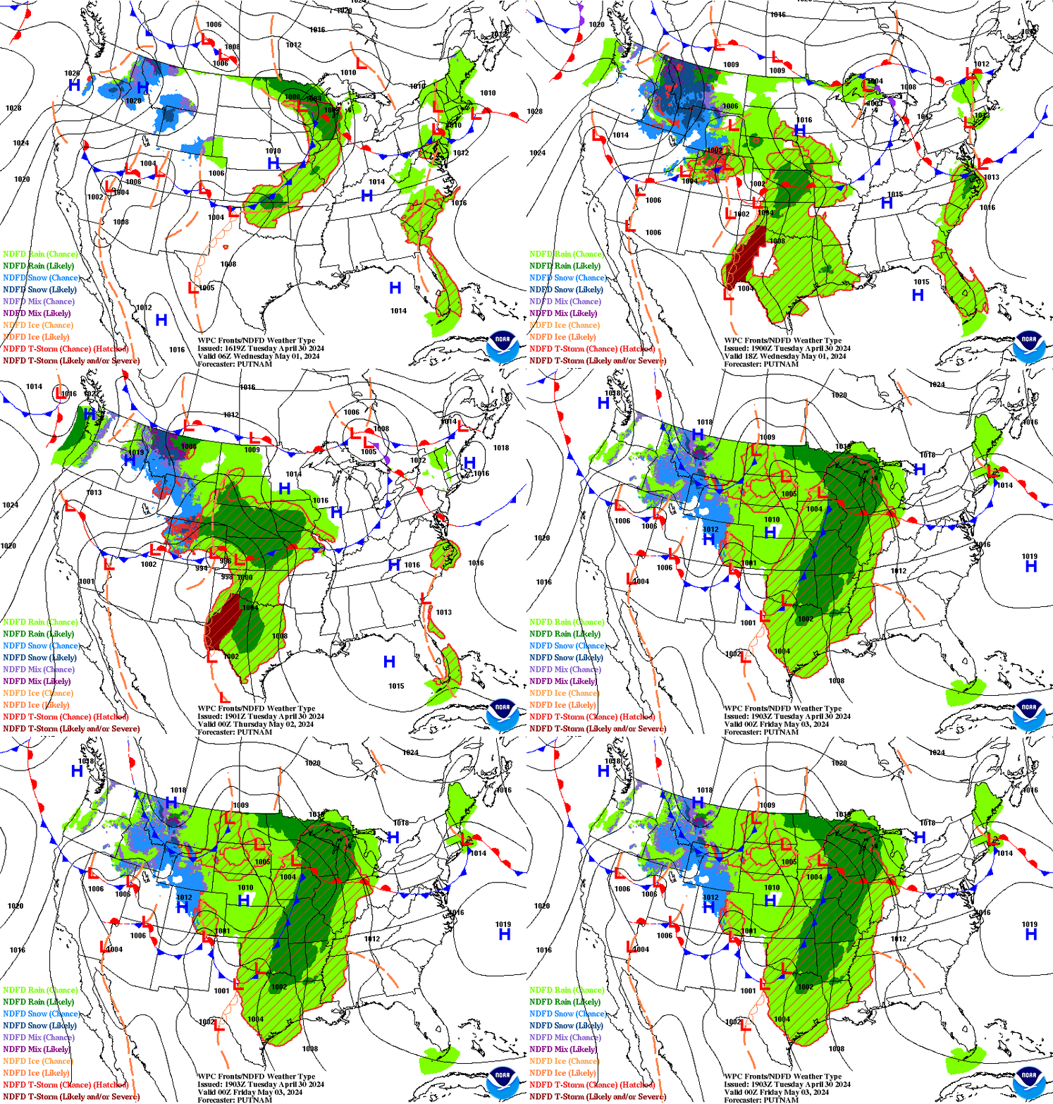
7 Day Loop for NOAA below.
https://www.wpc.ncep.noaa.gov/basicwx/day0-7loop.html always good to see the 7 day forecast.
* * *
Looks like it wants to pop an eye out?
Intensifying Marco.
Note the red cells in what is now a tail.
Dancing in the GOM
Laura looking on thinking...
"anything u can do I can do better"
and from far, far away...
without zooming you can see our 2 storms.
Cones from 11 AM
Any changes in Cones will be at 5 PM (if any are made)
11 AM Cones.
Going to say this I'm still leaning towards the right side of the cone for Marco, but we will see very quickly. This is a fast moving scenario and Marco is moving along in the channel that Mother Nature allows it as I show in the video below.

This is the 3 day.
As solid as it gets forecast wise.
Note Laura appears on the last day.
The Laura track is more of a question.
Not a big one but ....
Where does Laura emerge off of Cuba?
The cone could shift some IF
....as it's all fluid.
Much depends on the strength of Laura then.
And again location of it emerging into the GOM.
I'll update late today.
Watching, doing chores now.
Because tomorrow will be crazy busy.
Growing up in Florida when I didn't travel much as my parents were not into hitting the road for summer vacations I fell in love with this area of Louisiana now under the gun while reading Kate Chopin's "The Awakening" in college so if you are still looking for late summer reading I suggest you get a copy and aside from the compelling plot let the images and descriptions of the Low Country, New Orleans and Grand Isle in 1899 that are extremely incredible and inspiring. Years later I traveled back and forth to California and made stops along the way in Louisiana often, especially in New Orleans but I really fell in love with New Iberia in a way that is hard to explain. I got out of the car there and looked around and just fell totally in love. Those are the places in the path of both Marco and Laura as of Sunday morning as I near the anniversary in my head of Andrew... and when we boarded up the house in Miami Beach and moved upstairs to hunker down for landfall.
#Marco & #Laura water vapor loop discussion. Waiting to see what NHC does at 11. Made this for the blog. Will update with new Cones from NHC pic.twitter.com/WHLURrpQCE— BobbiStorm (@BobbiStorm) August 23, 2020
WV loop video discussion.
Marco will make landfall in south Louisiana Monday night. Laura could hit the same area late Wednesday. pic.twitter.com/7bKFpTVZgN— Brittany Bell (@BrittanyABC11) August 23, 2020
She's my favorite meteorologist on ABC in the Raleigh area that has many very good mets, she is good. A nice illustrated combined track for #Marco and #Laura. Note Hurricane Warnings now up for the coastline of the GOM so please while wondering how strong Laura could be days from now take one storm at a time as the one two punch of back to back tropical systems in that area is problematic.What Marco might weaken but not destroy will be loosened up for Laura that is forecast to be the stronger storm, a not good scenario.
Again as I said last night these storms are threatening places I love from the coast of Cuba to Key West where my family lived in the 1800s and to New Orleans where they did business and had family in the tobacco business and Tallahassee where I have family and my family had shade tobacco fields in Quincy just North of Tallahassee. I love New Orleans, think www.nola.comwas one of of the first sites I went to when I got online years back. Then I got to be the keynote speaker at a Cat Adjusters Confernce on a real riverboat rolling up the Mississippi, they took great care of me and I do so love New Orleans so wondering just exactly what Nola sees from both Marco and Laura, but as always time will tell. The loop below shows where we are today.

Above we have a wide view of the basin.
Amzing how Laura looks so good over land.
Yet Marco is on the brink of Hurricane status...
...headed for landfall.
I wrote a long detailed discussion last night and not much has changed in my thinking nor in reality so I ask you to read Sunday Night's discussion written around Midnight. I'll go long later today on new models, new satellite imagery observations and wisdom from the NHC and my own thoughts.
What I want you to remember is to take these storms one at a time, if you have loved ones in Haiti or Cuba obviously you are staring at Laura and wondering how much damage a still weak storm can do and the answer is it can do a lot of damage especially with regard to places that have terrain and are prone to flash flooding. But Marco is knocking on Hurricane strength, looking more like a June or October system in late August and if shear does not relax the WEATHER is very right sided meaning that places in Florida could get way more weather than a cone taking it to bayou country in Louisiana implies. And the flooding from torrential rains and storm surge can have an impact across a wide area. While Marco is small in size, it has traveled a long ways to get where it is and people will feel it when it gets to where it is going.
Then you have Laura taking her time down in the Greater Antilles. For people like Mike who always have problems with this GREAT in this case means LARGE and Lesser means SMALLER vs a review on Yelp. The bigter islands Cuba and Hispanoila are slowing Laura down some due to friction with land and moving WNW being pushed by the High and attracted to the low pressure of Marco as lows go to lows and prefer to stay away from Highs. Tropical meteorology steering currents 101 but highs are known to change shape and orientation and shear can appear out of nowhere even when a forecast forecsats low shear so again this is all happening in real time vs model solutions that change some on every model run. For now Laura, by many models, is forecast to become a Major Hurricane but for now it has to get past Haiti and Cuba before arriving in the heated pool of the Gulf of Mexico. So let's deal with Marco before obsessing on Laura's strength in the Gulf of Mexico. NHC stays conservative that is good so watch the trend and take it seriously.
Last night many online jumping to conclusions were touting Marco's death from shear and yet here we are this morning with a 70 MPH storm and Hurricane warnings posted for a populated coastline and the associated concern of weather being sheared off Marco still headed towards the Florida Panhandle and West Coast. Hurricanes are complicated and as the NHC does in that they wait it out sometimes before jumping to conclusions, being often slow to make change and in the end that works. If something changes rapidly they will update fast and again I urge you to follow your local NWS office as well as the NWS office of places in the path of the hurricane before it hits your location.
I really feel badly for New Orleans, that had to deal with Covid early on before all the issues were clearly understood and now back to back threats from tropical weather, one that could become a Major Hurricane. And, again between Laura over Haiti now and where Laura goes eventually landfall could be anywhere from Houston to Mobile Bay and again over the next few days that could change even more to the right or to the left. Once it's over water, depending on where it gets off land will tell the story as to where the exact cone will be but for now they are at the top.
2 things to remember with Marco and they are one the cone goes NNW towards the Central Gulf of Mexico coastline yet the presentation shows a right sided storm with weather leaning right far from the Cone so it's a kind of disconnect to look at these two images. As Marco is a small system core wise they are prone to pulsing up and down so will it be itnensifying into landfall or will the shear show up again in time to keep it weaker. That weather while not a hurricane can contain flooding rains and tornadoes in parts of Florida not in the Cone, so follow your local meteorologists and NWS watches and warnings please.

As for Laura we have plenty of time to talk on Laura, a really beatiful envelope that has remained the same even when it's core looked crummy, to be honest. Again a strong hurricane that is stacked vertically can take a bit hit from the mountains, but a weaker storm takes less of a bite and mountains enhance convection. Torrential rains are pounding the islands now as the NHC has said on it's website.
I'll update later. Please read the previous post and listen to the video I made before finally going to sleep last night. Again note the width of the watches and warnings for Marco before getting into betting games on how strong Laura will become later down the road. And, I really hope the flooding from these back to back systems doesn't play out as many fear. The Cajun Nation will be very busy this week and thankfully they do the most awesome job.
Now I'm gonna relax a bit, make some biscuits I think for brunch whenever that is and listen to Mike from www.spaghettimodels.com do this thing and he does it very well at 9:19 AM.
Besos BobbiStorm
@bobbistorm on Twitter and Instagram.
Ps again please watch the video in the previous post.


0 Comments:
Post a Comment
<< Home