More Hurricane History ... Florida Keys, Tampa & Miami
As I wrote this recon was flying around in TD 9 that is currently fighting northerly shear, mucho intense amounts of Saharan Dust that is traveling with the storm and marginal conditions. They may upgrade, they may not... the history remains the same of storms that did hit the areas highlighted in the long range models for TD 9.

Regardless of the condition of TD 9 or possibly TS Isaac today... it is forecast to be in a better area with less shear, warmer water and less dust infiltration in a day or so as it crosses through the Islands.
Most of these storms that hit South Florida were storms that came in October, the month Miami is most likely to deal with tropical trouble. But, each year is different and each storm is different, no two set ups are exactly a like.
Either way you should be thinking on revising your hurricane plans, upgrading your insurance while you can still get it (thanks Alfred Spellman on that one) as at some point you will not be able to get it. What looks like a weak depression today can be a Cat 2 headed towards your Florida town and you will suddenly be without insurance and the reality that you could lose a lot. Plain and simple. If you need Renters Insurance, think about getting it as so many people in the Miami area do rent. Your condo is only as secure as the weakest link in your condo. If one person does not board up ...the air gets in, whips around and creates trouble that could affect other units. Just an example.
And, regardless of what Isaac does... Joyce is not far behind.

SAL:

AGAIN... the reason we rely on models these days as well as solid forecasting is they add a dimension that was not seen years ago ... for instance when they thought Cleo would stay off shore in 1964.
Some history worth reading up on...
First and foremost the Great Miami Hurricane of 1926
http://www.srh.noaa.gov/mfl/?n=miamihurricane1926
A storm that cannot be ignored. I lived a few blocks inland from this picture through most of the 1970s and 1980s. If any storm, this one or another one, were to hit Miami Beach with the same force the loss of life, the dollar loss ... the losses cannot fully be fathomed. We think we got Andrew and we did get some strong damage. We think we suffered through Frances and Jeanne and all the others who came after...NONE hit Miami full on with the force of the 1926 Hurricane.
This picture sat on my desk at Touro College where I worked, a block from the ocean and block south of Lincoln Road for several years. A reminder of "what if" and "it could happen here" . . .

There wasn't much to knock down in 1926... there is now.
Did you know people taking refuge in the Church on Lincoln Road died... their bodies were found after the storm, like many other bodies scattered around the causeway, the beaches and some bodies were never found.
Again, storm surge wise... a hit from the SOUTH ...a direct hit would be a worst case scenario as the water would push UP the Miami River and a storm surge would smash the area to the South of the River known as Brickell and the SLOSH charts for a storm surge from the South are not pretty. Years ago, Biscayne Bay worked as a safety mechanism for the City of Miami... water would come in and flow straight up toward what is now Aventura and flow out around Bal Harbor and Haulover... it was a wash... water would flow into the mangroves. But now... we have bottled up that flow mechanism with Sunset and Palm and Hibiscus Island, the Julia Tuttle Causeway, Bay Harbor Island, etc, etc... the water would try to flow north and it would bottle up and create many problems in downtown Miami, Miami Shores.. Miami Beach... it would and could be a mess. The geography of Miami and it's billion dollar sandbar was designed to work with nature not against it.
Read on...
Some more walks down memory lane of the hurricanes that traveled these same paths and wreaked huge disaster in Florida in a time before most records were kept. Though people are not as familiar with them as they are Cleo, Betsy and Andrew... these storms took their toll on those who lived here, rearranged the geography at times, destroyed a few areas that never bounced back and sunk a lot of ships.
1846 Great Havana Hurricane... that moved north into the Key West Area and later made a landfall around Cedar Key. The track is a guesstimate ...not exact but you get the idea.
The 1846 Hurricane was POSSIBLY a Category 5 though there is no way of knowing for sure at this time...or possibly ever.
1909 brought several storms to the Miami area:
October storm

#10 has no track but this is the summary from wikipedia:
Tropical Storm Nine
| Tropical storm (SSHS) | |||
|---|---|---|---|
| |||
| Duration | September 24 – September 29 | ||
| Intensity | 60 mph (95 km/h) (1-min), Unknown | ||

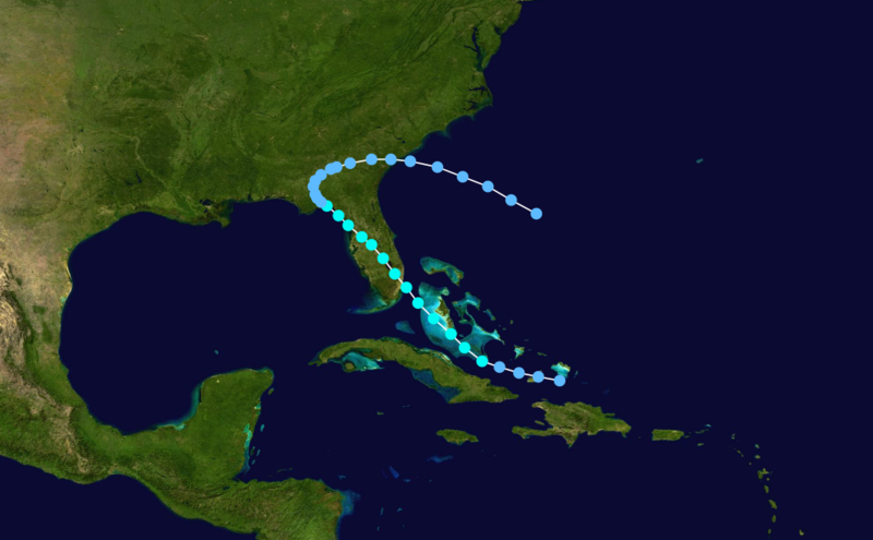
The ninth system formed north of the Isle of Youth and hit near Naples, Florida as a Tropical Depression on September 25. The system moved over Florida, strengthened to a 60 mph (95 km/h) tropical storm. By September 29, the storm had dissipated.
Another October Storm

FANTASTIC LINK on information on the Florida Real Estate Boom... which in the Tampa area ended abruptly with the 1921 Hurricane that hit Tampa. In theory, that money may have oozed over to the East Coast and a more southern location.. namely Miami ...which had milder winter weather for a longer growing season as well as more sunny days for tourists.
http://www.sptimes.com/2002/webspecials02/andrew/day4/story1.shtml (IT COULD HAPPEN HERE) Here =Tampa... it can and it will happen again... some day.
Current Models:
Something to think on while worrying on whether it's been named Isaac or we have to wait another day or so ..
Most likely.................TD 9 will become Isaac at Five PM. And, the cone may extend all the way to Key West ... that would be a five day forecast. About as accurate as it gets these days.
posted by BobbiStorm @ 12:30 PM
![]()


0 Comments:
Post a Comment
<< Home