UPDATED 5 PM Tropical Storm Nestor.... Moving FAST at 22 MPH to the NE. 60 MPH... Questions on Future Track, Intensity and Timing. Does History Repeat & Do Twisters Become a Problem as Happened in Josephine?
#tropical #storm #Nestor could it reach #hurricane strength before landfall? Worried on the threat of nighttime #Tornadoes fast moving storm .. stay alert for #surprises https://t.co/XLVVLmtkcS pic.twitter.com/0MnqgJfiWx— BobbiStorm (@BobbiStorm) October 18, 2019
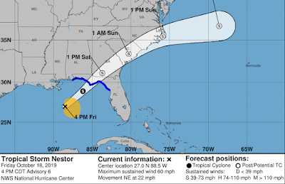
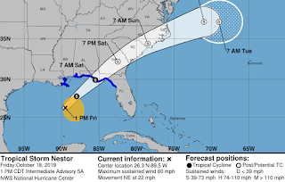
Updated 5 PM Info from NHC
And the beat goes on....
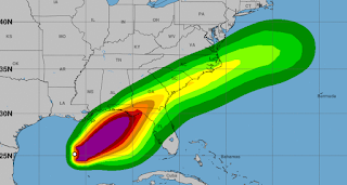
note the yellow circle to the SE of the center.
Again this is a very right sided storm.
I keep saying do not concentrate on the Cone..
...the black line in the Cone.
But posting it here below.
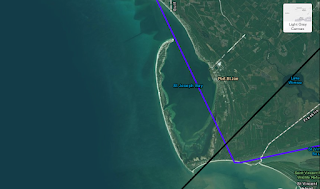
Personally I think it could come closer to Appalachicola Bay.
However that's spelled.
I'm short on time....
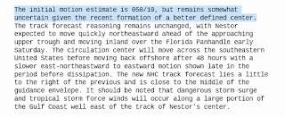
Discussion points out what I said below earlier.
Watch for reformations of the center.
Or a "better defined center"
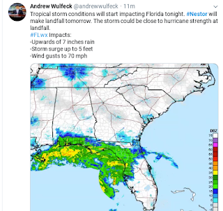
Note I'm not the only one talking hurricane.
I'm not saying it will be ....
....but it could be at landfall.
Most definitely close to hurricane strength.
Tropical Storm #Nestor continues to move quickly toward the Florida Panhandle. The maximum sustained winds are 60 mph and some slight strengthening is possible before it makes landfall. More details at https://t.co/BQCTvCQAMU #flwx #KeyWest #FloridaKeys pic.twitter.com/6vrD7prwPu— NWS Key West (@NWSKeyWest) October 18, 2019
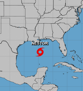
A look at Tropical Storm Nestor.
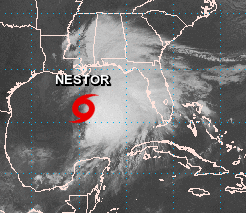
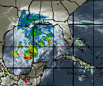
Visible Imagery shows the problems...
...with the forecast track.
Follow the NHC but....
.... beware of any surprises.
Strong weather is far removed from the center.
Complexities of strong #TropicalStorm #Nestor pic.twitter.com/zRZ3Kmn0VK— BobbiStorm (@BobbiStorm) October 18, 2019
Nestor a strong Tropical Storm now.
We now officially have Nestor.
A tropical storm born with 60 MPH winds.
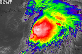
Showing this graphic as it shows the reality.
The center is far to the West of the strong weather.
Low level swirls can often give it up to...
...another center closer to the weather.
So don't obsess on the center of Nestor.

Watching that loop above.
You see the problem.
Everything is pulling East...
...or as we say to the "right"
But the NHC forecast pulls Nestor NE.
Let's see what they say at 5 PM.
And at 11 PM.
But Nestor evolves in real time.
So prepare for the worst...
...hope for the best.
But I hate October surprises...
...in strong October storms.
Remember #weather is fluid. The center could reform under strong convection. #Nestor could intensify towards hurricane force & shear forecasts are difficult. Timing is everything with this storm. https://t.co/vZ3Rogvgxa new blog out shortly. pic.twitter.com/af477Uc4N8— BobbiStorm (@BobbiStorm) October 18, 2019
Via satellite imagery and radar
Nestor's threats are visible to us.
Know when you look at the image below.
The "center" is on the dry edge to the West...
...of the severe weather.
So when you take that center and move it NE..
Much of the severe weather and high tides.
Can and will be way to the East
......of the Center of the Cone.
Check with the NHC for all their various Cones.
An added addition has been flood warnings.
That's good as many don't use the NWS site.
The NWS tends to give less heads up than the NHC
Though of late it's a blurred line.
The truth is in today's world.
It's easier to ask SIRI or Alexa..
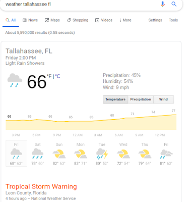
Or just put your city into Google ...
..and you get the Weather Report.
Click on the day you are interested in...
... check winds, rain, temperature.
Click on the link.
Tallahassee, Florida...
Tampa, Florida
Really he always says it the best so leading with this Tweet from a great meteorologists that forecasts for an area that is in the cone for Tropical Storm Nestor. Appearances can be deceiving, remember that when it comes to life or right sided Tropical Storms.
Tropical Storm #Nestor is a very lopsided storm with all the high wind and rain east of the center. The center won't cross our area until early Sunday morning but rain will begin well ahead of it Saturday. #scwx #ncwx pic.twitter.com/UCL1gTUui2— Ed Piotrowski (@EdPiotrowski) October 18, 2019
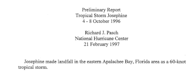
So again I'm going to talk on Josephine, a 60 MPH Tropical Storm, that made landfall with a track that was similar (though not as much offshore as the NHC has forecast for Nestor) that caught a cold front and produced many tornadoes way to the East of the center of the Tropical Storm.
NHC always puts out a great read, post storm analysis.
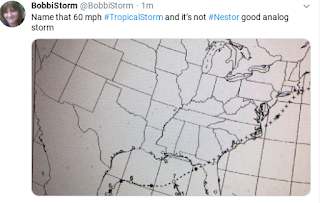
Track below.
Almost the same...
Josephine above.
Nestor below.
So here we are.... Nestor.

Oddly looking like it wants to become a Cane.
Could the "center" jump East or NE?
I've seen it happen before.
It's a storm you watch carefully in real time.
A friend online gets it.... look beyond the cone with Nestor.
If you are at say St. George Island prepare for Nestor.
The center may track over your home...
...recently trashed by Michael.
But this is NOT Michael... it's Nestor.
But the area circled South of the Cone...
may see tornadoes, high winds, power outages.
Travelers on the highway...
Florida Turnpike.
I-4
I-10
I-95 as it moves NE ...
...again the weather moves to the right.
REGARDLESS of where the center goes.
And remember there are swirls within the system.
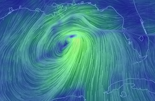
At different levels Nestor looks different.
It's evolving, growing, developing close in.
A recipe for nasty surprises.
Leaving you with this thought.
Could Nestor pull off becoming a Hurricane?
It's possible. I wouldn't rule it out.
Just musing. Not a forecast but thoughts while looping the Dvorak regarding future intensity of #Nestor pic.twitter.com/97fMAA6JBS— BobbiStorm (@BobbiStorm) October 18, 2019
Leaving you with this thought....
Could the center reform or jump?
Here's the center now....
Naked swirl to the West of the weather mass.
What if the center reformed or jumped....
to an area under the convection?
...what if it reformed under this area?
Earlier today....
And now....
Put it in motion below.
October Tropical Storms...
..often have surprises.
What surprise will Nestor give us?
Stay tuned.
I'll update later today at the top.
I'll update again Saturday Night.
Besos BobbiStorm
@bobbistorm on Twitter and Instagram
Ps... I'll add a song down here later after 5 PM...
Labels: History, hurricane, Nestor, Storm, tropical, tropics., weather











0 Comments:
Post a Comment
<< Home