5 PM UPDATE... TD2 FORMS ...FORECAST to be a 105 MPH Hurricane in the Caribbean... What Will be 96L is Right Behind it - 94L Hanging On at 30%
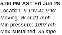
TD 2 Forms

Note NHC has it as a Hurricane on Sunday
Before the Islands.
No watches and warnings yet.
Imagine the 11 PM may add them in...
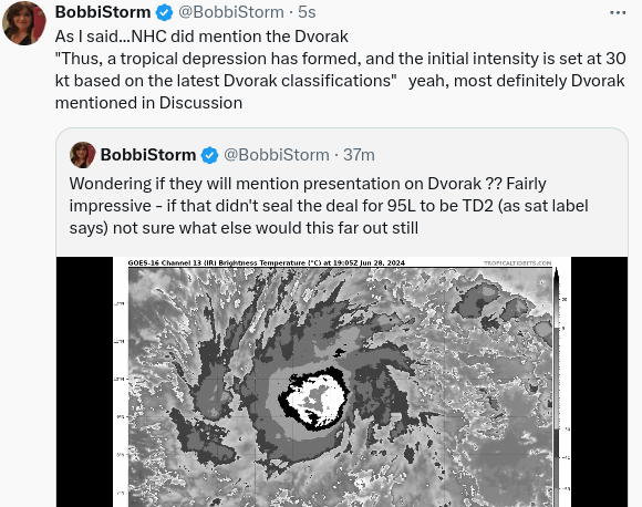
I did think they would use Dvorak.
Why I use it so often to be "sure"
Forecast to be a 105 MPH Hurricane.

It's worth saying that the intensify forecast is probably cautious and on the low side of some of the models that show it as much stronger. Nice and easy usually is the best way to proceed, especially as it's very far out still even tho it is moving West at 21 MPH a good clip for a Tropical Depression.
Wind Probabilities are very wide spread. Important to remember there's a graphic on the site that shows wind probabilities. There are many more products than "the Cone" to help you prepare for this should it move towards your home ....
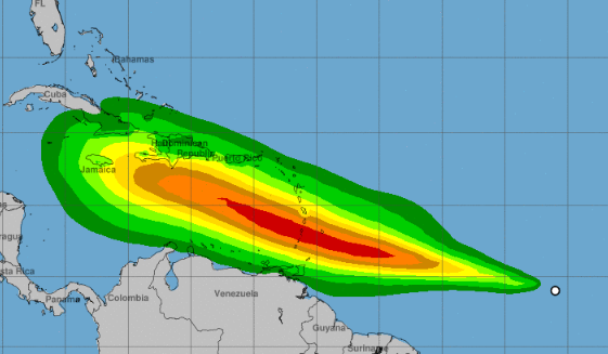
Bottom line is that we are a bit in unchartered territory as there are few hurricanes we can compare this to for this time of year, though there have been many before the time of satellite imagery as history goes way back as far back as the first sailor or settler had a pen and ink to record in their weather journal.
One thing I want to emphasize is that this is the FIRST CONE and often it changes in various ways down the road. A few models intensify this fast and the NHC usually stays conservative in the beginning. And, that's good as there's no reason to scream "SHARK!!" when it's just forming. For the NHC to forecast 105 MPH down the road as it is near Jamaica on the Southern end and Hispaniola and Cuba at the more Northern end says much on how strong it could become should those models verify.

Latest models as of 6 PM Friday
Going off in a while.
I'll update Saturday Evening.
Have a good weekend ...
AND
...check out your Hurricane Supplies.
Let TD 2 Forecast to be a Hurricane ...
..be your wake up call if you were waiting.
Please keep reading...
if you haven't.
Thanks!
Live Blogged all day ......as I knew there'd be an upgrade.
And there was....
*********************
4 PM
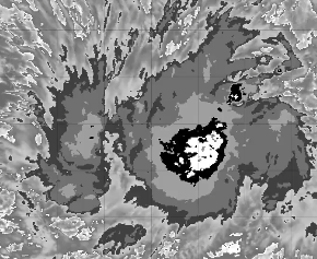
Just this one image tells the story. As much as I love color and ya all know I do... some things are black and white. Just the facts. Small core, strongest in the center... NHC is issuing advisories at 5 PM. I'll update with the Cone... with details, facts and information vs innuendo and rumors. ;)

Li'l dot in the center of the white.
Maybe not really anything.
But they better name this fast...
Waiting for the details...
..watches and warnings for Islands.
*****

Now 100%
Upgrade to TD?

Here's a loop of our system.
I'm a fan but I'll be honest.
It's one problem has been an elongated center.

Not the best signature for a TS or a TD
Maybe they will go with PTC
Most likely TD2
Waiting on NHC to put out a product, hopefully at 5 PM, and in the meantime going to put something up here with the caveat that many online are upset they would put out a "fake cone" as only NHC should make a "cone" and yet everyone knows it's Accuweather. So leaving this here out of mere curiosity as to how close the NHC cone comes to Accuweather's jump the cone make a map with a cone.

Clearly says Accuweather...
oh they called it an
"EYE PATH"
(not sure on that term usage...
..sounds like an eye patch ...)
So we will compare and contrast later.
Stay tuned.......
Is 5 PM later?
Keep reading what was written at 9 AM
* **
9 AM
We knew that last night....
..a yellow X was definitely coming.
Faster than an advisory for 94L
Always fun chatting with the weather crew on Twitter, especially after a long day, so while debating on when NHC would upgrade Invest 95L I made the comment I was more curious if they'd put up a yellow X for the next wave... and by the way there's a huge one behind that as well. This is as if it's late July and prime time for the African Wave Train... in late June. This Hurricane Season definitely seems as if Mother Nature if feeding those tropical waves some sort of energy drink ...because they are definitely over producing for the end of June.
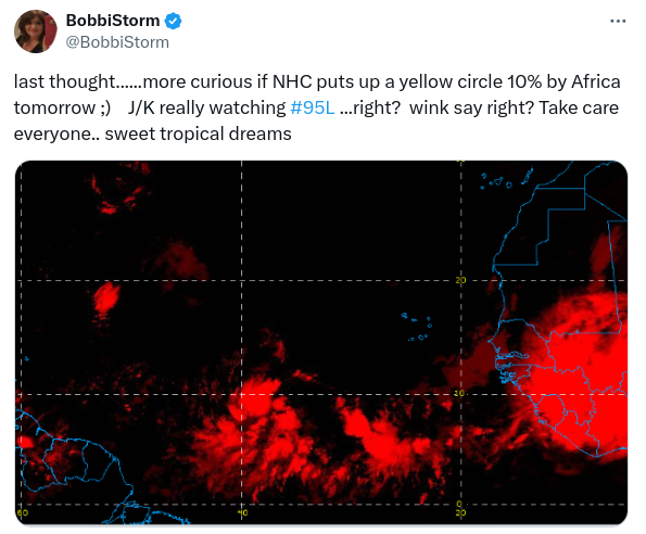
Yes, I was more curious when the NHC would put a yellow X on their main page than if 95L does or doesn't get designation. It's only a matter of time for 95L to be upgraded... but to see confidence in the next wave that models have been aggressive with says a lot.
So in waiting mode this morning to see if NHC is writing good discussion for a 11 AM advisory or if we continue in waiting mode til 5 PM. Whenever it happens it's a done deal for now.

Dense Central Core.
Banding.
Outflow.
Storms exploding.
You dont't need a loop to figure this one out.

First look long range, as I know everyone is with this system, the bottom line really depends on it's Intensity forecast as Intensity will steer this storm. A stronger storm may pull more to the North (WNW to NW then NNW) vs a weaker storm battling negative conditions in the Eastern Caribbean and if that happens it'll keep more to the West as the dark black line in the middle of the models above hints at.
That's basic tropical meteorology. Not much to add other until we see a Cone and Discussion from the NHC.
So let's look at short term.

Mr. Weatherman on YouTube does a great job.
Why do I say "great" you wonder.
He makes short videos that explain much.
He packs a lot into a shorter video than most.
And as time is money for many.
He's a good one to go with ...
...if you don't have a lot of time.
Especially when a system is in the Caribbean.
So he put this graphic up and he said with time he will narrow down the goal lines there, but for now this is the area in the Islands that could be looking at a developing hurricane on approach. Again, how much Beryl pulls to the N or not says a lot. A more WNW NW track takes it over the Greater Antilles and that may put a big road block in it's dreams of making it to the mainland somewhere. A track more to the West to the West to the WNW could put it over warmer water with less mountains in the SW Caribbean and give it more running room to grow.
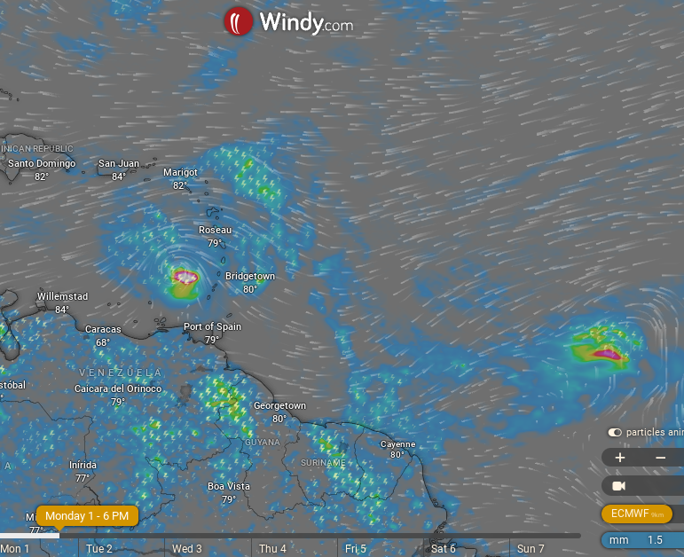
Monday the EURO has it zooming past the Islands.
In the Caribbean and what will be 96L
right behind it.
I'll udpate later today.
Besos BobbiStorm
@bobbistorm on Twitter
Twitter mostly weather
Insta whatever...
posted by BobbiStorm @ 7:00 AM
![]()


0 Comments:
Post a Comment
<< Home