Updated 7: 30 PM August 18th 98L Looks Like a TD To Me. Maybe Tomorrow??? Tropics Busy. Hilary in Pacific May Send Rain Towards Idaho and Canada! In the Atlantic 4 Areas Being Watched... 2 May Get Names.
A very quick update, feeling a bit under the weather today so I've been offline more than normal. We have a bevy of tropical candidates for development in the Atlantic. Each one has something wrong with it. And, following earlier trends this year we most likely will see one of them show new signs of life further down the road once out of the MDR. Isn't it ironic that all the talk this year has been on the HOT water temperatures in the Atlantic in the MDR and yet we can't get anything to spin there so far. Invest 98L will most likely get some designation, at least a bump up to Tropical Depression soon. It has a beautiful structure but lacks convection, further West Invest 99L has the convection but not such a viable circulation.
On the right you'd think that was a named storm....
...it looks good but needs to tighten up.
That' looks like a TD to me.
Small little pimple like bump on the NW
Ironically that's where the little mesovortex was ..
Either way looks like a TD to me.
This is the area I'm watching.
I'm following Hilary but watching closer in to my world.
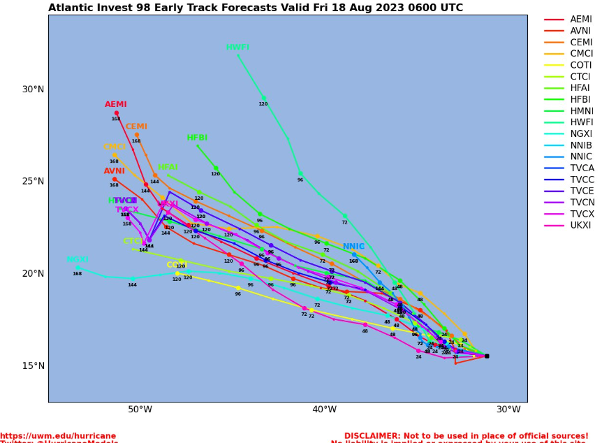
Some models show a hurricane near Florida...
..others show one near the Carolinas.
So far they only appear on models.
I'm not a big believer in models 10 day out, but I do watch them and yet until they begin to come together on a similar solution they are just some interesting "not ready for prime time" suggestions made my models. So far, the Atlantic has been fairly unfriendly to anything developing. I do think it's possible that something close in an pop up whether it's under Cuba from a westbound weak wave that didn't form or from some set up such as this one. Beyond that... I'll be back Saturday Night of Sunday Morning, Hoping I kick this cold or whatever over the weekend. I want to rest, ignore the hype over Hilary tomorrow and yet waiting to see what really happens. I lived in LA long enough (in El Nino Years) when we were supposed to get tropical moisture and all we really got was rain and an odd familiar soupy feel to the air for a half a minute. Hilary is impressive but much can change between now and then.
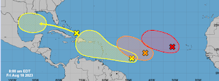
This is the Atlantic.
Lots of candidates but not getting man votes.
* * *
8 AM
While it looks busy in the Atlantic....
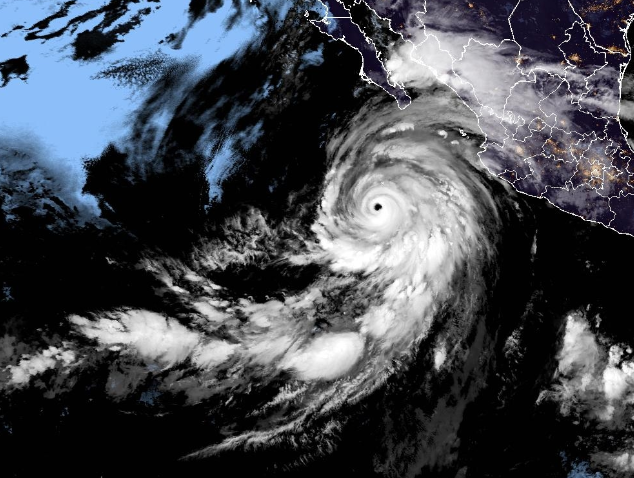
...all the drama is still in the Pacific.
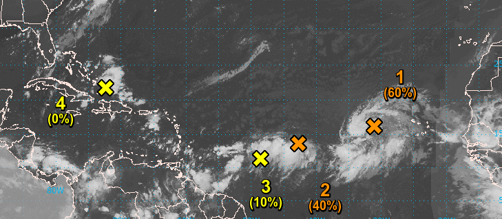
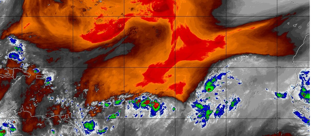
A look at satellite imagery shows that the wave closest to Africa, the large wave with a big of a spin signature and 70% red chances of attaining a name is the most put together looking wave in this clustered set of waves struggling with SAL. A look at SAL below shows you how difficult development has been out there this year.
This is a look at the Mid Levels, and the Mid Levels in the atmosphere have been extremely dry this Hurricane Season so far. Note the immense reddish orange holding down the waves or trying to suppress them. The larger wave is 98L with 70% chances and due to it's size it's stayed alive and taken a bite out of the Mid Level dry air and that's especially important as behind it is a wave coming off of Africa that shows signs of a weak circulation over Africa and as we near September these are the waves we worry on the most. Further West is the elongated convection of 99L. All the way to the West is the area of persistent convection moving into Florida area and South Florida if fairly well soaked this morning after torrential rains yesterday with gusty winds. To be clear those rains are part of the Summer Rain that slams Miami often as showers float in from the Everglades with strong gusty weather stronger than many weak tropical systems.
The Atlantic is colorful but nothing big happening.
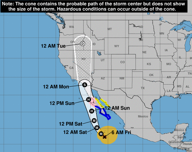
Hurricane Hilary is huge, massive and moist.
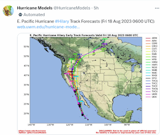
All that moisture will end up far to the North.
A swath from California towards Idaho may get rain.
And rain will be outside that cone.
But you get the idea which way it's going.
One wonders if the rains will help dampen ..
..the Canadian Fires??
Invest 98L stays out at sea for now.
Should get a name.
Back in early August when people were arguing over whether the predictions for a busy season were toast or were going to verify in August as July was slow I said by August 18th we should have something significan't going on and we do. We have a Red Hot Invest (shown above) trying to get designated and more than that we have possible close in drama in the Gulf of Mexico. Some models actually show tropical problems closer to the SE coast in the distant modeling frame. So stay tuned.
While it's not busy with named storms in the Atlantic ...where there is smoke there is fire and one if not two of these systems should get a name down the tropical road.
Stay tuned.
I'll update later today after the next model runs. Especially watching the two areas closest to the US as SAL rules the Atlantic still and often that means storms get named close in to land where it's a more favorable environment for development.
.gif)




0 Comments:
Post a Comment
<< Home