A writer and a tropical muse. A funky Lubavitcher who enjoys watching the weather, hurricanes, listening to music while enjoying life with a sense of humor and trying to make sense of it all!
Monday, August 14, 2023
Models, Loops, Yellow Circles! Ensembles Promise You ANYTHING You WANT to See. Regular Models Not so Bullish. GFS Got Out of the Closet, Fantasizing As Always.
2 waves with 20% and 30% chances in the 7 day.
Whoah...nice to be back. Nice to have my kids in town and grandkids to play with but good to be back to normal again as well. Whatever normal is, my life is generally way quieter than it was when I was raising the kids who became teens. Usually we travel to see them in Florida, but this year several have come up to NC. So.... thanks for your patience while I wasn't around much and let's talk tropical weather. We have 2 yellow circles with long distance possibilities and while they are not developing now...how they may develop over the next 7 days. Again as NHC has changed from the 5 day set up to the 7 day and again that may mean more yellow circles do not develop or are "duds" and that's to be expected and it's part of the learning process as we move towards a desire to warn the public earlier about tropical development. This year is like a Beta Year with regard to the 7 Day, we are live at 7 Day but we may need to fine tune it all some.
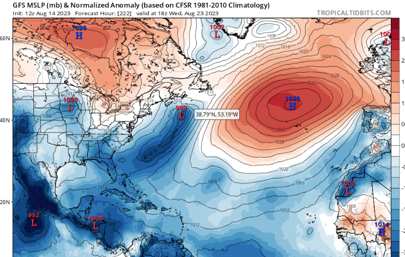
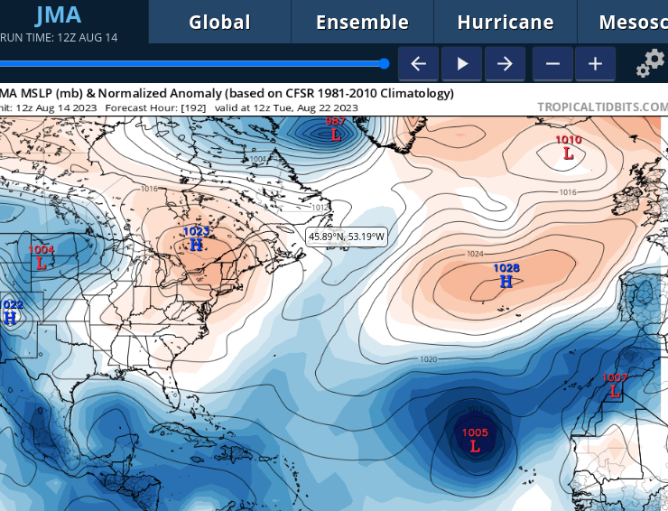
Using the GFS model, let's look at it not for actual development, but how the weather pattern is developing that will impact future development down the tropical road. We see a huge High Pressure (red area with the H in it) that a few days before this image showed it owning the Atlantic. Suddenly, low pressure systems seen as a red L in a sea of blue begin sliding up into the North Atlantic and carving away at the left side of the High until it looks like it does here above. Why is that important? IF a tropical storm developed from one of the tropical waves currently being monitored it would open up a doorway into the Atlantic for them to "swim" away from land and that is why we call those storms FISH storms. A lot of IFS but this is showing you how it could happen.
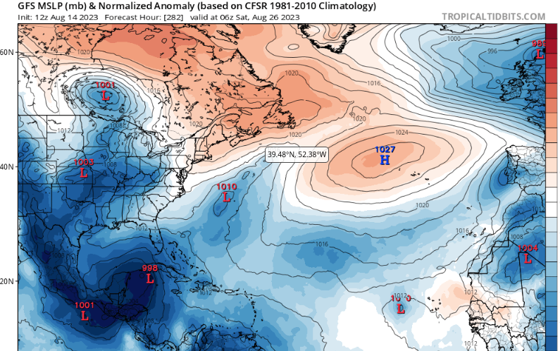
Saturday August 26th we see trouble.
A Low forms in the Carib.
Moisture had been building up there.
We see the L off the NC coast as well.
We see a new Low (wave) crossing the Atlantic.
Note the High is shrinking here....
Note this will change on the next model run...
On the right the High is trying to build back.
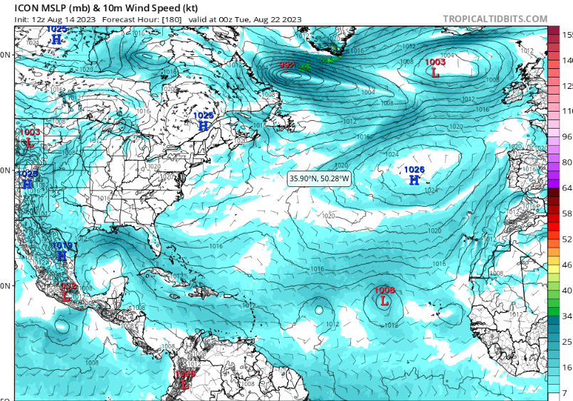
On the left we have GFS trouble.
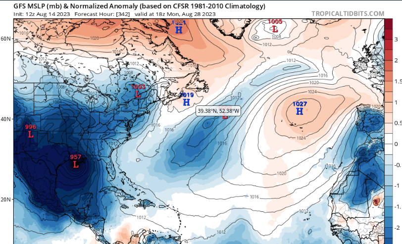
GFS is back to forming fantasy canes.
Actually looks like it's chasing iCyclone....
...vs the other way around.
Heading into Louisiana/Mississippi
Maybe Texas.
That would be a real drought buster.
This would bust the hell out of the Heat Wave.
And that does happen often.
Nothing kills a heat wave faster than a Hurricane.
Or a cold front.
Being August it's usually a Hurricane.
Again next model run of GFS who knows...
I did not show you this for anyone to think this exactly is going to happen I'm showing you how it could happen and more so showing a look at the shape of the High as hurricanes that form in the Atlantic trace the High and yet tropical trouble in the Caribbean heads North towards the Gulf Coast and chases after weak, early cold fronts. I am a bit concerned on the way too quiet Gulf of Mexico, can't stay quiet forever.
8/22
The EURO... King EURO
Shows a high moving wave.
And, shows a congregation of convection in the GOM
8/24 shown below.
Nothing much to talk about.
JMA shows not much in GOM
A huge wave riding High and a small High.
Some rain/storms in the GOM near Yucatan.
Icon shows 2 waves. Really 3.
Lead wave shrivels up.
A kink in the isobars in the GOM.
Nothing really to write about.
I went long as I have been away and some people like to see all the possibilities, but in truth this is all about possibilities. Most are far out, long range possibilities that probably will not happen. What the models do show is while there is a High Pressure in the Atlantic it's shape and very orientation is not so carved in stone. Waves are leaving Africa, but they aren't showing anything stellar to talk about other than they are a bit more viable than the previous waves. Convection (rain/low pressure) begins to congregate in the Gulf of Mexico South of a large High Pressure system that has been owning a good part of the South and MidAtlantic and that actually happens often. Low pressure begins to form to the South of a High Pressure area to the North in late Summer and sometimes, only sometimes, a spin begins and a tropical system develops heading up into the South busting the heat ridge, breaking down the pattern as we move from August into September and meteorologial Fall.
Ensemble runs will show you anything you want. They are like an advertisement for a Candy Store. Do you like chocolate? We have chocolate! Do you like gumdrops? Oh we have every flavor you want. Do you like licorice? We got licorice also!! You want a Fish Storm we have one of those, you want a Florida hurricane going up towards the Carolinas....we got that!! You want a hurricane in the Gulf of Mexico, YES we can find you one of those too. Tell me what you want...it's almost late August we can find you whatever hurricane you want or are terrified will happen. Tell me what you really, really want we can find it for you!
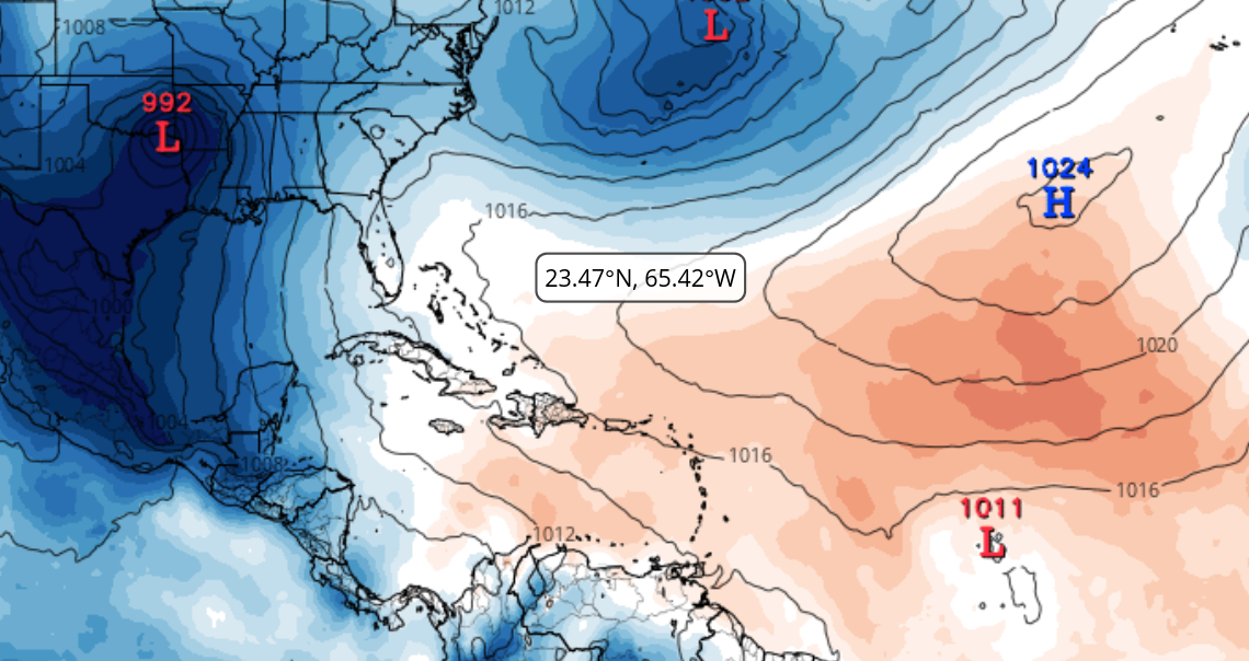
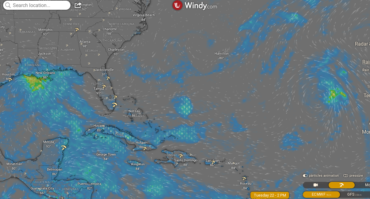
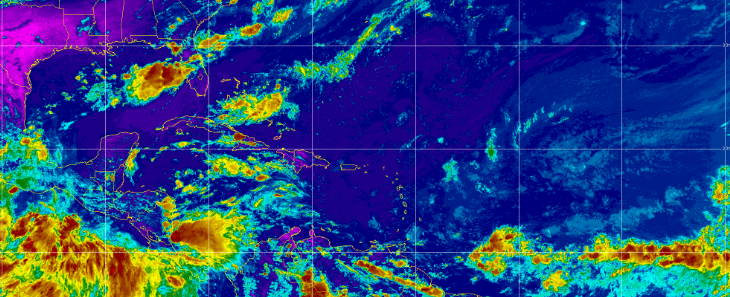
And when you look at a satellite image you see nothing.
EPAC busy.
ITCZ busy but no spin!
Some convection in the GOM.
High Pressure to the N of the ITCZ.
Pretty pink purple in the top left.
Dry air. Hot heat wave.
ITCZ with no spin in the bottom right.
Dark blue to the N = High Pressure.
Convection near FL in the summer.
Nothing spinning.
Nothing spinning.
Just hot weather and summer storms.
Nothing more.
So remember while watching online how some ensemble model shows storms forming everywhere, hurricanes happening hitting several places and the GFS suddenly escaped from the closet it was locked into showing a hurricane in the Gulf of Mexico once again.
Hurricane Season 2023 in the Atlantic just has not flipped the switch yet. Progress has been made, bit by bit, waves are stronger and we move towards CLIMO and September. If nothing forms that's huge or scary by September 10th we really have to wonder what is going on in the Tropical Atlantic. Til then we are waiting on Mother Nature to flip that switch, ring that bell and start her predicted parade of tropical systems that many have insisted will happen this year. I'm skeptical, more a show me the center of a tropical system not a model forecast as models have been off more often than not so far this hurricane season.
I'll update tomorrow. We will see if the GFS Fantasy Cane stays wth the Gulf Coast or heads towards Florida. Will the EURO show real development? Are we serving anything but Fish for the rest of August? Time will tell and that's the dirty truth.... truth is not always pretty and packaged with bright bows promising you everything you want ....the truth can be strange, weird, odd and surprising sometimes.
Personally when the wave train is wanting, and it is as the waves always look awesome over East Africa and not so awesome as they leave Africa towards the Atlantic... I look to close in systems that either develop from a Low pressure system that with a bit of spin that wanders over hot water or a lackluster wave that couldn't pull it together until it passed the Islands and looks suddenly worth painting yellow off the Florida coast or in the Gulf of Mexico.
Location: Miami, Raleigh, Crown Heights, Florida, United States
Weather Historian. Studied meteorology and geography at FIU. Been quoted in Wall Street Journal, Washington Post & everywhere else... Lecturer, stormchaser, writer, dancer. If it's tropical it's topical ... covering the weather & musing on life. Follow me on Twitter @ https://twitter.com/#!/BobbiStorm


0 Comments:
Post a Comment
<< Home