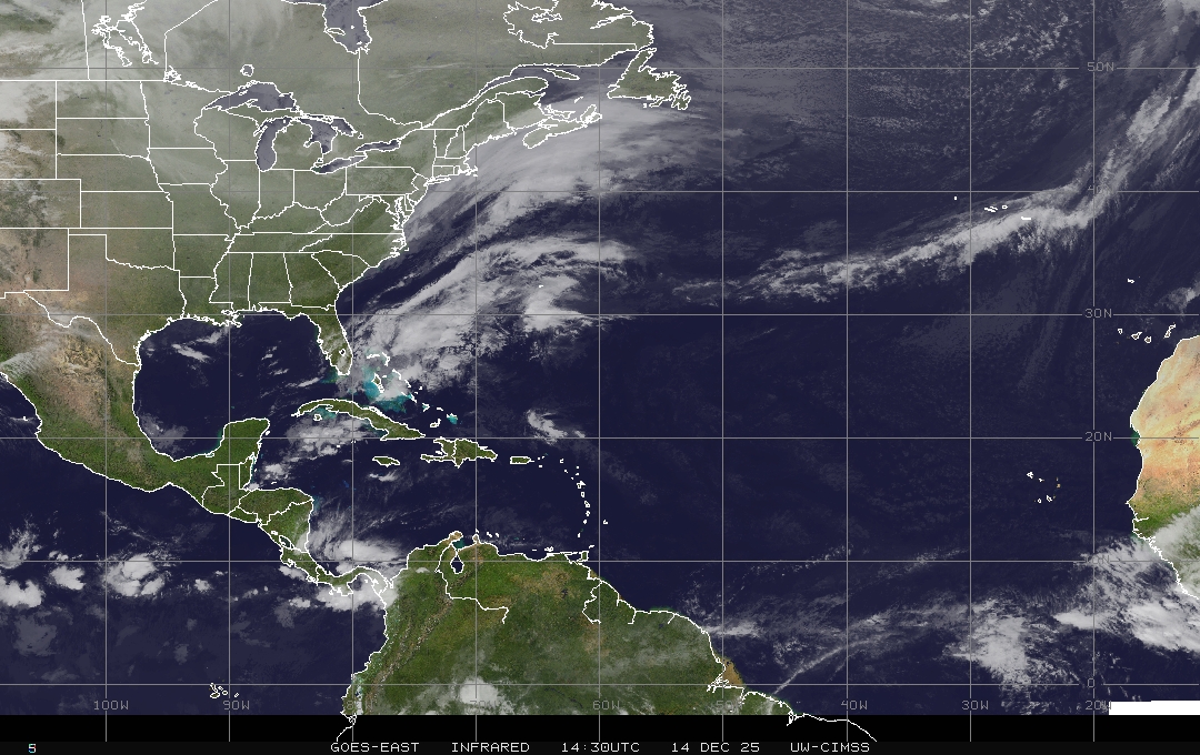
Carib Blob, Off E Coast Blob + 2 African Waves - Tropics Busy But Nothing Named or Dangerous, Just Possibilities.

This is Day 2 with the sat image from NHC
Note my Caribbean blob has a yellow circle.
Our waves now consolidated in the Atlantic.
A rogue system pops up off the East Coast.

2 red areas are 80% and 90%
I'd say we have a 100% chance of something forming.
Add in the 2 yellow "POP UP" areas.
If you go back to Friday you'll see I've mentioned that.
Even back on Thursday I said things "pop up" this time of year.
We now have invest #93L coming off the coast of Africa. 93L is fairly organized with a pretty well defined MLC and broad surface low. We will likely have a tropical depression in the next 48 hours or sooner. The environment is favorable for development. pic.twitter.com/a4nV0E0SP0— Railey Kelly (@NightriderFL) September 6, 2020
So as I know you want to know about Africa.
We have Invest 93L
Models below from Spaghetti Models.

Take those models with lots of sea salt..
As for the once there was 3 now there are 2..
We love to talk about Fujiwara but in truth it's more like a lightweight fight between contenders and one wins as it steals the energy from other, consolidates it (that takes time) and tries to evolve into a new, better version of itself and then it moves on. The problem with models is that they don't do well with 2 or 3 systems close together that are actually barely moving when the environment is in a mess and so that leaves us with waiting on the next model run and for the NHC to upgrade a system based on it having a TRUE CENTER and when that data is run into the models (the exact center degree vs a guesstimate) than we have better data in and better data out and a more reliable model. It's possible the new starting point may be lower than previously thought so while it may climb, the exact degree and track extrapolated over time may make a big difference. The new wave coming off of Africa, seen above, looks like a winner and a swimmer but a word of caution as many have looked good and fizzled once out in the water.
The truth is the enivornment today is different from last week and will be different from next week. Our atmosphere is currently clicking into gear for September and October vs summer systems when cold fronts are just dreams and the High is locked into place. At some point the High will lock up again but it occasionally has pathways out of a westbound track BUT the system has to be at the bus stop when the bus is leaving or it's going to need to start hitchhiking to get where it's supposed to go.
Tropical Weather this time of year is NOT WAZE and there are no guarantees with slow moving waves and pop up systems that no model saw coming but many of us felt the pattern would produce.
Take the Caribbean blob. I talked about something forming there days ago yet no model showed it. And off thee East Coat of America we now have an area that may or may not move West towards the East Coast and play a game of chicken with a cold front moving East so it's all about who gets there first and who wins.
Here's a good example about why models are not to be believed in unless you just want to root for your favorite. Two models down the road, note one sees a big hurricane and the other sees nothing. Now I can see if they both saw something of differing intensity and latitude but no one sees a wild storm and the other can't find it's glasses.

Next Monday.
Does the EURO get your attention?
Where did it go when looking at the GFS?
Note they both show the front.
GFS a kind of weak ghostlike pulse of a system.

EURO shows several formed lows.
GFS says no not really ... kind of..
Closer in regarding that pop up area.
The 3 day NAM shows it.

There's something there...
...what isn't exactly clear.
Because for all the Xs and Ox...
..there's not much organized out there.
So my advice is...while it's slow.
Have fun, enjoy.
Check back tomorrow!
Sweet Tropical Dreams,
Besos BobbiStorm
@bobbistorm on Twitter and Instagram
Ps.... a song for September 6th....
posted by BobbiStorm @ 7:26 AM
![]()


0 Comments:
Post a Comment
<< Home