Updated 2 PM INVEST 99L 80% Chance of Stealing the NANA Name from the Area Off the SE Coast....70% Red Off SE Coast. 3 Waves ....4 Areas to Watch on a Quiet Weekend.

You can see a bit of a spin in both areas now RED

Here's a link to the site below.
Mike links to on it SpaghettiModels.
They are great.

Old graphics, it's as if no one can keep up with it today as it's being studied for development.`If it develops sooner rather than later it will get the NANA name not the system off the SE coast that actually is doing it's thing as expected. The big question many have here is does it continue West towards the Pacific or lift just enough to get into the Gulf of Mexico. Long ways out now as it just began it's official trek this morning.
So much for a quiet day and a quiet week. That's why I don't listen to "talk" and pay attention to "click bait" promising you all sorts of things. Models show interes often when something develops and sometimes models can predict development; it's a science we are getting beter at it but it's not perfect. So NHC upped the chances at 2P to pretty much "stand by for upgrade" if you know what I mean.

So something changed.
A bit earlier than expected too.
NHC upped the ante on Invest 99L
Oh and we now have 99L

Actually low, closer to South America than looks.

Currently in low shear area...
..if it can slip South of the stronger shear.

Early models.

***
FROM 8 AM before new Invest.
And upgraded yellow to orange shown above.

Graphic of the day.
70% over the next 5 days off the E Coast.
Slides along the coast and out to sea.
How close to the coast?
We'll see.

A bit of low pressure and a frontal boundary.
Gets you red on the NHC main page.
If it gets very close to the coast..
...I may go to the beach to see.
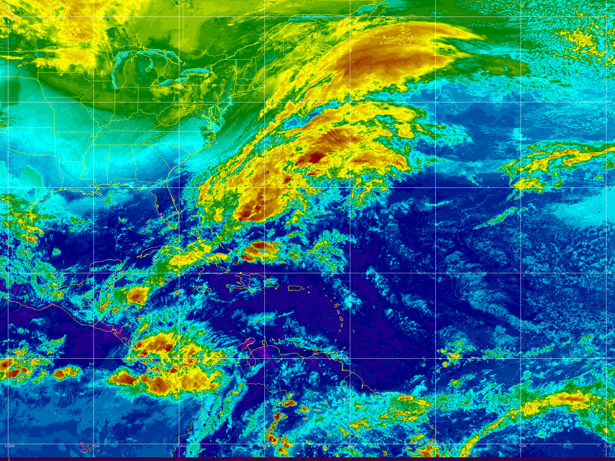
You can see the area along the East Coast.
Westbound waves.
What you don't see well here is SAL.
But you see it on the satellite image below.

You can see the waves tucked neatly below the SAL
Riding westbound under the High Pressure.
Even in black and white it shows up well.

Shows up very well above.
What's up with that?
Happens sometimes.
Squahes the wave production a bit time wise.
But past the surge line they flare up.

In motion you see the wave train.
And the lead wave flaring up.
And the area off the SE Coast.
See SAL squashing early actually is not great for our side of the world, as waves that come off spinning and have a chance to develop fast and lift for in latitude early on become fish storms moving over the open Atlantic. Yes, some storms come off spinning. I was talking tropics to my son the other night and told him to Google Hurricane Donna responsible for a plane crash before it even left the Cape Verde Islands (they were called that then) yet when dust deprives us of Fish Storms, we often end up with them in the Caribbean the way Camille formed later rather than sooner or Laura as well as East Coast Iconic hurricanes with names that are retired. So the SAL comes under the category of "that which doesn't kill us only makes us stronger" so keep preparing those hurricane kits.
NHC gives the lead wave low chances.
They aren't impressed.
People in the Caribbean are watching it.

I'm watching it too!
Good Carib site to follow.
Deep in data on the Caribbean.

Live reports from the Carib
And as always www.spaghettimodels.com
Lots of links, loops and zero carbs.
As for Laura
I'm not going to go long on Laura, the reality of what happened is obvious and there are images all over the web. There's some incredible imagery and information on the link below.

Everything from images as the one above.
And before and after as seen below.

Undersatnd you don't need a strong Cat 4..
..to do that along the coast in a hurricane.
Any Major Hurricane will wipe a beach town away.
A storm surge is unrelenting.
It's the sea trying to reclaim the land.
Power of storm surge in Cameron, LA.
Just a small fraction of the herculean recovery effort that is descending upon the Lake Charles area pic.twitter.com/I4BsiU33xt— Mark Sudduth (@hurricanetrack) August 30, 2020
As for Lake Charles built inland...
...it's all about the power now.
Currently down that way it's all about the power..
First comes power needed for clean up...
...and trying to get back to some sense of normal.
I'll be back later toady.
I'll put up some models...
..for now have a good weekend.
Enjoy it as who knows what will show up Labor Day.
Maybe nothing but don't waste a good day waiting.
Besos BobbiStorm
@bobbistorm on Twitter and Instagram.
Ps the song that comes to mind today.
posted by BobbiStorm @ 5:59 AM
![]()


0 Comments:
Post a Comment
<< Home