Thoughts on what 30% Means in the Tropics Tonight
A few quick notes while watching the HEAT play badly...sadly........on the system in the tropics.
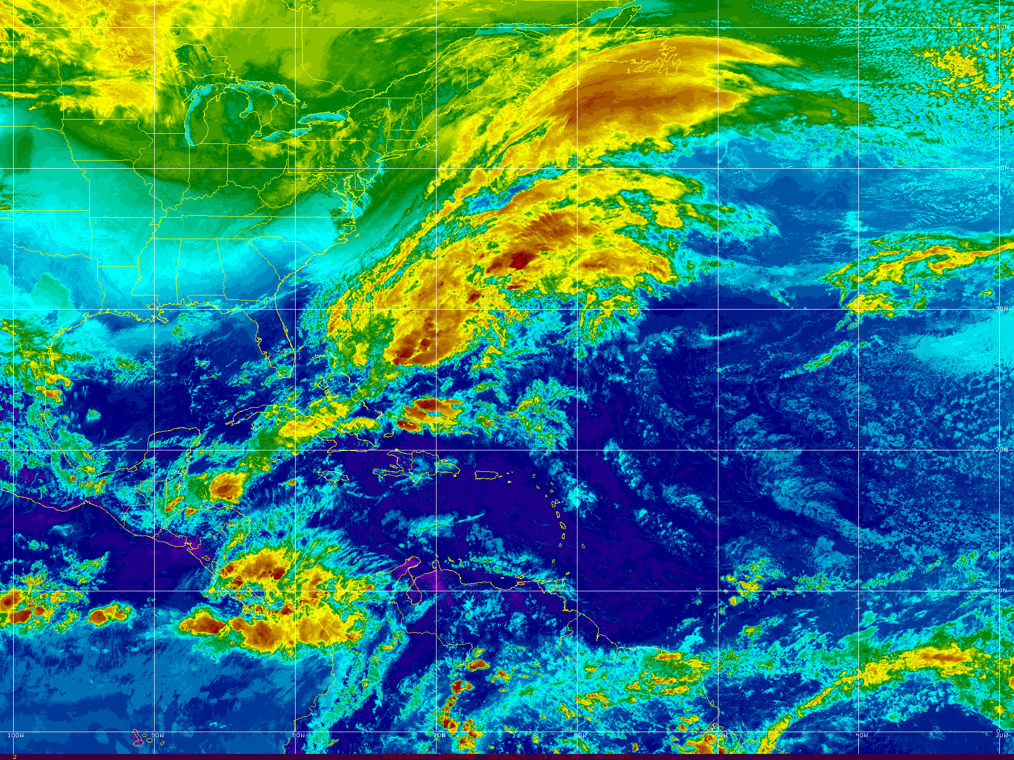
The satellite image above makes everything look wild.. in truth it shows you where the moisture is and yet it doesn't show you where the circulation is or is not. So far..the circulation is at mid-levels and not yet a real "system" but we are watching it as the NHC has given it a 30 chance of developing into a system.
http://www.ssd.noaa.gov/goes/east/tatl/flash-wv.html
The WV loop doesn't really favor significant development right now. The hot dome of hot air that is plaguing Texas is most likely going to keep any system away from Texas. Lows go to Lows on their most basic simplistic levels...they do not go towards hot dry air, they avoid it like the plague. There is an area I am still watching off the coast of FL and the next frontal boundary will deposit another area worth watching. Perhaps in a week or two...........there will be something to write about there. For now, no fronts are dipping down into the Gulf lifting storms north. It looks like it is moving north on some loops, those are the high clouds being pulled and tugged and played with in a power play between the upper level low and the system itself. It looks more organized than it is.................or it's a lot more organized than anyone gives it credit. What center it has is currently straddling land and sea and somewhere in between.
The MJO will be in the region in the next few weeks and the tropics should come alive in July due to that factor. Let me say this about the MJO .I like using it as a factor in evaluating chances of tropical development. It's one of the more reliable pieces of information and anyone who doesn't want to believe that is mostly holding on to an old school mentality and afraid to move forward with new prediction tools. It's currently not in our favor for development currently though that is forecast to change in July.
So what is in our favor? Persistence.
Persistence in the tropics of convection favors development. After a while pressures can and will drop and development chances go up. A flash in the pan of color gets no real respect from anyone in the meteorological world.
Position de 93L à 0h TU: 15.4N 84.8W, soit 430km ESE de Belize City, vents maxi 33km/h, déplacement WNW 300° à 19km/h, pression 1009mb
I think that says it all in any language. Invest..or unofficial invest 93L is at 15.4N and 84.8W... 1009mb.
http://www.ssd.noaa.gov/goes/east/carb/flash-ft.html (a good loop to loop... pin the head on the center of the system)
The Canadian Model does some sort of quasi fujiwara dance in the Pacific... click on this link and hit forward.
http://moe.met.fsu.edu/cgi-bin/cmctc2.cgi?time=2013061612&field=Sea+Level+Pressure&hour=Animation
Odd...
![[JavaScript Image Player]](http://moe.met.fsu.edu/tcgengifs/cmc/2013061612/slp23.png)
Most of the convection... tropical energy in the tropics is currently wrapped around this system and it's associated elongated trough.

Keep watching... trust me this wave has better chances of developing than the HEAT does for winning this game.
Sweet Tropical Dreams
BobbiStorm
posted by BobbiStorm @ 7:41 PM
![]()


0 Comments:
Post a Comment
<< Home