TD 2 Makes Gulf Fall... Will Watches Be Posted for Veracruz ... & ...watching the wave in the Atlantic.
Where do your eyes go in this satellite image?

A surge of moisture has invaded the dry lands of the tropics north of 20 at the entrance to the Caribbean and the assorted islands we so love to travel to on vacation.Interesting set up... it also surges westward in the Bay of Campeche where TD 2 will most likely come back to life and possibly... small sliver of a chance he becomes Barry .... before making landfall way south of the Tex-Mex line in Mexico around Veracruz. Sometimes I wonder if I lived there in a previous life time.. sometimes I wonder on a lot of things :) Don't you ever wonder on stuff like that? Anyway... it seems to be Veracruz or bust here, unless things change and things do sometimes change in the tropics.
"TUXPAN MX 34 X 1( 1) 2( 3) 2( 5) X( 5) X( 5) X( 5)
VERACRUZ MX    34  X   9( 9)  12(21)   3(24)   X(24)   X(24)   X(24)
VERACRUZ MX    50  X   X( X)   4( 4)   1( 5)   X( 5)   X( 5)   X( 5)

FRONTERA MX    34  5   1( 6)   X( 6)   X( 6)   X( 6)   X( 6)   X( 6)

$$
FORECASTER AVILA "
![[Image of 5-day forecast and coastal areas under a warning or a watch]](http://www.nhc.noaa.gov/storm_graphics/AT02/refresh/AL0213W5_NL_sm2+gif/203441W5_NL_sm.gif)
Currently shows it staying a Tropical Depression... time will tell on that one. Models are in fairly good agreement:
RED marks the spot here:

And the flow... across the Caribbean and the Gulf of Mexico as well as the Atlantic.

I know I am expected to write a nice little story about TD 2, but it's hard for me not to watch the wave in the Atlantic being tickled by the Upper Level Low to the north causing it to flare up and show some life. The models are ignoring it.

Discussion out of NWS Miami shows the wave giving Miami higher than average chances for higher than average rainfall over the weekend.
LONG TERM (FRIDAY-TUESDAY)...
MODELS REMAIN PERSISTENT FROM RUN TO RUN AND CONTINUE TO INDICATE A
TROPICAL WAVE APPROACHING AND MOVING THROUGH THE AREA OVER THE
WEEKEND. MODEL PWS ASSOCIATED WITH THIS WAVE ARE FORECAST TO NEAR
THE 2" MARK BY SUNDAY...WHICH SHOULD TRANSLATE TO HIGHER RAIN
CHANCES.
Miami is always a priority for me. Where this wave goes...other waves will begin to follow.
Avila uses the "I" word more than any other forecaster. Just by reading it you know he wrote it.
NHC Discussion earlier this afternoon:
"TROPICAL DEPRESSION TWO DISCUSSION NUMBER   6
NWS NATIONAL HURRICANE CENTER MIAMI FL       AL022013
400 PM CDT TUE JUN 18 2013

A FEW HOURS AGO I WAS TEMPTED TO DECLARE THE DEPRESSION A REMNANT
LOW. HOWEVER...CURRENT VISIBLE SATELLITE IMAGERY AND SURFACE DATA
FROM MEXICO STILL SHOWS A LARGE CIRCULATION WITH ENOUGH DEEP
CONVECTION TO MAINTAIN THE STATUS AS A TROPICAL DEPRESSION AT THIS
TIME. THE NORTHERN PORTION OF THE CIRCULATION IS ALREADY OVER THE
SOUTHERN BAY OF CAMPECHE WHERE SOME CONVECTIVE BANDS ARE
REDEVELOPING. ASSUMING THAT THE DEPRESSION MAINTAINS OR IMPROVES ITS
CURRENT STRUCTURE...TROPICAL STORM WATCHES OR WARNINGS FOR A
PORTION OF THE MEXICAN COAST WOULD BE REQUIRED THIS EVENING."
So...here are some bits and pieces like lyrics from your favorite song of a long gone wrong song lol.
"...TROPICAL WAVES...
TROPICAL WAVE IS ALONG 13N26W TO 6N25W MOVING WEST AT 15-20 KT.
THE WAVE LIES ON THE WESTERN SIDE OF A SURGE IN DEEP LAYER
MOISTURE EVIDENT IN TOTAL PRECIPITABLE WATER IMAGERY. THERE IS
ALSO A CLEARING IN THE LARGE AREA OF SAHARAN DUST THAT SPREADS
ACROSS THE TROPICAL ATLC. DUE TO THE PRESENCE OF THE
DUST...CONVECTION IS LIMITED TO THE MONSOON TROUGH/ITCZ
REGION...AND IS SPARSE THERE AS WELL.

TROPICAL WAVE EXTENDS FROM 15N68W TO 8N68W MOVING W NEAR 20 KT.
THE WAVE COINCIDES WITH A SURGE OF DEEP LAYER MOISTURE PRESENT
IN TOTAL PRECIPITABLE WATER IMAGERY. AN UPPER LEVEL TROUGH TO
THE EAST OF THE WAVE AND THE LESSER ANTILLES IS ALSO ADVECTING
MOISTURE NORTHWARD CAUSING A LARGE AREA OF MOISTURE TO BE
PRESENT EAST OF THE WAVE AXIS. SCATTERED MODERATE CONVECTION IS
FROM 12N-14N BETWEEN 61W-66W. CONVECTION CONTINUE TO THE
EAST...BUT IS MORE LIKELY CONNECTED TO THE UPPER TROUGH AND WILL
BE DISCUSSED IN THE ATLC SECTION. "
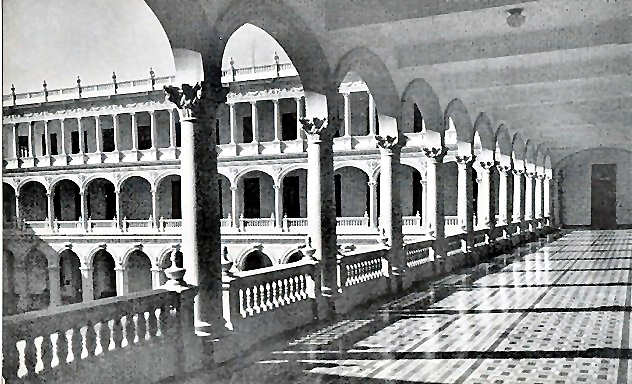
Here are some more thoughts from the powers that be..."ATLANTIC OCEAN... A BROAD RIDGE COVERS MUCH OF THE ATLC BASIN EXTENDING FROM A 1033 MB AZORES HIGH. DRY AIR ALOFT AROUND THE WEST SIDE OF AN UPPER LOW NEAR 23N65W IS PROVIDING FAIR CONDITIONS OVER THE FAR WEST ATLC. THE UPPER LOW IS ADVECTING MOISTURE AROUND THE EAST SIDE EXTENDING FROM THE FAR EASTERN CARIBBEAN. SCATTERED SHOWERS/THUNDERSTORMS ARE NOTED EAST OF THE LESSER ANTILLES FROM 11N-19N BETWEEN 55W-61W. FARTHER EAST...AN UPPER LEVEL RIDGE IS ALONG 52W...WHILE ANOTHER UPPER LOW IS CENTERED NEAR 28N42W. THE UPPER LOW SUPPORTS A BROAD SURFACE TROUGH ALONG 32N44W TO 27N41W. NO SHOWERS ARE ASSOCIATED WITH THE TROUGH. BROAD UPPER RIDGING DOMINATES THE TROPICAL ATLC...WHILE A THIRD WEAK UPPER LOW IS OVER THE EASTERN ATLC NEAR 25N23W. A SAHARAN AIR LAYER CONTINUES TO BE PRESENT OVER MUCH OF THE TROPICAL ATLC...EXCEPT NEAR THE TROPICAL WAVE...EXTENDING TO NEAR 55W."I'll be watching this area as it interests me more than your typical June too soon Bay of Campeche possible upgrade just prior to making landfall at or around Veracruz.Keep watching and place your bets on what you think will happen and when with this tenacious depression that confounded even the likes of Avila at the NHC...Besos Bobbihttp://en.wikipedia.org/wiki/Veracruz,_VeracruzLooks a lot like Havana if you ask me..see...Belen School Havana 1950s below:or Miami or Key Biscayne...


posted by BobbiStorm @ 6:29 PM
![]()


2 Comments:
I am from Veracruz and I wanna say thank you for posting pictures of my homeland and for saying such beautiful things about my beloved city-port, invaded in 1914 by the US Navy by the way, the celebrations and remembrances were just last Monday the 21st.
Glad you enjoyed it Manny and thank you for bringing that bit of history to my attention.
Post a Comment
<< Home