Hurricane Sandy at 11 PM & Concerns on Coverage of Sandy & Mayor Bloomberg in FantasyLand

A lot to discuss here tonight. First off the new information from the 11 PM Advisory

Again...note this is almost not worth posting as her weather is 450 miles to the north of this location.
She has stronger winds far to the West. In fact the recon suffered extreme turbulence on her W Side.
SUMMARY OF 1100 PM EDT...0300 UTC...INFORMATION
-----------------------------------------------
LOCATION...30.9N 74.3W
ABOUT 360 MI...580 KM ESE OF CHARLESTON SOUTH CAROLINA
ABOUT 305 MI...490 KM SSE OF CAPE HATTERAS NORTH CAROLINA
MAXIMUM SUSTAINED WINDS...75 MPH...120 KM/H
PRESENT MOVEMENT...NE OR 40 DEGREES AT 14 MPH...22 KM/H
MINIMUM CENTRAL PRESSURE...960 MB...28.35 INCHES
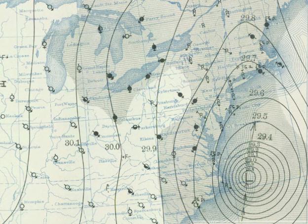
The Canadian Weather Center track is a bit further to the South..worth mentioning.

I really love their way of presenting the information.
Note the global view and note Sandy is pulling in moisture from the entire Atlantic Ocean.

That is one massive feed of tropical moisture...
(great satellite links you don't see usually)
There is a massive problem with regard to the way the public perceives this storm..
It is a storm within a storm and both parts have equally strong weather and problems.
Here is the storm tonight at 11 PM

As it is explained by meteorologists...
The East Coast of NC and the Outer Banks are now getting tropical storm force weather, but it's from the Noreaster part of the storm.. not the Hurricane part.
I'll break it down..

The wind flowing around the top of Sandy on the NE side is the part going hybrid

This is the CORE of Hurricane Sandy
How confusing can you get guys?
I suggest we start discussing the whole mass of Sandy as WEATHER and where the weather is vs "landfall of Core" "noreaster part" "center of the storm" "landfall will be at" because by the time this storm makes landfall somewhere, power may be out in that region, trees will be down .. they are falling currently in Dare County and other places in NC 400 miles to the NNE of the center of Sandy.
Kudos to TWC who changed their map to:

I'm in the Orange and let me tell you.. it's really, really windy.. almost howling outside here..
And the "this never happened before" hype has to stop unless you are trying to convey panic????
Do not believe that this has never happened, it sounds exciting but leads you to think "Okay, it won't really play out... something will happen and it won't happen now"
This is important to remember.
A great site is http://www.hurricaneville.com/historic.html
A sample of the list of storms is below. I have highlighted things that I want you to read in red:
- Start reading... remember history repeats.
- If it happened before ..it will happen again.....
- George Washington's Hurricane of 1788--This hurricane, which began its drive toward landfall after nearing Bermuda on July 19th, proceeded on a west-northwest course into the Outer Banks of North Carolina, and then into Virginia. The Chesapeake Bay region absorbed the worst that the storm had to offer. Most notably though, this storm is remembered for the way it was described by the father of the United States, and first president, George Washington. By the time the storm reached Washington's home in Mount Vernon, it was likely to have been a moderate tropical storm with winds about 50 mph.
- Hurricanes of 1795--Two hurricanes assaulted Virginia in August 1795, and destroyed the crops of another hero of the American Revolution, Thomas Jefferson. The two storms, which were ten days apart, caused the Appomattox River to crest more than 12 feet above flood stage at the city of Petersburg, which was the highest level reached in 70 years. Jefferson, who kept a perfect record of regular weather observations for 40 years between 1776 and 1816, recorded the devastation that the two storms left behind, especially the heavy losses that he suffered at his plantation, the famous Monticello.
- Great Coastal Hurricane of 1806--The first major hurricane of the 19th Century made landfall south of the city of Wilmington on the southern shores of North Carolina on August 21st, and then proceeded on a gradual northeasterly drift for about 250 miles over the subsequent 36 hours. Constant gale force winds produced tremendous beach erosion, and "firmly established" the sandbar of Willoughby Spit at the mouth of the Chesapeake Bay near Norfolk. It was also responsible for the loss of the ship, Rose-in-Bloom, which founded near Barnegat, New Jersey.
- Great September Gale of 1815--Was the last hurricane to strike New England before the Long Island Express of 1938. The storm struck on September 23, 1815, and brought an 11 foot storm surge to Providence, which was the highest storm surge in the Rhode Island captial prior to the Great Hurricane of 1938, which had a 17.6 foot storm surge. This storm was the first hurricane to strike New England in exactly 180 years.
- Cape May Hurricane of 1821--The last major hurricane to make a direct landfall in the Garden State of New Jersey. This storm, which was a Category Four Hurricane, struck Cape May, New Jersey on September 3, 1821, and had hurricane force winds go as far west as Philadelphia while folks in New Jersey experienced wind gusts of up to 200 mph. The storm cut a path of destruction that is similar to that of the Garden State Parkway. More detailed information on this hurricane is at Greg Hoffman's Real Lousy Weather Page.
- The Hurricane of 1846--Referred to as "The Great", used its northeast quadrant that caused havoc on the Delaware all the way up to Camden, New Jersey. This storm revealed the fact that Delaware Bay is open to southeast winds in the right quadrant, and water in the Bay would go upriver into cities such as Wilmington, Philadelphia, and Camden.
- Keep reading the list...
A link for Long Island Hurricanes if found on Hurricane City

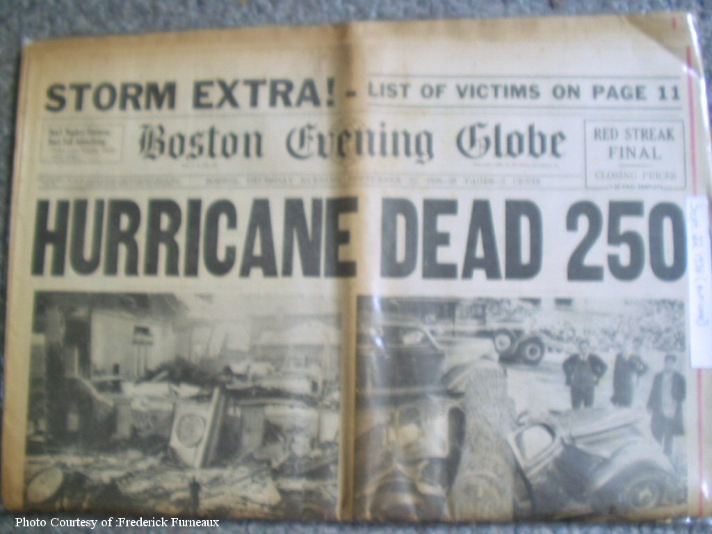
one of many old newspapers Jim Williams shown in the above link..
Mayor Bloomberg may want to rethink his policies regarding evacuations for Sandy
Just saying...
Frederick Furneaux has a massive collection and is a true hurricane history expert
he posts often on www.canetalk.com
A big confused on how Mayor Bloomberg insists the garbage collectors will be out
as it's really not safe to put out garbage...
we can only hope he gets with the plan here
1938 Hurricane
Look familiar???
1938 Storm...NOT Sandy
I do not know what world or information Mayor Bloomberg is privy to but... this system is so large and if it does come in to the south of NYC winds will blow, storm surge will flow and it's a mess any way you cut it. He wants everyone to know he is going to collect garbage during the storm. Okay... I hope he personally collects it using his trucks that his name on them...
No evacuations "based on the nature of this storm" and he needs to talk to the meteorologists who believe the south shore of Long Island may have 20 feet of a storm surge and that water WILL go up the East River and it's a new moon and high tides... maybe he is right. I think he is erring on the side of wishcasting and hoping for the best...etc...
Really... strange comment to make... maybe he's in touch with Miss Cleo???
More later...
Bobbi
Ps NEVER UNDERESTIMATE THIS STORM...
(the storm is far to the north of Miami... but they are still having problems)
Death Toll 58 and Climbing...
This storm could last for days............ maybe... not sure...
One thing you can be sure of is to prepare and listen to the NHC and your local NWS.
posted by BobbiStorm @ 8:11 PM
![]()


0 Comments:
Post a Comment
<< Home