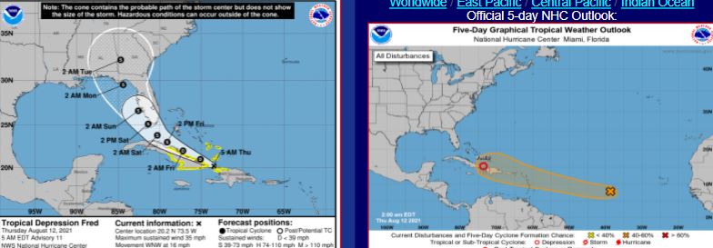
TD Fred, Crawling Along the Bahama Channel Along the North Coast of Cuba. Grace May Form from 95L & Trace It's Track in the Short Term. Long Term Could Have Great Dance Steps...
This is the main point we need to remember.
Where Fred goes, Grace may follow.
If 95L becomes Grace. as expected.
Hard to follow one without the other.
It's beastly hot in the Carolinas today.
Actually across a good part of the South.
High Pressure has dropped anchor.
Fred & "maybe" Grace tracing the border.
All the real weather is up near the Great Lakes.
Storms way bigger than anything Fred has got.
Grace is a question mark for now.

NWS Tallahassee region ....they will get weather.
Weather is the main impact here.
Save this link:
Read that discussion above it's incredibly written and tells the story best.
As always follow the NWS Key West and NWS Miami for excellent RELEVANT info.

Best discussion I read anywhere today.
And they are the place to be paying attention to Fred.
Being honest today in that there is much to watch, but not much to really say. It's been a done deal for a long time that Fred will take aim at some of the beautiful beaches between Apalachicola and the Big Bend of Florida. The problem with weak, poorly defined systems is that their moisture doesn't follow in a straight line the NHC Cone. Their Cone is great for a huge Cat 3 hurricane trying to reach Cat 4 and knocking on the door of West Palm Beach or Charleston. Where the mean, intense eye goes is where the worst of the weather will go with an almost Cat 4 knocking on your boarded up door. BUT, throw in some messy tropical depression/tropical storm with an "center" the NHC is tracking and the weather so far removed from the "center" it's hard to even see the real weather if you zoom in on the center.

Above is a close up of the visible image of Fred.
Sunrise over Fred I call it.
You can see the curved structure.
Fred is naked or well wearing swimming trunks.
It almost looks a bit like an elephant.
Big trunk to the North... but use the IR.
And yes I do use the IR satellite.

What do we want to track here?
A naked center or the weather?
Weather to the South.
Weather to the East.
I don't really track naked centers.
Because the problem will be the weather.
A dry "naked" center for continuity.
That works for the NHC.
So let's follow the RAIN for now.

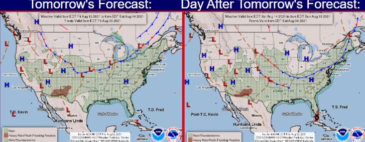
This is the 7 day forecast.
This is the 5 AM Cone.

Note the RAIN aka WEATHER is to the East.
Typical in weak systems.
Strongest storms may not be near that LINE.
But to the East of it...
....piling deep inland.
So while following the center remember that.
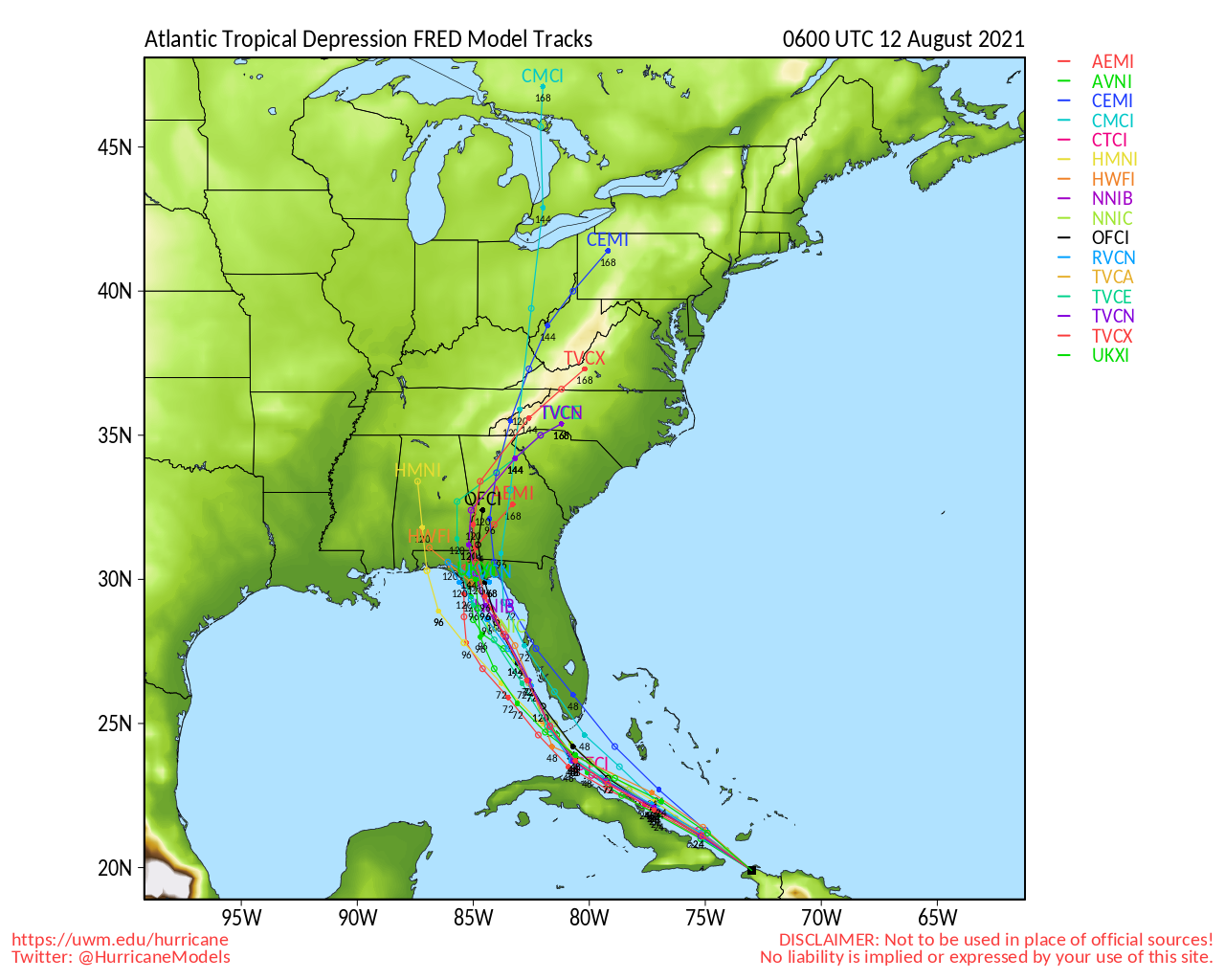
Models, as good as they are, track the "center"
Whatcha gonna worry on?
A naked center or the weather?
Being honest again and the problem with Fred "down the line" could be that it creates a problematic flash flooding set up in the mountains and the foothills. If it crawls up the backbone of the Appalachians and it's foothill communities this could be a real weather maker. It also, God Bless it's little naked center's heart, is going to lower our temperatures here in Raleigh, Atlanta and the rest of this region. Name landfall? It doesn't matter unless somewhere between the North Coast of Cuba, Key West and in the Gulf of Mexico it wraps up into a strong storm. Miami is NOT getting Hurricane Fred, but it's going to amp up the moisture and dump huge amounts of rain on Miami and Naples and Pt. St. Lucie even while it's cruising NNW up towards a pretty beach near the Big Bend. Oh, and it's very possible it stays way closer to Cuba that anyone is talking on. Fred seems to be a land creature more than a sailor, so being a land lover I expect it sticks like glue to the North coast of Cuba and crawls it's way through the Old Bahama Channel that sailors used as a compass like map in the days before we could bitch about which is better WAZE or Google Maps.
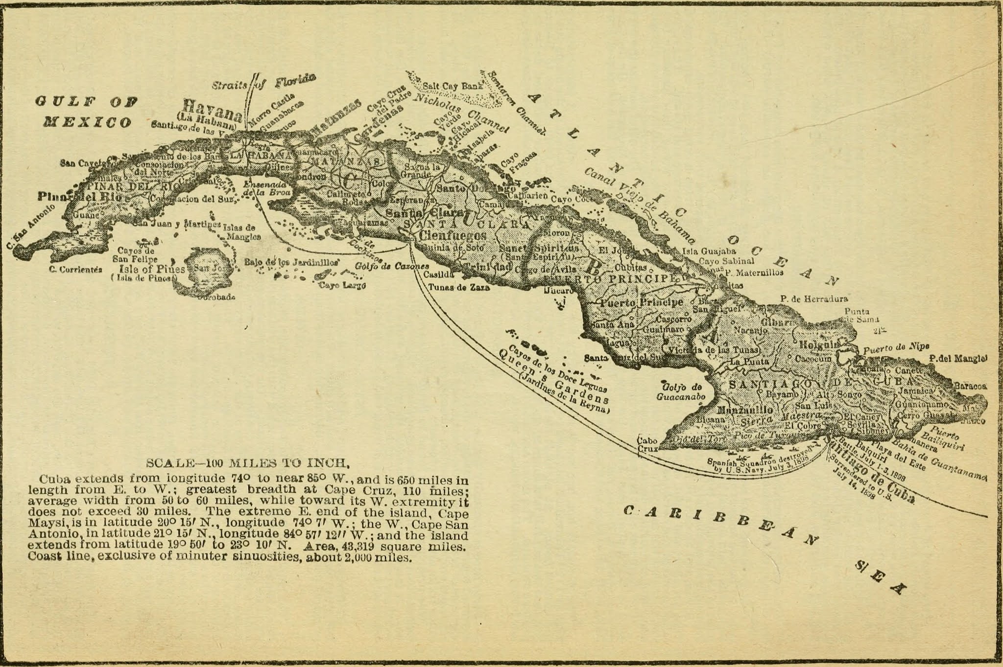
A fascinating history for those who love sailing ships, history and maps.
Next I'm going to say this about Invest 95L. Grace is expected to form from this Invest that looks better currently than TD Fred, but hey it's 2021 there are no assurances and the only consistency is that anything can happen. Live in the moment, play defense and expect curve balls!
There are some crazy models out there that show some long range odd dance steps that Grace could make if she tangles up with some remnant moisture anchored over the Appalachians and depending on quirky steering currents that could bring Grace to the Carolinas as one of our typical looper storms, yet other models keep it West and Low going where Fred did not go. It's just too soon to say. For now it's there, it is following the cookie crumbs Fred left and it has limited options, dry air to content with and the ever present Upper Level Lows nipping away at it, pestering it trying to tear it apart before it becomes a contender.
The name Grace is beautiful, yet it has brought us some complicated set ups so keep that in mind.
Have a great day. Nothing to worry on right now and no model intensifies Fred like crazy in the Florida Straits and yeah the models are not good with Intensity but there's shear dogging it and unless or until it becomes vertically aligned it's just a naked center stalking the North Coast of Cuba. Watch it's weather more in real time and the models less as they are tracking a naked center for the most part.
It is MUCH easier writing a short, easy blog when you have a Cat 3 cruising towards landfall with a set steering pattern and all the convection neatly wrapped around it's tight core that is carrying with it a definable storm surge. Messy tropical depressions wearing naked swimming trunks crawling across the North Coast of Cuba while giving Floridian's the tropical shivers are a pain in the ass to write about in truth. Potential vs Probabilities vs Real Time Mess...what you see today may not be what it is when it approaches some place like Carrabelle, Florida before trying to do the Appalachian Trail!
Besos BobbiStorm
@bobbistorm on Twitter and Instagram
Ps.. .pretty sure Fred is a Jimmy Buffet fan and he's dreaming on Havana...
Very into juxtaposition today.
posted by BobbiStorm @ 5:30 AM
![]()


1 Comments:
HMON is sniffing a deepening at landfall.
Keep up the good work!
https://www.tropicaltidbits.com/analysis/models/hmon/2021081206/hmon_ref_06L_35.png
Post a Comment
<< Home