Philippe & Rina ...Time to Move On.... What's Next in the Carib? Flash Flooding in NY/NJ a Concern ..Stay Aware of Current Conditions
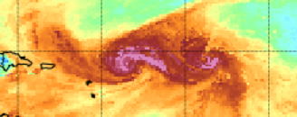
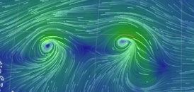
This is an image from the Mimic Loop.
Precipitable Water Vapor. Moisture.
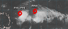
Below is the NHC Visible Sat Image
They look separated here, moving apart.
But above you see the real story.
While they each have a center...
...it's a murky singularity at best.
Yes meant singularity not signature.
Kind of like siamese twins.
Joined together in ways.
Usually if separated they do better.
Depends on the specifics.
Details are important in meteorology.
Easy to make this a tropical love story.
It's not.
One is actually killing the other.
One is a parasite in ways....
...trying to attach to the host.
Sucking it dry.
If this was a novel I was reading I would have already passed it along to a friend who might enjoy it more than me or donated it to a Neighborhood Library Box. Maybe someone else will enjoy the "dance" between the two but these feel like leftover defrosted fish sticks that have a bit of freezer burn on them, never the less, regardless .....they will go somewhere but until they break up it's hard to even watch loops. I lost interest a long time ago and the plot is all over the place, we need a good script editor as the screen writer fell in love with his own characters a bit too much. It's not impossible one survives and is far enough West to pay close attention be it the Islands or Bahamas but until that actually happens all bets are off. As always check with NHC site and your local experts online.
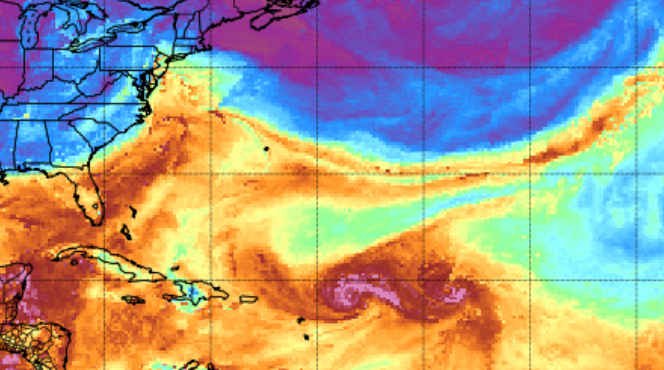
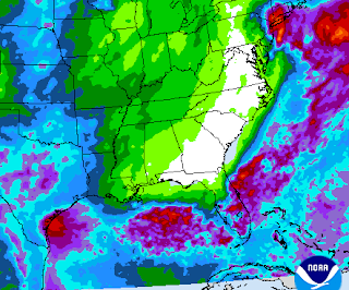
From left to right there is a surge of tropical moisture (deep reds and ochres near the Yucatan that is being drawn up along the SE coast over Florida. That area is connecting with the remnants of Ophelia because it's 2023 and tropical storms don't know how to just die. There is ongoing flooding in NYC and areas along the coast of NY/NJ and all those places where people are either Jets or Giants fans as New Jersey doesn't have a football team. In the center at the top of the page is dark, violet blues pushing DOWN into the Atlantic onto that strand of topaz, coral shades of golden orange with a strip of moisture strung out right now. Then we have the huge tropical wave complex known as Tropical Storm Philippe and Rina. Further East to the right we have nothing going on really.
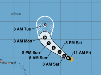
Where do these storms go and will they go their separate ways?
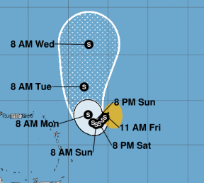
In theory, as even the NHC has made it clear they are not sure, Rina may move up around Philippe sort of drawn up to that orange area that seems to want to go NW like every other storm in this family group.
Philippe is not forecast to be a hurricane.
Philippe will "crawl" along (NHC word)
Moving SW slowly...then it finds a way North.
Rina moves a bit faster than Philippe
I really don't know why they upgraded to Rina.
I suppose their forecasts now verify.
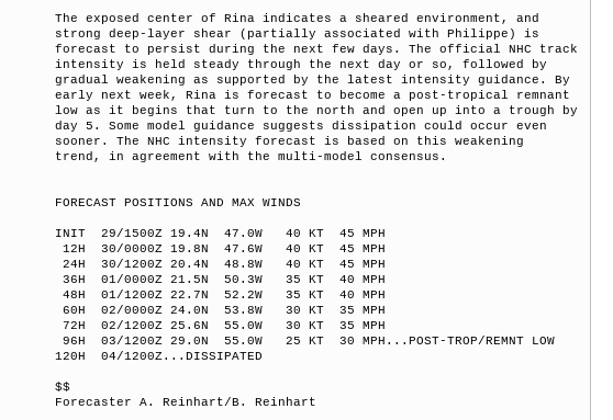
NHC discussion is a sad story....
...of lost opportunities.
Exposed center.
Dissipation....
Stays weak tropical storm....
...and then dies.
What do I think? I think this is a storyline that should be watched over time to see what really happens. I find Philippe's track strange but it's been a strange year, it moves slow so while moving slow ...oh wait "crawling" things can change. Rina I think was a flawed system more a tropical depression a Tropical Storm with areas of strong gusts above Tropical Storm force and they went with upgrading it. My opinion, as in the old days...not that long ago, a Tropical Depression wasn't upgraded because somewhere in the messy complex there were gusts over Tropical Storm force, a system .. a tropical depression had to really prove itself to be upgraded to a Tropical Storm. Names were not given out for participation then you really had to meet certain criteria.
I'm not arguing the "closed center" question.
Exposed or otherwise.
Enjoy it if you want ....I have things to do this weekend.
I'll be offline until Sunday evening or Monday morning.
Sure Philippe and Rina can spin without me.
Looking around the tropical basin.
That's a lot of rain in other places.
2 areas in the Gulf of Mexico ...
...frontal boundry, moisture surge off E Coast.
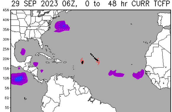
Note rain connects with the purple blobs below.
This NOAA map for the next 48 hours...
...shows an area off E Coast.
Areas in GOM and Carib.
I'd watch those areas.
At some point...
...in October.
Something forms somewhere.
October is tomorrow ...
Let's say first week of October.
Because the flow is fast....
...nothing is forming.
If the flow slows down.
Bears watching.
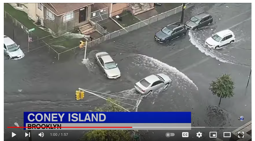
Big story is the remnants of Ophelia.
That's Brooklyn.
There's worse flooding but cool pick.
Annoyed the way this is being handled.
People ignore NWS info and go to work.
No watches/warnings. No name.
What's the big deal?
You'd think after Ida remnants they'd get it.
Take this seriously in NY/NJ
Very seriously and be careful.
Stay aware of flooding.
Flash flooding.
Sweet Tropical Dreams
or Winter Dreams.
Seems it's Autumn.
Enjoy it if you got it.
BobbiStorm
@bobbistorm on Twitter and Instagram


.gif)


0 Comments:
Post a Comment
<< Home