Fronts & Waves... Relationships of the Tropics

Today's radar tells the story better than anything I can say. Dry in the West, wet in the East.
A low pressure system hovering just north of the New Madrid Fault or the areas Edna Ferber named her character Kim for in the novel Showboat; Kentucky, Illinois and Missouri. Where the Mississippi reigns supreme.
Anyway, it's raining in Florida and the Carolinas and that is because there is a stalled out frontal boundary. This stalled out frontal boundary has been the signature of late Spring and early Summer so far..
Seems every day there is a new scroll on the TV saying the same old thing "Flood Advisory" and it's personally messing up my allergies and bothering my asthma. We are so heavily forested here that when the water puddles it takes a lot of dry days for the sun to dry things up.. mold grows, fungi and various other green colored substances that wreak havoc on every one's allergies. In Miami... the daily high heat and humidity and mold that grows from the constant afternoon thunderstorms kills my sinus. Actually, I did very well when I lived in LA.. trying to remember why we left.....
I digress..
Low pressure systems go towards low pressure systems is the old adage. Likes attract as we say in studying relationships between people. Weather systems, unlike dysfunctional people, are proactive and stay away from high pressure systems that are those hot dry creatures with a mean edge that sucks the life out of moisture laden, tropical systems. Maybe we should be more like the weather huh?
But, it is really the FLOW of the air... the atmosphere that is the real tantric dance that plays out that gives us our every day highs and lows, dry days ...wet days and the days in between when we have a little bit of everything in our soupy, summer atmosphere.
Look at the loop below. The moisture down in the tropics moves north towards other low pressure areas along the frontal trough as if it's a ride on the Silver Star from Tampa to DC and away from the high pressure that is putting on the squeeze play from both the left and the right. The Atlantic High which has been breathing in and out all week is trying to gain back control of the Eastern Seaboard... will it win that battle is the question. Yes, probably temporarily in a few days and hopefully in time for a nice 4th of July in the Carolinas. Miami is always iffy this time of year for firework celebrations, every summer of my life we had to wait out the day to see if we would or wouldn't get to see the big fireworks show or if we would see nature's fireworks in the form of cloud to ground lightning. Either way we usually had a fun 4th of July.

And, that is interesting is every year this battle happens...the high pushes west... some upper level low with an adjacent high pressure area nearby works in tandem to cut off a moisture from somewhere as if it will pinch it off like it's a dead pansy flower. It's a ballet the atmosphere plays out daily, changing in small subtle ways every hour.
12 hours ago:

Now:


And, if you are like me it's hard not to stare at that big ghostlike cyclone in the Atlantic that is really a big swirling Upper Level Low with some moisture that is trapped inside going round and round. Remember I said the other day that sometimes... moisture can work it's way down to the surface. The longer that it is there spinning the better of a chance that it can happen.
In the GOM IF any thing forms it will be very close in, as in close enough for lifeguards to watch happen in real time.
There is a tropical wave that might want to do a dance in the Gulf of Mexico and attain a name, however that strong shear zone from the high pressure circling down and around the dry high in the SW and the flow coming off of the active tropics in the Eastern Pacific is not letting it do so... stay tuned.

Rain is the bottom line for Florida and the East Coast. Historical amounts of rain. Earlier in the week Chapel Hill, NC had the most amount of rain it ever had in history in one day since they have been keeping records.. over 8 inches.. close to 9.

Purple Dots remain in the Gulf of Mexico though the one in the Atlantic has moved south which makes more sense to me..

It doesn't need a name to gain fame for a historic event and the summer of 2013 may be remembered for the day it rained every day in the SE and the summer the SW barely gets any and battles forest fires that have hit the historic range in both loss of life and dollar damage.

Graphics from the NHC:
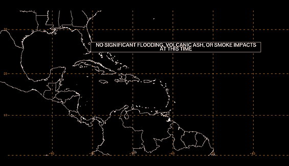
Official discussion on the Tropical Atlantic explains it as follows:
...DISCUSSION...
"GULF OF MEXICO...
BROAD UPPER TROUGH COVERS THE GULF W OF 83W EXTENDING FROM AN
UPPER LOW OVER THE MISSISSIPPI VALLEY AND SUPPORTING A
STATIONARY FRONT THAT AT 02/0900 UTC EXTENDS INTO THE GULF NEAR
PENSACOLA FLORIDA AND CONTINUES ALONG 27N92W TO INLAND OVER
TEXAS BETWEEN CORPUS CHRISTI AND BROWNSVILLE. SCATTERED SHOWERS/
ISOLATED THUNDERSTORMS ARE WITHIN 60/75 NM S AND E OF THE FRONT
AND WITHIN 120 NM ALONG THE COAST OF MEXICO BETWEEN TUXPAN AND
BROWNSVILLE TEXAS. A SURFACE TROUGH PRECEDES THE FRONT EXTENDING
FROM 29N86W ALONG 26N87W TO 22N92W WITH SCATTERED SHOWERS AND
POSSIBLE ISOLATED THUNDERSTORMS WITHIN 60 NM SE OF THE TROUGH. A
SECOND SURFACE TROUGH TRAILS THE FRONT AND EXTENDS FROM 30N89W
ACROSS THE MISSISSIPPI DELTA TO 28N93W. THIS TROUGH IS
INDICATING A WIND SHIFT ONLY. AN UPPER RIDGE EXTENDS FROM THE
CARIBBEAN ACROSS CUBA AND THE STRAITS OF FLORIDA INTO THE W ATLC
PROVIDING DIFFLUNCE ALOFT TO GENERATE SCATTERED SHOWERS/ISOLATED
THUNDERSTORMS E OF 85W TO ACROSS FLORIDA. A WEAK SURFACE TROUGH
IS INLAND OVER THE W PORTION OF THE YUCATAN PENINSULA.
STATIONARY FRONT WILL BEGIN TO LIFT TO THE NW AND SLOWLY
DISSIPATE LATE TODAY THROUGH THU. A SURFACE RIDGE WILL BECOME
REESTABLISHED AND SHIFT N AS THE FRONT DISSIPATES. A WEAK
SURFACE TROUGH OVER THE YUCATAN PENINSULA WILL MOVE INTO THE BAY
OF CAMPECHE LATER TODAY AND TONIGHT THEN W TO NW ACROSS THE W
GULF WED THROUGH FRI. THE TROUGH MAY APPROACH THE TEXAS COAST
LATE FRI INTO SAT."
Stay tuned...........that's the bottom line. If we were really expecting tropical action I'd be writing this from Florida and not the floor of my room in Raleigh, but either way it's raining in both places... from a stalled out frontal trough that is draped across the SE.
Tropical Wave in the Carib... Frontal Boundary across the SE...

That's the name of the game and the relationships between the fronts and the waves in the tropics.
At some point...........later in July................the front's should die down and the high should do it's magic and the Eastern Pacific will give way to the Atlantic ...each in it's own time.
Lastly.....................there is a lot of Cousin SAL in the Atlantic holding down tropical development from waves leaving Africa.
See this image below... that's DUST... in the clouds... dry air ruling over the Eastern Atlantic!

Besos Bobbi
Ps Posting a scene from the movie SHOWBOAT, the first official American Broadway Musical and a favorite of a beautiful older woman I knew who loved this movie.
http://www.youtube.com/watch?v=Hn76Tvbonw4
http://www.theatrehistory.com/american/musical005.html
A little bit of history on the play which was made into a movie later in 1936 and remade again in 1951.
http://www.theatrehistory.com/american/musical005.html
A little bit of history on the play which was made into a movie later in 1936 and remade again in 1951.
Ziegfeld Theatre and Show Boat[edit]
At a cost of $2.5 million, he built the 1600-seat Ziegfeld Theatre on the west side of Sixth Avenue between 54th and 55th Streets. Designed by Joseph Urbanand Thomas W. Lamb, the auditorium was egg-shaped with the stage at the narrow end. A huge medieval-style mural, The Joy of Life, covered the walls and ceiling.[16] To finance the construction, Ziegfeld borrowed from William Randolph Hearst,[17] who took control of the theater after Ziegfeld's death.
The Ziegfeld Theatre opened in February 1927, with his production of Rio Rita, which ran for almost 500 performances. This was followed by Show Boat,[9]which had the "largest advance ticket sale up to that time" and became a "substantial hit."[18] "When the stunned opening night audience reacted to the show in near silence, Ziegfeld was convinced his gamble had failed. The rave reviews in the papers and long lines at the box office the next morning proved otherwise."[3] It was a great success, with a run of 572 performances.[3] In May 1932, after Ziegfeld lost much of his money in the stock market crash, he staged a revival of Show Boat. "By Depression standards, it was a hit", running for six months.[19] That same year, he brought his Follies stars to CBS Radiowith The Ziegfeld Follies of the Air.[20]
posted by BobbiStorm @ 10:17 AM
![]()


0 Comments:
Post a Comment
<< Home