A Look at Eastern Atlantic, Africa and Senegal Today...

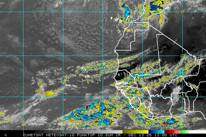
Going to look East today over towards Africa in honor of our President who is on his way to Senegal today. While watching news coverage of this historic event keep in mind that Senegal is where the big rain storms exit stage right and move out over the ocean and officially become "Cape Verde Hurricanes" if you got the right wave with the right mojo and not a lot of Saharan Dust. Got to keep that dust away from the waves unless you want them to suck all the life out of them.
Today we have a really pretty, early tropical wave exiting the African coast.....however it is early and moving into an area of Saharan Dust which is why June is too soon for this sort of development. Still...it's fun to watch.

Hey...at least there is something to watch going on there.
This wave will have a tough time staying together, but as evidenced from previous waves this year it will either crash onto the shores of South Africa or get ripped apart in the Hurricane Graveyard Area at the entrance to the Windward Islands.
Note the place where the waves need to be is a bit further north over the beach in Dakar....that's the BINGO spot for tropical development.

In the Gulf there IS a chance that something may form in a week or so. I'm not going to discuss models here because they have been wishy washy and unreliable so far...that may change. Still the constant presence of something forming is worth watching.
You can read this excellent article from 2006 about this ongoing meteorological interaction of rain and tropical waves and the people who study African Storms.
http://news.nationalgeographic.com/news/2006/08/060802-africa-storms.html
We are always making new discoveries, but the climatology remains the same.
Current satellite image of the Saharan Dust Layer:

That's it for now. Take care and enjoy the ride where ever you are weather wise or otherwise!
Besos Bobbi


0 Comments:
Post a Comment
<< Home