System Beginning to Come Together in the Caribbean

Down in the Caribbean the system that we have been watching is slowly coming together. The models currently show two possible tracks, one more to the North and the other more to the East.

I think this is one of those cases of SLOW, SLOW, SLOW and then speed up FAST it comes together.
Going to update this blog later today when the next set of runs come in and after we can watch it a bit on Visible Imagery. Right now it is trying to develop a center and that's big. Up until now it has been a lot of rain and multiple centers lingering down by the Yucatan, blowing rain up towards South Florida.
The silver lining for the Miami area and most of South Florida would be IF it develops as it would be a West Coast problem and it could draw some of that rain into a tighter system as it wraps.
See down by the Yucatan the colors are getting darker. I show this image because it really tells the story. It's a tropical system at the base of what is now a long trough oriented from the SW to the NE. Many cities along I95 are watching the tropics with this one, because after it would make landfall on the FL coast it would zoom up the Eastern Seaboard with strong rain and severe weather.
Note the system over Oklahoma today that all the news channels are hyping as the next possible outbreak. That system is pulling East slowly. The whole pattern right now is a S L O W pattern. Whatever is forming down there will catch either form and move in faster and further to the South around the Big Bend area or it will form slower and make landfall further north along the Panhandle of Florida.

Keep watching. I'll be back a little later when I see the convection connecting the dots and a circulation coming together.
For now the forecast for Florida is RAIN. And, more and more this is being called a "tropical disturbance" which I think means the NHC might up it from orange to red at some point later today if the current trend continues.
If you have an outdoor wedding in Tampa later this week or tickets to a sporting event, this may seriously impact your life. Sorry on that. It could just be a weak Tropical Storm with localized flooding and the random chance of a twister forming. Small chance it could develop into something more and then it's a whole new ballgame.

That's a lot of rain.
A coastal cruiser up the beach cities would dampen the weekend should it track further off shore and that could allow it to develop more or stay together as a TS or TD vs just rain.
If this was a Magic 8 Ball it would say
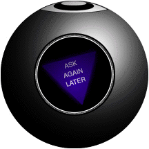
So I will....
You can too if you go to www.hurricanechat.com and ask there or ask online on Facebook :)
Keep watching... Andrea is taking her time here
and I am going to Ballet and going to be watching on my phone
Mid Day should tell the story and curious on the next model runs.

Besos Bobbi
Ps....go figure something to talk about on June 4th.... hmnnnn might be a busy season indeed.
posted by BobbiStorm @ 6:22 AM
![]()


0 Comments:
Post a Comment
<< Home