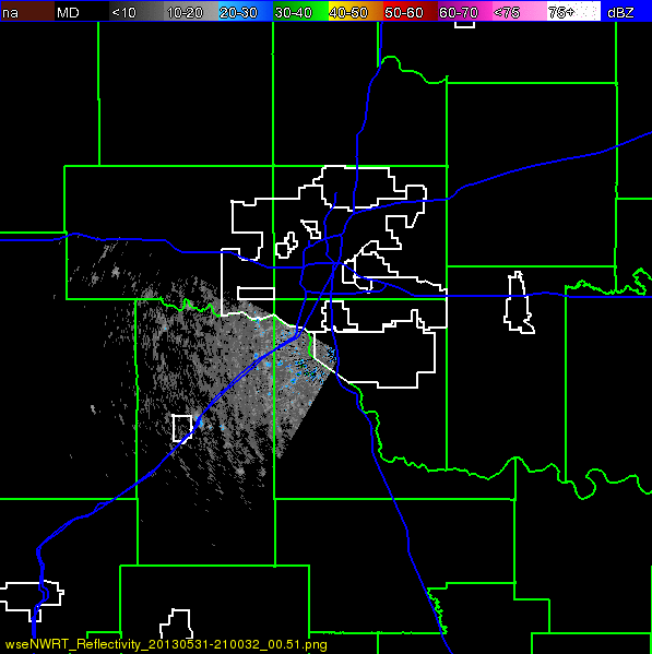
Models Back Off Development ..for now. Radar of the El Reno/OKC Tornado.

The "yellow" area of 20% chances has interestingly spread out into a larger area. Personally, I think that's more a timing issue and their way of saying it's going to be down there for a while and it may form later rather than sooner. Key West is INSIDE the yellow circle, and Key West is getting record amounts of rain. The beach at Naples is probably in that circle as well and it's looking lustingly at FMB up the coast while still hugging the Yucatan.

What's it gonna do? It's gonna RAIN... possibly on your wedding day if you have a wedding planned this week in Florida................
Key West currently... a wet mess and a good day for a margarita inside watching the people walk by on Duval Street, listen to the music and forget the sunset or the sunscreen..

Canadian typically takes this and intensifies it into a named system and slams it into the NW coast of Florida.

Interestingly if you notice the little dent at the base of the Atlantic Ridge NE of the islands?
Watch what happens at the end of the loop....

After "Andrea" swims out to sea finally after bringing a lot of rain to the whole Eastern Seaboard..
a small storm forms and maintains itself East of Florida
and a new storm forms in the Epac.
The Epac storm is more believable than the storm that makes it across the Atlantic :)
Hey.. models in early June are way too soon usually, but worth watching..
Loop it for yourself and see, but remember
the big issue here is really the prediction for a long rainy spell for the East Coast
and FLORIDA
if and that's a big IF
the Canadian is at all even a little bit reliable..
As for the GFS......the more reliable and much loved model:
GFS takes a much weaker "system" into the same area and oddly shows a system in the Atlantic working it's way along at the base of the high. Interesting, more interesting than "Andrea" in the Gulf.
Is there something out there? Hard to see well with all the sat problems........

Welcome to 2013... we have moved leaps forward and taken five steps backwards with regard to being able to see out into the tropics better.

http://moe.met.fsu.edu/cgi-bin/gfstc2.cgi?time=2013060312&field=Sea+Level+Pressure&hour=Animation
The Euro isn't biting for now.
And, that just about covers the yellow area that is poised to bring more rain to the not so very sunny Sunshine State ;)
As for the discussion on the El Reno/OKC Twister I am posting a radar view of the storm at it's height. Says so much.
Watch this video carefully... especially at the end. See the multiple vortices forming, swirling around each other in the mother cloud...
It reminds me of some Mothership in a Sci Fic movie that has guns shooting out and rearranging to attack. Like some massive spider/scorpion morphing in real time with new legs and stingers lashing out at everything in it's path.
Talk about "weather in motion"
Besos Bobbi
Musical bonus. . . http://www.youtube.com/watch?v=8v9yUVgrmPY
posted by BobbiStorm @ 2:19 PM
![]()


0 Comments:
Post a Comment
<< Home