Tropically Inspirational...
On a slow storm day, without any real named storm on the map in August I find great inspiration in great photography that illustrates better than any words can describe the beauty, the majesty and the wonder that is life in the tropics.

I grew up not far from where this picture was taken, every day is different...similar but different. In most parts of the country up north the leaves change, they turn colors... they fall off and everything is brown or white covered in snow. In Miami, the leaves stay the same and only the colors of the flowers punctuate our lush, green, tropical lawns yet the sky.... that's a different story. Sunrise and sunset bring colors not seen in most parts of the country. A thunderstorm covering the sky moving in over the Bay changes everything in less than fifteen minutes. I've sat not far from where this picture was taken on a sunny, warm, summer day and watched in utter amazement as a storm blew in from the West.... covered the sky and the Australian Pines and Coconut Palms turned the darkest green against a purple, black sky ...the color of the water turning a foamy sea green and then in fifteen minutes it was gone again as if nothing had ever happened.
Clouds form, they climb, they change color...and they do it so fast that if you stop to call someone or text them to look....the scene has changed and the clouds rearranged and you missed the shot or the moment. Sometimes, you just got to stop, point and shoot and hope you got the picture that you saw moments before.
Spent many a day as a child sitting on the sea wall on 15th Road looking out at the Bay...watching clouds.
Neal Dorst, a friend and a meteorologist at NOAA took that beautiful picture above. Just stunning. I feel like Dorothy looking through the looking glass back home at Kansas, except my Kansas is Miami and in particular the old part of Miami... the Roads Section, blocks from the Bay where my cousin and I would play as kids on bikes and when older we'd park the car, share a beer and stare out at the water. Pure love of the beauty of Biscayne Bay, pure love of watching the sky and the clouds that tower higher and more beautiful in Miami than any place I've ever seen...except for maybe Key West.
Almost the same view of the Key Biscayne Marina on a different day, another moment caught by Neal.

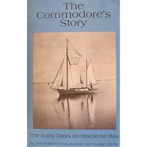
The same view, no matter what was built on the land.... the view of the clouds and Biscayne Bay has not changed since Ralph Munroe sailed the waters in his King Fish and Marjory Stoneman Douglas took picnics on Key Biscayne and watched the clouds and storms roll in...
One thing that has changed over time is the chain of islands going over to Key Biscayne from Miami. In 1835 a very strong Hurricane tore a hole through the island and gave us the gift of Bear Cut. Supposedly, according to Dr. Paul George it tore up the hammocks and mangroves facing south towards the Bay .... a Major storm so strong the likes of which Miami has not seen in well over a hundred years, now going on two hundred years... coming in from that particular angle as it curved up into Miami from the Keys vs coming in from the East like Andrew. We've had storms like King and Cleo that came in from that general direction , but neither of them were as strong as the 1835 Hurricane. One day, another storm will take that track however we will be as prepared as we can be because of the work of the National Hurricane Center.

Another pic by Neal Dorst of Bear Cut, not far from the roof of the AOML building sits a constant reminder of what nature can do to the land over time. In 1835 there weren't many people living in Miami, a few missionaries, Native Americans and a few farmers working land grants ...several decades before William Brickell set up his trading post at the mouth of the Miami River and watched clouds form out over the water waiting for customers to sail up to his dock.

http://www.brickell-life.com/2011/12/brickell-circa-1900.html
That curve of the land above the trading post is where I would sit with my cousin... watching the clouds.
And, that is what tropically inspires me on a day like today when there is not much to write about regarding the absence of storms with any real malice in the Caribbean or the Atlantic Ocean. What I can do is tell you why I love the tropics ...their weather, their flowers, their beautiful moments which come alive all hours of the day ...from sunrise to sunset and especially during late afternoon thunderstorms :)
See the links to books you might want to read ...while waiting for something to form in the Atlantic Tropical Basin... and maybe, perhaps you can see it through the eyes of Ralph Munroe or Margorie Stoneman Douglas.
As for the tropics today...
There isn't much going on in the Atlantic Tropical Basin to talk about of any real urgency.
The clusters of convection down in the SW Caribbean are the remnants of TD7, gone but not forgotten....but not doing anything exciting either.
In the middle of the Atlantic is an area that looks as if it has some circulation, some form... no color, no real convection and it's traveling with Cousin Sal ...otherwise it might have been a contender. It has an orange circle with 30% chances...but if it does develop it's going to circle around in the Atlantic and head back towards Europe. A little late for the Olympics, but the Queen is still there so imagine it wouldn't be a lost trip around the Atlantic. This was remember the system that was supposed to develop and make it's way across the Atlantic... sometimes it's good to remember that models can be wrong.

Officially, this is the Outlook aka the TWO from the NHC at 8AM. Updates again at 2PM, but there shouldn't be many changes to this discussion.
2. A TROUGH OF LOW PRESSURE LOCATED OVER THE CENTRAL ATLANTIC ABOUT
1050 MILES SOUTHEAST OF BERMUDA IS PRODUCING A CONCENTRATED AREA
OF SHOWERS AND THUNDERSTORMS. SURFACE PRESSURES ARE HIGH AND NO
SIGNIFICANT DEVELOPMENT OF THIS DISTURBANCE IS EXPECTED TODAY.
HOWEVER...ENVIRONMENTAL CONDITIONS ARE FORECAST TO BECOME MORE
CONDUCIVE OVER THE NEXT COUPLE OF DAYS.  THIS SYSTEM HAS A MEDIUM
CHANCE... 30 PERCENT...OF BECOMING A TROPICAL CYCLONE DURING THE
NEXT 48 HOURS AS IT MOVES WEST-NORTHWESTWARD TO NORTHWESTWARD AT
15 MPH.

ELSEWHERE...TROPICAL CYCLONE FORMATION IS NOT EXPECTED DURING THE
NEXT 48 HOURS.
The people who bought cheap Caribbean Cruises in August got lucky and are having beautiful sailing weather with nothing but a few stray afternoon showers to rain on their travel days.
But, you never really know when discussing the tropics. Things can blow up fast and develop close in without much model discussion. Nothing is going to surprise us again in the way that the 1935 Labor Day Hurricane suddenly developed into a Major Hurricane and took Sunday travelers out on the Overseas Highway by surprise the way it did back then. Hurricane Andrew is a good example of this, and that was 20 years ago. A weak, westbound storm barely surviving negative conditions on it's way towards the Carolina coast ...suddenly, rapidly intensified and turned due west and headed towards Miami. Had it been 1915 or 1935 we may have only had shipping reports of a small, cyclone out in the middle of the Atlantic... nothing to worry about. By the time Andrew would have taken the Bahamas by surprise Miami would have had very little time to prepare and most likely would not have believed the reports. In 1926, after two weak tropical storms that the natives were warned could be dangerous they took the reports of a another West Indies Storm headed their way with a lot of grains of salt.
There were no models... there were no APPS or websites warning people of destruction at dawn.
We have come a long, long way since even 20 years ago when the Aviation model was considered a new untested model and an August front was expected to pull Andrew NW rather than due West.
We owe a ton of gratitude to the people at both the NHC and AOML/HRD for the non-stop work they do improving on themselves every year in understanding how something that was once a mystery, that tormented the islanders is now something that we can watch as they develop in real time.
Still beautiful, still amazing.... still so much to learn... like why the models thought that Ernesto might make it into the Gulf of Mexico as a strong storm when.... he stayed weak and then made it into the Pacific as Hector. To be fair, some models showed him making it all the way west into the Pacific, but others took him north. We've come a long way... we are still learning............ but we have a lot more time to prepare than we used to and we are getting better every day.

Besos Bobbi
Ps...thanks Neal Dorst for the inspiration and the awesome pictures!
posted by BobbiStorm @ 10:13 AM
![]()


0 Comments:
Post a Comment
<< Home