SOUTH Florida ... PAY ATTENTION... Stock up...
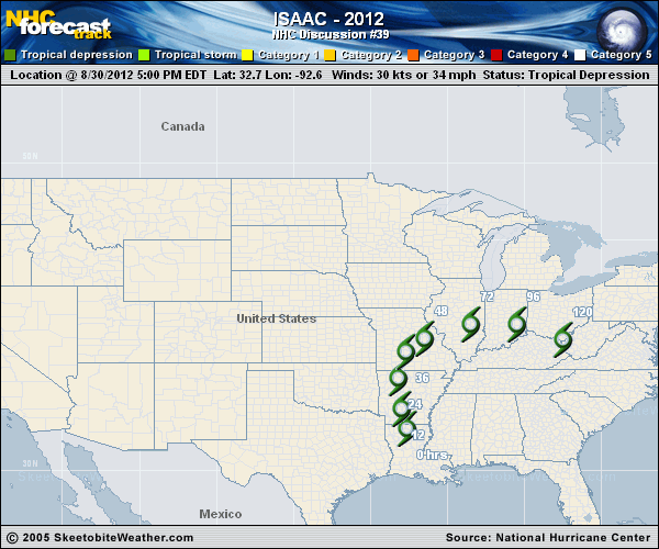
This is a map from Skeetobite and he is very very good. Graphically speaking, he is very good at predicting...or rather highlighting and illustrating where the storm is forecast to go. IF... the Lake is inside and or above the next map he puts up I'd be pretty sure your part of South Florida may seriously suffer tropical storm conditions... possibly hurricane conditions within that time frame.
Tropical weather forecasting is a science, but it is a science being modified in real time as we learn more and more about what makes a storm intensify and where it will go and when it will get there.
That is as simple as I can put it. This may shift a bit to the left or right depending on which model winds the long range shoot out.
One model takes it into the Gulf...which is very warm right now and would make it into a very strong storm with more running room before it hits somewhere along the NW coast of Florida all the way west to the La/Ms border with special emphasis I think on the area between Mobile and Pensacola Bays. That is the left goal post scenario...
Another model takes it to the north faster, slides by Miami blowing kisses and sending some weather it's way and heading up towards North Carolina... though one model prefers the beaches in South Carolina.
Another model takes it up the backbone of Florida, across the Keys through Florida Bay raking the Everglades and Miami and Naples on either side with strong weather and heading straight up across THE LAKE through Ga, SC and NC. A few models have it raining inland for days in the areas north of GA which would lead I fear to big storms inland, a lot of inland flooding at the base of the Mountains. Happens sometimes, actually happens often.
One of the biggest problems here is the timing. Timing throws things off and it also is directly connected to intensity. A slow moving storm over hot water and low shear will hit as a Category 2 or even Category 3. A fast moving storm caught in the steering currents shooting up from the Carib faster than a pinball out of the plunger about to start a game and light up the board with points, whistles or rings. A slow moving storm will come in at a different place...point on the map. It may make the turn slower... different angle. When you play pinball, and I was and am very good at it by the way, it's all a matter of the smallest, slightest degree and how you ummmm shake the machine without hitting the "tilt" buzzer. The lightest tap of the flippers makes a big different where the ball goes.
The ball here is a slowly building Tropical Storm that MAY become a BIG hurricane and the exact degree here of entry onto the map near Florida will spell the difference between misery and disaster and there are no spell checkers here... only a storm, caught up in a current of wind that is moving around Planet Earth bringing us cold fronts, warm spells and tropical moisture.

Look at that front diving down .... as i look it's moving down at an angle through Tennessee, into Mississippi... pushing side ways and beginning to make a move into Asheville. By the time you look it may be different. But, you see I am not watching Isaac... I am watching the Upper Level Low and the Front and how the air is hooking around in Mexico and what is happening in the NW part of the GOM because that is going to really write the drama..
Isaac is just a storm caught in the Earth's Atmosphere... unless of course he becomes a big Hurricane and makes his own atmosphere, building a big high a loft which he has yet to do.
A weaker storm goes west, that is just the way it goes... since the dawn of time and until we get weather mod perfected it will be that way a long, long time. A stronger storm heeds the call to go North... and is caught up by stronger Upper Level winds... and sometimes makes it's own wind.
For now.. I have a lot of people I am mildly worried on in the Florida area...both no longer live in high rise penthouse apartments facing the Ocean and bay with fantastic views and sliding glass doors that do not lock (insert smile here for son) so although he won't be getting any great pics this time around he is further inland where the wind really blows when it blows. And, other assorted relatives who are taking the storm seriously enough that I don't really worry on it.
You can't worry on it. Now is not the time to worry. It's the time to make sure you have:
Insurance up to date
Medications refilled
Diapers stocked up
Batteries, trust me you will need them for something in you lose power long enough.
Crayons for kids. Paper for the kids to color on if you forgot how that works.
Your favorite water at Publix before your sister or neighbor gets to it.
Caffeine.... choose your fix. Cola, Coffees in cans that don't need refrigeration.. after Andrew I'd kill for a coke... maybe my priorities are screwed up by the warm bottle of Cola I found was better than water.

see my point here...
Your emergency prep list might include Gatorade... your favorite color, scotch and baby formula.
Pets... do you have pets? Buy pet food ...etc..
The models seem to be shifting

Watch the wind prob odds... currently Miami and Naples are both 50/50 for getting Tropical Storm force winds... or more.
Am SURE if you thought you had a chance to win the lotto with 50/50 odds you'd buy more than quikpick...
So... plan, decide and act by this evening if the 5pm model has you in the path of it's next destination and join the crowd at Publix sooner rather than later. Use it for school lunches, trips, donate it to a food shelter if you over stock on Oreos.
For those of you further up the coast... this state of indecision may or may not be coming to a town by you soon.
Will update later today after the 11 AM track and after the next set of models.
Besos Bobbi
Ps...still too soon to tell...especially because of the degree of the track down the road and the strength of the storm.. which is currently getting it's act together as it nears the Leeward Islands.
Links galore at www.spaghettimodels.com
Note newest Navy map almost goes to the Georgia line.....

posted by BobbiStorm @ 7:21 AM
![]()


0 Comments:
Post a Comment
<< Home