Are Models Right & Nothing is Gonna Form Soon? Maybe. Maybe Not. Barbara Still Going Strong & African Waves Making It Intact Across Atlantic Despite Shear & SAL. Home Grown Concerns .. Round July 10th Give or Take a Few Days Could Have a System in the Atlantic
Very brief discussion on Hurricane Barbara ... still going strong... moving into a less friendly environment but she has sign and spin going for her still. Dry air to the NW but sucking in moisture from the SW still. Really a beautiful hurricane that totally out performed the early models and NHC discussion. Look back a few blogs and you'll see the discussion from the NHC with an intensify forecast that was way off. In basically 48 hours Barbara went from just forming to a strong Category 4 Hurricane just a week or two after long academic discussions on why the EPAC wasn't going to get going anytime soon. They were wrong. Yes, it began later than usual and Alvin wasn't much to look at but Barbara took off like a horse at the races looking for the finish line and the history books.

Bryan Norcross does a great summary online.
I mean he does everything great.
If he ran for President most of Florida would vote for him.
140 MPH.
Impressive.
I said earlier last month that I was waiting for the EPAC to begin to kick in and spit out storms to see how the models and the new management at the NHC handled the EPAC as it's a clue to what we will be seeing soon in the Atlantic. When I say soon I mean sooner rather than later. Though nothing is expected to form in the short term it doesn't mean there aren't possibilities and regions that need to be watched for sudden pop up convection that makes a run at a named system. July is filled with low end Tropical Storms that form close in with tracks that often are traced later by stronger hurricanes. I say that from the view of history and it happens over and over. Again Alberto took aim at the same part of the Florida Panhandle that Michael did later in the year.

Speaking of computers........
Hasn't Facebook, Instagram and Whatsapp been fun today?
My sister-in-law posted a picture of a beach somewhere....
My son most likely posted a picture of coffee somewhere.

Yeah so about those computer models...
They adjust in real time fast when things pop up.
Let's go back to last year and Florence and Gordon.
Note I'll discuss the coming weeks later.
Remember my blog is basically my online Hurricane Diary.
Early on it became apparent Florence wasn't a Fish.
There was the possibility she would turn eventually.
NHC discussion explained why it would turn.
It didn't turn and it intensified and out performed intensity forecast.
Then Gordon popped up out of basically nowhere.
It was not expected to form.
All eyes were on Fishy Florence...
Miami got swamped with rain.
NHC issued Tropical Storm Info...

Again the GFS said Florence was turning.
The Euro showed a strong ridge.
Watching Florence consistently doing her thing...
.... much as Georges did in 1998 it was apparent it wasn't a fish.
Well it was apparent to me.
The NHC took off for the races with Gordon.
Gordon never got as strong as it did over Miami.
Not really.
Yet they insisted Florence was only 20 mph stronger.
Florence looked like a Hurricane.
Quacked like a hurricane.
Eventually they caved and upgraded it.


Florence was ignored.
Everyone insisted it was a Fish.
It was all about Gordon.
Some made fun of Gordon.
NHC insisted Florence was a TS
Earthnull showed otherwise.
Note she's still moving WEST...
70 MPH

NOTE she had an EYE.....

Florence kept sucking up that moisture out ahead of her.
Feeding her like she was on steroids.
Gordon looked wimpy.
But was close to home so ...

Long term models showed Florence close to land.
As in she swam and she swam right over the damn.

I pointed out it was a LONG RANGE MODEL.
And I pointed out Florence was moving West.
Despite all discussion otherwise.

So how did the NHC do with Florence?
In the end they nailed her...sort of.

September 1st...
They keep her a Tropical Storm.
Move her up into the ocean... "Fish Storm"
Now below...
September 5th.
Okay they put the Hurricane symbol in finally.
Okay they admit she's going West...
...but they show her turning NW.


September 8th she's a got a M for Major Hurricane.
Her 5 day Cone touches land.
They remind us she could take the top part of the Cone too.
"Don't watch the middle of the cone.." they said.

September 13th...
Florence name is obviously gonna be retired.
Florence as not a fish.
She apparently wanted Carolina BBQ
Way inland and up the coast.

This is why I don't go along with every model I see.
I watch the model then I watch the satellite loop.
At one point based on models NHC warned Savannah to watch out.
So 2018 gave us Gordon that formed from a rainstorm.
And a long tracking hurricane that wasn't the Fish that was predicted.
Well it was a fish it just was not going Out to Sea....

If you read my blog you know I called what Florence did early on.
The ridge dug in, there was moisture available.
Cantore was there.......
So the tropics today.
There is a tendency for thunderstorms to gather in the GOM.
Waves that should have been killed off keep swimming.
There's SAL dust... there's shear.
Yet they keep getting further West than they should intact.
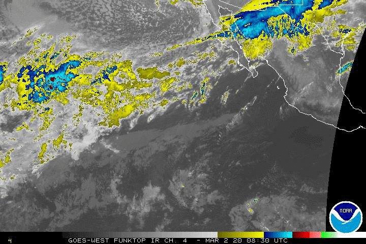
See the waves below.
While they did not develop ....
...they remained intact.
Normally in early July with SAL & shear they are gone.
These are tenacious waves.
Strong swimmers.

Long range models show this continues.
And some models show possible development close in..
Not strong development.
Think Gordon ...developing in real time.
Not specifically closing off but a concentration of convection.
And with water temperatures EXTREMELY HOT.
They need to be watched.
As for models......
They are good but they change in real time.
In real time the NHC changes it's forecast.

Using www.windy.com because it's a great visual.
In the Big Bend of Florida.... there's intense moisture.
The EURO then shows the moisture congregating near GA/SC
As that has been happening nonstop of late.
I'd take it seriously....
...and watch to see if it shows development.

Again watch what is going on currently.

Moisture in the GOM.
That's a lot of moisture for a strong High.

And wild storms off the East Coast...
...as record temperatures get recorded each day.
Yes there is a strong high.
Yes there is SAL and shear.
At some point... something develops.
Have a nice July 4th...
But if you have any snacks left over.
Put them in a box for Hurricane Supplies.
Clean that grill off well.
You may need it to cook with down the road.
I love models.
But they infer and imply and it's good.
But they also change in real time.
And weather pops up fast.
Concerned on GOM and off the SE Coast.
Close in. Home Grown.
I'm also concerned that some surviving wave...
... flares up as soon as shear abates.
And the hurricane season begins.
Besos BobbiStorm
@bobbistorm on Twitter and Instagram.
Well once Instagram is back working again...
Ps... Happy July 4th
God Bless the USA
posted by BobbiStorm @ 3:01 PM
![]()


0 Comments:
Post a Comment
<< Home