Cold Front Made It Thru Florida... Invest 94L Looking Messy with Minimal Chances of Development for Now... In NC Stuck in Colder Weather Stay Tuned.
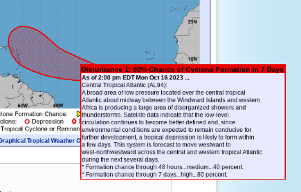
There is an 80% chance of development in 7 day.
It really doesn't look like much....
...and a look at the image below shows why.
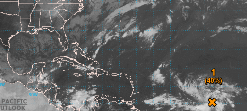
Bottom right a weak wave.
In the GOM and off SE coast...
signs of cooler water.
Cold front made it to Miami.
(cool front there...)
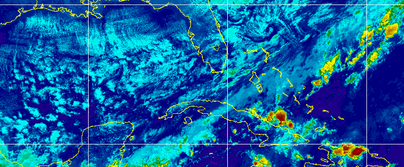
Cold water clouds.
Front made it to Cuba!
It's in low 40s in NC tonight...
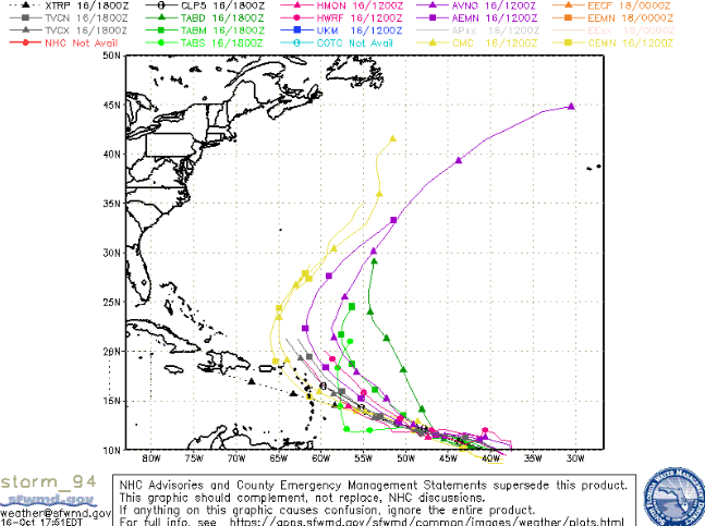
Should it try to form it's recurving.
If it doesn't form and gets into W Carib.
Something to think on way down the road.
That's really it. I looked at models, all I see is more cold weather on the way in waves, like cold weather waves vs tropical waves rolling off of Africa. There is some very long range support on "some" models that show a quasi subtroipical/Noreaster up near New England. I'd call it a wild card for now, though we are getting into winter weather season.
In Raleigh the low tomorrow AM is supposed to be 45 degrees!
Just that time of year when CLIMO reminds us that the Hurricane Season is slowing down and while it could put out another system somewhere, this is not prime time anymore in the tropics. Maybe North Atlantic gets more action but will it just be a winter system or a wayward subtropical/tropical storm?
Stay tuned.
BobbiStorm
@bobbistorm on Twitter and Instagram
posted by BobbiStorm @ 3:14 PM
![]()


0 Comments:
Post a Comment
<< Home