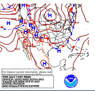
100% RED Invest 95L Set to be Hurricane Lee Down the Road - Another Wave Behind it Orange in 7 Day

95L to the left.
100% chances developing in 7 day
90% in next 2 days.
Any time now....

60% in the 7 day.
Yellow circle is...............
..........get ready for it
X Franklin!
20% chances in the 7 day.

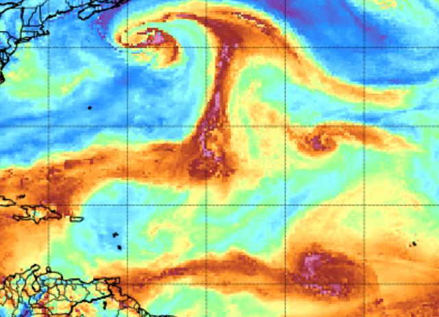
Top left corner SWIRL X Idalia
(except NHC ignoring it)
(maybe a factor in steering Lee)
(maybe a factor in steering Lee)
Guess you can have it both ways.
You can see what will be Lee...
in the ITCZ healthy looking

Current models.
Most clip the Islands.
One broke from the pack westbound.
Long term party all night GFS below

Takes Lee towards NE... into Canada.
what might be Margot stays out East.
Euro below

This Thursday
Lee and Margot in the Atlantic.
Read the Isobars... keeps Lee West.
Down the road a front appears...
Will the front grab it? Sweep it away?
Or does it get stuck and impact land?
Easy to say ...out to sea.
But it's way to far away.
Icon below

Slides Lee West periously close to Islands.
Westbound... see Isobars.
High pressing down on it.
Oh let's go for broke...
CMC below.

Icon barely misses Islands.
Finds a weakness.
Margot goes the other way.
Monday you can see a bit of Lee
side right...
You can see the cold front.
Listen I looped a lot today... looked at models, played on Twitter/X and did a whole lot of cleaning. I've been wanting to go through some things and it was forecast to be like 95 degrees so no thank you, other than an early trip to Target staying home in AC and taking care of things I ignored while Idalia did its thing.
Depending on who you talk to online you will be told:
Lee going to the biggest OMG Cat 5 Hurricane.
Lee gonna be a Major Hurricane!
Lee is going to hit the Virgin Islands!!!!
Lee is missing the Islands!!!
Lee going out to sea.
Lee moving towards North Carolina and OBX.
Lee moving up the I95 corridor (1 interesting run) from DC to NYC to Boston
Lee may come near Cape Cod
Margot too!!
It's literally like Elvis, there are sightings EVERYWHERE!!
And everyone is fighting about it on Twitter...
Truth?
We don't really know.
There is a strong cold front (God Bless) and it's moving down around the time that Lee would be near the outer Bahamas North of PR and there is High Pressure to it's North for a long while propelling it Westward. At some point a weakness in the High (maybe from X Idalia anchored there) allows Lee to slip slide away. But.........depending on what happens with the High it could get trapped off the coast or it could go easily out to sea eventually. I predict it racks up a lot of ACE!!
Let's look again.
Blue dry air...high pressure.
Orange/gold moistiure/low pressure
X Idalia (I see nothing) up there...
has this long vertical signature.
If Lee gets there it could find a weakness.
There is blue out in front of Lee
And a moisture trail out in front ...
...providing perpetual gas for Lee to travel West.
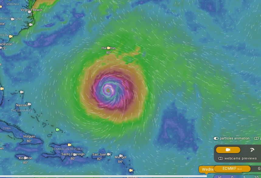
Next Wednesday look at the size of Lee.
Euro
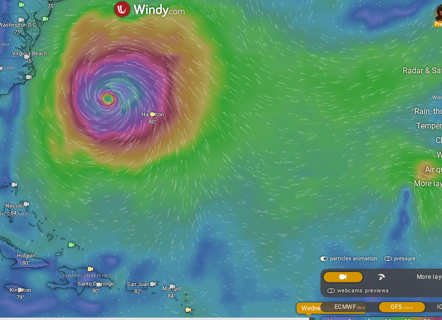
GFS below.
Look at the size of LEE
Looks like it wants to try out for Macy Parade!!
Let's ignore all the hype, all the drama.
All the fighting....
Let's go with this image below.

This Friday we have 2 twin Canes?
Moving West.
At some point things change.
It's the Hurricane Season you are supposed to be prepared and aware that at any time the NHC starts putting out advisories on a storm that is forecast to be a Hurricane in early September. You all want snow on Christmas even if you live in Atlanta or Raleigh or Oklahoma City... but if you live in Montana or Maine you expect it to snow. You got to know it's September you have to be prepared!
Don't believe it's a "Fish Storm" yet and do not believe it's going to explode all over the East Coast shutting down I95 for who knows how long.
Go about your business. Watch for updates from the NHC. Eventually we will see where Lee's true center is, get dropsondes into it and run that data and in 2 or 3 days time we will have a better idea what Lee is most likely going to do.
That's it.
Took a nice break today for Labor Day.
Careful on Twitter there's more hype there than the lady on Twitter insisting we will have a Cat 6 Hurricane on September 6th because time travel taught her that. She did say tho it's important for people to know so they can prepare. Now, that is true! You should be prepared rather than deciding Idalia was the end of the 2023 Hurricane Season. Nope... not over yet.
Love ya all.
Stay safe, stay sane...and check back tomorrow morning for an update!
Sweet Tropical Dreams,
BobbiStorm
@bobbistorm on Twitter and Instagram

posted by BobbiStorm @ 6:22 PM
![]()


1 Comments:
Very nice
Post a Comment
<< Home