Last Day of July. Tropics Fairly Quiet. 2 Invests and a Quiet GOM & ATL. What Will August Bring?.
This is where we are at 2 PM.
Monday, July 31st, 2023.
Monday, July 31st, 2023.
I waited to write the blog to see what the NHC would do at 2 PM. They are keeping 96L at red circle, yet it's chances are currently 70% on the 7 day. Our fast moving invest 97L "lil yellow circle" is moving fast like it's trying to escape Earth's atmosphere and trying to go find the missing Voyager space craft that is no longer receiving commands from NASA. I am of couse being silly, but they are hoping to reset it Voyager in October and well often the hurricane models don't seem to be connecting with reality weather wise also.
Note the vigorous lil wave.
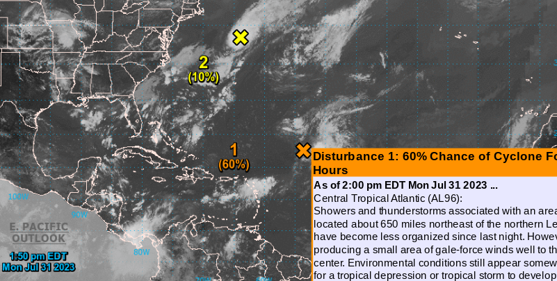
Let's look at the satellite imagery on the 2 day forecast page from the NHC. Note the orange X is where Invest 96L is not where the 1 60% is to it's left. I say that as that graphic is actually near a nice little tropical wave getting little attention, yet it's blasting through the shear that's usually there this time of year as it moves westbound into the Caribbean. Most of the US is devoid of major convection though there are some areas that will flare up as they do in the summer and zip along slamming someone with severe weather. Isn't the Gulf of Mexico quiet for July, a time when usually it's climatologically favorable for development and add in we know how hot the water is currently. Then again the area off of Florida where the hot water temperatures have been in the media every day did not produce a tropical system when the little yellow circle showed up with a high aloft and low shear there. Quite the puzzle but other than not having enough time over the water, under high pressure with low shear it wasn't able yet to get a center going even though there was some spin.
This is really a look back at July.
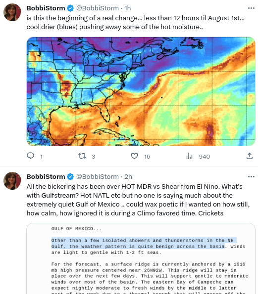
Quiet Gulf of Mexico and adjacent Bay of Campeche.
Quiet Caribbean other than the old wave rebounding and heading into the Pacific.
The MDR has been very quiet, as it usually is in July, as tropical waves tried to fight off the SAL.
The North Atlantic has been a friendlier spot for development as we saw with Don and Invests 95L and 96L
African Waves, there were a few good ones, came off beautiful and fell apart due to SAL. Happens in July.
You could say "well we are already looking for the E storm in late July... oh my!!"
Yes, you can say that but in reality it needs an asterisk as it's only because of the upgraded January storm.
Otherwise..........we would be looking for the D storm and not looking for the E storm.
Not being contrary, just being honest and transparent because it's true.
So where do we go from here.
Some changes going on.
A front pushed through.
Another small front pushed down.
Died around SC I heard.
Most early fronts do die there.
Then we watch the end of dead fronts.
That just hang around... off SE Coast.
(over very warm water)
BUT...........nothing is forecast to develop.
Models are tight lipped and saying no, no, no!
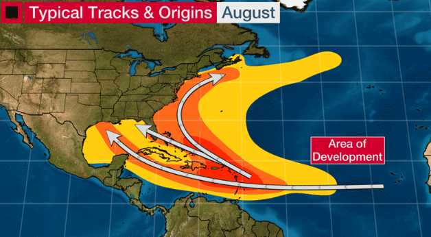
In truth July is usually slow. There's always exceptions to the rule but Hurricane Bertha was a real exception to the rule. And, when we have development (unless it's in the GOM) it's often short lived weak storms that attain a name but no real fame. So let's look at where we normally find August development in the Atlantic Tropical Basin.
Pretty much anywhere.
Make from Wundground I believe.
Orange is closer in...
..note the sneaky track into the GOM.
Many recurve up along the coastline.
Some make landfall.
Intresting graphic.
Despite hot water everywhere close in...
...it's most intensely hot water.
BOC is hot but quiet.
(yes shear from El Nino)
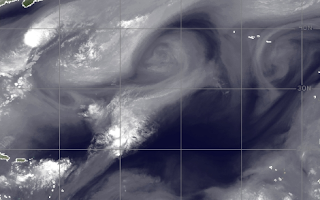
And then there's Upper Level Lows.
They can enhance development.
Or they can inhibit it with shear.
Upper Level Lows get a vote too!
See the 2 black looking dark Cane like features.
Lows... Upper Level Lows.
Lows... Upper Level Lows.
They have been dogging 96L
If one was to the SW of 96L...
..would help ventilate it some.
When they are on top of it...
..they make it difficult to get going.
Kind of like life right?
If it's not one thing it's another.
You roll with the punches.
You make lemonade out of lemons.
Pink lemonade if you're Barbie?
But seriously...
Hang in there.
I will say I'll be very surprised, but not shocked, if we do not reach the high expectations numbers wise that have been forecast for the 2023 Hurricane Season. We could have weak storms named, and as fronts become stronger they will mostly be swept out to sea. But, then there is that exception to the rule that makes a perfect set up for a dreaded, dangerous landfall. Every season produces something eventually, last year was slow despite all the "Go for Lift Off!" articles and yet we all remember Hurricane Ian.
Stay prepared.
Stay aware.
Know August usually ups the ante.
If by say August 18th it's still slow.
We're gonna have to rethink the very busy season.
Especially if winter forecasts verify.
There's a door for strong development.
It's opening.
At some point it snaps shut.
Time will tell.
Stay tuned.
Have a good day.
Happy August...
..maybe it be just what you want.
I know what many of you want........
...and many of you do not want!
BobbiStorm
@bobbistorm on Twitter and Instagram
Twitter mostly weather..
..Instagram whatever.
Yeah Threads too.
First song that comes to mind...
... have a fun rest of Summer.


0 Comments:
Post a Comment
<< Home