Yellow Circle Off SE Coast 20% - Don Devalued... 95L Bringing Tropical Rains to the Islands. What's Behind 95L? That'll Have to Wait for Now..

This is from a trough of low pressure.
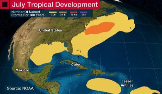
Climo wise in July this is a spot we watch.
MDR is usually on hold.
Due to SAL and shear
Near the coastline things can spin up.

So this is our area of convection.
A lot going on there.
Just watching it.
You have to think where would it go...
...if it tried to develop?

See the small red line N of PR?
East of Florida.
That is what we are watching.
Old frontal boundary near NC
High in place...
..so where would it go?
I'll update later today.
Just wanted to put this here on blog.
95L has gained in girth...
..and headed to the islands.
Will bring flooding rains to some places..
..that have terrain.
terrain + rain = flooding.
While 95L lacks a circulation.
It's got a lot of rain today.
And it's moving towards the Islands.

So remember that.
Oh and behind it is another wave.
For now the NHC went with the close in area.
Actually I totally agree...
...wait and see
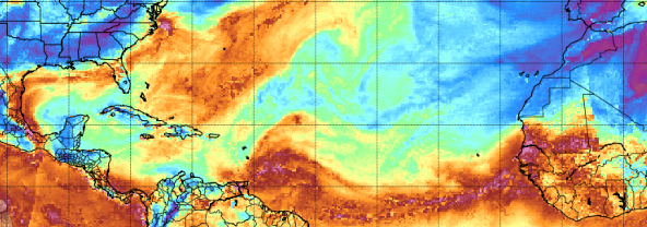
There's your moisture "ring of fire"
It oozes, it moves.
It slides around.
95L bright ..
ITCZ behind it...
new wave behind it.
Area of moisture to NW of it.
El Nino like stream of air ...
up and thru ...across GOM
Feeds into dangling cold front...
..that's now just limp in the water.
Warm Water.
Gulfstream.
New area of interest.
20% in the next 7 days.
Area we normally watch in July
Time will tell
BobbiStorm
@bobbistorm on Twitter and Instagram
Threads.......
posted by BobbiStorm @ 11:31 AM
![]()


0 Comments:
Post a Comment
<< Home