Updated 9 PM - INVEST 96L Orange 40% for LEAD Wave...Models Sniffing Fiona in the Wings... Then GASTON Off Africa ? Does Gaston Form Close In? Into Carib? Up & Over Islands? Stay Tuned

IF there was a named storm........
...there would be watches or warning up.
But there isn't... just an Invest.
NHC investigating the situation.

Choose your poison!
Westbound for now.
If it develops it pulls North eventually.
Intensity forecasts are conservative.

EURO shows next Friday "something"
And off Africa a named storm probably.
It's really hard to tell what will be or won't. On any model run there are two storms or three storms or one trying hard to form. Models keep it under a High Pressure area moving West towards the Islands (over the Islands, through them or under them?) and then a lot depends on what forms and where and when it forms. There will be an opening in it's path to pull more to the North but less likely before the islands. There's a front and one model has Fiona runnin away with the front to elope. It's like a model solution buffet and there's just no way of knowing. But the models really, really love the African Wave.

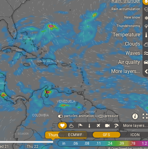
From Windy.com

Misplaced convection.
It's not aligned.
Models love to play with it.
One can connect the dots...
... I can see in my head what it might do.
But will it do that?
Time will tell.
More on it tomorrow.
Compare and contrast...

Tonight above.
This morning below.
Yes, big wave coming off of Africa.
8 AM.

There are 3 systems to talk about...
..I will discuss them in depth later today.
This morning we are focusing on the lead wave..
..not at 40% Orange.

NHC has the lead wave up to 40% in the 5 Day.
A healthy, fast moving organge circle.
Fast moving aka "timing" is a question here.
There are a lot of questions.
Models below are FAR out...
...super unreliable always.
Especially this year.
Below is September 22nd...

The EURO shows a developing storm.
Not a monstor but name worthy.
Up and over the Islands.
The GFS shows a murky mess of moisture...
There's something there but what exactly?
Same time frame as the stronger EURO model.
Long term GFS is nasty...
Lows popping up and playing hide and seek.
Then hits FL (Keys) goes into GOM...
..replays similar nasty storms.
I want to add in a word of caution here, there are so many models and variations of the models and ensemble models that there is always that one model run you can find to validate any wild theory or be sure it's coming to your home town. Ensembles are great as they really show the trend but the details long range are like stabs in the dark and rarely pan out. So wait until Hurricane Recon has found a closed center and then models run from that and if it begins to properly align in the atmosphere you can worry on a scary model run. Til then it's for entertainment purposes. Some of these long range model runs look like a trailer for a scary Halloween Movie... just don't eat the Twinkies and wait until something actually forms and see what hard data the Hurricane Hunters get for evaluating real possibilities vs fantasy tracks.
The Icon does not go as far out in time.
But it shows something.
Mike (Spaghetti Models) likes Icon this year.
So including it as it has done well.
Then again it's not looking 10 days out..

Let's keep things in perspective.
I'll update later today.
For now know the models are sniffing Fiona ...
...and some models sniffing Gaston.
Are they reliable?
Correct?
Time will tell.
I'll update later today.

Check back later....
BobbiStorm
Ps... Not easy to reason with the 2022 Hurricane Season.
posted by BobbiStorm @ 5:30 AM
![]()


0 Comments:
Post a Comment
<< Home