Invest 93L in a Dry Environment. Struggling to Stay Afloat.
To be honest Invest 93L is not looking very good Tuesday evening. That is not to say it cannot come back, but it is having a problem with the dust I mentioned earlier. I'm a little confused why the NHC didn't mention the dust as it's obviously still a problem.
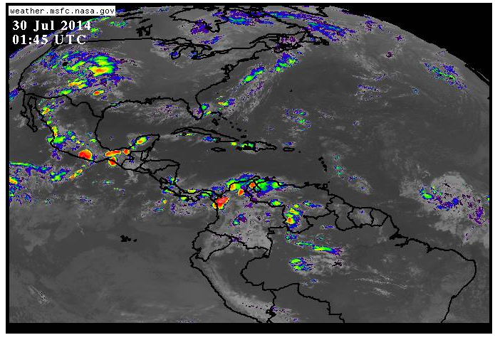
That little green dot to the far right of the image above is Invest 93L. This site is infamous for making a bad storm look good. This is as good as I could get it . . .

A close up look shows a small ball of convection that may be moving faster than the rest of the wave. Sometimes a center out runs it's convection. I am not saying that is what is happening, I'm saying it's a possibility. Also, dry air has entered the system and it can't seem to get up..
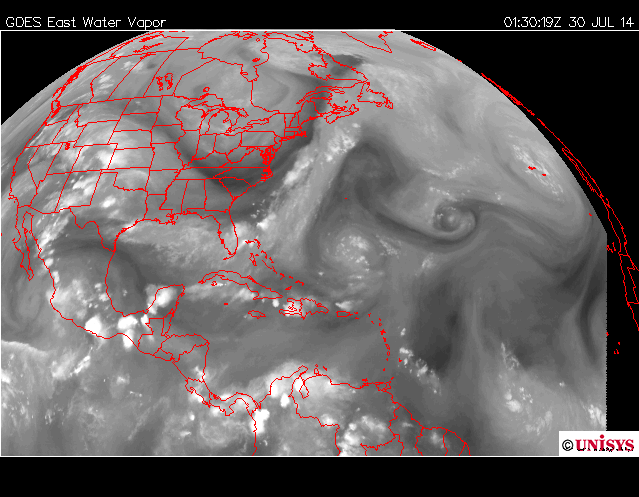
I'm going to post an image I posted earlier. Shows the dry air and my question mark is why...how this system gets to where the models say it is going to get with so much going against it.

Look at the system 12 hours ago. See the Invest in the bottom right of the image ..

Now look at the system 12 hours later... an image from 11PM. Hard to even find it...
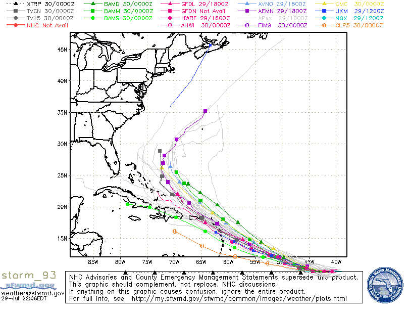
The models began to bother me when I saw several of them show Invest 93L as a Tropical Storm barrel through a strong high. Made no sense. I could see that happening if it was a hurricane. Easy to believe the model sees things I do not, that is the purpose of the models to see into the future and see things we might not see. In this case.......not sure what the models were thinking.
The ULL to the North and NW are sucking the moisture up out of the not so developing storm.

Lastly note that yesterday there was a lot of moisture out in front of the Invest.See the bright orange yellow area between 50W and 40W.

Current "juice loop" shows a lack of "juice" . . .
Understand that tropical systems need warm moist air about as much we need water when we are out walking around in 90 degrees in the hot tropical sun in Key West in almost August. (It's 87 degrees here in Key West at 11 PM at night..........think on it)

A break in the moisture......not good for Invest 93L.
It's like someone suddenly turned the stove off and the chicken ain't cookin...
We'll see tomorrow what happens. But, I wouldn't be surprised if the NHC lowers the % down a bit on Invest 93L.
As for track discussion it's silly until we have a well defined system that the models can track.
IF it stays weak it will go further west or fall apart all together as Invest 92L did and the search goes on for the B storm.. Bertha.........
If it revives a bit over night and has delayed development it will probably miss the islands and pull north towards a weakness in the ridge. The High is forecast to pull back to the East a bit and that leaves the door way to curving out to sea near the Bahamas and hopefully missing the islands.
Right now Invest 93L seems to have missed the boat.
As always the tropics work in real time so let's see what happens Wednesday...
I'll update with information as the situation warrants.
Besos Bobbi
And.. remember to purchase a shirt and the proceeds are donated to a fund to help Stormchaser Jim Leonard "Cyclone Jim" who is battling terminal cancer. Scroll down to the information on the shirt. Thanks.
http://www.skiesovertheplains.com/
posted by BobbiStorm @ 8:33 PM
![]()


0 Comments:
Post a Comment
<< Home