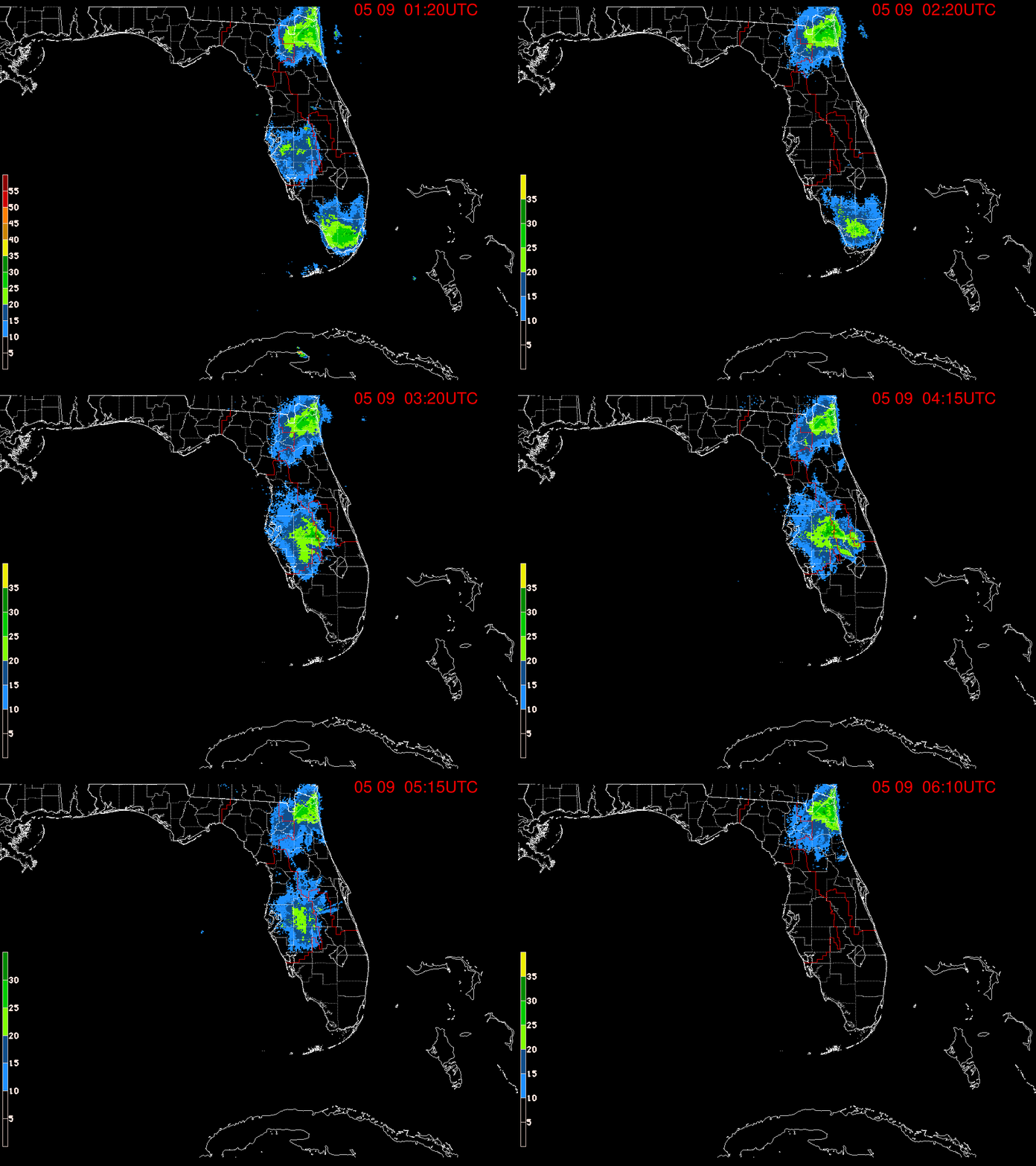
Tropical Disturbance Forming Or Hybrid. Flash Flood Warnings Posted for Miami. Recon on Hold. You Can Watch 90L on Radar.

Refer to the NHC for the small print.
Whenever you see that much small print it's not good.
Means there's lots to explain.
Regardless means ... deal with it.
It is what it is today.
It is still forecast to be a storm with a name.
Most likely..
Spinning.
Rose up off of Cuba...
If you see a red box that says SAV
ignore it, been that kind of afternoon.

Let's see what it looks like tomorrow.
Strong winds out there.
High Seas Forecast goes long.
Models

Still there.
Red Bow Tie near S tip of Florida.
Big convective shield to it's E
Give it some time.
I have a soup on the stove that's been like that all day.
Developing... I keep adding things.
By the way it has rained ALL day in parts of Miami.
The complaining is epic.
Yes they want rain but it's like the last straw.
And originally the forecast said for 3 hours.
Still raining.
Random post ;)
Especially when it was all day where he lived.
In other news.
My youngest son sent me this book.
Miami History.
North Miami Beach History.
I used to run the Archives for NMB...
...so I'm excited.
Everyone have a wonderful Saturday.
TGIF because I'm going offline for Shabbos.
And going to rest, eat, pray, read and relax.
I'll look to see if Arthur has showed his face ...
...Saturday Night.
I'm thinking 5/20/2020 should be fun.
Let's see how it all turns out.
Everyone have fun and stay safe.
...continue reading if you didn't already...
It Spins!

Still holding on ....
Going to do something different today.
I'm putting up the video I made at the top.
You can just watch the video.
Or read my thoughts below.
And enjoy the tropical ride.
Got 3 loops going but using this Total Precipitable Water loop to show the point. Whether ur staying home or were driving to work this morning in #Miami ...y’all feel like ur living in a Yellow Submarine? Until #90L wraps it’s gonna feel tropical in #Florida even #Naples #Tampa pic.twitter.com/p7Q2z8aYZr— BobbiStorm (@BobbiStorm) May 15, 2020
And I wrote more on this below...
...but it felt like a hurricane in Miami today.
@tropicalupdate my thoughts on the Mess in #Miami this morning. #tropical mess. Are u doing a Facebook Live this morning? pic.twitter.com/XIThHrnKxp— BobbiStorm (@BobbiStorm) May 15, 2020
Yes, we have an Invest!
90L
First since.........
And we have model runs...
Suggestion for possible tracks.
No real center yet.
And the NHC has called off recon today.
Maybe over night or in the morning.
We can watch it in real time actually.
On Miami or Key West radar.
That's a screen grab.
Top band of rain slammed Miami area.
A Flash Flood Warning was Issued.
The center is somewhere near the bottom two globs.
Blobs of red... down near Cuba.
This will lift...generally NE or NNE then NE
And we can watch it spin below.
Note the orange twist to the South...
...of the rain band moving in over Florida.
And when I say Florida.
Naples and Tampa getting rain too.

You can find that loop on www.spaghettimodels.com
Nice model graphic from www.tropicaltidbits.com below.
Have to watch that High down the road.
Note that track kind of travels across I-95 in Miami.
Close enough to remind ppl there the Season is here.
They got that coming attraction promo this morning.
We finally have a purple splotch.
They've been slow to jump.
Slower than the NHC
So yes the potential is there in pretty purple.
Looking at Earthnull below.
Also on SpaghettiModels
From far away you can see our something.
Close up we can see another piece of the puzzle.
Note the little circulation down by Cuba.
As in partially over Cuba.
The weather is displaced to the NE
Also note shear is strong.
Usually it's not easy to form with strong shear.
But let's see what happens.
What happened today?
When weather people try to win the war....
...but lose the battle in front of them.
Let's look at the graphics again.
Close up.
Florida Straits separate Florida from Cuba.
Yeah NHC wearing a red bow tie today.
Dr. George.
Taught me everything I know about California Weather!
Below is an interesting graphic.
Note the convection South of Nola.
Yesterday if came off Texas.
Note our Invest.
Note to the East of the Invest.
Is a large ball of convection.
To the ENE of our X is a large rounded mass.
You can watch this loop for yourself.
But pointing out something is happening.
A strong area of convection is consolidating.
Far from our X.
https://weather.cod.edu/satrad/?parms=global-halfdiskeastnorth-ntmicro-96-1-101&checked=latlon-map&colorbar=undefined
Hmmmm what is really going on here?
That image begs the question.
The loop demands the question.
It's kind of dragging a caboose behind it.
What is really going on?
Currently looks like some Hybrid Storm.
But in the given time frame.
It may get a name.
Reality is that this system didn't move much over night and is still in formation stages. It also has multiple vortexes and that's totally normal in these sort of systems that form without a verified low pressure system in the way a vigorous tropical wave moves off of Africa with a low pressure system attached in the last week of August. This is not quite the last week in May and storms that form from old frontal boundaries over tropical waters with upper level support from other features form slowly and in a messy way.
Sunset to Sunrise on #90L, nearly stationary pic.twitter.com/ZBTKB7zo9r— Pee Dee Weather (@PeeDee_WxSC) May 15, 2020
Why Miami got swamped with the same amounts of rain and gusty winds as the Florida Keys got yesterday is because our fledgling system is stalled or moving very slowly over the warm waters of the Florida Straits. One small center is off the North Coast of Cuba but it's a battle for the heart of the start of what most likely will become a Depression of some kind or a named storm of some kind further down the road as it moves towards it's date with the mess of rain from a slow moving system up towards the Mid Atlantic that is forecast or was forecast to move out to sea grabbing the named storm with it and leaving the vicinity. That may or may not happen, the end game is being thrown off time wise because in real time both areas of convection are taking their own slow time making any real distance up as they seem to be in no rush. That may change of course as weather evolves in real time while models suggest what may happen.
Really these types of systems seem to be the hardest for official weather sources to deal with as they focus on the end game, where it is going down the road, which side of the center has the weather so they can assure the people on the East Coast that while it's close to the coast the weather will mostly stay offshore. They debate whether it will be a Tropical System or a Subtropical System and wax poetic on the differences. For those of us who understand the process we enjoy the discussion in May, but for those driving to work this morning in Miami where there were no watches or warnings up for a deluge of rain training in dumped over I-95 the main North and South artery for commuters trying to drive through water logged roads and being buffeted with higher than normal winds. Yes, that happened today so what happens is the NWS hoists up a Flash Flood Warning, the media sends out tweets and TWC rushes to find good video of palm trees looking tropical next to a flooded roadway. While that makes for a good story, it's too little too late in the communication process.
My son sent this in the WhatsApp Group.
WhatsApp works in real time.
When it explodes I know something big happened.
The highway is covered with water....
...the rain is coming in ...in bands.
Squalls.
People complain.
Probably people trying to get to work at the NWS.
Bet that was some drive this morning......
The NWS posts a Flash Flood Warning.
TWC posts pretty images of dark stormy skies over Miami.
When I went to bed last night.
I knew this would happen.
I've seen it many times.
Especially from these systems forming in the Straits.
Waiting to wrap but dumping rain.
And in general today is a day for rain.
Wet weekend coming up across many areas.
I'll update later today.
When the NHC has something to say.
Stay tuned.
Besos BobbiStorm
@bobbistorm on Twitter and Instagram
Save
Save
Sav


0 Comments:
Post a Comment
<< Home