Erick Makes Landfall as a Major Hurricane. EPAC Still Going Strong. When Does the Atlantic Wake Up? Some Thoughts...
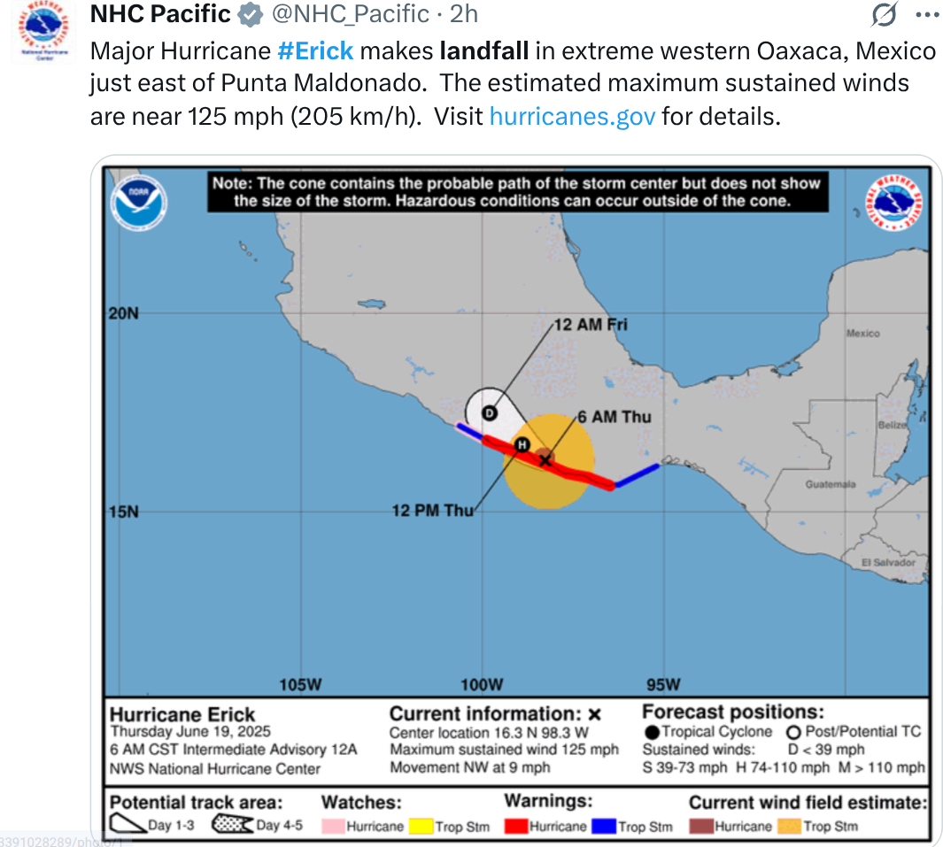
Major Hurricane Erick makes landfall!
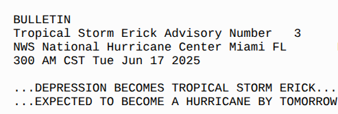
Note it became a TS and got the name Erick
on June 17th.
It made landfall as a Major Hurricane...
on June 19th.
Barely 48 hours after getting it's name.
Major Hurricane Landfall.
This is a perfect example of a storm that forms close in and goes through Rapid Intensification as it approaches landfall. Much like Charley, it had a difficult approach to landfall moving somewhat paralleling the coastline and making the forecast difficult to pin point an exact point where it would cross land way ahead of time. Storms like this play out in real time both in rapid intensification, the timing of eye wall replacement cycles and wobbles in track close in to the coast.
A Major Hurricane landfall in the EPAC in Mid June such as this is very rare and I'm wondering how many were actually prepared for hurricane season both regarding supplies and more so for the emotional impact of such a rare, sudden event. And, again many online have mentioned how rare Beryl was last year in the Atlantic also in an area not prone to such landfalls .... let alone that early in the season.
Bridgett in 1971 and Carlotta in 2012 made landfall in that region both as Cat 2 hurricanes in mid June, not as a Category 4 Hurricane. Both made landfall a few days after forming as hurricanes have been doing since forever. Rarely do they become a Category 4, but conditions as I have said in the EPAC have been ripe for development and even before the season began there was a parade of waves there in the same area.

There's been flooding since before landfall and remember terrain is involved in that part of the world so flash flooding can be an issue. Erick is moving 9 MPH forward speed but the convection...the rain shield is way out ahead of the Erick's center and will mix it up with convection in the BOC. Not looking for development, just saying there's rain everywhere both in BOC and as it feeds into the atmospheric currents up through Mexico and into the SW and beyond. That'll be something to watch down the road weather wise.

Speaking of waves....they are moving West from Africa out into the Atlantic and each wave takes a bite out of the Saharan Air Layer and as the water warms up in the MDR we will see development. Currently it's the EPAC's time and there's another area being watched that is currently yellow behind Eric. And, the wave train in the EPAC is still going strong as you can see below. Could we see the F storm form down the tropical road there?

One last thing I want to add.
The forecast is for a large High....
...to take hold over the South.
Over a good part of the country.
Over a good part of the country.
Hot temperatures near 100 for days.
High Pressure.
Sometimes.....
When a High takes hold to the North of the Gulf.
Low pressure can form to the South of it.
Ironically I was only looking for Pressure.
I wanted to see the pressures on Windy.com
(so many filters)
Took me a minute ....
Oh........
The GFS is back!

Is the GFS just whistling Dixie or....
...is it onto something.
It had promoted a July 4th Weekend storm...
..a while back.
And now just like the cat it's back!!
Take the GFS with a cup of sea salt.
But never ignore it.
Stay tuned.
Bobbistorm
@bobbistorm on X
X mostly weather
Elsewhere whatever mood I'm in ;)
Question.........
When does the EPAC take a break?
Count a week and Atlantic may wake up!!
posted by BobbiStorm @ 7:47 AM
![]()


0 Comments:
Post a Comment
<< Home