Cape Verde Waves. Watching Strong CV Waves Moving West ... While Bill Travels East.

What amazes me is that this Cape Verde Wave is even here ....in the Atlantic. Stage Right.
1. It's too early to be that far north where they need to be to develop.
2. There is a strong amount of SAL in the atmosphere.
3. The water is not that warm...
4. It's way too soon.
5. El Nino is on the clock...
And, yet there is an impressive signature with this wave. Will it develop? Have you seen any models saying it will? I ask because if there was model support every meteorologist worth their Twitter Handle would be all over it. Truth is everyone is watching it humorously thinking "what the heck is it doing there?" and then patting them self on the shoulder reminding them self.. "there is no model support" as they go back to their graphs of El Nino and place their bets if this will be a moderate or strong El Nino. Others refuse to stop watching Tropical Depression Bill as he sits and spins landlocked. There's also a Mesoscale that will cause possibly more damage than Bill, but every one's watching Bill to see if he makes it to "seafall" intact.
We are in my mind too model drive sometimes. We don't appreciate the beauty and wonder of the meteorological world, because we hear there is no model support and we turn it off like yesterday's news. In truth, I love the fact that models give us a heads up on tropical development but I'm saddened that many don't even watch the satellite loops anymore. Well, they do.. IF it has model support. If it's not being Tweeted about, it's not relevant.
What I find interesting is not what we talk about but what we don't talk about. What we ignore.
There are patterns in the tropics that are always worth watching in any given year.
I have quite a few meteorolgically impressive friends who worry about development this year despite all the negative media press that the 2015 Atlantic Hurricane Season. Note, they have been skeptical before the A storm formed and before the B storm formed. Before the A and B storm made landfall.
Sometimes life is not about quantity but quality. Sometimes the big one occurs in quiet years.
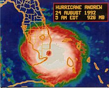
1921 Tampa Bay Hurricane. Referred to by NOAA has the "Forgotten Hurricane"

(I don't make this stuff up...)
For years newspapers have been writing about Tampa Bay's big one..
http://www.srh.noaa.gov/images/tbw/1921/1921_hur_90th_anniversary.pdf
List of links on that 1921 Hurricane and Tampa Bay
http://www.sptimes.com/2002/webspecials02/andrew/day4/story1.shtml
http://www.tampabay.com/news/weather/hurricanes/90-years-after-1921-hurricane-bay-area-officials-fear-direct-hit/1169992
http://www.hurricanecity.com/city/tampa.htm
1921 not a "busy" season.
But, a memorable one.

Sometimes the worse case scenario happens
You think it never will... but it happens.
I worry on years when waves should not be there.
But, they are there.

Luckily we have models now days.
We know more these days.
Right now it's June too soon.
Strong shear.
Gale Centers in the Caribbean.

If these waves keep coming..
At some point...
We could have a problem.

That's a strong ITCZ

I've seen it vacant in some El Nino Years

Why is that wave there?
Why is there a moderate surge of convection...
Despite SAL

I understand it's chances are next to nothing.
My question is........
How did it get that far?

Why is it still alive?

So...........
I wonder why the waves coming off of Africa are so viable this year?
It's very dry. But it's been very warm.
They are well spaced.
They are well formed.
Only takes one to get through...
Quality not quantity.
https://www.google.com/webhp?sourceid=chrome-instant&ion=1&espv=2&ie=UTF-8#q=nhc%20hurricane%20preparedness
Not many people will mention the obvious.
I do. Remember I mentioned it here.
Just watching....
Besos Bobbi
Ps. There is also convection again down near the Yucatan

And a wild spinning ULL North of PR.
posted by BobbiStorm @ 12:48 PM
![]()


0 Comments:
Post a Comment
<< Home