A writer and a tropical muse. A funky Lubavitcher who enjoys watching the weather, hurricanes, listening to music while enjoying life with a sense of humor and trying to make sense of it all!
Tuesday, December 26, 2023
Updated 4 PM Blizzard Warnings in South Dakota.... Fog in the South.... Thunderstorms Tonight in Carolinas? How Long Til We See SNOW?? Stay Tuned.
This week's storm is a photogenic Low swirling about out in the Plains about to make strange moves towards the East Coast...dipping down, possibly making a small loop before moving on out to sea. Add in moisture down near Florida will move up towards the Carolinas (much like a tropical system but NOT a tropical system) possibly form a low and hook up with our Westbound system now out over the Plains and move on towards Canada similar to the 2023 Hurricane Season.
Looking at the visible imagery below....
The low spinning there is impressive.
South of the low is a large flow of moisture.
The Southern Jet aided by the El Nino.
Pumps up moisture across the GOM....
..where it meets up with the moisture off of FL
Timing is everything.
How they interact, fuse together.
This is not expected to bring snow to the Carolinas, though it's possible in the mountain areas of GA, SC and NC there could be snow as elevation is everything when it comes to rain turning to snow. But, it's a long shot to get anything else in the piedmont or along the beaches of the Carolinas. The NWS in discussion talks on a problem with timing and how the system is moving slower than expected. And this is my issue with events such as this in that they evolve in real time and often timing is off and if so all those various models you looked at on Sunday, Monday and Tuesday are no longer reliable. That said there is always one model showing a flurry of fast moving...flurries!
This is not a hurricane .........
It's a winter storm that brought a blizzard to South Dakota.
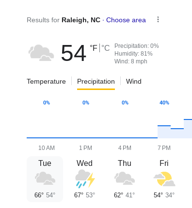
This is for Wilmington, NC
Models slowing down.
Hanging back a bit.
Panhandle of Okalhoma watching it.
It was supposed to rain today in Raleigh, early in the morning. Still nothing falling from the sky at 4 PM. Happens commonly, timing is hard to pin down in this region. And, we do have a drought!
I'm currently talking about this week's storm, but worrying on next week storm is even further down the road. It's still December and the temperatures are playing the flip flop, see saw game they often do this time of year. A night or two of freezing temps and then warm air comes in from the South and the heat is no longer needed and you actually crack open the windows some for it to bit to cool off. May I say reverse cycle AC is a wonderful thing round these parts of the country.
Short tem models show thunderstorms tonight.
(Count 10 days til snow...)
(old saying...)
Let's see if tonight's forecast verifies!!
www.windy.com
A LOW is forecast to form off the coast.
Moisture surge moving N off the coaset of FL.
And the Winter Low goes where hurricanes went.
Eventually....towards Canada, out to sea.
2023 is not over.
One last stormy punch.
Let's look further down the road.........
.... Early January 2024. January 2nd!
A low is centered over my house.
Much will change.
It's a week away.
And today's forecast didn't verify.
So not relying on ones for 10 days from now.
Or even a week from now.
Dreams are just dreams.
But they are for snow.
Sooner rather than later.
It always helps to have cold air in place.
Bottom line the Low will make it's move in it's own time once it moves onshore from the Pacific!
Next week's low is out there, waiting and we are waiting to see what it'll do. Actually there are a few lows out there as we head into the heart of Winter.
Stay tuned... keep reading.
YouTube told me this was one of my most played songs.
Yes, that is true.
It just began playing out of nowhere.
Now I hear it in my sleep (oh my gosh)
Good song.
* * * *
10 AM below........
We see 2 things here.
2 eyes so to speak
One is a Winter Storm... a blizzard!
The other stretches from the South...
Takes I-10 to I-95 N bound!
Lots of moisture... fog, rain, clouds
Possible Thunderstorms tonight!
Faith is being tested in SD today!
Subtropical Blizzard?
New Flavor at Dairy Queen ;)
Seriously and it's on the move...
...dipping down from the Dakotas!
Depending on where you live you either think Mother Nature dealt you a hard difficult hand this morning or there is no weather to speak of going on today. Weather is location, ethnocentric even as most people look at the Weather Map with blinders on ...only looking at where they live. Sometimes they check their parent's location or children's location or the location they wish to visit later in the week. In the South snow did not show up for the holidays, and many cities are socked in with fog or very low gauzy white clouds as well all await the weather we were promised would arrive on Tuesday in my part of the world.
If you are driving somewhere tonight along I-95 from the South to the North or from the North to the South or some place nearby on some branch off road.... be careful, beware of the weather. Stay informed.
Location: Miami, Raleigh, Crown Heights, Florida, United States
Weather Historian. Studied meteorology and geography at FIU. Been quoted in Wall Street Journal, Washington Post & everywhere else... Lecturer, stormchaser, writer, dancer. If it's tropical it's topical ... covering the weather & musing on life. Follow me on Twitter @ https://twitter.com/#!/BobbiStorm


.gif)


0 Comments:
Post a Comment
<< Home