UPDATE 8 PM Invest 91L in GOM. Hurricane Season Begins at Midnight. GOM Yellow Circle 20% Battling Strong Shear. African Wave! FL Getting Tropical Rain on June 1st - Tour of Spaghetti Models Has Links for Hurricane Prep!
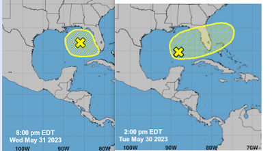
Current location on the left.
Yesterday on the right.
So far it's lost latitude and is further N in the GOM.
It's battlilng shear...
There is dry air moving in...
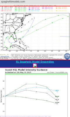
Models show it almost anchored in the GOM...
..a slow drift to the SE is expected by the NHC.
I wouldn't bet on it yet personally.
As it's an Invest now we have better models.
More investigating the situation.
Strength forecasting keeps it low.
Possible window for development.
Still 20% in the 2 day and 5 day.
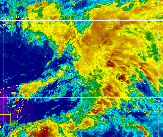
Red/Black/yellow is DRY AIR
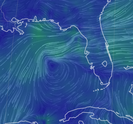
Where's 91L?
It's there...
The lines close together show the shear there.
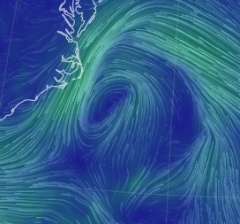
Note there's the unnoticed low by the Carolinas too.
Just hanging out.
Funneling cool beautiful air into NC
So where's the weather?
Everywhere else......
It's common to have messy disturbances on June 1st.
In the GOM... right sided
Let's see what it looks like tomorrow.
It's there.
In 4 Hours the NHC 2023 Hurricane Season begins.
Have you made a plan?
Please make a plan....
It's a good place to start, unless you are an old timer and you know the drill...
There is no reasoning with Hurricane Season as Jimmy Buffett knows well, so as the song goes "squalls out on the Gulfstream, big storm's coming soon" take a rest in your hammock but only do that AFTER you have done what you got to do and if you did then you will definitely need some rest.
Ain't no reasoning with Mother Nature.........
Besos BobbiStorm
...with the smaller yellow circle in the GOM at 8 PM.
* * * * *
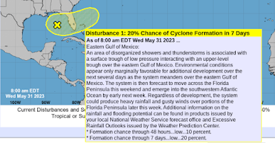
Always start at the beginning with the NHC
They are the bottom line.
20% in 7 days....
...battling strong shear.
Storms blown off towards Florida.
What begins in GOM may not end in GOM.
Keep watching.
Keep prepping those Hurricane Supplies.
This is only the beginning.
Going to stay relatively short today word wise here as I went long yesterday. There is an area of interest (AOI) in the GOM, but know it's being sheared wickedly and the result is the storms will be blown East with the shear towards Florida and that will add fuel to the fire of the Rainy Season already in place there. Also, Cuba and the Yucatan will get strong thunderstorms while the center like area, the "vort" as Dabuh calls it often is anchored for now in the GOM. Going to post some images from Mike's Weather Page aka SpaghettiModels.com as a guide as it's good to know the huge site and appreciate the many links he has there for you all to use.... use them all!
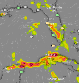
This is EURO Thunder Storm model on Windy.com
Camera filter on - my way of showing you..
..they have the best webcams around!
Take a tropical vacation to any beach any time.
Models are all over the place and as always with systems such as this we watch the satellite loops in real time and wait for the next model run. While I can't promise you a Tropical Storm named Arlene on June 1st, I can promise you lots more tropical rain storms over Florida from the nearness of this quasi tropical disturbance. Acting more like a subtropical disturbance today as Havana getting more weather than the actual area we are watching, but it's all about the weather in cases such as this one. Ironically if it pulled together suddenly into some neat little tropical ball worthy of a name, the result would be that less people would be impacted by the worst weather than is forecast with it being sheared apart currently and everyone to it's East getting rain.
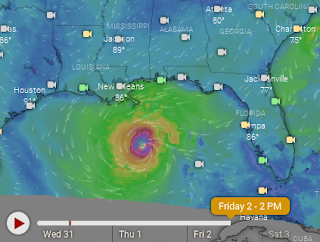
Speaking of odd models, the NAM shows this for 6/1
Perhaps it's trying to find a spot with less shear?
Then on Friday it moves back into the GOM more.
That's as short term a model as it gets!
While ppl love to make fun of it...
...it sometimes shows details valuable.
No 1 model is always right.
As we see below......
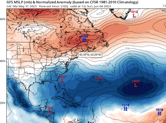
GFS does nothing much with it.
Takes an area by the Yucatan S.
Shows L off SE coast (logical)
We won't talk about the rest...of GFS.
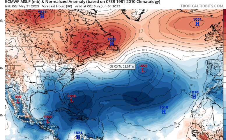
EURO shows it come together in GOM finally.
Move fast thru FL and the then...
Florida Straits gets a chunk of it...
..Low ends up E of Florida.
Carolina Low goes out to sea.
Low pressures in ATL like GFS actually.
Icon keeps it in GOM longer.
But eventually gets it into the Atlantic.
Nuff said about the 20% AOI in the GOM. Honestly I could write forever on anything, but this is all up to the area itself to see how it handles the shear, where it goes and then what it does. It's an evolution that can be like watching paint dry on the wall... unless of course you believe the NAM. 2023 is a year of mixed signals, in years such as that it's not always easy to rely on models, analog years or forecasts. Remember that.
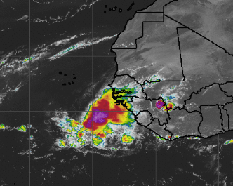
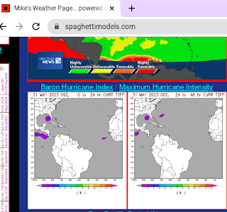
Oh Look at Africa!
That's one sexy Mama wave that departed the coast.
Has a small purple splotch for today tho...
....should cool down a bit the next day.
Time will tell as always.
One heck of a wave for last day of May!
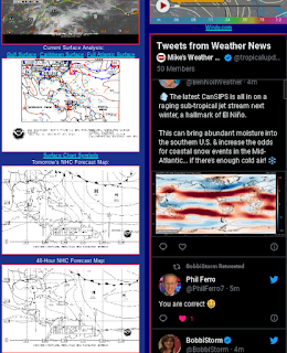
Lastly, these images are from SpaghettiModels.com a site I love and spend a good amount of my time on. No, I'm not paid by Mike to say this ........we've been friends a long, long time and it's been awesome to watch his evolution over time, learning every year better ways to explain, advise and give heads up to his viewers, fans and friends. Okay, my blog is listed at the top of his page and I'm very proud of that as who wouldn't want to be proud of being on one of the best, most popular tropical sites around.
Top left models.
Sites with relevant information.
On the right side his store.
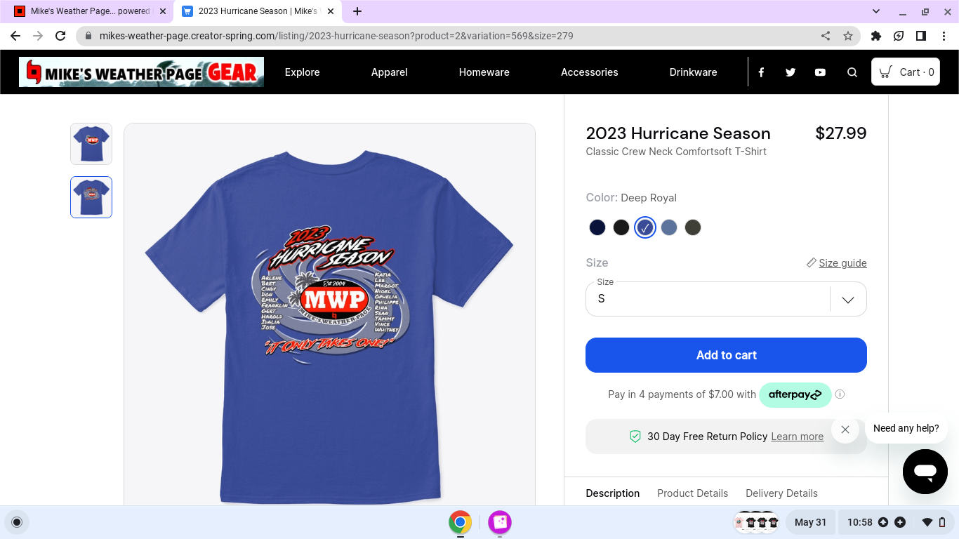
Buy a shirt...I will when I figure out which one.
Because I like V Necks and I'm indecisive ;)
Fantastic shirt with all the names on it for 2023!
My Purple Splotch @atch sites are on his page!
One of my fav parts of the page.
There's a great scroll from Twitter.
Honestly fast news from the best!
And some you might not follow...
..easy to scroll fast. Love it.
Even if you're not on Twitter...
...u can follow the tropical news!!
5 Day Rainfall on left....
...5 day forecast on the right.
More to come tomorrow.
Be prepared.
Be a Hurricane Prepper!
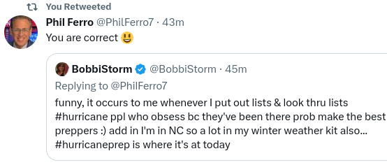
Phil Ferro is my Go To Source in South Florida.
He's the best.
And an incredible human being.
No he doesn't pay me ;)
He's awesome, answers questions on Twitter
No ego, no attitude just the INFO.
INFO is what we need in Hurricane Season!
Sweet Tropical Dreams,
BobbiStorm
@bobbistorm on Twitter and Instagram
Twitter mostly weather and Instagram bit of whatever!
YES the waves over Africa ARE starting early this year!






0 Comments:
Post a Comment
<< Home