Update from Charlotte. 50% Chances for Both Orange Circles. Caribbean Questions Down the Road. Remember Hurricane Season Ends in November For a Reason. Especially in La Nina Years!
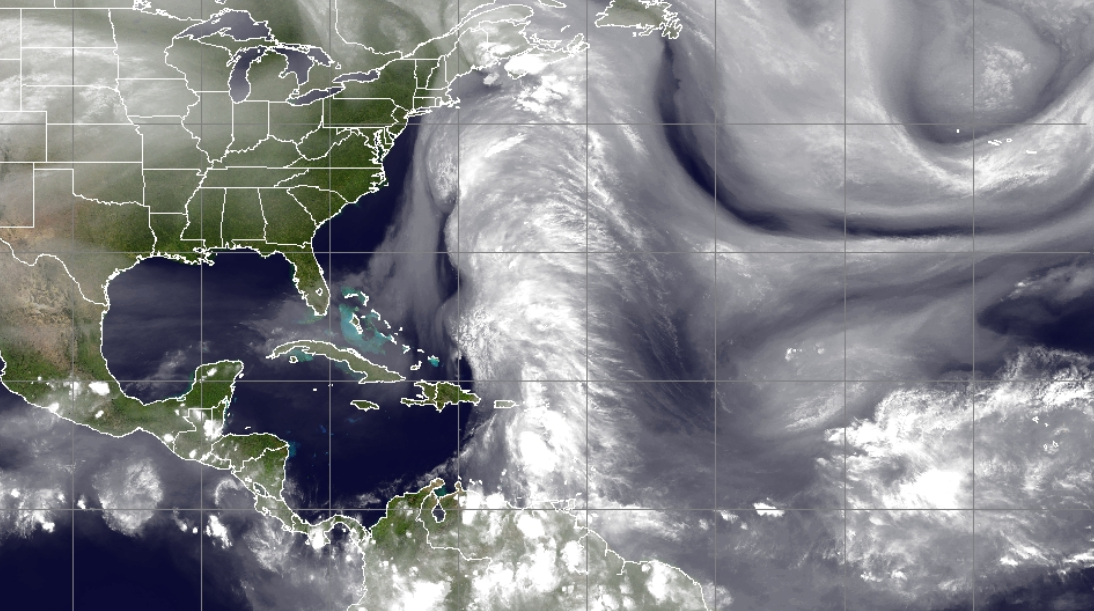
This is the tropicsl tonight.
A plue of tropical moisture moving N out of Carib.
A tropical wave moving westbund.
Currently the Caribbean is clear sailing.
Note the direction of the Orange X
Up with the plume of moisture.
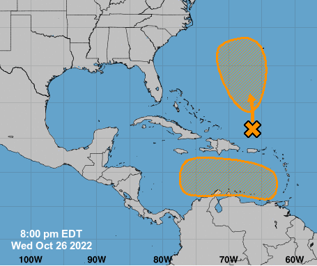
50/50
Both areas have 50% chance of forming.
Caribbean system goes W because it's 2022!
The Atlantic one E of the Bahamas goes North.
Again note the flow below from the Mimic Loop.
I took a great bath. Warm, hot and so good! I'm going to sleep early. Much to do tomorrow before going back to Raleigh. My husband has clients he is seeing and I'm doing some shopping and just taking in the beauty of Fall in the Carolinas. Last month we were tired up with the Jewish Holidays and it was hard to get away so this week we are making up for it.
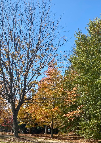
North Carolina is a very beautiful state with a rich diversity of geological features, as well as the twin assets of both a beautiful coastline and mountains on our Western edge and yet the rolling hills and varying elevation of the Piedmont in the middle provides a dazzingly array in the Spring and the Fall of brillant color and inspiring hues that make you appreciate the flow of time, seasons and life.

Sailboats in New Bern down near the coast.
This was just after sunset.
Oriental is magical.
Another day...
...Charlotte has fountains.
I don't know why but it's a thing here.
Everywhere there are fountains...

This was also just after sunset.
So we will see what we see tomorrow, more models will be run. More options will arise and some will be taken out of circulation and many will pretend they never mentioned them.
Lastly I want to mention something I saw today and was reminded how much information there is on Spaghetti Models website as Mike keeps things there kind of like a filing cabinet that he shares with you.

Almost ALL Hurricane INFO comes down to this.
Some Hurricane Hazards.
1. STORM SURGE
2. INLAND FLOODING
3. HIGH WINDS
4. TORNADOES
If you keep ALL 4 of these dangers in mind, you will better understand hurricanes. Some have all three and some have only one or two. But there's more to worry on than if you are "in the cone" or "in the middle of the cone" as tornadoes, inland flooding, storm surge and high winds can all happen far outside the middle of the cone and often the cone.

A child was killed in South Carolina far to the North of Hurricane Andrew from a strong storm in a very distant band in it's circulation but far away. Look at the image above and you will see strong, nasty weather coming in far to the North of Andrew moving towards South Carolina. Crazy but true. One random mean storm took a child's life. Often it's more bands of tornadoes to the right of the eye in the Florida Panhandle somewhere while a hurricane is making landfall in Mississippi.
A hurricane is more than just a cone or a line in the middle of a cone.

This is INLAND FLOODING.
https://www.wnct.com/news/a-look-back-at-hurricane-floyd/ There are many articles out there but far from landfall, the bigget story unfolded across the landscape of North Carolina as "river basins" flooded and that is what most river basins are they can and will at some time flood.

New Bern, one of my favorite places.
Old city, very old filled with history.
A history of flooding.
Lastly, regarding what I said about TWC I have to admit it's upsetting for me. I'm sure many people love the various segments and discussion on festivals around the country. I'm a hard weather person... I want facts, info and details. I want more than a radar map, because TWC used to use various, beautiful satillite loops and on air the mets would explain what was going on and that is what fascinated us with TWC. There are decorating shows and travel channels but there is only one The Weather Channel.
A friend of my husband once said that anytime someone invents something to do two or three things at once, it usually works but it doesn't do any of them perfectly. You can try to appeal to all of the people all of the time, but only the Weather Channel can explain WEATHER and teach new generations about how hurricanes work and why one town gets a heavy snowfall and another town nearby gets nothing. Only they can cover a hurricane or a blizzard the way they do but any number of on air shows can do chit chat and cover human interest stories. It's just not my prefence. And, I really dislike the couch, it reminds me of some very old late night TV show like Johnny Carson not a modern, sleek set with moving, busy on air meteorologists.
Just me. I'm sure many people love it the way it is.
That's life.
Have a wonderful day and thanks for reading.
Writing is my way of breathing, relaxing and thinking and being in the moment.
I needed to write a bit tonight, before going to sleep and what will I dream of?
Hurricane winds or a gentle snow falling in the moonlight?
Chow for now... Bobbi ;)
I know how to spell it right, I like it this way!
* * *

A few things that bother me that aren't currently issues vs what may come from the Caribbean next week.
Note how the stream of moisture above goes N from South American to the Mid Atlantic while crossing Puerto Rico... that's a lot of moisture. In a few days it's likely a tropical depression could form at the base of that plume of moisture when the tropical wave to the right moves into the Caribbean. Originally models fomed something there and pulled it north and it is easy to see how that would happen. However, the more recent model runs showed whatever forming in the Caribbean moving more into the SW Caribbean.
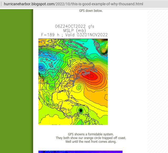
I say this always and I'll say it again, until something forms and a real, true center is obvious models are less than stellar on accuracy. They are good at sniffing out something forming. The Euro is on board currently but takes that system to the West towards the Pacific and with the pattern this year that could easily happen. The GFS still forms a strong storm, possibly hurricane in the Caribbean AFTER our current yellow blob forms and moves towards the West.
In the Atlantic our tropical possibility will take advantage of the moisture streaming up in it's area. The more Northern system flirts with the US but more so provides abundant rain possibilities even if it stays out at sea.
Monday's blog above.
If you remember the other day we had that set up on the GFS with a system forming in the Atlantic off the East Coast and one to the South near South America, as if they were vertically stacked in a line.

Sunday GFS model above.
Note the Atlantic system forms first.
Slowly the Caribbean one forms.
There's a wave off of Africa.
But it should be one of the last waves.

Africa going quiet.
Attention in November turns towards the Caribbean.
And in November close in development.

November 7th, very long range.
Our Carib low is near SW Carib.
A new stronger storm forms.
Anything that forms here usually ...
...gets grabbed by a cold front.
European loses our Carib Wave.
The Atlantic area gets caught up in the front.
Actually the EURO takes it into the Caribbean.
Could that be Seymour in the EPAC?
I don't know.
I have one hand in winter and one hand in fall.
See what I mean?
I'll update after 8 PM.
I want a long bath....
... I've been in 3 parts of NC in 24 hr period.
Sunset in New Bern down by the coast.
Foggy sunrise surprise in Ralegh.
Bright gold sunset in Charlotte.
Lisa is most likely forming.
Stay tuned.
***
8 AM
Down to the 2 basic areas to watch
Models trending a bit to the West.
EURO sees something.
GFS is always more pronounced.

This is more a matter of wait and see what comes together. I'd like to see the model runs later today before weighing in on any thoughts other than the Hurricane Season isn't over because you want it to be and often Halloween and Hurricane Season have a named storm somewhere.
Foggy in Raleigh again. On the road later today again so I'll update when I get to where I'm going. Just it's hurricane season and hurricanes can happen in the Caribbean so keep them in mind while wishing on Winter and decorating your pumpkin!
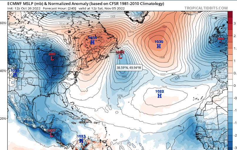
As for the very long range GFS it has some real tricks down the road. I'm very not into discussing this but you can look at the images and see what I mean. And, the ONLY reason I am showing this is to remind you that Hurricane Season ENDS in NOVEMBER for a reason. November is historically busy in La Nina seasons with patterns such as this year and while many have predicted a back loaded season I'd be surprised, but not shocked, to see something like this pop up on our maps while parts of the country have snow.

Again reminding you Hurricane Season goes into Nov!
Besos BobbiStorm
@bobbistorm on Twitter and Instagram
Twitter mostly weather and Instagram whatever.
posted by BobbiStorm @ 5:02 AM
![]()


0 Comments:
Post a Comment
<< Home